Focus Keyword: Manali to Leh highway status
SEO Title: Traversing the Manali to Leh Highway in July: Pass Status, Road Conditions & Tips
Meta Description: Planning a road trip from Manali to Leh in July? Get updates on pass status, road conditions, safety tips, and custom Ladakh tours.
Permalink Slug: manali-to-leh-highway-july-status
—
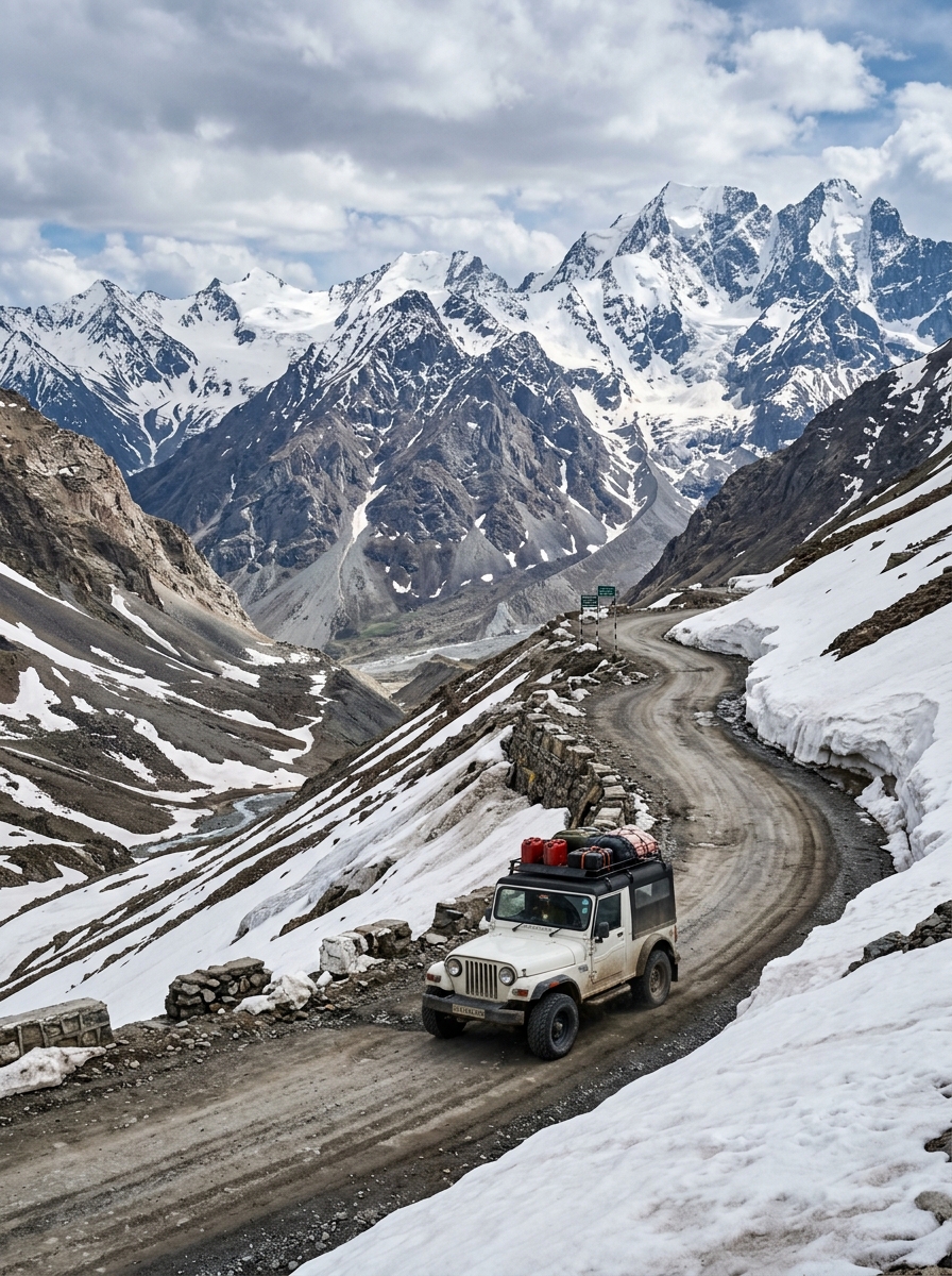
For adventure seekers, road-trippers, and motorcyclists, the Manali to Leh Highway (NH-3) represents the ultimate road trip. Spanning approximately 428 kilometers, this legendary highway cuts through some of the highest mountain passes in the world, traversing rugged terrain, dry cold deserts, and high-altitude plains.
July is the peak season to travel the Manali to Leh Highway. By this month, the Border Roads Organisation (BRO) has cleared the winter snow, the highway is fully open, and the cold desert of Ladakh is basking in summer warmth. However, July also coincides with the monsoon season in the lower Himalayas (Himachal Pradesh). This brings unique challenges, such as landslides, mudslides, and roaring water crossings (*nalas*) fed by melting glaciers and rain.
If you are planning this epic road trip in July, being prepared is your key to safety and success. In this comprehensive guide, we cover the latest highway status, detailed conditions of the five major passes, altitude sickness prevention tips, a recommended 3-day itinerary, and essential safety guidelines.
—
Pass-by-Pass Breakdown of the Highway
Traveling from Manali to Leh requires crossing five high-altitude passes, each presenting its own set of geographical features and road conditions:
1. Rohtang Pass (Altitude: 3,978 meters / 13,050 feet)
Located 51 km from Manali, Rohtang is the gateway to the Lahaul Valley. While the Atal Tunnel (9.02 km long) now bypasses Rohtang, offering a fast and safe route directly to Keylong, many adventure travelers still choose to climb the pass for its views. In July, the pass is lush green, though the road can become muddy and slippery due to monsoon showers.
2. Baralacha La (Altitude: 4,890 meters / 16,043 feet)
Baralacha La is a high-altitude pass in the Zanskar range that connects Lahaul to Ladakh. Known for its heavy snowfall, Baralacha La often has towering walls of snow even in July. Due to melting snow, the road around the pass is famous for difficult water crossings, notably Pagal Nala and Bharatpur Nala, which can be challenging to cross in the afternoon.
3. Nakee La (Altitude: 4,739 meters / 15,547 feet)
Located in Jammu & Kashmir (Ladakh region), Nakee La is reached after negotiating the famous Gata Loops—a series of 21 hairpin bends that climb 465 meters in a short distance. The road here is generally dry, but the steep climb requires excellent driving skills and vehicle power.
4. Lachung La (Altitude: 5,065 meters / 16,616 feet)
Just 25 km after Nakee La, you will cross Lachung La. The terrain here is highly rugged, dry, and wind-swept, characterized by unique rock formations and gorges. The road conditions can be bumpy with loose gravel.
5. Tanglang La (Altitude: 5,328 meters / 17,480 feet)
Tanglang La is the second-highest motorable pass on this route (and one of the highest in the world). The climb to the pass is steep, but the road is mostly well-paved. Once you cross Tanglang La, you descend into the scenic Indus Valley, leading directly to Leh.
—
Road Conditions and Pass Status in July
- Status: Fully Open. The highway is open to all vehicles, including motorcycles, SUVs, and heavy transport.
- Lower Section (Manali to Jispa): Mostly smooth tarmac via the Atal Tunnel. However, the section between Manali and the tunnel entrance can experience landslides during heavy rain.
- Middle Section (Jispa to Sarchu): This is the most challenging section. It includes the climb to Baralacha La. Roads can be broken, muddy, and interrupted by deep water crossings.
- Upper Section (Sarchu to Leh): The roads are generally in excellent condition, especially the flat stretch of the More Plains (a 40-km straight road at an altitude of 4,800 meters). The final stretch from Tanglang La to Leh is smooth double-lane tarmac.
—
Detailed Manali to Leh Route Guide and Altitude Tracker
Below is a detailed breakdown of the major stops along the highway, their altitudes, and recommended travel actions:
| Location | Altitude (Meters) | Distance from Manali | Key Feature / Challenge | Recommended Action |
|---|---|---|---|---|
| :— | :— | :— | :— | :— |
| Manali | 2,050 m | 0 km | Starting point; lush green valleys. | Spend 1 day acclimatizing here. |
| Jispa | 3,200 m | 93 km | Beautiful village along the Bhaga River. | Ideal Night Stop for acclimatization. |
| Baralacha La | 4,890 m | 140 km | Glacial pass; heavy water crossings. | Cross before 11:00 AM to avoid high water levels. |
| Sarchu | 4,290 m | 177 km | Cold, wind-swept campsite border. | Avoid staying here if you feel symptoms of AMS. |
| Gata Loops | 4,190 m | 200 km | 21 hairpin bends; steep ascent. | Drive in low gear; do not cut corners. |
| Lachung La | 5,065 m | 224 km | Rugged mountain terrain. | Do not stop for long due to thin air. |
| Pang | 4,600 m | 242 km | High-altitude army transit camp. | Good spot for a quick lunch and hot tea. |
| More Plains | 4,800 m | 250 km | 40 km of flat, straight plateau. | Enjoy the smooth road, but watch for sudden dips. |
| Tanglang La | 5,328 m | 365 km | Extremely high altitude; cold winds. | Limit your stop to 10-15 minutes for photos. |
| Leh | 3,500 m | 428 km | Capital of Ladakh; Indus Valley. | Rest at your hotel for the evening. |
—
Understanding and Preventing Altitude Sickness (AMS)
Acute Mountain Sickness (AMS) is a very real danger on this route, as you ascend from 2,050 meters (Manali) to over 5,000 meters (Tanglang La) in a single day.
- Symptoms of AMS: Throbbing headache, nausea, dizziness, fatigue, shortness of breath, and loss of appetite.
- The Golden Rule of Acclimatization: Do not sleep at Sarchu on your first night. Sarchu sits at 4,290 meters, and its extreme cold and low oxygen levels make it a common spot for severe AMS. Instead, break your journey and sleep at Jispa (3,200 meters) or Keylong (3,080 meters).
- Stay Hydrated: Drink 4-5 liters of water daily. Dehydration accelerates AMS. You can also carry water mixed with ORS or glucose.
- Medication: Consult a doctor before starting. Taking Diamox (Acetazolamide) 24 hours before ascending can help your body adjust to lower oxygen levels.
- Carry Portable Oxygen: Keep small, portable oxygen canisters (available in Manali and Leh) in your vehicle for emergency use.
—
Monsoon Road Safety Alerts (July):
* Water Crossings (Nalas): Water levels in glacial streams like Pagal Nala rise dramatically in the afternoon as the sun melts the glaciers. Plan your day to cross these streams early in the morning (between 6:00 AM and 9:00 AM).
* Landslide Zones: The areas around Marhi, Rohtang, and the Lahaul Valley are prone to sudden landslides during heavy rainfall. If a landslide blocks the road, stay in your vehicle at a safe distance and wait for the BRO to clear the path. Do not attempt to cross falling debris.
* No Night Driving: Never drive on this highway after sunset. The roads lack street lighting, temperatures drop below freezing, and emergency assistance is unavailable.
—
Biking vs. SUV: Which is Best in July?
- Motorbike Expedition: Riding a motorcycle to Leh is a dream for many. In July, you must be prepared for wet weather. Waterproof riding gear, gumboots (for water crossings), and waterproof luggage bags are essential. Ensure your bike is in top condition, with good tire tread.
- Private SUV (Cab): For families, groups, or those prioritizing safety and comfort, a 4×4 or high-clearance SUV (like a Toyota Innova or Mahindra Scorpio) is the best option. An SUV protects you from the cold wind, rain, and thin air, and a professional local driver knows exactly how to navigate water crossings and landslide-prone areas.
—
Conquer the Leh Highway with Travel Path Holiday!
Don’t let the challenging terrain stop you from completing this bucket-list adventure. At Travel Path Holiday, we specialize in organizing safe, fully-supported Ladakh road trips. Whether you want to join a guided group motorcycle tour with backup vehicles, mechanics, and medical support, or prefer a private SUV tour with a seasoned mountain driver, we have the perfect itinerary for you.
Book your Ladakh adventure today:
- Chat with Our Travel Planners: WhatsApp us at +91 7869926222 to discuss route plans, vehicle rentals, and permit bookings.
- Get a Custom Tour Quote: Head over to our Travel Path Holiday Contact Page and share your travel requirements. We’ll build a customized, safety-first Himalayan itinerary just for you!