
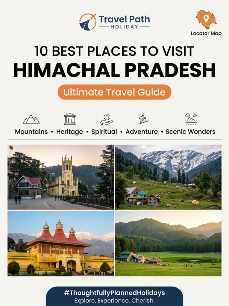
Himachal Pradesh

Historical Significance and Architecture of Kufri Snow Adventure

Overview Nestled at an imposing altitude of 2,720 meters (8,923 feet) above sea level in the Shimla district of Himachal Pradesh, Kufri is renowned across India as a premier destination for winter sports, high-altitude tobogganing, and snow-draped alpine panoramas. However, beyond its modern identity as a snow adventure park, Kufri possesses a rich historical heritage dating back to the 19th-century British Raj. Originally a quiet mountain hamlet—its name derived from *’kufr’*, meaning a pond or lake in the local Pahari dialect—Kufri evolved from a secluded colonial summer retreat into the birthplace of Himalayan skiing in Northern India during the 1930s. The architectural fabric of Kufri reflects a unique convergence of British colonial country retreats and traditional Himachali *Kath-Kuni* timber-and-stone craftsmanship. Built to withstand sub-zero winter temperatures and heavy Himalayan snowfall, these historic structures feature steep gabled roofs, stone fireplaces, and glass-encased sun verandas. Complemented by the sprawling Himalayan Nature Park and protected deodar reserve forests, Kufri seamlessly balances historical charm, winter sports legacy, and environmental preservation. For travelers departing from Indore and Central India, exploring the history of Kufri Snow Adventure offers an enriching journey into high-altitude mountain heritage, colonial history, and Himalayan winter sports traditions. Local Logistical Advice for Indore Travelers Planning a vacation from Indore to Kufri requires careful travel preparation to manage transit connections, rapid altitude changes, and seasonal climate shifts. Below is practical logistical advice tailored specifically for travelers departing from Madhya Pradesh: 1. Transit & Route Coordinates from Indore Flight Routes (Fastest Transit): Book a flight from Indore’s Devi Ahilya Bai Holkar Airport (IDR) to Chandigarh Airport (IXC) (approx. 2 hours direct or via New Delhi). From Chandigarh, Kufri is a scenic 125 km drive (approx. 4 to 4.5 hours) via the well-paved NH5 national highway passing through Solan, Kandaghat, and the Shimla Bypass. Alternatively, fly from IDR to Indira Gandhi International Airport, New Delhi (DEL) and take the Kalka Shatabdi Express to Kalka or transfer to a pre-booked private cab. Train Routes (Budget & Heritage Experience): Board the Indore–Chandigarh Express (19307) or the daily Malwa Express (12919) from Indore Junction to Kalka Railway Station. From Kalka, board the UNESCO World Heritage Kalka–Shimla Toy Train to Shimla Railway Station, followed by a short 16 km private cab ride to Kufri. Private Vehicles & Mountain Driving: The ascent from Shimla to Kufri involves steep mountain curves and icy road patches during peak winter (December to February). Booking a private, heated Innova Crysta or Fortuner with Travel Path Holiday guarantees an experienced local mountain driver equipped for high-altitude snow transit. 2. Climate Transition & Acclimatization Guidelines Temperature Shift: Travelers from Indore transition from the tropical dry Malwa plateau climate (typically 20°C to 35°C) to crisp alpine conditions. Summer temperatures in Kufri range between 12°C and 22°C, while winter brings sub-zero weather ranging from -5°C to 8°C with heavy snowfall. High-Altitude Acclimatization: Due to Kufri’s elevation of 2,720 meters, visitors should take it easy during their first few hours in the mountains. Stay hydrated with warm herbal teas, wear multi-layered thermal clothing, and avoid sudden physical exertion immediately after arriving from lower altitudes. 3. Mobile Connectivity & Prepaid SIM Cards National Roaming Status: Travelers often inquire about mobile SIM compatibility in Himachal Pradesh. Unlike restricted border zones, standard prepaid SIM cards from MP (Madhya Pradesh) operate smoothly under national roaming across Kufri and the entire Shimla district. Network Reliability: Airtel and Reliance Jio provide strong 4G/5G mobile signals across Kufri Bazaar, luxury resort zones, and adventure park entrances. While signals may fluctuate slightly on forest nature trails inside the Himalayan Nature Park, digital UPI payments and voice calls remain dependable across major tourist hubs. Complete Details & Practical Guidelines The Historical Origins of Kufri & British Era Retreats The history of Kufri is intertwined with the British imperial history of Shimla, which was declared the Summer Capital of British India in 1864. While Shimla developed into a bustling administrative center, British officers, survey engineers, and viceregal guests sought quieter, higher-elevation sanctuaries nearby. “` +———————————————————————————–+ KUFRI HISTORICAL TIMELINE & EVOLUTION +——————-+—————————————————————+ Historical Period Significant Developments & Milestones +——————-+—————————————————————+ Pre-1800s Small Pahari agricultural hamlet named after a local pond (‘Kufr’) along ancient mountain trade routes. +——————-+—————————————————————+ 1860s – 1900s British Raj officers establish summer retreats, hunting lodges, and sanatoriums due to crisp alpine climate. +——————-+—————————————————————+ 1930s Modern skiing introduced on Mahasu Ridge slopes; Kufri becomes Northern India’s pioneer winter sports destination. +——————-+—————————————————————+ 1960s – 1980s Himachal Tourism and National Skiing Clubs formalize winter sports festivals and amateur skiing courses. +——————-+—————————————————————+ 1990s – Present Establishment of Himalayan Nature Park (1992) and modern snow adventure parks, balancing tourism with forest ecology. +——————-+—————————————————————+ “` #### 1. Discovery as a Colonial Sanatorium In the mid-19th century, British medical officers identified Kufri’s dense pine forests and oxygen-rich alpine air as ideal for summer sanatoriums. British officers suffering from the oppressive heat of the Indo-Gangetic plains retreated to Kufri to recuperate in rustic wooden bungalows and secluded country houses. #### 2. The Legacy of Wildflower Hall & Mahasu Estate Located just 3 km from Kufri towards Shimla, the historic Wildflower Hall estate played a pivotal role in popularizing the region. Originally the country residence of Lord Kitchener (Commander-in-Chief of the British Indian Army in the early 1900s), the estate hosted high-ranking British dignitaries who frequented Kufri for horseback riding, nature walks, and winter excursions. Today, the rebuilt Wildflower Hall stands as a world-renowned luxury resort that retains colonial-era elegance. Architectural Heritage: Colonial Retreats & Kath-Kuni Style The architectural landscape of Kufri showcases two distinct structural influences: 19th-century British Colonial architecture and traditional Himachali *Kath-Kuni* timber-and-stone masonry. Both styles were engineered specifically to endure severe Himalayan weather conditions. “` +———————————————————————————–+ ARCHITECTURAL COMPARISON IN KUFRI +———————–+—————————–+—————————–+ Architectural Element British Colonial Retreats Traditional Kath-Kuni Style +———————–+—————————–+—————————–+ Primary Materials Imported pine, brick, slate Deodar logs, slate tiles, tiles, and cast-iron fixtures dry-stacked river stones. +———————–+—————————–+—————————–+ Structural Design Gabled roofs, wide verandas, Interlocking wood-and-stone brick chimneys, solariums. layers built without mortar. +———————–+—————————–+—————————–+ Thermal Insulation Double-brick walls & indoor Air gaps


Himachal Pradesh

Emergency Numbers, Hospitals & Tourist Police in Kasol Parvati River

Overview Kasol and the surrounding Parvati Valley—stretching from the river confluence at Bhuntar up to Manikaran, Tosh, and the high Himalayan alpine trails of Kheerganga—is renowned for its dramatic natural grandeur, dense deodar pine forests, and roaring glacial rivers. Positioned at an altitude of approximately 1,580 meters (5,180 feet) in the Kullu district of Himachal Pradesh, Kasol attracts thousands of vacationers, mountain trekkers, and leisure travelers each year. However, navigating this rugged Himalayan landscape requires more than just sightseeing itineraries; having instant access to a reliable emergency helpline in Kasol Parvati River, knowing local hospital coordinates, understanding tourist police procedures, and following strict river safety protocols are essential for a safe, stress-free vacation. For travelers journeying from Central India—especially families, couples, and group travelers departing from Indore and the Malwa region—the mountain terrain presents unique environment and logistics challenges. From swift glacial river currents and narrow cliffside driving corridors to high-altitude sickness (AMS) and sudden weather shifts, being prepared with critical safety information ensures that unexpected situations are managed swiftly. Travel Path Holiday has compiled this definitive, practical emergency directory and safety guide, featuring verified phone contacts for Kullu District Police, Kasol Police Outpost, local Primary Health Centres (PHCs), regional trauma care centers, mountain search-and-rescue teams, and 24/7 road assistance networks. Local Logistical Advice for Indore Travelers Planning a journey from the Malwa plateau in Madhya Pradesh to the deep gorges of Parvati Valley requires clear transit logistics and safety awareness. Travel Path Holiday ensures Indori travelers enjoy smooth coordination from their doorstep to the mountains. Transit Coordinates from Indore (IDR) to Kasol Air Routes via Delhi / Chandigarh: Take a non-stop flight from Indore’s Devi Ahilya Bai Holkar Airport (IDR) to Chandigarh International Airport (IXC) via IndiGo, followed by a comfortable 7.5 to 8-hour private vehicle drive (approx. 275 km) via Swarghat, Mandi, and the Aut Tunnel to Bhuntar and Kasol. Alternatively, connect through Indira Gandhi International Airport, Delhi (DEL) to fly directly into Kullu-Manali Airport at Bhuntar (KUU), located just 31 km (approx. 1 to 1.5 hours) from Kasol town. Train & Highway Routes: Executive travelers can board the *Malwa Express (12919)* or *Indore-Chandigarh Express (19307)* from Indore Junction directly to Chandigarh or Ambala Cantt Junction. From the railway terminal, Travel Path Holiday arranges private luxury vehicle transfers (Innova Crysta or Fortuner) driven by hill-certified mountain chauffeurs. Self-Drive & Private Chauffeur Route: The road journey covers approximately 1,280 km from Indore via NH46 to Gwalior, Agra-Delhi Expressway, NH44 up to Chandigarh, and NH21 (Chandigarh-Manali Highway) up to Bhuntar, where you branch right onto the narrow Bhuntar-Manikaran road along the Parvati River. Climate Transition: From Malwa Warmth to Alpine Weather Indore’s tropical dry climate—with hot summers reaching 38°C–42°C and mild winters around 10°C–12°C—contrasts sharply with Parvati Valley’s high-altitude climate: Winter Travel (November to March): Night temperatures in Kasol regularly plunge below zero (-3°C to 4°C), causing heavy frost and occasional road ice. Travelers must carry heavy thermal layers, windproof down jackets, insulated gloves, and winter footwear. Monsoon Caution (July to September): High rainfall causes river surges and occasional rockfalls along the Mandi-Bhuntar-Kasol corridor. Travelers should monitor live weather updates and maintain emergency contacts. Summer Comfort (April to June): Day temperatures remain between 15°C and 25°C, making it pleasant, though cool evening winds require light woolens and jacket layers. Mobile Network Coverage & Prepaid SIM Roaming Travelers from Indore will find that standard prepaid SIM cards issued in Madhya Pradesh (Jio, Airtel, Vi, BSNL) function without any restriction under national roaming throughout Himachal Pradesh. High-speed 4G and 5G signals are available in Kasol town, Katagla, Jari, and Manikaran. Signal strength degrades on remote trekking trails such as the upper Tosh route and the Kheerganga forest path, making it vital to note hardline emergency contacts and offline maps before trekking. Complete Details & Practical Guidelines 1. Essential Emergency Helplines & Tourist Police Directory When traveling through Kasol and Parvati Valley, store these official government emergency contacts directly into your mobile phone prior to departure. Service / Authority Helpline Number / Phone Contact Location / Jurisdiction Operating Hours Himachal Unified Emergency Services 112 (Toll-Free National Emergency) Statewide (Police, Fire, Ambulance) 24 Hours / 365 Days Ambulance Service (EMRI) 108 Statewide Emergency Response 24 Hours Kullu District Police Control Room 01902-222722 / 100 District HQ, Kullu 24 Hours Kasol Police Outpost (Chowki) 01902-273822 Main Road, Kasol Market 24 Hours Manikaran Police Post 01902-273724 Manikaran Taxi Stand Precinct 24 Hours Fire Station (Kullu / Bhuntar) 101 / 01902-222201 Regional Dispatch, Kullu 24 Hours District Disaster Management (DDMA Kullu) 1077 / 01902-225630 DC Office Complex, Kullu 24 Hours State Disaster Response Force (SDRF HP) 0177-2812344 / 112 Himachal Pradesh Command 24 Hours Himachal Tourist Helpline / Support 0177-2625924 / 01902-222405 HPTDC Tourist Office, Kullu 10:00 AM – 5:00 PM #### Role of Kasol Tourist Police Outpost The Kasol Police Outpost operates under the jurisdiction of the Kullu District Police Administration. Located centrally in Kasol town along the Manikaran main road, the police outpost assists travelers with: Lost Belongings & Identity Documents: Assisting tourists with lost passports, wallets, or luggage filing official police loss reports (FIR copies needed for insurance or SIM reissue). Trekker Safety & Missing Persons Reporting: Maintaining track of trekking groups heading towards high-altitude passes (Pin Parvati Pass, Sar Pass, Malana Cliff trails). Traffic Management & Highway Emergencies: Clearing vehicle congestions along narrow single-lane bridges near Kasol, Choj, and Manikaran. Traveler Protection & Dispute Resolution: Handling landlord, hotel, or local vendor disputes and enforcing zero-tolerance policies on illegal substance trade to maintain visitor safety. 2. Medical Infrastructure & Hospitals in Parvati Valley Medical facilities in Parvati Valley range from basic Primary Health Centres (PHCs) for minor illnesses to large government hospitals in Kullu equipped for severe trauma and medical procedures. “` PARVATI VALLEY MEDICAL TRANSIT CORRIDOR [Tosh / Manikaran] ──► [CHC Manikaran] ──► [PHC Kasol] ──► [PHC Jari] ──► [Regional Hospital Kullu (RHK)] (High Alt/Remote) (Basic Emergency) (First Aid/O2) (Mid-Valley) (Trauma, ICU, Surgeries – 35km) “` #### Primary & Community Health Facilities

Himachal Pradesh

Pre-Wedding Shoot & Couple Photography in Spiti Valley Kaza

Overview Planning a pre-wedding shoot in Spiti Valley Kaza is the ultimate romantic adventure for couples seeking raw, otherworldly, and breathtaking cinematic frames. Located high in the Trans-Himalayan desert of Himachal Pradesh at an elevation of 3,800 meters (12,500 feet), Kaza and its surrounding high-altitude villages present an unprecedented landscape for couple photography. Moving far beyond conventional palace courtyards and manicured resort gardens, Spiti offers dramatic 1,000-year-old cliffside monasteries, deep canyon suspension bridges, ancient high-altitude post offices, vibrant seated Buddha statues set against perpetual snow peaks, and crystal-clear night skies lit by the Milky Way. However, executing a seamless, comfortable, and visually stunning pre-wedding shoot in this remote mountain desert requires specialized logistical planning. From managing altitude acclimatization and winter wardrobe layering to adhering to monastery photography etiquette, obtaining local drone clearances, and securing dedicated high-clearance transport from Indore, this comprehensive guide provides everything couples, photographers, and styling crews need to create timeless mountain portraiture. Local Logistical Advice for Indore Travelers For couples and photography teams traveling from Indore and Central India, journeying to Spiti Valley involves a dramatic transition in geography, climate, and elevation. Leaving behind Indore’s tropical dry climate (where ambient temperatures range from 25°C to 40°C at an elevation of 550 meters), you will ascend into a high-altitude cold desert where oxygen levels are roughly 30% to 40% lower, and temperatures can plummet below freezing even during summer evenings. Thorough preparation ensures your creative crew remains healthy, energetic, and fully operational throughout the shoot. Transit Coordinates & Air Routes from Indore 1. Flight Connections via Delhi or Chandigarh: Indore to Delhi / Chandigarh: Board a direct flight from Indore’s Devi Ahilya Bai Holkar Airport (IDR) to New Delhi (DEL) (1 hour 30 minutes flight time) or Chandigarh International Airport (IXC) (2 hours 15 minutes flight time via IndiGo or Air India). Indore to Kullu-Bhuntar Airport (KUU): For couples seeking a faster transit via the Manali route, take a connecting flight from IDR to Kullu-Bhuntar Airport via Delhi. Onward Crew Transit: From Chandigarh or Delhi, hire a dedicated private SUV (Innova Crysta or 4×4 Fortuner) to comfortably carry your photography equipment, lighting reflectors, heavy designer gowns, suit carriers, makeup kits, and crew members across the mountains. 2. Overnight Train Options from Indore: Malwa Express (12919): Departs Indore Junction (INDB) daily at 12:15 PM, arriving at New Delhi (NDLS) by 04:30 AM the next morning or Ambala Cantonment / Chandigarh Junction. Indore-Chandigarh Express (19307): Departs Indore Junction on weekly schedules, connecting directly to Chandigarh Junction (CDG). 3. Circuit Selection for Photography Crews: The Shimla-Kalpa-Kaza Circuit (Recommended for Shoot Logistics): Indore → Delhi/Chandigarh → Shimla → Kalpa (Kinnaur) → Nako → Tabo → Kaza. This 10-day gradual ascent allows couples coming from Central India to acclimatize effortlessly while capturing bonus pre-wedding frames among the apple orchards of Kalpa and Kinnaur. The Manali-Atal Tunnel-Kaza Route (Faster Express Route): Indore → Chandigarh → Manali → Atal Tunnel → Batal → Kunzum Pass → Kaza. Shorter in distance, but requires spending at least 2 nights in Manali and Kaza before commencing active shoot days. Mobile Connectivity & Roaming Guidelines Standard prepaid SIM cards from Madhya Pradesh work seamlessly under national roaming across Himachal Pradesh. However, within the Trans-Himalayan Spiti region, cellular network dynamics shift: BSNL (Prepaid & Postpaid): Delivers the most consistent voice and cellular coverage across Kaza town, Tabo, Hikkim, and Langza. Jio & Airtel: Offer reliable 4G data coverage in main Kaza town, but signal drops significantly when shooting in high-altitude villages like Langza, Hikkim, Komic, and Mudh. Crew Communication Tip: Equip your production team with offline GPS maps and portable handheld walkie-talkies for seamless communication between the photographer, drone operator, and couple during wide-angle landscape shots. Acclimatization & Health Safeguards for Posing Couples Posing for photos, holding poses in windy conditions, walking uphill in heavy lehengas, or doing quick outfit changes outdoors can trigger rapid exhaustion at 12,000–14,500 feet if you are not fully acclimatized. Mandatory 48-Hour Rest Period: Spend the first 2 full days after arriving in Kaza relaxing, taking light village walks, and drinking plenty of fluids before scheduling high-intensity shoot sessions. Emergency Oxygen Kits: Always keep portable oxygen canisters (such as Oxygize or 10-liter medical cylinders) in your dedicated tour cab during every outdoor shoot location. Complete Details & Practical Guidelines 1. Top Scenic Couple Photography & Pre-Wedding Spots in Spiti Valley #### A. Key Monastery (Ki Gompa) Landscape Backdrop Elevation: 4,166 meters (13,668 feet). Visual Appeal: Perched dramatically on a conical hill overlooking the wide, braided Spiti River bed, the 1,000-year-old Key Monastery is the most iconic visual landmark of the valley. Best Photography Framing: *Wide Riverbed View:* Position the couple on the open gravel plains across the Spiti River (along the Kibber road link) to capture a breathtaking wide-angle shot showing the fort-like monastery rising sharply against towering barren mountains. *Courtyard & Prayer Flags:* Capture romantic candid portraits near the monastery’s whitewashed outer walls and colorful fluttering Buddhist prayer flags. Best Lighting Window: Golden hour during early morning (07:00 AM – 08:30 AM) when the rising sun illuminates the monastery’s red and gold sanctum towers against a crisp deep-blue sky. #### B. Hikkim Highest Post Office Postbox Elevation: 4,440 meters (14,567 feet). Visual Appeal: Home to the world’s highest post office, Hikkim offers a charming, rustic village aesthetic characterized by traditional mud-stone homes, winding dirt paths, and the iconic bright red postbox. Creative Concept Shots: Capture intimate candid frames of the couple writing handwritten postcards or romantic love letters to each other and mailing them directly through the historic postbox. Styling Advice: Cozy winter knits, vibrant woolen scarves, stylish trench coats, and boots perfectly complement the authentic, cozy mountain village setting. #### C. Chicham Bridge Heights Elevation: 4,145 meters (13,596 feet). Visual Appeal: Known as Asia’s highest bridge suspension span, Chicham Bridge spans a dizzying 150-meter deep canyon gorge connecting Kibber to Chicham village. Best Photography Framing: Capture dramatic leading-line portraits of the couple walking hand-in-hand down the center of the striking yellow bridge

Himachal Pradesh

ATM, Cash & Mobile Connectivity Guidelines in Dalhousie Khajjiar

Overview Navigating the tranquil pine forests, colonial promenades of Dalhousie, and the picturesque emerald meadows of Khajjiar requires smart financial and digital preparation. While Dalhousie is a well-established hill station equipped with modern banking infrastructure, mobile towers, and high-speed 4G/5G data coverage, traveling through high-altitude valleys, dense deodar sanctuaries, and remote meadow hamlets introduces unique connectivity dynamics. For travelers departing from Indore and the wider Malwa region, knowing where to find operational ATMs along Dalhousie’s Mall Road, understanding cash requirements for adventure activities in Khajjiar, evaluating UPI transaction reliability, and selecting the best mobile network (Jio, Airtel, Vi, or BSNL) is essential for a seamless holiday. This definitive guide by Travel Path Holiday (TPH) provides comprehensive, actionable insights into financial logistics, cellular signal strength, emergency cash buffers, and digital tools tailored specifically for Central Indian tourists. Local Logistical Advice for Indore Travelers Transit Coordinates from Indore (IDR): By Flight + Cab: Board a morning non-stop or quick connecting flight from Indore’s Devi Ahilya Bai Holkar Airport (IDR) to Indira Gandhi International Airport in Delhi (DEL) (approx. 1 hour 30 minutes). From Delhi, take a connecting flight to Gaggal Airport (DHM) in Kangra/Dharamshala (approx. 1 hour), followed by a 3.5-hour private cab drive (110 km) to Dalhousie via the Chamba highway. Alternatively, fly from Indore to Sri Guru Ram Dass Jee International Airport in Amritsar (ATQ) or Chandigarh Airport (IXC), and take a comfortable 4.5 to 5-hour drive (190 km from Amritsar via Pathankot) in a pre-arranged TPH private vehicle. By Train: Book reserved berths on the direct Malwa Express (12919) departing Indore Junction (INDB) at 12:15 PM and arriving at Pathankot Cantt Railway Station (PTKC) the next morning at 11:45 AM. From Pathankot Cantt, Dalhousie is a convenient 80 km uphill drive taking approximately 2.5 to 3 hours. By Road: Driving from Malwa via NH44 through Gwalior, Agra, Delhi bypass, Ambala, and Pathankot covers roughly 1,250 km. TPH arranges customized multi-day road itineraries with comfortable overnight halts in Delhi or Chandigarh. Climate & Battery Performance Adaptation: Departing from Indore’s tropical dry Malwa climate (summer peaks of 35°C–42°C and mild dry winters of 12°C–25°C) for the crisp mountain air of Dalhousie (1,970 meters) and Khajjiar (1,920 meters) brings noticeable atmospheric changes. Summer temperatures (April to June) remain pleasant between 15°C and 25°C, while winter months (December to February) experience sub-zero temperatures and heavy snowfall. Sub-zero mountain cold causes smartphone and power bank lithium-ion batteries to discharge 30% to 40% faster than in Indore. Keeping devices inside inner jacket pockets close to body heat prevents sudden battery drain. Prepaid SIM Cards & Roaming Status: Travelers carrying standard prepaid SIM cards registered in Madhya Pradesh (Jio, Airtel, Vodafone Idea, or BSNL) can rest easy: standard domestic prepaid SIM cards work perfectly under national roaming across Himachal Pradesh without requiring local SIM cards or special documentation. Voice calls, SMS, and mobile data function smoothly as long as your home pack includes active national roaming. Complete Details & Practical Guidelines 1. ATM Availability & Cash Logistics in Dalhousie & Surrounding Valleys While digital payment adoption is growing rapidly across Himachal Pradesh, physical cash remains king in high-altitude meadows, local handicraft stalls, taxi unions, and remote mountain trails. Dalhousie Town Centre (High Reliability): Gandhi Chowk & Subhash Chowk: The primary commercial hubs of Dalhousie feature multiple fully functional nationalized and private bank ATMs. Key operational cash points include State Bank of India (SBI), Punjab National Bank (PNB), HDFC Bank, ICICI Bank, and Axis Bank ATMs near Gandhi Chowk and along Mall Road. Uptime & Withdrawal Limits: These ATMs are regularly replenished during normal weekdays and maintain excellent uptime. Standard per-transaction withdrawal limits range between ₹10,000 and ₹20,000 depending on your card issuer. Peak Season Cash Crunch Warning: During peak summer holiday months (May to June) and heavy winter snow weekends (Christmas through New Year), high tourist inflows can lead to long ATM queues or temporary cash exhaustion at Gandhi Chowk. It is strongly advised to withdraw adequate physical cash immediately upon arriving in Dalhousie or during your transit halt at Pathankot. Khajjiar Meadow & En-Route Transit (Extremely Limited Cash Points): Khajjiar Village: Unlike Dalhousie, Khajjiar has extremely limited banking infrastructure. While there is a single SBI ATM point near the main bus stop, it frequently experiences technical downtime, link failure, or cash shortages during peak tourist hours. Why Cash is Mandatory in Khajjiar: Local outdoor adventure operators (paragliding, zorbing, horse riding, pony handlers), local tea dhabas, roadside photography rentals (Pahadi traditional dress photos), and handicraft vendors operating in the center of the meadow operate almost exclusively on cash. Always carry at least ₹2,000 to ₹3,500 per person in physical cash when taking day trips from Dalhousie to Khajjiar. Spiti Valley & Remote Chamba Valley Transits (Kaza Comparison): For travelers extending their Himachal tour from Dalhousie towards high-altitude circuits like Spiti Valley (Kaza) or remote Chamba districts (Bharmour and Pangi Valley), banking connectivity drops drastically. The world’s highest ATM operated by SBI at Kaza (3,800 meters) and ATMs in Chamba town often face multiday link disruptions due to landlines being severed by landslides or snow. Travelers heading toward Kaza or inner Chamba routes MUST carry 100% of their anticipated budget in physical cash withdrawn in major towns like Pathankot, Dharamshala, or Dalhousie. 2. UPI & Credit/Debit Card Reliability Dalhousie Urban Core (80%–90% Digital Acceptance): Hotels & Restaurants: Established 3-star and 4-star resorts, heritage hotels, fine dining establishments (such as Kwality Restaurant, Cafe Dalhousie, and Moti Mahal near Mall Road), and woollen garment showrooms accept credit cards, debit cards, and standard UPI apps (Google Pay, PhonePe, Paytm, BHIM). POS Terminal Stability: Card swipe machines work smoothly over high-speed Wi-Fi and 4G networks. However, minor delays can occur during heavy evening rainfall or thunderstorm-induced network fluctuations. Khajjiar & Offbeat Trails (40%–50% Digital Acceptance): QR Code Scans in Meadows: While QR code placards are displayed at many roadside eateries and souvenir shops surrounding Khajjiar Lake, weak mobile signal in dense tree clusters often causes payment timeouts or delayed SMS

Himachal Pradesh

Local Shopping Guide in Dharamshala McLeod Ganj: Authentic Souvenirs

Overview Exploring the bustling bazaars of Dharamshala and McLeod Ganj is an immersive cultural experience that connects travelers directly with centuries-old Himalayan traditions and rich Tibetan artistry. Known globally as the seat of His Holiness the Dalai Lama and the cultural heart of “Little Lhasa,” McLeod Ganj, alongside lower Dharamshala’s historic Kotwali Bazaar, offers an extraordinary array of authentic hand-crafted souvenirs. Visitors flocking to these twin hill towns will find hand-hammered 7-metal Tibetan singing bowls, intricately painted canvas Thangkas, colorful wind-horse prayer flags, GI-tagged Kangra tea, and ultra-warm Himachali woolens including authentic Yak wool mufflers and traditional Bushehri topis. Whether you are searching for sacred spiritual tools, artisanal winter wear, or organic hill produce, shopping in Dharamshala McLeod Ganj delivers a vibrant market landscape where age-old craftsmanship meets scenic mountain charm. Local Logistical Advice for Indore Travelers Transit Coordinates & Flight Connections from Indore For travelers departing from Indore’s Malwa plateau, reaching the shopping hubs of Dharamshala and McLeod Ganj involves straightforward air, rail, or road connections: Air Routes via IDR: Take a morning flight from Indore’s Devi Ahilya Bai Holkar Airport (IDR) to New Delhi (DEL), followed by a direct 1-hour-15-minute connecting flight (operated by IndiGo or Alliance Air) into Gaggal Airport / Kangra Airport (DHM). Gaggal Airport is located just 14 km from lower Dharamshala and 24 km from McLeod Ganj. Alternatively, fly from IDR to Chandigarh International Airport (IXC) and take a comfortable 6 to 7-hour private drive (240 km) up the Kangra valley via Una. Train Routes: The direct *Malwa Express* (12919) operates daily from Indore Junction (INDB) to Pathankot Junction (PTK). From Pathankot, it is a scenic 85 km (2.5 to 3-hour) drive via cab up to McLeod Ganj. Another convenient route is taking a superfast train from Indore to New Delhi, connecting onto the New Delhi-Pathankot Vande Bharat Express. Road & Drive Strategy: Driving directly from Indore covers roughly 1,350 km via NH48 and NH44 (Indore – Kota – Jaipur – Delhi NCR – Ambala – Chandigarh – Kangra). For long-distance road trips, breaking the journey overnight at Delhi NCR or Chandigarh ensures fresh arrival in the hills. Climate Transition: From Malwa Heat to Alpine Chills Transitioning from Indore’s warm, dry tropical plateau (where summer temperatures hover between 38°C and 42°C) to McLeod Ganj’s high-altitude Dhauladhar alpine climate (1,750 meters above sea level) requires smart packing. Summer daytime temperatures in McLeod Ganj range from 20°C to 28°C, while evening temperatures drop sharply to 12°C–15°C. Winters (November to February) bring brisk sub-zero to 10°C weather with occasional snowfall on surrounding peaks like Triund and Naddi. Shopping Footwear: Cobblestone streets, steep inclines on Jogiwara Road, and narrow alleyways around Temple Road demand sturdy, slip-resistant walking shoes or boots. Layering & Luggage Space: Keep space in your bags for heavy woolens, shawls, and brass singing bowls. Sturdy hard-shell luggage with protective bubble-wrap layering is essential if packing fragile brass bowls or framed Thangka scrolls for return flights from DHM or IDR. Prepaid Mobile Connectivity for Central India Visitors Travelers holding standard prepaid SIM cards (Jio, Airtel, Vodafone Idea) issued in Madhya Pradesh will experience seamless mobile connectivity across Dharamshala, McLeod Ganj, Kotwali Bazaar, and Dharamkot under national roaming. Unlike Jammu & Kashmir or Ladakh, Himachal Pradesh does not impose post-paid SIM restrictions on domestic travelers, allowing easy UPI payments via Google Pay, PhonePe, and Paytm across street stalls and emporiums. Complete Details & Practical Guidelines 1. Tibetan Singing Bowls: Pitch Testing & Authenticity Tibetan singing bowls are acoustic instruments historically crafted for meditation, chakra balancing, and sound healing. The bazaars along Temple Road and Jogiwara Road feature thousands of singing bowls, but discerning buyers must distinguish between hand-hammered traditional pieces and factory-molded commercial souvenirs. “` Types of Singing Bowls in McLeod Ganj ┌───────────────────────────┬───────────────────────────┐ │ Hand-Hammered Bowls │ Machine-Molded Bowls │ ├───────────────────────────┼───────────────────────────┤ │ 7-metal alloy (copper, │ Standard brass or bronze │ │ tin, iron, lead, zinc, │ alloy cast in uniform │ │ gold, silver) │ factory molds │ ├───────────────────────────┼───────────────────────────┤ │ Deep, rich harmonic │ Single flat pitch with │ │ overtones with 30s+ │ short sustain (5-10s) │ │ sustain │ │ ├───────────────────────────┼───────────────────────────┤ │ Irregular hammer facets, │ Smooth surface, laser- │ │ matte antique finish │ etched glossy designs │ ├───────────────────────────┼───────────────────────────┤ │ Price: ₹1,500 – ₹18,000+ │ Price: ₹400 – ₹1,200 │ └───────────────────────────┴───────────────────────────┘ “` How to Test a Singing Bowl: 1. The Striker Technique: Hold the bowl on your flat open palm (do not grip the sides with fingers, as this dampens vibration). Strike the outer rim gently with a wooden mallet lined with leather. 2. The Rim-Rubbing Test: Firmly rub the outer edge with the mallet in a smooth, continuous clockwise motion. A genuine hand-hammered bowl will gradually emit a multi-tonal, reverberating hum that stays vibrant for over 30 seconds. 3. Water Vibration Test: Ask the shopkeeper to pour a small amount of water into the bowl. Rubbing the rim should create visible water ripples and micro-droplets dancing on the surface due to resonant acoustic frequency. Pricing Expectations: Small decorative machine bowls start at ₹400 – ₹800. Medium hand-hammered bowls range from ₹1,800 to ₹4,500. Large antique or master-grade healing bowls cost between ₹6,500 and ₹18,000+. 2. Thangka Paintings: Sacred Tibetan Canvas Art Thangkas are traditional Tibetan scroll paintings created on cotton or silk canvas depicting Buddhist deities, complex Mandalas, or the Wheel of Life (*Bhavacakra*). They serve as visual aids for meditation and sacred household blessings. Recognizing Genuine Craftsmanship: Mineral Pigments & Real Gold Leaf: Authentic Thangkas use crushed natural minerals (lapis lazuli, malachite, cinnabar) blended with tree sap and 24K gold dust leafing for highlights. They do not fade under ambient light and possess a subtle matte texture. Screen Prints vs. Hand-Painted: Cheap machine screen prints sold on street stalls feature uniform ink layers and synthetic gloss. Look closely with a magnifying loupe—hand-painted Thangkas reveal fine, deliberate brushstrokes, intricate facial detail on deities, and slight hand variations. Where to Buy Authentic Thangkas: Norbulingka Institute (Sidhbari): Located 15 km below McLeod Ganj,

Himachal Pradesh

Seniors & Kids Safe Travel Guidelines in Shimla Ridge Mall Road

Overview Planning a family holiday with senior citizens and young children to Shimla requires a thoughtful approach to mountain logistics, terrain navigation, and climatic adaptation. While Shimla Ridge and Mall Road form the iconic, pedestrian-only heart of Himachal Pradesh’s capital, situated at an elevation of 2,205 meters (7,234 feet) above sea level, its steep paved gradients, high-altitude mountain chills, and lack of vehicular traffic can present unexpected physical challenges for multi-generational families. For travelers departing from Indore and Central India, transitioning from the flat tropical dry terrain of the Malwa plateau to Shimla’s hill architecture demands specialized safety planning. From utilizing the Himachal Pradesh Tourism Development Corporation (HPTDC) Lift to bypass steep stair climbs, to navigating Mall Road’s cobblestones with baby strollers, managing rapid post-4:00 PM temperature drops, and knowing nearby tertiary medical centers like IGMC Shimla, this comprehensive safety guide ensures a comfortable, worry-free vacation for grandparents, parents, and toddlers alike, expertly managed by Travel Path Holiday Indore. Local Logistical Advice for Indore Travelers Connecting Indore (Devi Ahilya Bai Holkar Airport – IDR / Indore Junction – INDB) to the serene heights of Shimla requires strategic itinerary structuring, especially when traveling with elderly family members and infants: Air Transit Options (Lowest Strain for Seniors & Kids): The fastest and most comfortable route from Indore is booking a direct or morning flight from Indore (IDR) to Chandigarh International Airport (IXC) via New Delhi (DEL) (such as IndiGo connecting flights). From Chandigarh, Shimla is approximately 113 km away. Travel Path Holiday arranges pre-booked, air-conditioned Toyota Innova Crysta private vehicles up the Himalayan Expressway (NH5), ensuring smooth suspension, relaxed driving speeds, and scheduled rest stops at Jabli or Dharampur. Alternatively, Alliance Air operates seasonal flights connecting Delhi (DEL) directly to Shimla’s Jubbarhatti Airport (SLV), located 22 km from the city center, though ground transfers from Jubbarhatti to Mall Road involve steep mountain curves. Rail Connections & UNESCO Toy Train Experience: For senior travelers who prefer rail journeys, take the overnight Malwa Express (12919) or Paschim Express from Indore Junction (INDB) to Kalka Junction (KLK) via New Delhi or Ambala Cantt. At Kalka, board the UNESCO World Heritage Kalka-Shimla Toy Train (such as the *Shivalik Deluxe Express* or *Rail Motor Car*). The 5.25-hour slow-gauge journey gently winds through 102 tunnels and 864 bridges without steep acceleration, providing a scenic, strain-free ride that kids love and seniors find deeply nostalgic. Acclimatization & Altitude Strain Prep: Central India travelers originating from Indore’s altitude of ~550 meters experience a notable change at Shimla’s altitude of 2,205 meters. Reduced atmospheric oxygen can cause mild breathlessness or fatigue in elderly travelers during their first 24 hours if they immediately attempt steep uphill walks. TPH recommends keeping Day 1 relaxed: check into your hotel, stay well-hydrated, and enjoy light strolls along flat sections of The Ridge rather than ascending steep inclines like Jakhoo Hill right away. Prepaid Mobile Connectivity for MP Subscribers: Travelers carrying standard prepaid mobile SIM cards (Jio, Airtel, Vi) registered in Madhya Pradesh can rest assured that national roaming functions automatically across Shimla, Mall Road, and surrounding towns without requiring special SIM card replacements or regional permits. Vehicle Access Restrictions & Parking Coordinates: Vehicle entry onto Mall Road, Scandal Point, and The Ridge is strictly prohibited under local municipality regulations. Private taxis, Volvo buses, and tourist cabs drop off passengers at the Tourist Bus Stand on Cart Road or near the Old Bus Stand. To prevent seniors and toddlers from climbing 200+ steep steps carrying heavy luggage, TPH pre-arrangements include hotel bellboy assistance and HPTDC Lift ticket passes. Complete Details & Practical Guidelines Mall Road Pedestrian Zone Regulations & Walking Dynamics Shimla’s Mall Road and The Ridge are dedicated vehicle-free zones designed to preserve historical heritage and offer clean, unpolluted mountain air. However, navigating the promenade with seniors and kids requires understanding local ground rules and terrain features: Parameter Location / Zone Regulation / Safety Tip Best Practice for Seniors & Kids Motor Vehicle Ban Mall Road, The Ridge, Scandal Point 100% Pedestrian only; vehicles strictly prohibited except emergency ambulances Enjoy safe, car-free walking without traffic noise or fumes Battery Golf-Cart Shuttles HPTDC Lift exit to CTO Building & Scandal Point HP Tourism operates limited electric battery carts for seniors & disabled visitors Fee: ~₹20–₹30 per seat. Priority given to senior citizens Paved Inclines & Slopes Lower Bazaar connection ramps & Gaiety Theatre incline Gradient angles range from 10° to 25° across side alleys and walkways Walk along central flat corridors; use rubber-soled anti-slip shoes Cobblestone Safety Scandal Point & Christ Church open square Heritage stone surfaces become slippery during morning dew, rain, or winter frost Walk slowly; equip seniors with rubber-tipped walking sticks Rest Benches & Seating Along The Ridge & Mall Road promenade Over 150 wooden and wrought-iron public benches installed every 100 meters Schedule 10-minute rest breaks after every 15 minutes of walking HPTDC Lift Carriage Usage: Bypassing Steep Climbs The Himachal Pradesh Tourism Development Corporation (HPTDC) Public Lift is the single most vital piece of transit infrastructure on Cart Road for senior citizens and families with small children: Location & Connectivity: Situated on Cart Road (near Hotel Combermere and the multi-story parking complex), the lift directly connects lower vehicular road levels to the upper Mall Road near Combermere Bridge and Gaiety Theatre. Two-Stage Elevator Architecture: *Stage 1:* Transports passengers from Cart Road level to Middle Bazaar. *Stage 2:* Transports passengers from Middle Bazaar up to Upper Mall Road. Using the lift bypasses a grueling 200+ step uphill stair climb that often strains senior knees and exhausts young children. Operating Hours & Ticket Pricing: Operating Timings: 8:00 AM to 9:00 PM daily (extended up to 10:00 PM during peak summer months of May and June). Fare Structure: ₹20 per passenger per single trip. Children under 3 years ride free. Queue Management: Priority queues and separate seating benches are maintained for senior citizens and pregnant women during high-traffic evening hours (5:00 PM to 8:00 PM). Wheelchair & Stroller Ramp Access: Both upper and

Himachal Pradesh

Weekend Getaway from Indore to Manali Solang Valley: Itinerary

Overview Escaping the bustling commercial urban routine of Indore for a refreshing weekend break in the Himalayas is one of the most rewarding travel experiences for Central Indian travelers. Nestled in the upper Beas River valley of Himachal Pradesh at an elevation of 2,050 meters, Manali offers a breathtaking panorama of snow-capped Himalayan peaks, fragrant pine forests, and crisp mountain air. Combined with the high-octane adventure sports of Solang Valley (2,480 meters), the tranquil historic ambience of the 16th-century Hadimba Temple, and the modern engineering marvel of the 9.02 km Atal Tunnel connecting to Sissu in Lahaul Valley, a 3-Day/2-Night weekend itinerary delivers the ultimate mountain getaway. Crafting a fast-paced weekend trip to Manali Solang Valley from Indore requires precise transit planning, seamless flight-to-road transfers, and expert local scheduling to maximize sightseeing without travel fatigue. From navigating early morning flight connections out of Indore’s Devi Ahilya Bai Holkar Airport (IDR) to enjoying evening walks on Mall Road and savoring freshly cooked pure vegetarian dining, this guide provides complete operational coordinates, day-by-day itineraries, pricing benchmarks, and safety protocols tailored specifically for Indori travelers. Local Logistical Advice for Indore Travelers Departing from the Malwa plateau (altitude ~550 meters) to the alpine altitudes of the Kullu Valley demands careful transit choices and health awareness. Here are the core travel logistics every Indore resident needs to know: Optimal Transit Coordinates from Indore: Air Transit via Delhi or Chandigarh (Fastest Route): Board an early morning direct flight from Indore (IDR) to New Delhi (DEL) or a connecting flight to Chandigarh International Airport (IXC) via IndiGo or Air India (approx. 1 hour 35 minutes flight time to Delhi). From Delhi or Chandigarh, board a pre-arranged private AC cab (Innova Crysta) or an evening luxury AC Volvo sleeper coach. The drive from Chandigarh to Manali via the Kiratpur-Nerchowk four-lane highway bypass takes approximately 7 to 8 hours across 270 km. Train + Luxury Bus Combination: Board the Malwa Express (12919) departing Indore Junction at 12:15 PM, arriving at New Delhi Railway Station (NDLS) by 04:30 AM the next morning. Spend the day resting or exploring Delhi, then board an overnight Volvo bus departing Majnu Ka Tila or ISBT Kashmiri Gate between 5:00 PM and 7:00 PM, reaching Manali Private Bus Stand by 7:30 AM the following morning. Climate & Acclimatization Transition: Indore experiences a tropical dry climate with daytime temperatures ranging between 28°C and 38°C during warmer months and mild 10°C to 25°C winters. In sharp contrast, Manali presents crisp alpine air, with summer temperatures between 10°C and 25°C and sub-zero winter temperatures (-5°C to 8°C from December to February). Solang Valley and Atal Tunnel areas are consistently 4°C to 8°C colder than Manali town. Carry warm layered clothing, windproof jackets, and thermal innerwear even during spring and autumn trips. Mobile Connectivity & Prepaid SIM Regulations: Unlike sensitive border zones like Ladakh or Jammu & Kashmir, standard MP-registered prepaid SIM cards (Airtel, Jio, Vi) work seamlessly across Himachal Pradesh under national roaming. 4G and 5G signals are strong throughout Manali town, Mall Road, Solang Valley, and inside the Atal Tunnel. BSNL serves as a reliable backup network in remote side-valleys. Managing Transit Fatigue & Layovers: Ensure at least 3 hours of layover margin when transferring from flights to Volvo buses in Delhi or Chandigarh. Staying hydrated during long highway climbs prevents motion sickness along the winding mountain bends past Mandi and Kullu. Complete Details & Practical Guidelines Customized 3-Day / 2-Night Weekend Itinerary: Indore to Manali & Solang Valley #### Departure Night (Day 0): Transit from Indore to Delhi/Chandigarh & Night Journey Morning/Afternoon: Depart Indore (IDR) via flight to Delhi or Chandigarh, or take the overnight Malwa Express from Indore Junction. Evening (06:00 PM – 08:00 PM): Board your pre-booked luxury AC Volvo bus or private Innova Crysta cab from Delhi (Majnu Ka Tila) or Chandigarh. Enjoy an overnight scenic journey through the Himalayan foothills. #### Day 1: Manali Arrival, Acclimatization, Hadimba Temple & Mall Road Evening 07:30 AM – 08:30 AM: Arrive at Manali Bus Stand. Transfer to your pre-booked resort/hotel in Model Town or Log Huts Area. Check-in and enjoy a hot breakfast. 09:00 AM – 01:00 PM: Acclimatize and relax. Enjoy stunning balcony views of snow-capped peaks and pine groves. 01:30 PM – 03:30 PM: Visit the famous Hadimba Temple (Dhungri Temple), built in 1553 AD amidst giant deodar pine trees. Walk through the scenic Dhungri Van Vihar, take photos in traditional Himachali attire, and visit the nearby Ghatotkacha Shrine. 04:00 PM – 05:30 PM: Proceed to Vashisht Village across the Beas River to visit the ancient Vashisht Rishi Temple and soak your feet in the natural therapeutic hot sulfur springs. 06:00 PM – 09:00 PM: Spend a vibrant evening strolling along Manali Mall Road and the adjoining IBEX Market. Explore local handicraft shops, buy Himachali woolen shawls, and enjoy freshly cooked pure vegetarian thalis at reputed family restaurants. Overnight stay in Manali. #### Day 2: Solang Valley Adventure Sports & Atal Tunnel Scenic Drive to Sissu 07:30 AM – 08:30 AM: Early morning departure after breakfast towards Solang Valley (2,480m), located 13 km north of Manali, to beat the peak morning traffic. 09:00 AM – 12:30 PM: Experience Solang Valley’s thrilling adventure hub. Enjoy high-flying tandem paragliding with certified pilots, ride the Solang Ropeway (gondola cable car) to Mt. Phatru for panoramic glacier views, try zorbing down green meadows, and take quad bike (ATV) off-road tours. 01:00 PM – 03:30 PM: Drive through the world-famous Atal Tunnel (9.02 km long, built at an elevation of 3,060 meters beneath Rohtang Pass). Emerge into the stunning, arid alpine landscape of Sissu in Lahaul Valley. Photograph the breathtaking Sissu Waterfall (Palden Lhamo Dhar), relax by the Beas riverbank, and enjoy steaming vegetable noodles and hot tea at roadside cafes. 04:30 PM – 06:30 PM: Drive back through Atal Tunnel to Manali. 07:00 PM – 09:30 PM: Visit Old Manali for a relaxed evening. Walk along narrow cobblestone lanes lined with wooden heritage houses, craft shops,

Himachal Pradesh

Packing Guide for Kufri Snow Adventure: Summer vs Winter Wear

Overview Perched at an impressive altitude of 2,720 meters (8,923 feet) above sea level in the Shimla district of Himachal Pradesh, Kufri is one of North India’s premier hill stations for snow adventures, ski slopes, tobogganing, and panoramic Himalayan vistas. Located just 16 kilometers uphill from Shimla, Kufri presents a dramatic climatic transition for travelers departing from the tropical flatlands of Indore and Central India. Whether you are traveling during the freezing winter months (December to March) to experience fresh snowdrifts at Mahasu Peak or escaping the sweltering 40°C Malwa heat during pleasant mountain summers (April to June), assembling an accurate packing list for Kufri Snow Adventure is essential for a safe, comfortable, and memorable journey. Packing for a high-altitude destination like Kufri requires careful planning. Winter temperatures in Kufri frequently plummet to sub-zero levels (-5°C to 2°C), bringing icy winds, thick snowpacks, and slippery mud trails, whereas summer temperatures fluctuate between a comfortable 12°C and 22°C with sharp alpine UV exposure. This definitive packing guide by Travel Path Holiday breaks down season-specific clothing, footwear, gear rentals, health kits, and electronic essentials tailored specifically for Indori travelers venturing into the snow-capped landscapes of Himachal Pradesh. Local Logistical Advice for Indore Travelers Planning a trip from Indore to Kufri involves navigating a significant elevation gain—from Indore’s 553 meters to Kufri’s 2,720 meters—and transitioning from Malwa’s dry climate to alpine mountain weather. Here is the concrete logistical breakdown for travelers departing from Madhya Pradesh: Direct & Connecting Flight Coordinates Indore to Chandigarh (IXC): The most efficient air route for Indori travelers is booking a direct or one-layover flight from Indore’s Devi Ahilya Bai Holkar Airport (IDR) to Chandigarh International Airport (IXC) (flight duration approx. 2 hours direct). From Chandigarh Airport, Kufri is a scenic 120 km mountain drive along National Highway 5 (NH5), taking approximately 3.5 to 4 hours in a private taxi. Indore to Delhi (DEL) to Shimla (SLV): Alternatively, take a direct flight from Indore (IDR) to Indira Gandhi International Airport (DEL) in New Delhi. From Delhi, connecting regional ATR flights operate to Shimla’s Jubbarhatti Airport (SLV). From Jubbarhatti Airport, Kufri is located 35 km uphill (approx. 1.5 hours by cab). Railway & Overland Express Routes Malwa Express (12919): Runs daily from Indore Junction (INDB) directly to New Delhi, Ambala Cantt, and Chandigarh. Paschim Express (12925): Ideal for rail enthusiasts, connecting major hubs to Kalka Railway Station (KLK). Kalka-Shimla UNESCO Toy Train: From Kalka, board the legendary narrow-gauge toy train to Shimla Railway Station (4.5 to 5 hours of scenic travel through 102 tunnels). From Shimla station, local mountain cabs cover the remaining 16 km climb to Kufri in under 45 minutes. Road Highway Routes If you prefer a long-distance road trip or private luxury tempo traveller from Indore, the popular route follows: `Indore → Gwalior → Agra → New Delhi → Ambala → Chandigarh → Solan → Shimla → Kufri` via NH48 and NH44. Climate Shock & Altitude Transition While Indore experiences warm summers up to 42°C and mild winters averaging 10°C to 15°C, Kufri’s high elevation means sharp temperature drops the moment the sun dips behind the pine ridges. Indori travelers, unaccustomed to prolonged sub-zero chills, must prepare proper thermal layering to avoid altitude sickness, cold stress, and sudden shivering fits during outdoor snow sports. Refer to our guide on the Best Time to Visit Shimla & Kufri to align your packing with monthly weather shifts. Mobile SIM & Connectivity Guidelines Unlike union territories such as Jammu & Kashmir or Ladakh—where prepaid SIM cards from other states get deactivated—standard prepaid SIM cards issued in Madhya Pradesh (Airtel, Reliance Jio, Vi) work seamlessly under national roaming in Kufri, Shimla, and across Himachal Pradesh. You do not need to buy a local tourist SIM card upon arrival. Both Jio and Airtel offer strong 4G/5G connectivity around Kufri main market, Mahasu Peak, and hotel zones. Complete Details & Practical Guidelines 1. Sub-Zero Winter Adventure Packing List (December to March) During winter, Kufri transforms into a white wonderland. Heavy snowfall covers Mahasu Peak, Fagu Valley, and the Kufri Fun World adventure park. However, temperatures routinely drop between -5°C and 4°C. To stay warm while enjoying skiing, tobogganing, and horse rides, you must follow the classic 3-Layer Apparel System: “` +————————————————————————-+ THE 3-LAYER WINTER SYSTEM +————————————————————————-+ OUTER SHELL LAYER : Heavy Down Jacket (700+ Fill) / Waterproof Parka MID INSULATION : Fleece Jacket / Heavy Woollen Sweater BASE THERMAL LAYER: Merino Wool / Synthetic Thermal Innerwear +————————————————————————-+ “` #### A. Layer 1: Base Thermal Innerwear What to Pack: 2 to 3 pairs of high-quality thermal tops and bottoms. Best Materials: 100% Merino wool or high-tech synthetic polyester-fleece blends (such as Heattech). Avoid pure cotton base layers, as cotton traps body sweat and cools down rapidly, causing chills. Usage: Wear directly against skin under your daily clothes. #### B. Layer 2: Mid Insulation Layer What to Pack: 2 fleece jackets, heavy knit sweaters, or full-sleeve fleece sweatshirts. Purpose: Traps warm air generated by your body base layer and creates an insulating thermal cushion. #### C. Layer 3: Outer Weatherproof Shell What to Pack: 1 heavy down jacket (rated for sub-zero temperatures, 700+ fill power) or a hooded, water-resistant ski parka with a windproof exterior membrane. Why It Matters: Mountain winds at Kufri’s ridges are biting. A windproof and water-resistant outer jacket prevents snow melting onto your inner clothes. #### D. Winter Legwear & Pants What to Pack: Fleece-lined cargo pants, water-resistant ski trousers, or heavy denim jeans worn over thermal leggings. Pro Tip: Jeans alone will freeze and become stiff when soaked in snow. Always wear water-repellent pants over your thermals for snow sports. #### E. Essential Winter Accessories Waterproof Thermal Gloves: Leather or Gore-Tex ski gloves with soft fleece lining. Woollen knitted gloves quickly get soaked in wet snow and become unusable. Woollen Beanies & Balaclavas: Ear-covering woollen caps or full-face balaclavas to shield against freezing winds on open horse rides up Mahasu Peak. Fleece Neck Gaiter / Muffler: Protects your throat

Himachal Pradesh

Hidden Gems and Quiet Spots in Kasol Parvati River: Offbeat Guide

Overview Kasol, situated at an elevation of 1,580 meters along the thundering banks of the Parvati River, is world-famous as the vibrant hub of Himachal Pradesh’s Parvati Valley. While the main market street of Kasol bustles with colorful cafes and lively traveler hubs, the true soul of the valley lies tucked away in its tranquil side valleys, ancient timber hamlets, moss-draped deodar forests, and secluded riverbank sanctuaries. For travelers seeking peace, nature immersion, and authentic mountain culture, discovering the hidden gems in Kasol Parvati River offers an unforgettable escape from conventional tourist crowds. Crossing the footbridges over the roaring, glacial-blue Parvati River opens gateway trails to enchanted destinations like the quiet pine paths of Chalal, the high-altitude viewpoints of Kutla above Tosh, the serene alpine sanctuaries of Pulga’s Fairy Forest, the peaceful spiritual corners of Manikaran Sahib, and the panoramic summit trails of Rasol. For travelers departing from Central India—particularly Indore and the Malwa region—these offbeat spots provide a soothing retreat into pristine mountain air, where pine-scented breezes replace urban noise. Travel Path Holiday specializes in orchestrating personalized journeys to these hidden spots, combining seamless logistics from Indore with verified local guidance, comfortable mountain transport, and tailored dietary arrangements. Local Logistical Advice for Indore Travelers Planning an offbeat mountain expedition from Indore to the hidden corners of Parvati Valley requires well-orchestrated transit coordinates to ensure a smooth transition from the Malwa plateau to high-altitude Himalayan trails. Travel Path Holiday ensures your journey from Central India is effortless and comfortable. Flight Coordinates & Air Connections from Indore (IDR) Direct Flights to Chandigarh (IXC): The most practical and time-efficient route for Indori travelers is booking a non-stop or one-stop flight from Indore Devi Ahilya Bai Holkar Airport (IDR) to Chandigarh International Airport (IXC) via IndiGo. Upon arrival in Chandigarh, your private Travel Path Holiday chauffeur in a luxury Toyota Innova Crysta or Fortuner picks you up for a scenic 7.5 to 8-hour drive (approx. 275 km) via Swarghat, Mandi, the historic Aut Tunnel, and Bhuntar into Kasol. Regional Flights to Bhuntar / Kullu-Manali Airport (KUU): For travelers looking to minimize mountain road transit, regional flights operated by Alliance Air connect Delhi (DEL) or Chandigarh (IXC) directly to Kullu-Manali Airport at Bhuntar (KUU). Bhuntar is situated just 31 km (approx. 1 hour drive) from Kasol, providing rapid access to the Parvati Valley. Delhi Flight & Executive Chauffeur Route: Alternatively, catch an early morning flight from Indore (IDR) to Indira Gandhi International Airport, Delhi (DEL), followed by an overnight luxury sleeper transfer or a private chauffeur drive along the Delhi-Chandigarh-Mandi highway. Train & Road Transit Coordinates from Central India Train Routes: Executive rail travelers can board the *Malwa Express (12919)* or *Indore-Chandigarh Express (19307)* directly from Indore Junction to Ambala Cantt or Chandigarh Junction. From the railway station, dedicated private vehicles transfer your group directly into the heart of Parvati Valley. Highway Self-Drive / Chauffeur Route: The total road distance from Indore to Kasol spans approximately 1,280 km via NH46 (Gwalior), the Yamuna Expressway to Delhi, NH44 to Chandigarh, and NH21 through Bilaspur and Mandi. Climate Transition: From Malwa Warmth to High Alpine Chill Indore’s tropical dry climate—characterized by warm summers reaching 38°C–42°C and mild winters around 10°C–12°C—differs significantly from the mountain microclimates of Parvati Valley: Summer Season (April to June): Day temperatures in Kasol and lower villages range from a pleasant 15°C to 24°C, while higher offbeat hamlets like Tosh, Rasol, and Pulga stay cooler between 10°C and 18°C. Evenings require light fleeces or woolen jackets. Winter Season (November to March): Night temperatures in Kasol regularly drop to freezing (-2°C to 4°C), while higher spots like Tosh, Pulga, and Kutla experience heavy snowfall and sub-zero temperatures (-6°C to 0°C). Indori travelers must pack thermal innerwear, down jackets, insulated gloves, and waterproof trekking boots. Monsoon Season (July to September): The valley transforms into a lush green wonderland with bursting waterfalls. However, river water levels swell significantly and trail rocks become slippery. Sturdy rain ponchos, waterproof footwear, and real-time route advisories from Travel Path Holiday are essential. Mobile Connectivity & Prepaid Roaming for MP Travelers Travelers from Madhya Pradesh can rely on standard prepaid SIM cards (Jio, Airtel, Vi) functioning smoothly under national roaming across Kasol, Manikaran, Katagla, Chalal, and Tosh. High-speed 4G/5G mobile data is readily available in main village hubs. However, higher offbeat trails like Rasol and Grahan feature spotty cellular coverage, making offline maps and local guide assistance valuable during hikes. Complete Details & Practical Guidelines Overview of Offbeat Gems in Parvati Valley Hidden Spot Name Elevation & Location Accessibility & Trail Effort Primary Highlight & Vibe Recommended Duration Ideal Visitor Profile Chalal Village 1,580 m (~1.5 km from Kasol) Easy 20–30 min riverside forest walk Tranquil deodar woods, quiet riverside cafes 2 to 4 hours Families, couples, casual walkers Tosh & Kutla Meadows 2,400 m – 2,800 m (~20 km from Kasol) Moderate 1-hour trek beyond Tosh village Glacier viewpoints, wooden chalets, waterfalls Half day to full day Nature lovers, photographers, trekkers Rasol Village Hike 2,590 m (~8 km trek from Chalal) Steep 3 to 4-hour uphill mountain hike Panoramic valley vistas, ancient Himachali culture Full day Active trekkers, fitness enthusiasts Manikaran Hot Springs Quiet Wings 1,760 m (~4.5 km from Kasol) Easy motorable road access + quiet inner courtyards Geothermal sulfur springs, serene river terraces 2 to 3 hours Pilgrims, wellness seekers, families Pulga Pine Forest (Fairy Forest) 2,210 m (~22 km from Kasol to Barsheni + 20 min walk) Easy to moderate 20 min walk from dam point Dense mossy pine forest, mountain streams, chalets Half day Nature enthusiasts, creative writers, photographers Katagla & Choj Hamlets 1,550 m (~2 to 3 km from Kasol) Easy 15–20 min footbridge walk Secluded river bends, peaceful timber retreats 2 to 3 hours Couples, slow travelers seeking quiet stays 1. Chalal Village Walk: The Riverside Pine Retreat Located directly across the rushing Parvati River from Kasol’s main market, Chalal Village is reached by crossing an iconic cable suspension bridge. As soon as

Himachal Pradesh

Pony Ride, Cab & Boat Booking Rates in Spiti Valley Kaza

Overview Planning an expedition across the high-altitude cold desert of Spiti Valley requires precise financial and logistical preparation, particularly regarding local transport, pony rides, cab tariffs, and water activity guidelines around Kaza. Because Spiti operates under a strictly regulated mountain transport eco-system, knowing the exact booking rates in Spiti Valley Kaza protects travelers from unexpected costs, local disputes, and sudden surge pricing. The Kaza Taxi Union enforces standardized tariffs for private vehicle hires covering iconic high-altitude circuits like Key Monastery, Kibber, Chicham Bridge, Hikkim, Komic, Langza, Pin Valley, Tabo, Dhankar, and the treacherous route to Chandratal Lake via Kunzum Pass. Complementing private taxis, shared Tata Sumos and state-run Himachal Road Transport Corporation (HRTC) buses provide budget-friendly transit across rugged valley corridors. In remote mud villages such as Mudh in Pin Valley, local pony and mule handlers offer vital transport for high-altitude trekking trails and village exploration. Meanwhile, strict environmental and religious regulations ban all motorboats and rowboats on sacred water bodies like Chandratal Lake and Dhankar Lake, though controlled whitewatwer river rafting is organized along designated stretches of the Spiti River near Kaza. For travelers from Central India seeking a seamless trans-Himalayan journey, understanding these union-mandated rates and operational rules ensures an itinerary executed with safety, speed, and complete budgetary clarity. Local Logistical Advice for Indore Travelers Navigating from the plains of Malwa to the high mountain passes of Spiti Valley requires strategic transit planning. Travelers departing from Indore must account for severe altitude transitions, long road legs across remote Himalayan terrain, and distinct regional infrastructure constraints. 1. Air and Rail Transit Options from Indore Flight Routes (IDR to IXC / DEL): Depart from Indore’s Devi Ahilya Bai Holkar Airport (IDR) on direct morning flights to Chandigarh International Airport (IXC) via IndiGo (6E-6395) in approximately 2 hours. Alternatively, connect via Indira Gandhi International Airport in New Delhi (DEL) with seamless transfers to Chandigarh or Kullu-Bhuntar Airport (KUU). From Chandigarh, proceed by pre-booked private SUV or overnight Volvo luxury coach to Shimla or Manali. Train Routes (INDB to CDG / NDLS): Take the daily Malwa Express (12919) departing Indore Junction (INDB) at 12:15 PM and arriving at Chandigarh Junction (CDG) by 04:30 AM the next morning. Alternatively, catch the Indore-Amritsar Express (19325) or connect through New Delhi (NDLS) via the Shatabdi Express to Chandigarh. 2. Overland Driving Circuits from Indore to Spiti The Acclimatization Route (Via Shimla & Kinnaur): Drive or take a private cab from Indore following NH48/NH52 north through Agra and Delhi to Chandigarh, then ascent via Shimla, Rampur, Reckong Peo, Nako, and Tabo into Kaza. This 1,450 km gradual climb is strongly recommended for Central Indian travelers to prevent Acute Mountain Sickness (AMS). The Express Route (Via Manali & Atal Tunnel): From Chandigarh, route via Mandi, Kullu, Manali, through the Atal Tunnel to Gramphu, Batal, across Kunzum Pass (4,551 m), and down into Kaza (~200 km from Manali, 8–9 hours of rugged mountain driving). This route is operational strictly between late May and October. 3. Climate Shift & Acclimatization Guidelines Indore travelers transition from a warm, dry tropical climate (averaging 30°C to 38°C) to Spiti’s extreme high-altitude cold desert environment (3,800 m to 4,500 m elevation). Daytime summer temperatures in Kaza range between 5°C and 15°C, but plummet to -5°C to -15°C after sunset, accompanied by high wind chill, intense solar UV radiation, and thin atmospheric oxygen. Travelers must spend at least 36 to 48 hours acclimatizing in Shimla, Kalpa, or Kaza before attempting high-elevation day trips to Komic (4,587 m) or Chandratal (4,250 m). 4. Mobile Network & Connectivity Conditions Standard prepaid SIM cards issued in Madhya Pradesh work smoothly under national roaming across Himachal Pradesh without regional lockouts. However, network coverage in Spiti Valley is localized: BSNL (Prepaid & Postpaid): Offers the most widespread connectivity, maintaining 3G/4G voice and basic data signal in Kaza, Tabo, and select sections of Pin Valley. Jio (Postpaid): Delivers fast 4G coverage inside Kaza main market and immediate surroundings, but loses signal completely on high-village loops and pass routes. Airtel & Vodafone Idea: Extremely limited or completely unserviceable past Reckong Peo and Tabo. Zero-Signal Zones: Mobile network drops completely around Chandratal Lake, Kunzum Pass, Batal, and Mudh village in Pin Valley. Carry printed itineraries and driver contact cards. 5. Cash & Payment Management While UPI and digital wallet transactions function sporadically in Kaza town when fiber internet is operational, cash remains the sole accepted tender across Spiti. The state bank ATM in Kaza frequently runs out of cash or experiences multi-day network blackouts. Travelers from Indore should withdraw sufficient INR cash in Chandigarh, Shimla, or Manali to cover all local cab union fares, pony rides, homestay tariffs, and meal expenses. Complete Details & Practical Guidelines 1. Official Kaza Taxi Union Rate List (2025–2026 Season Tariffs) Local sightseeing and inter-city transfers out of Kaza are strictly governed by the official Kaza Taxi Union rate list. Vehicles are classified broadly into Category A (Sedans/Bolero/Tata Sumo) and Category B (Innova Crysta, Mahindra Scorpio, Mahindra Thar 4×4). Round-trip tariffs include fuel, driver charges, and designated parking waits. Route / Circuit Key Destinations Included Category A (Sumo / Bolero) Tariff Category B (Innova Crysta / 4×4 Thar) Tariff Typical Duration & Distance Kaza Local Circuit 1 Key Monastery, Kibber Village, Chicham Bridge ₹3,200 – ₹3,800 ₹4,200 – ₹4,800 Half Day (5–6 Hours, ~60 km round trip) Kaza Local Circuit 2 Langza (Buddha Statue), Hikkim (Post Office), Komic ₹3,500 – ₹4,000 ₹4,500 – ₹5,200 Half Day (5–6 Hours, ~55 km round trip) Full High-Village Combo Key, Kibber, Chicham, Langza, Hikkim, Komic ₹5,500 – ₹6,500 ₹7,000 – ₹8,500 Full Day (8–9 Hours, ~110 km round trip) Pin Valley Excursion Kungri Monastery, Sagnam Village, Mudh Village ₹4,500 – ₹5,500 ₹6,000 – ₹7,200 Full Day (7–8 Hours, ~100 km round trip) Tabo & Dhankar Circuit Tabo Monastery, Dhankar Monastery & Fort ₹4,800 – ₹5,800 ₹6,500 – ₹7,500 Full Day (7–8 Hours, ~130 km round trip) Kaza to Chandratal Lake Kaza to Chandratal Parking (Overnight drop/wait) ₹6,500 – ₹8,000 ₹8,500

You have been successfully Subscribed! Ops! Something went wrong, please try again.

About Us

Travel Path Holiday is a full-service travel company dedicated to delivering seamless, personalized, and memorable travel experiences. We specialize in crafting customized journeys for both corporate and leisure travelers, ensuring every trip is stress-free and enjoyable.

Destinations

Kashmir

Manali

Leh-Ladakh

Nepal

Bhutan

Blog

  • All Post
  • Adventure, Trekking & Road Trips
  • Andaman
  • Bali Honeymoon
  • Bhutan Honeymoon
  • Dubai Honeymoon
  • Family & Leisure
  • Goa Honeymoon
  • Gujarat
  • Himachal Honeymoon
  • Himachal Pradesh
  • Honeymoon & Romance
  • India Travel Guides
  • Kashmir Honeymoon
  • Kerala Honeymoon
  • Nepal Honeymoon
  • Rajasthan Honeymoon
  • Seasonal & Monsoon Specials
  • Sikkim & Northeast
  • Singapore Honeymoon
  • Spiritual & Pilgrimage
  • Thailand
  • Tour Packages & Guides
  • Uttarakhand Honeymoon

Travel Path Holiday, Indore | © 2026 Travel Path Holiday. All Rights Reserved. | Website crafted by Amit Nayak, India

Scroll to Top