Tour Packages & Guides

Best Time to Visit Ujjain Mahakal Lok Corridor: Month-by-Month Weather Guide

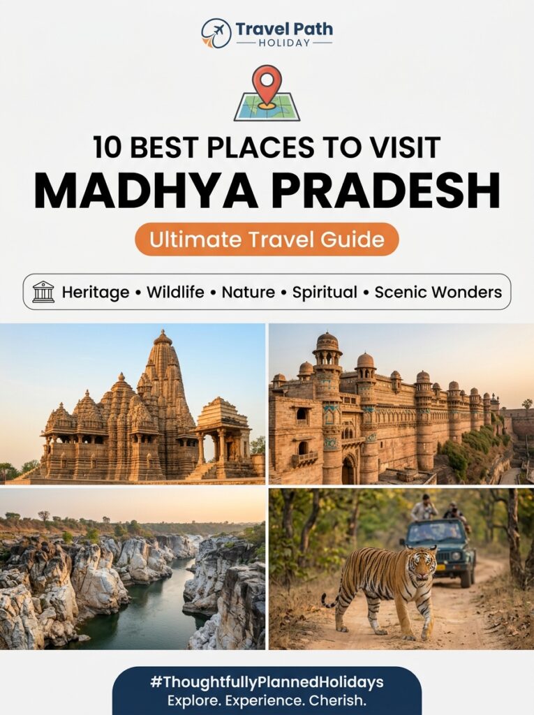
Overview Planning a pilgrimage to the holy city of Avantika (Ujjain) requires careful timing, especially with the addition of the grand Shri Mahakal Lok Corridor. The best time to visit Ujjain Mahakal Lok Corridor is during the winter months, from October to March, when the weather is pleasantly cool and comfortable for walking the 900-meter open-air pedestrian pathway. While the corridor is open year-round, seasonal fluctuations significantly affect the temple experience, outdoor walking comfort, and crowd densities. As Indore travelers are uniquely positioned just a short distance away, choosing the right month to plan your road or rail journey ensures you can experience the divine illumination of the corridor and the holy darshan of Lord Mahakaleshwar without the physical toll of extreme weather. Local Logistical Advice for Indore Travelers For travelers starting from Indore, Ujjain is the most popular day-trip or weekend spiritual destination. Here is how you can optimize your travel plans: 1. Transit & Route Options from Indore By Road (Highly Recommended): The distance between Indore and Ujjain is just 55 km. The journey via the smooth, 4-lane Indore-Ujjain Road (SH-27) takes approximately 1.5 hours by private AC cab or self-drive car. It is ideal for families and senior citizens who want a door-to-door transfer. By Train: Several daily trains run between Indore Junction (INDB) and Ujjain Junction (UJN), including the *Avantika Express*, *Malwa Express*, and frequent local DEMU shuttle trains. The rail travel time ranges from 1 to 1.5 hours, making it a budget-friendly option. By Flight: For outstation travelers booking under Indore to Madhya Pradesh Tour Packages, the Devi Ahilya Bai Holkar Airport (IDR) in Indore is the closest airport. You can land in Indore and directly board a pre-arranged cab to Ujjain. 2. VIP Darshan & Bhasma Aarti Booking Guidelines VIP Sheegra Darshan: To avoid standing in long lines that can stretch for 3 to 5 hours on weekends and holidays, you can purchase the Sheegra Darshan tickets (Rs. 250 per person). These can be booked online via the official temple website or at the designated ticket counters near the entrance. Bhasma Aarti Bookings: This sacred ritual occurs daily from 4:00 AM to 6:00 AM. Online booking slots open exactly 30 days in advance at 8:00 AM on the temple’s official portal. It requires uploading valid ID proofs. If you fail to secure an online slot, a limited offline quota is allocated daily at the temple office on a first-come, first-served basis (long queues form from the previous afternoon). Dress Code for Garbhagriha: To enter the sanctum sanctorum (Garbhagriha) for Jal Abhishek or during Bhasma Aarti, men must wear a traditional Dhoti-Sola (dhoti and upper stole), and women must wear a Saree. Traditional clothing is readily available for rent or purchase outside the temple. 3. Food and Rest Stops When travelling with family, finding hygienic dining options is key. The Indore-Ujjain highway features several excellent family restaurants. In Ujjain itself, close to the Mahakal Lok Corridor, you will find multiple options offering hand-vetted vegetarian options/dining and traditional Malwi cuisine like Dal Bafla, ensuring strict culinary compliance for traditional families. Complete Details & Practical Guidelines Month-by-Month Weather & Tourism Breakdown Season & Months Temperature Range Corridor Experience Key Festivals & Crowd Guidelines Winter (October – March) 10°C to 28°C Excellent. Mild, pleasant breeze. Ideal for daytime walks and evening exploration along Rudrasagar Lake. • Kartik Sawari (Nov)• Mahashivratri (Feb/Mar) – heavy crowds.• *Guideline:* Book VIP tickets & rooms 1 month ahead. Summer (April – June) 30°C to 45°C Challenging. Scorching daytime heat. Stone pathway absorbs heat; walking barefoot during the day is extremely difficult. • High summer vacation rush in May.• *Guideline:* Visit the corridor strictly after 6:30 PM to enjoy the lighting and cool breeze. Monsoon (July – September) 22°C to 32°C Scenic but Humid. Lush green surroundings. Rainfall makes walking pleasant but can disrupt outdoor sightseeing. • Shravan (Sawan) Month (Jul-Aug)• Sawan Monday Sawari processions.• *Guideline:* Expect massive crowds; expect local transport diversions. Detailed Seasonal Analysis #### 1. The Peak Winter Window: October to March (Best Time to Visit) This is undeniably the prime season to plan your journey. The day temperatures hover around a pleasant 24°C, while evenings can drop to a chilly 10°C. Why it works: The Mahakal Lok Corridor is an expansive, outdoor, open-sky plaza. Walking along its 900-meter length to view the 108 pillars, majestic sculptures, and fountains depicting Shiv Leela is comfortable at any hour of the day. Crowd Alert: This season coincides with peak wedding and school holiday periods. Weekends are heavily crowded. During Mahashivratri (usually late February or early March), the temple witnesses over a million devotees. If visiting during Mahashivratri, expect strict queue management and travel restrictions. #### 2. The Spiritual Monsoon Window: July to September Monsoons bring heavy rainfall to the Malwa region, painting the landscape green and filling the Kshipra River. The Sawan Experience: The holy month of Shravan (Sawan) falls during July and August. This is the most spiritually vibrant time to visit Ujjain. Every Monday, the deity is carried in a royal chariot (*Mahakal Sawari*) through the streets of the old city. Transit Tip for Indore Travelers: During Sawan Mondays, the local administration enforces strict vehicle barricading. Cabs from Indore are diverted or stopped at outer boundaries (like the Ujjain bypass or Nana Kheda). You will need to take local e-rickshaws to reach the corridor area. #### 3. The Hot Summer Window: April to June (Off-Peak) Summers in Central India are intense, with temperatures frequently touching 42°C to 45°C. Survival Guide: Inside the main temple, devotees must walk barefoot. During summer afternoons, the stone floors of the temple and the Mahakal Lok Corridor become extremely hot. Best Time of Day: If you are traveling in summer, plan your day-trip starting from Indore around 4:00 PM. Arrive in Ujjain by 5:30 PM, complete your Darshan, and enter the Mahakal Lok Corridor by 7:00 PM. The corridor is beautifully illuminated with LED lighting, and the lake breeze makes the evening walk very pleasant.
Tour Packages & Guides

Weekend Getaway from Indore to Udaipur Lake Palace: Itinerary

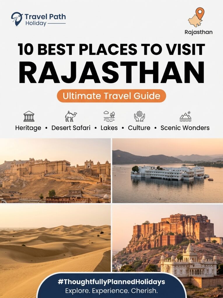
Overview Udaipur, affectionately known as the “Venice of the East” and the “City of Lakes,” stands as the quintessential royal escape for travelers departing from Indore. Nestled against the dramatic backdrop of the ancient Aravalli Range, Udaipur’s romantic allure centers around the mesmerizing Taj Lake Palace (Jag Niwas)—an 18th-century white marble marvel floating like a mirage on the calm waters of Lake Pichola. For working professionals, couples, and families in Malwa seeking a high-value 3-Day/2-Night weekend retreat, Udaipur delivers an irresistible blend of majestic palaces, sunset boat cruises, hilltop fortresses, vibrant markets, and rich Mewari cuisine. Executing a seamless weekend trip to Udaipur Lake Palace from Indore requires smart route selection, pre-arranged heritage admissions, and a well-paced sightseeing schedule. Located just under 390 km from Indore, Udaipur is effortlessly accessible via overnight sleeper train, private highway road trips, or rapid flight connections. This comprehensive 3-Day/2-Night weekend itinerary, curated by local experts at Travel Path Holiday, details exact transit coordinates, hour-by-hour sight itineraries, Lake Pichola boat booking procedures, Sajjangarh Monsoon Palace sunset strategies, and hand-vetted vegetarian dining options. Local Logistical Advice for Indore Travelers Planning a short weekend escape from Central India demands logistical precision to maximize your hours on the ground without travel fatigue. Here is essential advice tailored specifically for travelers departing from Indore: Transit Coordinates from Indore Overnight Train Route (Best for Maximizing Weekend Time): The most convenient and cost-effective option for Indori travelers is the Indore – Udaipur City Veer Bhumi Express (Train 19329). Departing Indore Junction (INDB) daily at 17:40 hrs, it glides across Madhya Pradesh into Rajasthan overnight, arriving at Udaipur City Railway Station (UDZ) at 05:00 hrs the following morning. Taking this train on Thursday or Friday evening grants you three full days of sightseeing. For the return journey, Train 19329 leaves Udaipur City at 20:35 hrs and drops you back in Indore at 08:50 hrs Monday morning—perfect for returning straight to work. Additionally, travelers planning broader multi-city itineraries can connect via the Indore – Jaipur Express (12973) or Ranthambore Express (12465). Highway Self-Drive & Private Taxi Route: A scenic 385 km road trip connects Indore to Udaipur via well-paved, four-lane national and state highways. The optimal route runs: Indore → Ujjain Bypass → Ratlam → Mandsaur → Neemuch → Chhoti Sadri / Chittorgarh Bypass → Udaipur (via NH48 and State Highways). Driving a private AC Sedan or SUV (such as an Innova Crysta booked through Travel Path Holiday) takes approximately 6.5 to 7.5 hours including breakfast stops. Departing Indore by 05:00 AM allows you to reach your lakefront hotel in Udaipur by 12:30 PM. Flight Connections: Travelers preferring air travel can fly from Indore (IDR – Devi Ahilya Bai Holkar Airport) to Udaipur (UDR – Maharana Pratap Airport at Dabok). Direct non-stop flights operate seasonally (taking approx. 1 hour 15 minutes), while year-round daily connecting flights operate via Mumbai (BOM) or Delhi (DEL) with travel times between 3.5 and 5 hours. Maharana Pratap Airport is situated 22 km (about 35 minutes) east of Lake Pichola and the Old City heritage district. Climate Transition: Malwa Plateau to Aravalli Lake Basin Indore travelers accustomed to Malwa’s dry tropical weather should prepare for Udaipur’s distinct valley micro-climates: Winter Season (October to March): Magnificent weather for outdoor exploration with daytime temperatures ranging between 18°C and 26°C. However, cold winds off Lake Pichola cause night temperatures to dip sharply to 8°C–12°C. Pack warm jackets and woolens for evening boat rides and rooftop dinners. Monsoon Season (July to September): Udaipur transforms into a lush green paradise as rains fill Lake Pichola, Fateh Sagar, and Swaroop Sagar. Temperatures remain comfortable (22°C–30°C), making it the most romantic season for an Indori weekend road trip. Summer Season (April to June): High midday temperatures (36°C–42°C) with intense solar reflection off marble monuments. Schedule heavy monument tours like City Palace during early morning hours and relax during afternoon heat. Mobile Connectivity & Prepaid SIM Cards Travelers traveling from MP can rest assured that all standard prepaid mobile SIM cards (Jio, Airtel, Vi) function seamlessly across Rajasthan without any national roaming fees or service disruptions. High-speed 4G/5G data is reliable throughout Udaipur city, hotel hubs, and along the Indore-Ratlam-Neemuch highway corridor. Complete Details & Practical Guidelines Customized 3-Day / 2-Night Weekend Itinerary #### Day 1: Royal City Palace, Jagdish Temple, Lake Pichola Sunset Cruise & Taj Lake Palace Views 08:00 AM – 09:30 AM | Hotel Check-In & Malwa-Style Refreshment: Arrive in Udaipur via overnight train or morning drive. Check into your lake-view hotel near Hanuman Ghat or Lal Ghat. Refresh and enjoy a light breakfast of hot Poha, Pyaz Kachori, and Kulhad Chai at lakeside cafes. 10:00 AM – 01:30 PM | City Palace Complex & Crystal Gallery Tour: Walk to the sprawling City Palace Udaipur, built over 400 years by a succession of Maharanas. Explore the Badi Mahal (Garden Palace perched on a natural hillock), Mor Chowk (famous courtyard decorated with 5,000 glittering glass mosaic peacocks), Zenana Mahal, and Chini Chitrashala. Upgrade your entry to visit the world-renowned Crystal Gallery inside Fateh Prakash Palace, showcasing custom crystal furniture and delicate glasswork ordered by Maharana Sajjan Singh in 1877. *Museum Entry Fee:* ₹400 per adult; *Crystal Gallery Entry:* ₹700 per adult; *Camera Fee:* ₹200. 01:30 PM – 02:30 PM | Heritage Pure Vegetarian Lunch: Enjoy freshly cooked pure vegetarian dishes at established dining halls along Jagdish Temple Road. Sample authentic Mewari Thali featuring Dal Baati Churma, Gatte ki Sabzi, and Ker Sangri. 02:45 PM – 04:15 PM | Jagdish Temple & Old City Heritage Walk: Visit the magnificent Jagdish Temple, built in 1651 by Maharana Jagat Singh. Marvel at its 79-foot high carved Indo-Aryan spire, intricate marble elephant carvings, and bronze Garuda statue. Take a short walk through the bustling lanes of Bada Bazaar and Clock Tower area. 04:45 PM – 06:30 PM | Official Lake Pichola Boat Cruise & Jagmandir Island Stopover: Head to the official City Palace Boat Jetty for a high-value sunset cruise on Lake Pichola. Glide past the shimmering

Tour Packages & Guides

Historical Significance and Architecture of Kochi Fort

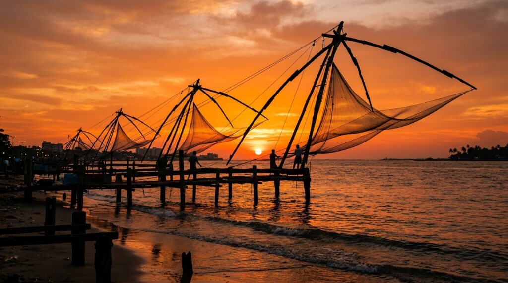
Overview Fort Kochi is a living open-air museum where five centuries of global colonial history meet traditional Malabar maritime heritage. Located along the serene harbor waters of the Arabian Sea in coastal Kerala, this historic enclave is internationally renowned for its extraordinary blend of Portuguese, Dutch, British, and indigenous Kerala architectural styles. The fascinating history of Kochi Fort traces back to 1341, when a massive flood in the Periyar River carved out a natural harbor, transforming an obscure fishing hamlet into Asia’s premier spice hub. Over the next 500 years, Fort Kochi became the very first European colonial settlement in India. In 1503, the Portuguese established Fort Manuel here with the permission of the Rajah of Kochi, constructing grand churches, stone forts, and cobblestone lanes. They were followed in 1663 by the Dutch East India Company (VOC), who re-engineered the town with distinctive gables, heavy bastions, and whitewashed brick masonry, and finally by the British Crown in 1795, who introduced Neoclassical civic architecture, sprawling bungalows, and leafy parade grounds. From the timber-framed nave of St. Francis Church (India’s oldest European church) and the soaring Gothic spires of Santa Cruz Cathedral Basilica to the stone ramparts of Bastion Bungalow and the iconic cantilevered Chinese Fishing Nets (*Cheena Vala*), Fort Kochi offers travelers an unmatched journey through time. For travelers departing from Indore and Central India, exploring Fort Kochi’s architectural landmarks is a rich cultural experience. This comprehensive guide provides deep historical insights, architectural analysis, practical visitor guidelines, and tailored transit logistics for an unforgettable holiday planned by Travel Path Holiday. Local Logistical Advice for Indore Travelers 1. Transit Coordinates from Indore to Kochi Flight Routes & Layovers: The fastest and most convenient connection from Indore to Kerala is via direct connecting flights from Devi Ahilya Bai Holkar Airport (IDR) to Cochin International Airport (COK). Leading carriers such as IndiGo, Air India, and Vistara operate daily flights with short, smooth layovers in Mumbai (BOM, 1h 30m to 2h layover), Delhi (DEL, 2h 10m layover), or Bengaluru (BLR, 1h 40m layover). Total flying and layover duration ranges between 4.5 and 6.5 hours. Upon arrival at Cochin International Airport (Nedumbassery), Fort Kochi is located approximately 42 kilometers to the southwest. Travel Path Holiday arranges private, pre-booked AC sedan or SUV cabs for a comfortable 75 to 90-minute highway drive straight to your heritage hotel in Fort Kochi. Train Routes: For travelers who enjoy long-distance scenic rail journeys through Central and Southern India, direct trains link Indore Junction (INDB) to Ernakulam. The Ahilyanagari Express (22645) departs Indore every Tuesday at 16:45 PM and arrives at Ernakulam Junction (ERS) on Thursday morning at 06:00 AM after a 37-hour journey across Madhya Pradesh, Maharashtra, Andhra Pradesh, Tamil Nadu, and Kerala. Alternatively, the Indore – Kochuveli Weekly SF Express (20932) runs every Tuesday morning. From Ernakulam Junction station, Fort Kochi is just 12 kilometers away (25 minutes by taxi or auto-rickshaw). Travelers can also take the scenic public Ro-Ro water ferry from Ernakulam Marine Drive jetty to Fort Kochi jetty for a nominal fare of ₹6 to ₹10 per passenger. 2. Climate & Humidity Transition (Malwa Plateau to Coastal Kerala) Moving from the dry, elevated continental climate of the Malwa plateau in Indore to the humid coastal climate of Kochi involves an environmental shift. Relative humidity in Fort Kochi averages 75% to 90% year-round, with daily temperatures ranging between 26°C and 34°C. Clothing & Hydration Tips: Pack breathable, lightweight cotton or linen clothing, wide-brimmed sun hats, UV protection sunglasses, and comfortable flat walking shoes or cushioned sandals suitable for cobblestone lanes and heritage stone pathways. Stay well-hydrated throughout your walking tours by enjoying fresh tender coconut water (*Elaneer*), widely available along Fort Kochi Beach and Parade Ground for ₹40 to ₹60. Plan architectural walking tours during the cooler morning hours (8:30 AM to 11:30 AM) or late afternoon (3:30 PM to 6:00 PM). 3. Mobile Data & Connectivity Unlike certain sensitive border regions or union territories like Jammu & Kashmir where out-of-state prepaid mobile SIM cards are blocked, standard prepaid SIM cards issued in Madhya Pradesh (Airtel, Jio, Vi) work flawlessly across Kerala. High-speed 4G and 5G mobile data, GPS navigation, and digital UPI payments remain completely operational throughout Fort Kochi, Mattancherry, and Ernakulam. Complete Details & Practical Guidelines The Historical Evolution of Fort Kochi: Four Distinct Layers The unique architectural skyline of Fort Kochi is the result of four overlapping historical eras: “` +———————————————————————————–+ HISTORICAL TIMELINE OF KOCHI FORT +———————————————————————————–+ 1341 AD Great Periyar Flood creates Kochi natural harbor & spice port 1500–1663 AD Portuguese Era: Fort Manuel built, Catholic churches established 1663–1795 AD Dutch VOC Era: Bastion Bungalow, Dutch gables, urban redesign 1795–1947 AD British Era: Neoclassical bungalows, open parade grounds, trade 1947–Present Heritage Protection Enclave, UNESCO Candidate & Cultural Hub +———————————————————————————–+ “` #### 1. The Pre-Colonial Malabar Era (Before 1500) Prior to European arrival, Kochi was governed by the Rajahs of the Kingdom of Cochin (Perumpadappu Swaroopam). Following the catastrophic flood of 1341 that silted the ancient port of Muziris (Kodungallur), Kochi emerged as the premier natural deep-water harbor on the Malabar Coast. Arab, Chinese, and Jewish merchant fleets established trade ties here, trading Malabar black pepper (“black gold”), cardamom, and cinnamon. Local building methods relied on *Thachu Shastra* (traditional Kerala science of carpentry and architecture)—featuring laterite stone masonry, heavy teakwood timber frameworks, steep sloping hip roofs clad in terracotta clay tiles, and open inner courtyards designed to channel coastal breezes and shed heavy monsoon rains. #### 2. The Portuguese Era (1500 – 1663) Following Vasco da Gama’s landing at Calicut in 1498, Portuguese commander Afonso de Albuquerque arrived in Kochi in 1503. In exchange for helping the King of Kochi against the Zamorin of Calicut, the Portuguese were granted land to build Fort Manuel—the very first European fortress constructed on Asian soil. Architectural Legacy: The Portuguese introduced European ecclesiastical Gothic and Manueline architectural elements to India. They constructed sturdy thick-walled churches, residential quarters with arched arcades, high timber-trussed ceilings, and central plazas. They

Tour Packages & Guides

Packing Guide for Kochi Fort: Summer vs Winter Wear

Overview Planning a getaway from Central India to the historic coastal precinct of Fort Kochi requires a smart strategy when zipping up your luggage. Unlike the dry, continental climate of Malwa—where Indoris experience crisp winters and scorching dry summers—Fort Kochi presents a tropical maritime climate characterized by high humidity, coastal breezes, sudden rain showers, and intense midday sunshine. Whether you are wandering through cobblestone alleys, admiring Dutch and Portuguese heritage villas, dining at bohemian cafes along Princess Street, or watching fishermen operate the iconic Chinese Fishing Nets, what you wear directly dictates your comfort. A well-planned packing list for Kochi Fort ensures you remain cool, stylish, and culturally respectful throughout your stay. Summer in Kochi demands ultra-light, moisture-wicking organic cottons and loose linen silhouettes, while the winter months (October through February) offer pleasant mornings and breezy evenings ideal for smart-casual wear, requiring lightweight layering. Additionally, monsoon travelers must account for sudden tropical downpours with quick-dry apparel and specialized gear. This definitive packing guide breaks down seasonal wardrobe choices, anti-slip footwear for heritage walking tours, high-SPF skincare essentials, tropical mosquito protection, and practical luggage tips tailored specifically for travelers departing from Indore. Local Logistical Advice for Indore Travelers Transit Routes & Flight Connections from Indore Travelers departing from Indore have convenient air and rail connections to reach Cochin International Airport (COK) or Ernakulam Junction (ERS): Air Routes: Devi Ahilya Bai Holkar Airport (IDR) offers daily connecting flights to Cochin International Airport (COK) via major aviation hubs including Mumbai (BOM), Delhi (DEL), and Bengaluru (BLR). Connecting flights operated by IndiGo and Air India typically feature short layover times ranging between 1.5 to 3 hours, bringing your total travel duration to around 4.5 to 6 hours. Rail Options: For those who prefer scenic long-distance train journeys, the direct Ahilyanagari Express (Train No. 22645) connects Indore Junction (INDB) directly to Ernakulam Junction (ERS). Departing Indore on weekly schedules, this train crosses Central and Southern India, taking approximately 36 to 38 hours. Connecting trains via Mumbai Central or Hazrat Nizamuddin are also popular choices. Climate & Humidity Transition Strategy The Malwa-to-Coastal Shift: Indoris leaving behind Indore’s dry atmosphere (where summer humidity drops below 25% and winter temperatures can dip to 8°C) will immediately feel Kochi’s tropical humidity, which remains high year-round between 75% and 90%. Transit Clothing Tip: Wear lightweight, breathable cotton trousers and a layered t-shirt during your flight or train journey. Keep a light jacket or stole in your cabin baggage for cold air-conditioned airport terminals or train coaches, but ensure your main apparel underneath is breezy so you can comfortably step into Kochi’s warm tropical air upon arrival. Mobile Connectivity Note for MP Travelers Travelers from Madhya Pradesh often ask about mobile network roaming restrictions. Rest assured that standard prepaid SIM cards issued in MP (Airtel, Jio, Vi) work seamlessly across Kerala with full 4G/5G data roaming enabled. Unlike regions with security restrictions like Jammu & Kashmir, your domestic prepaid connection will operate smoothly without needing any temporary local SIM cards. Complete Details & Practical Guidelines Seasonal Breakdown: Summer vs. Winter (and Monsoon) Wear #### 1. Summer Wear (March to May) Summer in Fort Kochi is warm and intensely humid, with daytime temperatures hovering between 29°C and 34°C, accompanied by high heat index levels. Apparel Strategy: Pack exclusively natural, breathable fabrics such as 100% pure cotton, khadi, and linen. Loose-fitting cut-sew t-shirts, oversized linen shirts, airy palazzo pants, and cotton shorts are essential. Color Palette: Opt for whites, creams, pastels, and soft earth tones that reflect sunlight rather than absorb heat. Avoid: Synthetic materials like polyester, nylon, tight skinny jeans, and heavy denims, which trap sweat and cause heat rashes in high humidity. #### 2. Winter Wear (October to February) Winter is the peak tourist season in Kochi, featuring pleasant, sunny days (24°C to 30°C) and cooler sea breezes in the late evenings. Apparel Strategy: Pack light cotton smart-casuals for daytime sightseeing. For evenings at waterfront restaurants or cultural Kathakali performances, carry breathable cotton maxi dresses, linen trousers, short-sleeved casual button-downs, and light cotton shrugs. Evening Layering: A lightweight cotton scarf, pashmina stole, or light denim shirt is sufficient for breezy coastal nights along Fort Kochi Beach or air-conditioned dining spaces. Heavy woolen coats, thermals, or leather jackets are completely unnecessary. #### 3. Monsoon Wear (June to September) The South-West Monsoon brings heavy, romantic downpours and dramatic coastal skies, with temperatures averaging 24°C to 28°C. Apparel Strategy: Focus on quick-drying synthetic blends, lightweight polyester shorts, knee-length skirts, or cropped linen trousers that do not drag in rain puddles. Darker colors are recommended to prevent mud splatter visibility. Rain Gear: Carry a compact, wind-resistant umbrella and a high-quality lightweight poncho or breathable raincoat. Avoid heavy waterproof jackets that lock in body heat and cause excessive perspiration inside. Footwear Recommendations for Heritage Walks Fort Kochi is best explored on foot. However, its historic streets feature a mix of cracked stone pavements, unpaved alleyways, cobblestone plazas around Jew Town, and sandy stretches near the beach. Footwear Type Recommended Usage Key Features & Tips Cushioned Walking Sneakers Daytime heritage walking tours, visiting Mattancherry Palace & Jew Town Choose breathable mesh uppers with arch support. Wear thin cotton socks to prevent blisters. Anti-Slip Strapped Sandals Monsoon walks, casual beach strolls, evening cafe visits Water-resistant rubber or EVA soles (brands like Teva or Decathlon) with adjustable straps. Canvas Slip-Ons / Loafers Evening dining, art gallery visits, Kathakali shows Easy to slip off when entering traditional heritage spaces, art centers, or places of worship. Footwear to Leave at Home High heels, formal leather shoes, slick-soled flip-flops High heels get trapped in cobblestone gaps; smooth soles slip on wet heritage tiles and algae-covered sea steps. Sun Protection, Skincare & Tropical Health Essentials The tropical sun in coastal Kerala is strong even on overcast days. Your toiletry kit should prioritize sun defense and hydration: High-SPF Sunscreen: Pack a broad-spectrum SPF 50+ PA++++ sunscreen. Opt for sweat-resistant, non-greasy water-gel formulations that absorb quickly without feeling sticky in high humidity. Reapply every

Tour Packages & Guides

Local Food in Kochi Fort: What and Where to Eat

Overview Fort Kochi is a coastal historic enclave where centuries of international spice trade have shaped an extraordinary culinary culture. Walking through its tree-lined colonial streets, travelers are treated to a blend of native Malabar flavors, Arab spice traditions, Dutch maritime influences, and Portuguese culinary inheritances. From iconic regional dishes like Karimeen Pollichathu (pearl spot fish wrapped in banana leaf) and rich Malabar seafood curries to flaky Kerala Parotta with Veg Kurma and bohemian artistic cafes like Kashi Art Cafe, the neighborhood offers an unforgettable feast for every palate. For travelers arriving from Indore and Central India, exploring local food in Kochi Fort is both an adventurous culinary journey and a delightful cultural experience. Whether you are looking for authentic coastal non-vegetarian delicacies or seeking hand-vetted vegetarian options/dining prepared with strict kitchen hygiene, Fort Kochi delivers an unbelievable array of flavors. This comprehensive guide outlines what to eat, where to eat, price expectations, and essential food logistics tailored specifically for travelers departing from Indore. Local Logistical Advice for Indore Travelers 1. Transit Coordinates from Indore to Kochi Flight Routes & Layovers: The most comfortable way to reach Kochi from Indore is via direct connecting flights departing from Devi Ahilya Bai Holkar Airport (IDR) to Cochin International Airport (COK). Airlines such as IndiGo, Air India, and Vistara offer seamless daily connections with short layovers in Mumbai (BOM, 1h 45m layover), Delhi (DEL, 2h 10m layover), or Bengaluru (BLR, 1h 30m layover). Total flight travel time ranges between 4.5 to 6 hours. Upon landing at COK, Fort Kochi is located approximately 42 kilometers away, reachable in 75 to 90 minutes via private AC taxi pre-arranged by Travel Path Holiday. Train Routes: For travelers preferring scenic rail journeys, direct train options connect Central India to Ernakulam. The Ahilyanagari Express (22645) departs Indore Junction (INDB) every Monday, taking approximately 34 to 36 hours to reach Ernakulam Junction (ERS). Alternatively, the Indore – Kochuveli Weekly SF Express (20932) provides direct connectivity. From Ernakulam Junction, Fort Kochi is a short 12-kilometer drive (25 minutes by taxi or auto-rickshaw). 2. Climate & Humidity Transition (Malwa Plateau to Coastal Kerala) Indore travelers transition from the dry, elevated continental climate of the Malwa region to Fort Kochi’s warm tropical maritime environment, where relative humidity routinely stays between 75% and 90%. Digestive & Food Adaptation Tips: To stay energized while sampling spicy Malabar gravies and coconut-infused dishes, drink plenty of fresh tender coconut water (*Elaneer*), widely sold by street vendors along Fort Kochi Beach for ₹40 to ₹60 per coconut. Balance heavy evening seafood dinners with light, steamed breakfast staples such as *Puttu* (steamed rice cylinders with grated coconut) or *Appam* (fermented rice pancakes). 3. Mobile Data & Connectivity Unlike union territories like Jammu & Kashmir where prepaid mobile SIMs from other states are blocked, standard prepaid SIM cards issued in Madhya Pradesh (Jio, Airtel, Vi) work flawlessly throughout Kerala. High-speed 4G and 5G data roaming remains fully operational across Fort Kochi, Mattancherry, and Ernakulam, making digital payments (UPI) and map navigation effortless. Complete Details & Practical Guidelines Iconic Local Dishes in Fort Kochi: What You Must Eat #### 1. Karimeen Pollichathu (Coastal Specialty) What It Is: Pearl Spot fish (*Karimeen*), native to Kerala backwaters, marinated in a paste of shallots, red chillies, ginger, garlic, curry leaves, and lemon juice. The fish is seared, wrapped tightly in a wilted banana leaf, and slow-cooked on a flat skillet so the aromatic spices infuse deep into the meat. Flavor Profile: Smoky, tangy, and moderately spicy with rich herbal notes from the banana leaf. Average Price: ₹380 to ₹580 per dish (depending on fish size). Best Paired With: Steamed Kerala red Matta rice or hot appams. #### 2. Kerala Parotta with Veg Kurma What It Is: Flaky, multi-layered, ringed flatbread made from refined flour dough kneaded with oil and beaten till paper-thin before rolling and pan-tossing. It is paired with Veg Kurma—a velvety, mildly seasoned coconut curry stewed with diced potatoes, carrots, green beans, and green peas. Flavor Profile: Rich, buttery texture of the parotta perfectly complements the creamy, aromatic, clove-and-cardamom infused veg kurma. Average Price: ₹120 to ₹220 per thali/plate. Ideal For: Pure vegetarian travelers looking for a comforting, satisfying lunch or dinner. #### 3. Traditional Malabar Fish & Veg Curry What It Is: A signature Malabar curry prepared with a base of freshly pressed coconut milk, ground turmeric, coriander, mustard seeds, and *Kudampuli* (Malabar tamarind/brindleberry), which imparts a distinct sour-smoky edge. Available in both fresh sea fish varieties (Kingfish, Seer fish) and vegetarian variations using raw plantain or Yam (*Parippu & Olan* style). Average Price: ₹260 to ₹460 per portion. #### 4. Kochi Coastal Seafood Platter (For Non-Vegetarian Foodies) What It Is: Fresh daily catch including Jumbo Tiger Prawns, Calamari (Squid), and Red Snapper. Ordered either in *Meen Moilee* style (a gentle, creamy white coconut milk gravy with turmeric and ginger) or spicy Malabar pepper fry. Average Price: ₹450 to ₹850 per dish. Hand-Vetted Vegetarian Options & Dining in Fort Kochi For travelers from Indore who maintain strict dietary preferences—including pure vegetarian meals cooked without garlic or onion, or prepared in dedicated vegetarian kitchens—Fort Kochi offers reliable, high-quality choices: Saravana Bhavan & Gokul Oottupura (KB Jacob Road & Fort Kochi Entrance): Established pure vegetarian restaurants offering traditional South Indian thalis, Ghee Roast Dosas, Crispy Medu Vadas, and North Indian vegetarian curries served with phulkas. All items are prepared in strictly vegetarian kitchens with separate utensil standards. Average cost for two: ₹250 to ₹450. Gujarati Street Heritage Dining (Mattancherry – 2 km from Fort Kochi): Mattancherry has been home to a vibrant Gujarati merchant community for over 150 years. Along Gujarati Street, small heritage eateries serve freshly cooked pure vegetarian thalis, dhokla, khakhra, and sweet shrikhand. These spots are exceptional for families seeking wholesome, familiar North Indian and Central Indian vegetarian flavors. Hotel Dining Setup via TPH: When you book through Travel Path Holiday, our team pre-maps restaurants along your daily sightseeing trail to ensure you receive hand-vetted vegetarian options/dining throughout

Tour Packages & Guides

Nilnag Lake Yusmarg: Pine Forests Trekking & Cab Guide

Overview Nilnag Lake is a high-altitude alpine lake nestled deep inside dense blue pine forests near Yusmarg in Kashmir’s Badgam district. Sitting at an altitude of 2,180 meters (7,150 feet) above sea level, Nilnag—derived from the Kashmiri words meaning “Blue Lake”—is famous for its sparkling greenish-blue waters, ancient pine woods (*Pinus wallichiana*), and tranquil mountain ambiance. Located approximately 47 km southwest of Srinagar and 13 km from the sprawling meadows of Yusmarg, Nilnag remains one of Kashmir’s most captivating offbeat destinations for nature lovers, trekkers, and peace-seekers away from crowded commercial spots. Travelers can reach Nilnag either by taking a scenic 4.5 km downhill forest trek from Yusmarg meadow through pine woods or by driving along a motorable mountain road via Nagam and Surasyar. This comprehensive guide outlines flight and train connections from Indore, trekking routes, cab union regulations, pricing, optimal visitor timings, forest safety protocols, and how Travel Path Holiday ensures a seamless travel experience from Central India to the Pir Panjal range. Local Logistical Advice for Indore Travelers Planning a trip from Indore to the quiet pine forests of Badgam requires thoughtful preparation regarding transport, elevation changes, telecom rules, and dietary preferences. Direct & Connecting Flight Options from Indore (IDR to SXR) Morning Flight Routes: Depart from Devi Ahilya Bai Holkar Airport (IDR), Indore on early morning connecting flights operated by IndiGo or Air India via Indira Gandhi International Airport (DEL), Delhi. Layover & Arrival Timings: Flights typically feature a 2 to 3-hour layover in Delhi, landing at Srinagar’s Sheikh ul-Alam International Airport (SXR) between 12:30 PM and 2:00 PM. Same-Day Transfer: Srinagar Airport is located just 42 km from the Nagam/Nilnag access route. Landing by early afternoon allows travelers to reach Yusmarg or Nilnag Lake by private vehicle within 1.5 to 2 hours, making a direct transfer smoothly achievable on day one. Train Routes via Malwa Express (IDA to JAT/SVDK) Train Schedule: For travelers from Malwa who prefer rail travel, board the daily Malwa Express (12919) departing Indore Junction (IDA) at 12:15 PM and arriving at Jammu Tawi (JAT) / Shri Mata Vaishno Devi Katra (SVDK) around 4:10 PM the following afternoon. Onward Highway Journey: From Jammu or Katra, travelers can take the Vande Bharat Express to Banihal and transfer to local train services, or hire a private tourist cab via the Jammu-Srinagar National Highway (NH-44), crossing the major Chenani-Nashri and Banihal-Qazigund tunnels to reach Srinagar or Yusmarg. Altitude Adaptation & Weather Readiness Elevation Shift: Indore rests at approximately 550 meters (1,804 feet), whereas Nilnag Lake sits at 2,180 meters (7,150 feet) and Yusmarg meadow at 2,400 meters (7,874 feet). Acclimatization Tips: Severe altitude sickness is rare at 2,180 meters, but the transition from Central India’s warm plains to cool mountain air can cause mild tiredness. Maintain good hydration during layovers and avoid heavy physical exertion immediately after arriving. Clothing Recommendations: Summer daytime temperatures average 15°C to 24°C, dropping to 8°C–12°C under deep forest canopies. Carry light woolens and windcheaters for summer (May–September), and heavy thermals, fleece jackets, down coats, and warm boots for spring (April) and autumn/winter (October–March). Mobile SIM Card Rules in J&K Prepaid SIM Restriction: Pre-paid mobile SIM cards purchased in Madhya Pradesh (Central India telecom circle) do not work in Jammu & Kashmir due to regional security regulations. Postpaid SIM Requirement: Indori travelers must use a Postpaid SIM card (Jio, Airtel, or BSNL) for mobile data and calling services. Local Prepaid Tourist SIM: If you travel with a prepaid SIM, TPH assists in getting a temporary local J&K prepaid SIM card at Srinagar Airport or Chadoora upon displaying a valid government photo ID (Aadhaar or Voter ID). Hand-Vetted Vegetarian Dining Options for Indori Travelers Dietary Comfort: Indori food lovers with strict vegetarian habits receive dedicated meal arrangements through Travel Path Holiday. En-Route Meals: Along the Srinagar-Chadoora-Yusmarg corridor, TPH arranges stops at verified hygienic eateries serving freshly cooked pure vegetarian Kashmiri dishes—such as *Dum Aloo*, *Chaman* (cottage cheese gravy), and *Haak* greens—prepared in dedicated vegetarian kitchens with fresh local ingredients. Trail Catering: We provide hand-vetted vegetarian options/dining for all your day trips, complete with warm packed lunches and hot tea for forest hikes. Complete Details & Practical Guidelines Route Maps & Geographic Distances Nilnag Lake is accessible directly via the Nagam road route or by trekking down from Yusmarg meadow. Route Segment Distance Approximate Driving / Hiking Time Road & Trail Conditions Srinagar Airport (SXR) to Nagam 28 km 45 minutes Smooth asphalt, double-lane state road Nagam to Nilnag Lake Parking 19 km 40 minutes Winding mountain road, narrow asphalt curves Yusmarg Meadow to Nilnag Lake (Road) 13 km 35 minutes Motorable road via Nagam-Surasyar junction Yusmarg Meadow to Nilnag Lake (Trek) 4.5 km 1.5 – 2 hours (one way) Unpaved forest dirt trail through pine woods Trekking Trails: Yusmarg to Nilnag Lake The trek from Yusmarg meadow down to Nilnag Lake is one of Central Kashmir’s most scenic day hikes. “` [Yusmarg Meadow – 2,400m] │ ├─► (4.5 km Downhill Forest Trail through Kail & Blue Pine Woods) │ [Nilnag Lake Edge – 2,180m] │ ├─► (2.5 km Trail along Riverbank) │ [Doodh Ganga River Stream] “` Trail Experience: Starting near the JKTDC complex in Yusmarg, the path descends through dense blue pine (*Kail*) and fir trees. The 4.5 km trek drops about 220 meters in elevation over soft pine-needle forest ground. Trek Duration: 1.5 to 2 hours downhill; 2 to 2.5 hours uphill on the return leg. Difficulty Rating: Moderate. Easily manageable for beginners, active families, and fit seniors. Doodh Ganga Extension: From Nilnag Lake, an optional 2.5 km trail leads north to the white water cascades of the Doodh Ganga river stream, where mountain waters surge over boulders. Cab Union Rules, Stand Fees & Fair Pricing Understanding local transport rules in Kashmir ensures a hassle-free journey. Srinagar Taxi Union Regulations: Private tourist cabs (Innova, Ertiga, Swift Dzire) hired from Srinagar are fully authorized to drive passengers directly to the Nilnag Lake parking area via the Chadoora-Nagam route. Standard Srinagar-Nilnag Round

Tour Packages & Guides

Malwa Express Indore to Jammu: Train Travel Tips & Tatkal Booking Guide

Overview For travelers departing from Indore and the wider Malwa region, Train 12919 / 12920 Malwa Superfast Express represents the most direct, dependable, and traditional rail gateway to Kashmir. Connecting Indore Junction (INDB) directly to Jammu Tawi (JAT) and onwards to Shri Mata Vaishno Devi Katra (SVDK), this iconic daily express spans a distance of approximately 1,540 kilometers across central and northern India in around 27 hours and 35 minutes. Whether you are planning a multi-generational family holiday to Srinagar, traveling with senior citizens who prefer spacious AC berths over air travel, or combining a Kashmir valley tour with a holy visit to Mata Vaishno Devi, the Malwa Express eliminates the hassle of changing trains or switching terminals in Delhi. However, securing confirmed berths on this highly sought-after route requires strategic planning. Due to heavy demand from Central India, regular quotas fill up months in advance, making Tatkal and Premium Tatkal bookings a crucial skill for prospective travelers. This comprehensive guide covers exact departure coordinates from Indore, AC class selection, onboard food and hygiene tips, Tatkal booking blueprints, and seamless road or rail connections from Jammu Tawi to Srinagar—brought to you by the local experts at Travel Path Holiday Indore. Local Logistical Advice for Indore Travelers 1. Boarding Coordinates at Indore Junction (INDB) Train 12919 Malwa Express departs daily from Indore Junction at 12:15 PM. To ensure a relaxed start to your journey: Station Arrival Time: Reach Indore Junction by 11:30 AM (45 minutes prior to departure). Platform 1 is the primary rake placement platform for Malwa Express, though checking the live National Train Enquiry System (NTES) status on arrival is recommended. Access & Parking: If you are arriving from Vijay Nagar, Saket, or Palasia, route via the main station gate (Sialpur/Platform 1 entrance). For travelers from Annapurna, Rajendra Nagar, or Mhow, using the Chhoti Gwaltoli side parking offers faster drop-offs away from central city traffic. Intermediate Boarding Points: If you reside near Dewas or Ujjain, boarding at Dewas Junction (12:51 PM) or Ujjain Junction (01:50 PM) is equally convenient, saving you the drive to central Indore. 2. Choosing Between Train & Flight from Indore When planning your trip from Central India to Kashmir, evaluate your travel style and schedule against the available options: Direct Rail (Malwa Express): Departs Indore at 12:15 PM and arrives at Jammu Tawi at 03:50 PM the next day. Best for relaxed family bonding, budget optimization, senior citizens, and those traveling with extra luggage (up to 40–50 kg per berth in AC classes without excess baggage charges). Connecting Flights (Indore to Srinagar via Delhi): Flights departing Devi Ahilya Bai Holkar Airport (IDR) connect via Indira Gandhi International Airport (DEL) to Srinagar International Airport (SXR) in approximately 5 to 7 hours total transit time. For a detailed breakdown of flight layovers, baggage transfers, and airport navigation, explore our Indore to Srinagar Flight & Delhi Layover Guide. 3. Food, Water, and Catering Strategy for Indori Palates The 28-hour journey on Malwa Express crosses Madhya Pradesh, Uttar Pradesh, Haryana, Punjab, and Jammu & Kashmir. Indori travelers accustomed to specific culinary tastes should plan their onboard meals thoughtfully: Home-Packed Snacks: Pack dry Indori specialties such as Sev, Khakhra, Mathri, and roasted Makhana for the afternoon and evening. Fresh Poha-Jalebi packed from local Indore halwais stays fresh for the first 3–4 hours of travel. IRCTC e-Catering Options: Order fresh, hot meals through the IRCTC RailConnect app or RailRestro at key halts. Recommended ordering points for pure vegetarian thalis include Bhopal Junction (05:30 PM), Agra Cantt (01:25 AM), New Delhi (04:15 AM), and Ambala Cantt (07:30 AM). Hand-Vetted Vegetarian Options: Families adhering to strict dietary preferences can rely on pre-ordered pure vegetarian thalis at major stations along the route, ensuring clean preparation without garlic or onion when requested via select e-catering vendors. 4. Altitude Transition and Health Preparation Traveling by train provides a gradual altitude adjustment compared to flying. You move from the Malwa plateau (~550 meters above sea level) down to the northern plains, arriving in Jammu (~327 meters). However, the subsequent road drive from Jammu to Srinagar ascends through the Pir Panjal range to over 1,585 meters (Srinagar) and up to 2,650 meters in Gulmarg. Pack motion sickness remedies for the winding mountain section between Udhampur, Ramban, and Banihal. Refer to our detailed guide on Essential Kashmir Medical & AMS Kit Guide for prescribed altitude medication and motion sickness preventative measures. 5. Essential Telecom Rule: J&K Postpaid Requirement A critical rule for all travelers departing MP: Prepaid SIM cards issued outside Jammu & Kashmir cease to function as soon as your train enters J&K territory (after Pathankot/Lakhanpur). Only postpaid mobile connections (BSNL, Airtel, or Jio) work in Kashmir. Upgrade your mobile number from prepaid to postpaid at an Indore customer center before your journey, or read our step-by-step Kashmir Postpaid SIM Card Rules to arrange local connectivity upon arrival. Complete Details & Practical Guidelines 1. Train 12919 / 12920 Malwa Express Schedule & Routing Coordinates Below is the verified, real-world schedule for Train 12919 (Indore Junction to Jammu Tawi & SVDK Katra): Station Name Station Code Day Arrival Time Departure Time Distance (km) Key Transit Tips Indore Junction INDB Day 1 Origin 12:15 PM 0 km Boarding Platform 1; check-in by 11:30 AM Dewas Junction DWX Day 1 12:50 PM 12:52 PM 39 km Convenient stop for Dewas road commuters Ujjain Junction UJN Day 1 01:50 PM 02:05 PM 79 km 15-min halt; good point for fresh evening snacks Bhopal Junction BPL Day 1 05:25 PM 05:30 PM 263 km Major halt; ideal for early dinner e-catering orders VGL Jhansi Jn VGLJ Day 1 09:35 PM 09:43 PM 555 km Night operational stop Gwalior Junction GWL Day 1 11:00 PM 11:02 PM 653 km Northern MP boundary stop Agra Cantt AGC Day 2 01:20 AM 01:25 AM 771 km Late night halt New Delhi NDLS Day 2 04:15 AM 04:30 AM 1,003 km 15-min engine check/cleaning halt Panipat Junction PNP Day 2 05:55 AM 05:57 AM 1,092 km

Tour Packages & Guides

Nigeen Lake Houseboat Honeymoon: Quiet Stays & Romantic Privacy

Overview Nigeen Lake (often spelled Nagin Lake) is Kashmir’s premier sanctuary for newlyweds seeking quiet luxury, romantic seclusion, and untouched natural beauty. While Dal Lake is famous for its vibrant energy, sprawling floating bazaars, and heavy tourist boat traffic, Nigeen Lake—nestled just north of the historic Hari Parbat hill—is affectionately known as the “Jewel in the Ring.” Framed by weeping willow trees, tall poplars, and pristine spring-fed waters, Nigeen provides an intimate, tranquil setting far removed from commercial crowds. For couples planning an unforgettable Kashmir honeymoon, staying in a handcrafted Deodar-wood luxury houseboat on Nigeen Lake offers an unmatched combination of privacy, regal heritage architecture, personalized butler service, and panoramic Himalayan vistas. Whether watching the golden sunset from your private cedar deck, floating through lotus-filled channels on a silent Shikara ride, or savoring a candlelit dinner under starry mountain skies, Nigeen Lake creates memories that last a lifetime. Discover how to plan your dream Nigeen Lake houseboat stay, complete with logistical guidance for travelers departing from Indore, transparent cost breakdowns, and expert booking guidelines from Travel Path Holiday. Local Logistical Advice for Indore Travelers Planning a romantic Kashmir honeymoon from Central India requires thoughtful connectivity, optimal timing, and hassle-free transit. Travel Path Holiday ensures your journey from Indore to Srinagar is comfortable and seamlessly executed. Flight & Rail Connectivity Options from Indore Connecting Flights via New Delhi (IDR to SXR): The fastest and most convenient route for couples flying out of Devi Ahilya Bai Holkar Airport (IDR) in Indore is a morning connecting flight to Sheikh ul-Alam International Airport in Srinagar (SXR) via Indira Gandhi International Airport (DEL) in New Delhi. Airlines like IndiGo and Air India run early morning flights out of IDR (typically departing around 06:55 AM or 08:15 AM). Choosing a flight with a 90 to 120-minute layover at Delhi T3/T2 ensures a smooth transition to your Srinagar leg, delivering you to SXR between 11:45 AM and 01:15 PM—ideal for a relaxed afternoon check-in on Nigeen Lake. Train Routes via Jammu Tawi: For newlyweds who enjoy scenic long-distance rail travel, the daily Malwa Express (12919) connects Indore Junction (INDB) directly to Jammu Tawi (JAT) in approximately 27 to 28 hours. From Jammu Tawi, couples can step into a pre-booked private luxury vehicle for a scenic drive along the Jammu-Srinagar Highway (NH44) passing through the Syama Prasad Mookerjee (Chenani-Nashri) Tunnel, or connect via the Vande Bharat rail link onward to Srinagar. Srinagar Airport to Nigeen Lake Transfer Distance & Drive Time: Nigeen Lake lies roughly 18 to 22 km northeast of Srinagar Airport. A pre-arranged private AC sedan or SUV transfer takes approximately 45 to 55 minutes via Airport Road, Boulevard Road, and Hazratbal Road. Private Shikara Dock Boarding: Unlike traditional hotel check-ins, accessing your Nigeen Lake houseboat features a romantic 5-minute private Shikara boat transfer from designated landing ghats (such as Nigeen Club Ghat, Sudribal Ghat, or Mirgund Ghat). Your private driver coordinates with your houseboat butler so your boat awaits your arrival right at the bank. Important Telecom & Health Preparation Postpaid Mobile Connection Requirement: Due to regional security rules in Jammu & Kashmir, prepaid SIM cards issued outside J&K will stop functioning once you enter the state. Ensure both partners switch to postpaid plans (Airtel and Jio offer robust 4G/5G connectivity around Nigeen Lake) before leaving Indore. Travel Path Holiday can also assist with local temporary SIM card arrangements upon arrival. Altitude & Seasonal Packing Checklist: Srinagar rests at an altitude of 1,585 meters (5,200 feet). While altitude sickness is rarely an issue here, significant evening temperature shifts call for proper apparel: April to October (Spring/Summer/Autumn): Daytime temperatures range between 15°C and 28°C, while nights cool down to 8°C–14°C. Pack light woolens, stylish jackets, and pashmina wraps. November to March (Winter/Snow Season): Daytime temperatures range from 2°C to 10°C, dipping to freezing levels (-2°C to 4°C) after dark. Bring heavy down jackets, thermal layers, woolen gloves, and warm footwear. Complete Details & Practical Guidelines Nigeen Lake vs. Dal Lake: Privacy & Atmosphere Comparison Selecting the right lake for your Kashmir honeymoon shapes your overall experience. Here is a clear breakdown of why privacy-focused couples prefer Nigeen Lake over Dal Lake: Feature / Aspect Nigeen Lake (Secluded Luxury & Privacy) Dal Lake (Vibrant & Commercial) Ambience & Noise Level Peaceful, serene, mirror-still waters with minimal motorboat traffic. High energy, bustling tourist crowd, frequent commercial motorboats. Couple Privacy High; houseboats are moored with generous spacing along willow-lined shores. Moderate to low; houseboats are anchored close together in dense clusters. Water Quality & Surroundings Deep, spring-fed clear waters framed by Hari Parbat Fort and poplars. Sprawling surface area; heavy commercial activity and floating vendors. Shikara Experience Private, tranquil cruises; lotus gardens, water lilies, and quiet twilight drifts. Busy floating markets, floating kebab stalls, photo booths, and lively ghats. Ideal Guest Profile Honeymooners, luxury seekers, photography enthusiasts, and peaceful couples. Large family groups, budget tour groups, solo travelers, and short-stop tourists. Heritage Luxury Houseboats on Nigeen Lake Houseboats on Nigeen Lake are handcrafted architectural masterpieces made from naturally aromatic Deodar (Cedar) wood, which naturally resists water damage for generations. The interiors feature intricate Khatamband wooden ceilings, hand-carved Walnut wood furniture, and plush hand-knitted Kashmiri silk rugs. #### Houseboat Amenities & Facilities Super Deluxe & Heritage Suites: Offer expansive front sun decks overlooking the lake, cozy grand drawing rooms, formal dining areas, and 2 to 4 plush master bedrooms. In-Room Heating Facilities: *Winter Heating:* Traditional wood-burning Bukhari stoves or modern electric oil radiators alongside electric blankets ensure bedrooms remain warm (22°C–24°C) during chilly nights. *Kangri Comfort:* Experience traditional woven wicker earthen pots with burning willow embers during evening tea on the deck. Modern En-Suite Bathrooms: Continuous 24/7 hot water supply powered by dedicated geysers, high-end brass fittings, and modern western sanitaryware. Personal Butler (Khansama) Service: Dedicated resident hosts attend to your meals, housekeeping, and daily itinerary needs. #### Houseboat Pricing Guidelines Luxury Heritage Houseboats (Nigeen Lake): ₹7,500 – ₹14,000 per room/night (Includes daily breakfast, dinner, and private Shikara transfers).

Tour Packages & Guides

Historical Significance and Architecture of Elephant Falls

Overview Elephant Falls, situated just 12 kilometers southwest of Shillong city center in the Upper Shillong zone of East Khasi Hills, is one of Northeast India’s most iconic natural landmarks. Historically revered by the indigenous Khasi people as *Ka Kshaid Lai Pateng Khohsiew* (meaning “The Three-Step Waterfall”), this majestic site encapsulates centuries of tribal heritage, colonial history, tectonic geological shifts, and rich ecological biodiversity. The waterfall earned its popular English moniker during the British colonial era due to a massive dark basalt rock outcrop near the main cascade that bore an uncanny resemblance to a seated elephant. Although the devastating Great Assam Earthquake of 1897 destroyed this natural stone monolith, the historic name endured. Today, Elephant Falls stands as an architectural masterpiece of nature—a three-tiered cascade descending through ancient slate ledges and dense Khasi pine woodland (*Pinus kesiya*). For travelers booking an itinerary via Indore to Meghalaya Tour Packages, understanding the cultural history, tectonic legacy, and geological tiers of Elephant Falls transforms a simple sightseeing stop into an enriching journey through Meghalaya’s living heritage. Local Logistical Advice for Indore Travelers Planning a journey from the flat, dry Malwa plateau of Indore to the misty highland pine forests of Upper Shillong requires practical logistical preparation. Travel Path Holiday ensures every aspect of your transit from Central India to Meghalaya is seamlessly coordinated. Flight & Rail Connectivity from Indore: Air Routes: Depart from Indore’s Devi Ahilya Bai Holkar Airport (IDR) to Lokpriya Gopinath Bordoloi International Airport in Guwahati (GAU). Major carriers like IndiGo and Air India offer convenient daily connecting flights via New Delhi (DEL), Kolkata (CCU), or Mumbai (BOM) with total travel times ranging between 4.5 to 6.5 hours. Alternatively, seasonal feeder flights connect Kolkata directly to Shillong Umroi Airport (SHL), located 30 km from Shillong city. Train Routes: For slow-travel enthusiasts from Madhya Pradesh, direct trains like the Ahilyanagari Express or connecting routes via Howrah Junction (HWH) to Kamakhya Junction (KYQ) in Guwahati provide rail access. Mountain Highway Transfer: Upon landing at Guwahati Airport, travel in a private, air-conditioned vehicle booked through Travel Path Holiday along National Highway 6 (NH6). The 100-kilometer mountain drive takes approximately 3 to 3.5 hours, bypassing scenic landscapes like Umiam Lake (Barapani) before reaching Upper Shillong. Climate Shift & Thermal Adaptation: Indore travelers accustomed to tropical dry summer temperatures exceeding 38°C to 42°C will experience an immediate climate contrast upon arriving in Upper Shillong, where temperatures range from a pleasant 15°C to 22°C in summer and drop to a crisp 4°C to 10°C in winter. Even during peak summer months (April to June), carry light woolens or windproof jackets for cool mountain evenings. During the monsoon season (May to October), heavy downpours transform the waterfall into a roaring spectacle; sturdy waterproof footwear and quality raincoats are essential. For seasonal packing checklists, consult our Packing Guide for Elephant Falls. Prepaid SIM Cards & National Roaming: Travelers from Indore do not need to purchase local SIM cards. Standard prepaid SIM cards from Madhya Pradesh (Jio, Airtel, and Vi) function under national roaming across Meghalaya. Airtel and Jio offer strong 4G and 5G network coverage at Elephant Falls, the ticket complex, and surrounding Upper Shillong areas. Pure Vegetarian Dining Options: Indori travelers seeking pure vegetarian food will find clean, hand-vetted vegetarian options near the Elephant Falls entrance plaza. Local stalls serve freshly cooked vegetarian dishes, piping hot vegetable Maggi, fried bread rolls, potato snacks, and steaming cups of ginger tea—perfect for warming up after exploring the misty cascades. Detailed food options can be explored in our guide on Local Food in Elephant Falls. Complete Details & Practical Guidelines 1. Indigenous Khasi Heritage & Nomenclature: *Ka Kshaid Lai Pateng Khohsiew* Long before British cartographers documented the site, the indigenous Khasi inhabitants of the East Khasi Hills held this natural cascade in high cultural regard. In the Khasi language: *Ka Kshaid* translates directly to “The Waterfall.” *Lai Pateng* means “Three Consecutive Steps or Tiers.” *Khohsiew* refers to “Knee-like steps” or descended terraces. Native Khasi folklore attributes sacred natural power to the mountain streams descending from Shillong Peak (*Lum Shillong*—the highest point in Meghalaya at 1,965 meters above sea level). The pristine waters flowing through Elephant Falls were historically considered a vital natural lifeline, nourishing downstream villages and feeding into the regional Umshing River catchment. Local tribal elders preserved oral legends highlighting how the three distinct water steps symbolized the harmony between human life, mountain spirits, and the natural elements. “` +————————————————————————-+ KA KSHAID LAI PATENG KHOHSIEW (The Three-Step Waterfall of Upper Shillong) +————————————————————————-+ v [ Tier 1: Upper Cascade ] –> Broad, gentle stream amid pine canopy v [ Tier 2: Middle Cascade ] –> Narrow ledge through dark basalt rocks v [ Tier 3: Lower Cascade ] –> Grand sheet of roaring water & plunge pool “` 2. British Colonial Era & The Great Assam Earthquake of 1897 During the mid-19th century, when the British East India Company and subsequently the British Raj established Shillong as the administrative capital of Assam Province (earning it the moniker “Scotland of the East” due to its rolling green hills and damp climate), British officers surveyed the Upper Shillong region. The Origin of the English Name: Near the left flank of the lowest and main cascade stood a massive, dark natural rock formation composed of weathered basalt. Shape-crafted by thousands of years of water erosion, the stone outcrop closely resembled the silhouette of a seated elephant with a prominent head and trunk. Impressed by this natural landmark, colonial administrators officially designated the location as “Elephant Falls.” The Tectonic Cataclysm of June 12, 1897: On June 12, 1897, one of the most violent earthquakes in Indian recorded history—the Great Assam Earthquake (estimated magnitude 8.0 to 8.3 on the Richter scale)—struck the region. Epicentered in the Shillong Plateau, the massive tremors caused widespread geological destabilization, triggering massive rockslides and altering river channels across East Khasi Hills. Destruction of the Elephant Rock: The intense seismic shockwaves completely sheared the elephant-shaped rock monolith, causing it to

Tour Packages & Guides

Emergency Numbers, Hospitals & Tourist Police in Laitlum Canyons

Overview Perched on the dramatic ridgelines of the East Khasi Hills at an elevation of nearly 2,000 meters, Laitlum Canyons (meaning “End of Hills” in the local Khasi language) offers some of the most breathtaking, cliff-side panoramas in North-East India. Located approximately 24 km hilltop-south of Shillong near Smit village, this offbeat paradise features deep green ravines, dramatic drop-offs, swirling mountain mist, and the famous 3,000-step stair trail descending to the isolated village of Rasong. While the sweeping canyon views draw travelers from across India, the high-altitude terrain, sudden fog blanketing, narrow single-lane roads, and steep unprotected cliff edges require essential safety awareness. Knowing the exact emergency helpline in Laitlum Canyons, nearby medical trauma centers, police outposts, and mountain rescue protocols ensures a safe and worry-free experience for families, honeymooners, and senior travelers departing from Central India. For travelers journeying from Indore, understanding local emergency contacts and medical infrastructure is a vital part of trip preparation. While Laitlum Canyons is remote, it is well-supported by the nearby Smit Police Outpost, Smit Primary Health Centre (PHC), the 24/7 108 EMRI Ambulance Network, and Meghalaya’s premier tertiary care hospital—NEIGRIHMS Shillong—located just 15 km away. This comprehensive safety guide compiled by Travel Path Holiday provides an exhaustive list of verified emergency numbers, primary healthcare coordinates, village Dorbar rescue protocols, road safety rules, and essential mobile roaming guidelines tailored for Indori travelers exploring the edge of the Khasi hills. Local Logistical Advice for Indore Travelers 1. Climate & Altitude Shift: Central India to the High Canyon Ridge Departing from the warm, flat plateau climate of Indore (approx. 550 meters elevation), travelers arrive at the cool, windswept ridge of Laitlum Canyons (approx. 1,950 meters elevation). Day temperatures in Indore often hover around 30°C to 35°C, whereas Laitlum experiences sharp mountain chills ranging from 8°C to 18°C in winter and brisk 15°C to 22°C conditions during summer days. Sudden Weather Shift Alert: Strong gusty winds and sudden dense fog can roll over the canyon edge in under five minutes, dropping visibility to less than 5 meters and causing rapid temperature dips. Packing Essentials for Indori Travelers: Always keep a windproof jacket, fleece layer, sturdy non-slip trekking shoes, and a pocket flashlight in your daypack when stepping onto the Laitlum viewpoint. 2. Flight & Transit Coordinates from Indore to Laitlum Reaching Laitlum Canyons involves transit from Indore to Guwahati or Shillong, followed by a scenic mountain highway drive: Air Travel via Guwahati Airport (GAU): Take a morning flight from Indore’s Devi Ahilya Bai Holkar Airport (IDR) to Lokpriya Gopinath Bordoloi International Airport in Guwahati (GAU), with a quick single layover at New Delhi (DEL) or Kolkata (CCU) on IndiGo or Air India (total flight time: 5.5 to 7 hours). From Guwahati, take a private SUV via the Shillong Bypass directly toward Smit and Laitlum (approx. 125 km / 3.5 to 4 hours). Air Travel via Shillong Airport (SHL – Umroi): Direct feeder flights connect Kolkata to Umroi Airport. Landing at Umroi places you just 42 km (1.5 hours) away from Laitlum Canyons via the scenic Shillong bypass road. Rail Option via Indore Junction: The direct Indore – Kamakhya Express (Train No. 19305) runs weekly from Indore Junction (INDB) to Kamakhya (KYQ) in Guwahati (46-hour journey), ideal for long-duration holiday planners. 3. Mobile Network Coverage & MP Prepaid SIM Roaming National Roaming Status: Standard prepaid mobile SIM cards issued in Madhya Pradesh (Jio, Airtel, Vi, BSNL) work seamlessly across Meghalaya under national roaming. You do not need a specialized postpaid connection to access mobile networks in East Khasi Hills. Signal Strength at Laitlum Ridge vs Canyon Gorge: Both Jio and Airtel provide strong 4G cellular coverage and GPS connectivity at the main Laitlum Canyons viewpoint and parking area. However, if you trek down the 3,000 steps toward Rasong village inside the deep canyon ravine, cellular signals will drop significantly or become unavailable. Always inform your driver or local guide before descending the valley stairs. 4. Mountain Driving & Chauffeur Vehicle Selection The 6 km narrow approach road from Smit village to Laitlum Canyons consists of tight curves, steep gradients, and limited passing bays. Self-driving rented cars are strongly discouraged due to blind curves and frequent afternoon fog. Travel Path Holiday provides experienced local mountain chauffeurs driving heavy-duty vehicles like the Toyota Innova Crysta or Mahindra XUV700, equipped with fog lamps and terrain expertise. Complete Details & Practical Guidelines Essential Emergency Helplines for Laitlum Canyons & Shillong Region Keep these emergency contact numbers saved on your mobile device before heading from Shillong toward Smit and Laitlum Canyons: Emergency Service / Authority Direct Contact Number Operational Hours Coverage & Location Details National Emergency Response Support System (ERSS) 112 24/7 Toll-Free Unified helpline for Police, Fire, and Ambulance Meghalaya 108 Emergency Ambulance (EMRI) 108 24/7 Toll-Free Quick-response medical dispatch from Smit & Shillong Smit Police Outpost (Nearest Jurisdiction) 0364-2560233 / 112 24/7 Station Duty Located at Smit Village (~6 km from Laitlum Viewpoint) East Khasi Hills District Police Control Room 0364-2222277 / 0364-2222215 24/7 Control Room District HQ in Shillong for urgent security & police support Shillong Tourist Police Hub 0364-2224400 / 0364-2222277 24/7 Assistance Specialized tourist safety unit based in Police Bazar, Shillong Meghalaya State Disaster Management Authority (MSDMA) 1070 / 0364-2502098 24/7 Emergency Mountain rescue, landslide assistance & emergency response Shillong Fire & Emergency Services 101 / 0364-2222222 24/7 Dispatch Fire rescue and vehicular accident response unit Women Helpline Meghalaya 181 / 1091 24/7 Toll-Free Specialized emergency assistance for female travelers Primary Health Centers & Major Referral Hospitals Near Laitlum Canyons In the event of sudden altitude sickness, slip-and-fall injuries along canyon trails, or acute medical emergencies, medical facilities are accessible within short driving distances from Laitlum: #### 1. Smit Primary Health Centre (PHC) Distance from Laitlum: ~6 km (12 to 15 minutes drive). Location: Central Market Area, Smit Village. Services: First-aid treatment, wound dressing, basic trauma stabilization, oxygen support, and primary doctor consultation. Serves as the immediate triage point for minor trekking injuries before transferring patients to

You have been successfully Subscribed! Ops! Something went wrong, please try again.

About Us

Travel Path Holiday is a full-service travel company dedicated to delivering seamless, personalized, and memorable travel experiences. We specialize in crafting customized journeys for both corporate and leisure travelers, ensuring every trip is stress-free and enjoyable.

Destinations

Kashmir

Manali

Leh-Ladakh

Nepal

Bhutan

Blog

  • All Post
  • Adventure, Trekking & Road Trips
  • Andaman
  • Bali Honeymoon
  • Bhutan Honeymoon
  • Dubai Honeymoon
  • Family & Leisure
  • Goa Honeymoon
  • Gujarat
  • Himachal Honeymoon
  • Himachal Pradesh
  • Honeymoon & Romance
  • India Travel Guides
  • Kashmir Honeymoon
  • Kerala Honeymoon
  • Nepal Honeymoon
  • Rajasthan Honeymoon
  • Seasonal & Monsoon Specials
  • Sikkim & Northeast
  • Singapore Honeymoon
  • Spiritual & Pilgrimage
  • Thailand
  • Tour Packages & Guides
  • Uttarakhand Honeymoon

Travel Path Holiday, Indore | © 2026 Travel Path Holiday. All Rights Reserved. | Website crafted by Amit Nayak, India

Scroll to Top