
Nepal Honeymoon

Local Food in Muktinath Temple: What and Where to Eat

Overview Visiting the sacred site of Muktinath (known locally as Chumig Gyatsa), situated at an elevation of 3,710 meters (12,172 feet) in Nepal’s Mustang district, is both a spiritual pilgrimage and a unique culinary journey. Nestled in the township of Ranipauwa just below the temple complex, the food culture reflects a rich blend of Thakali heritage, Tibetan high-altitude mountain traditions, and dedicated vegetarian hospitality designed for Hindu and Buddhist pilgrims. Knowing what and where to eat near Muktinath Temple ensures you stay nourished, warm, and energetic in the rare air of Lower Mustang. Key culinary highlights include authentic Mustang Thakali Thali seasoned with wild Himalayan herbs like *jimbu*, deep-fried or pan-baked Tibetan Bread (*balep*), energy-rich Tsampa porridge made from roasted barley flour, steaming vegetable momos, hot Tibetan butter tea (*suja*), and mountain-fresh Marpha apple pies. Crucially for Indian pilgrims, hand-vetted vegetarian options and freshly cooked pure vegetarian dining setups are widely available across Ranipauwa’s lodges and local temple canteens. Local Logistical Advice for Indore Travelers Travel Coordinates & Flight Connections from Indore For travelers departing from Indore, reaching Muktinath involves a seamless transition across air and high-mountain road networks: Flight Route: Board an early morning flight from Devi Ahilya Bai Holkar Airport (IDR), Indore to Indira Gandhi International Airport, New Delhi (DEL) (approx. 1 hour 30 minutes). Connect on an international flight from New Delhi to Tribhuvan International Airport in Kathmandu (KTM) (approx. 1 hour 30 minutes). Kathmandu to Pokhara: From Kathmandu, take a brief 25-minute domestic flight or a 6-to-8-hour scenic highway transfer to Pokhara (PKR), the gateway city for Mustang. Pokhara to Muktinath / Ranipauwa: From Pokhara, you can either take a scenic 20-minute mountain flight to Jomsom Airport (JMO) followed by a 1.5-hour 4WD jeep drive up to Ranipauwa, or opt for a full 4WD Mahindra Scorpio / Toyota Innova overland drive (7 to 8 hours) along the rugged Kali Gandaki River Valley via Beni, Tatopani, and Marpha. Climate Transition & High-Altitude Nutrition Advice Leaving behind Indore’s tropical dry climate (where temperatures often range between 30°C and 40°C), travelers arrive in Mustang’s cold, arid, high-altitude alpine environment. At 3,710 meters, Muktinath experiences sharp seasonal temperature drops—daytime temperatures hover between 5°C and 15°C during peak spring (March–May) and autumn (September–November) seasons, while night temperatures routinely drop below freezing (-5°C to -10°C). Because reduced atmospheric pressure (around 65% of sea-level oxygen) slows down digestive processes, heavy or greasy meals can trigger altitude discomfort or nausea. High-altitude nutritionists and mountain guides strongly recommend eating light, carbohydrate-dense, piping-hot meals. Dishes like Tsampa porridge, warm Thakali Dal, vegetable soups, and hot herbal teas provide quick metabolic calories, maintain bodily warmth, and aid altitude acclimatization while navigating the 108 holy waterspouts (*Mukti Dhara*). Mobile Connectivity & Local Tourist SIM / eSIM Guidelines Standard Indian prepaid SIM cards (Jio, Airtel, Vi) do not work on regular domestic roaming tariffs in Nepal. Even with international roaming packs, mobile network coverage frequently drops in the high-altitude valleys of Lower Mustang. Purchase Upon Arrival: We strongly advise Indore travelers to buy a local Nepalese tourist SIM card or activate a digital eSIM (from Ncell or Nepal Telecom / Namaste) upon arrival at Tribhuvan International Airport in Kathmandu or at designated counters in Pokhara. Requirements: You will need a physical copy of your Indian Passport or Voter ID, along with one passport-sized photograph. Coverage & Data: A 7-day or 14-day data bundle (costing approx. NPR 500 to NPR 1,000 / ₹310 to ₹625 INR) ensures reliable 3G/4G connectivity in Ranipauwa, Jomsom, and around the Muktinath Temple complex, allowing you to stay connected with family back in MP and access online navigation. Complete Details & Practical Guidelines 1. What to Eat: Must-Try Local Delicacies in Muktinath #### Mustang Thakali Thali The Thakali people, native to the Kali Gandaki Valley, are renowned across Nepal as master culinary hosts. A traditional Mustang Thakali Thali served in Ranipauwa is a balanced, nourishing platter comprising: Steaming Grain Base: Organic local white rice or *Dhido* (a traditional cooked mash made from highland buckwheat or millet flour). Jimbu-Tempered Dal: Rich black or yellow lentil soup tempered with *Jimbu*—a fragrant wild Himalayan herb harvested from the high meadows of Mustang that aids digestion. Saag & Fermented Greens: Freshly sauteed wild mountain spinach (*saag*) and *Gundruk* (sun-dried, fermented leafy greens with a tangy flavor profile). Mula ko Achar: House-made sun-dried radish pickle infused with mustard oil, fenugreek, and local spices. Desi Ghee: A generous drizzle of warm clarified butter poured over the grain base to enhance flavor and caloric intake in the cold weather. *Note:* Pure vegetarian Thakali Thalis are prepared using dedicated plant-based ingredients and separate cooking vessels across most pilgrim lodges in Ranipauwa. #### Tibetan Bread (Balep) A comforting breakfast staple across the Trans-Himalayan region. Tibetan Bread is made from hand-kneaded wheat dough, flattened into round disks with decorative center slits, and lightly pan-fried or deep-fried until golden and puffed. Crisp on the outside and soft inside, it is served hot alongside local yak butter, wildflower honey, fruit jam, or a mild vegetable curry. It offers ideal fuel before undertaking the uphill climb to Muktinath Temple. #### Tsampa (Roasted Barley Flour) Tsampa is the ultimate traditional Himalayan superfood. Made from highland barley grains that are roasted and finely ground, it requires no extensive cooking. In Ranipauwa, it is commonly served as *Cham-dur*—a hot, soothing porridge cooked with warm milk or water and sweetened with honey or sugar. Alternatively, it is mixed directly into salted Tibetan butter tea. Tsampa is lightweight on the stomach, rich in dietary fiber, and provides long-lasting stamina against high-altitude chills. #### Steamed Vegetable Momos & Chhurpi Dumplings Piping-hot steamed momos are widely available in Ranipauwa’s teahouses. High-altitude vegetarian fillings include finely minced cabbage, carrots, onions, wild herbs, and grated *Chhurpi* (a hard, smoky local cheese made from yak or chauri milk). They are served alongside a warm tomato-sesame chutney infused with garlic and Sichuan pepper (*timur*). #### Marpha Apple Specialties Located just 25 kilometers down the valley from Muktinath, the

Nepal Honeymoon

Luxury Resorts in Sarangkot Sunrise: Premium Stays & Villas

Overview Perched at an altitude of 1,600 meters directly above Pokhara and the serene waters of Phewa Lake, Sarangkot is Nepal’s most famous viewpoint for witnessing mountain sunrises over the Annapurna Massif. Watching the golden morning light touch the icy peaks of Machhapuchhre (Fishtail, 6,993m), Annapurna I (8,091m), and Dhaulagiri (8,167m) directly from your luxury private balcony or heated infinity pool is an unforgettable experience. Selecting high-end luxury resorts in Sarangkot Sunrise allows travelers to skip the early 4:00 AM wake-up call and hectic uphill morning drive from Pokhara’s Lakeside, offering front-row Himalayan views paired with modern climate control, private villas, floor-to-ceiling glass suites, and upscale dining. This comprehensive guide covers top luxury stays, room heating facilities, infinity pool availability, seasonal tariff structures, mobile SIM connectivity upon arrival, and seamless travel logistics designed specifically for travelers departing from Central India and Indore. Local Logistical Advice for Indore Travelers Planning a high-end trip from the Malwa plateau of Indore to the alpine ridge of Sarangkot requires well-structured travel coordinates: Flight Routes & Layover Schedules: Departure: Fly out from Indore’s Devi Ahilya Bai Holkar Airport (IDR) on an early morning domestic flight (IndiGo or Air India) to Indira Gandhi International Airport, Delhi (DEL) (approx. 1 hour 30 minutes). International Transit: Catch a direct connecting flight from Delhi (DEL) to Kathmandu’s Tribhuvan International Airport (KTM) (approx. 1 hour 35 minutes). Connecting to Pokhara: From Kathmandu (KTM), board a 25-minute domestic flight (operated by Buddha Air or Yeti Airlines) to Pokhara International Airport (PKR). Final Hill Transfer: From Pokhara Airport or Lakeside, Travel Path Holiday arranges a private luxury 4WD vehicle (such as a Toyota Innova Crysta or Mahindra Scorpio) for the scenic 35-minute (11 km) uphill drive to Sarangkot ridge. Alternatively, travelers can take the modern Annapurna Cable Car from Sededi (Lakeside) directly to the Sarangkot upper station in just 10 minutes. Climate & Temperature Transition: Indore travelers accustomed to a warm, tropical Malwa climate must prepare for sharp mountain temperature shifts. Sarangkot experiences crisp alpine mornings where winter temperatures (December to February) range between 3°C and 7°C, accompanied by fresh Himalayan breezes. Even in autumn (September to November) and spring (March to May), morning air remains chilly at 10°C to 14°C. Booking a property equipped with effective room heating—such as radiant floor heating, split inverter climate control, or cozy wood-burning fireplaces—is essential for Indori families, seniors, and honeymooners to ensure indoor comfort. Mobile Connectivity & Prepaid Tourist SIMs/eSIMs on Arrival: Standard Indian mobile SIM cards (Jio, Airtel, Vi) incur expensive international roaming rates across Nepal. To maintain uninterrupted high-speed internet for work, family updates, and navigation, travelers are advised to purchase a local Nepal tourist SIM card or eSIM immediately upon arrival. Dedicated service counters for Ncell and Nepal Telecom (NTC) are conveniently located in the arrival lounge at Kathmandu (KTM) Airport as well as Pokhara Airport. Present your valid Indian Passport (or original Voter ID card) along with one passport-sized photograph for instant registration. Tourist SIM data packages range from NPR 500 to NPR 1,200 (approx. INR 310 to INR 750), providing 10GB to 30GB of high-speed 4G/5G data valid for 7 to 30 days. Travelers using eSIM-compatible smartphones can scan a digital QR code at the airport kiosk for instant activation without changing physical SIM cards. Complete Details & Practical Guidelines Top Luxury Resorts & Stays on Sarangkot Hill 1. Sarangkot Mountain Lodge: Property Overview: Located along the upper Sarangkot ridge line, this premier boutique lodge offers 360-degree views of the Annapurna Range and Pokhara Valley. The property features 30 luxury suites crafted with natural stone, warm timbers, and expansive glass walls facing Mount Machhapuchhre. Key Amenities: Temperature-controlled outdoor heated infinity pool overlooking the Himalayas, underfloor radiant heating, private sunrise balconies, luxury spa, and a glass-enclosed fine dining restaurant. Tariff Structure: Deluxe Sunrise Rooms range from NPR 25,000 to NPR 35,000 per night (approx. INR 15,600 to INR 21,800); Executive Himalayan Villas start from NPR 40,000 to NPR 55,000 per night (approx. INR 25,000 to INR 34,300), including breakfast and evening high tea. 2. Annapurna View Sarangkot: Property Overview: Built with Japanese architectural precision at an altitude of 1,600 meters, this eco-luxury resort offers front-row seats to the golden sunrise reflections on Annapurna South and Hiunchuli. Key Amenities: Centralized climate control and room heating systems, deep-soaking marble bathtubs with mountain vistas, spacious wooden sun decks, stargazing telescopes, and multi-cuisine dining featuring hand-vetted vegetarian options. Tariff Structure: Mountain View Rooms range between NPR 18,000 and NPR 28,000 per night (approx. INR 11,250 to INR 17,500); Sunrise Luxury Suites range from NPR 32,000 to NPR 45,000 per night (approx. INR 20,000 to INR 28,100). 3. Himalayan Front Hotel by KGH Group: Property Overview: Perched right on the Sarangkot ridge, every room in this modern property is oriented toward the Annapurna range. It features a popular rooftop sky lounge and panoramic observation decks. Key Amenities: Individual split inverter hot-and-cold climate units, electric heated bed blankets upon request, rooftop lounge, temperature-regulated pool facilities, and customized private sunrise breakfast service. Tariff Structure: Deluxe Panorama Rooms start from NPR 14,000 to NPR 22,000 per night (approx. INR 8,750 to INR 13,750); Presidential Himalayan Suites range from NPR 28,000 to NPR 38,000 per night (approx. INR 17,500 to INR 23,750). 4. The Pavilions Himalayas (Lake View & Sarangkot Villa Collections): Property Overview: An ultra-luxury, eco-conscious villa retreat tucked away in the lush hills near Pokhara and Sarangkot. Designed for honeymooners and luxury travelers seeking privacy, tranquility, and high-end hospitality. Key Amenities: Private heated plunge pools/infinity pools, organic farm-to-table dining, cozy wood-burning fireplaces, dedicated private butler service, and natural herbal spa treatments. Tariff Structure: Luxury Eco-Villas start from NPR 35,000 to NPR 60,000 per night (approx. INR 21,800 to INR 37,500) depending on seasonal demand. Room Heating & Heated Infinity Pools: Essential Amenities Breakdown Advanced Room Heating Systems: High-altitude mountain air drops rapidly after dusk. Premium resorts in Sarangkot incorporate multi-stage heating solutions, including dual-zone inverter air conditioning, underfloor radiant heating, electric mattress warmers, and insulated double-glazed

Nepal Honeymoon

Budget Planning Guide for a Vacation to Lumbini Birthplace of Buddha

Overview Planning a budget trip to Lumbini Birthplace of Buddha is one of the most rewarding spiritual and cultural experiences available to Indian travelers, offering a tranquil pilgrimage to the UNESCO World Heritage site where Siddhartha Gautama was born in 623 BCE. Located in the Rupandehi District of southern Nepal’s Terai region—just 26 kilometers across the Indian border at Sonauli—Lumbini is uniquely accessible and remarkably affordable. An individual or family traveling from Indore can comfortably experience Lumbini’s Sacred Garden, historic Ashoka Pillar, Mayadevi Temple, and global monastic complex for as little as ₹1,200 to ₹2,500 INR (NPR 1,900 to NPR 4,000) per person per day, including comfortable accommodation, fresh vegetarian dining, local transport, and monument entry. This comprehensive budget planning guide breaks down real-world costs for entry fees, bicycle and e-rickshaw hires, homestays, pure vegetarian dining, border immigration procedures, and local SIM connectivity to ensure a seamless vacation from Central India. Local Logistical Advice for Indore Travelers Departure Coordinates & Transit Options from Indore Travelers departing from Indore (IDR) have two primary, highly efficient routes to reach Lumbini: 1. Train + Overland Border Crossing via Gorakhpur & Sonauli (Most Economical Route): Train Segment: Board a direct or connecting train from Indore Junction (INDB) to Gorakhpur Junction (GKP) in Uttar Pradesh (such as the Gorakhpur Express or via Kanpur/Lucknow hubs). Sleeper class fares range from ₹450 to ₹650 INR, while 3AC tickets cost approx. ₹1,250 to ₹1,550 INR. Gorakhpur to Sonauli Border: From Gorakhpur Railway Station or the adjacent bus stand, frequent Uttar Pradesh State Road Transport (UPSRTC) buses and shared cabs run to the Sonauli border (95 km; 2.5 to 3 hours travel time). Bus fares are ₹120 to ₹180 INR per passenger. Border to Lumbini Master Plan: After completing border check routines at Sonauli (India) and Belahiya (Nepal), cross on foot into Nepal. From the Belahiya bus terminal, direct local buses and shared mini-vans depart frequently for Lumbini Bazaar (26 km; 45 to 60 minutes; NPR 80 to NPR 120 / approx. ₹50 to ₹75 INR). 2. Flight Route via Delhi & Kathmandu or Bhairahawa: Take a domestic flight from Indore’s Devi Ahilya Bai Holkar Airport (IDR) to Indira Gandhi International Airport, Delhi (DEL) (1 hour 30 minutes). Fly from Delhi to Tribhuvan International Airport, Kathmandu (KTM) (1 hour 40 minutes). From Kathmandu, connect on a 35-minute domestic flight to Gautam Buddha International Airport (BWA) in Bhairahawa (fares average NPR 3,500 to NPR 5,200 / approx. ₹2,200 to ₹3,250 INR). Gautam Buddha Airport is situated just 22 km (30 minutes by taxi or prepaid electric auto) from the Lumbini Monastic Zone. Climate Transition: Indore Plateau to Terai Subtropical Plains Indore sits on the elevated Malwa plateau at 550 meters above sea level, characterized by semi-arid conditions, dry heat, and cool evening breezes. In contrast, Lumbini lies in the low-lying Terai plains at an altitude of just 150 meters. Winter (October to March) – Best Time for Budget Travelers: Daytime temperatures range between 18°C and 25°C, while nights cool down to 8°C–12°C. Fog can occur during December and January mornings, but afternoon sunshine makes cycling across the Monastic Zone exceptionally pleasant. Summer (April to June): Temperatures frequently reach 38°C to 42°C with elevated humidity. If traveling in summer, plan all temple outdoor visits between 6:00 AM and 9:30 AM or after 4:30 PM, taking advantage of mid-day rest in air-conditioned guesthouses. Monsoon (July to September): The region receives heavy rainfall, creating lush green garden landscapes. While room rates drop by 20% to 35%, bring umbrellas, light rain gear, and waterproof footwear. Border Immigration, Documents & Currency Guidelines for Indian Citizens Identity Proof: Indian citizens do not require a visa to enter Nepal under the 1950 Indo-Nepal Treaty. However, you must carry either your original Indian Passport (valid for at least 6 months) or your original Voter Identity Card issued by the Election Commission of India. *Note: Aadhaar Cards, Pan Cards, and Indian Driving Licenses are not legally recognized by Nepalese border immigration authorities for entry verification.* Indian Rupee Acceptance: Indian Currency notes of ₹10, ₹20, ₹50, ₹100, and ₹500 denominations are widely accepted across Lumbini Bazaar, Bhairahawa, and border shops. The standard official peg is 1 INR = 1.60 NPR (e.g., ₹100 INR = NPR 160). Avoid carrying old/withdrawn notes or ₹2000 notes. Carry crisp ₹100 and ₹500 notes for easy transactions. Vehicle Custom Pass (Bhansar): If driving your private vehicle or a rental cab from India into Nepal across the Sonauli border, you must obtain a daily custom permit called Bhansar at the Belahiya customs border office. Bhansar costs approx. NPR 500 to NPR 650 per day (approx. ₹315 to ₹400 INR) for cars/SUVs, plus a nominal traffic entry pass (NPR 100) at Bhairahawa. Prepaid Tourist SIM & eSIM Setup on Arrival Indian prepaid mobile connections automatically switch off or enter expensive international roaming mode upon crossing into Nepal. To maintain budget connectivity and access navigation maps: Where to Purchase: Purchase a local Nepalese tourist SIM card (from Ncell or Nepal Telecom / NTC) directly at the Sonauli/Belahiya border immigration gate or at Gautam Buddha International Airport (BWA) in Bhairahawa. Documentation Needed: Bring 1 photocopy of your Indian Passport or Voter ID, plus 1 passport-size color photograph. Activation takes less than 10 minutes. Pricing: A physical tourist SIM card costs NPR 100 to NPR 150 (approx. ₹60 to ₹95 INR). Data packages cost approximately NPR 300 to NPR 500 (approx. ₹190 to ₹315 INR) for 10 GB to 20 GB of high-speed 4G data valid for 7 to 14 days. International eSIMs (via providers like Airalo) can also be pre-activated prior to border arrival. Complete Details & Practical Guidelines Daily Budget Summary Table for Lumbini Category Budget Tier (Per Person/Day) Mid-Range Tier (Per Person/Day) Details & Inclusions Accommodation NPR 800 – NPR 1,500 (₹500 – ₹940 INR) NPR 2,500 – NPR 4,500 (₹1,560 – ₹2,800 INR) Guesthouses/Homestays vs. 3-Star Hotels near Sacred Garden Local Transport NPR 150 – NPR 300 (₹95 – ₹190 INR) NPR 600 – NPR

Nepal Honeymoon

Top 10 Things to Do in Everest View Point Nagarkot: Sightseeing Itinerary

Overview Perched at an elevation of 2,175 meters (7,136 feet) on the eastern ridge of the Kathmandu Valley, Nagarkot stands as Nepal’s premier mountain viewpoint. Famous for offering one of the broadest panoramic vistas of the Himalayas, Nagarkot allows travelers to witness 8 of Nepal’s 13 Himalayan mountain ranges—including clear dawn views of Mount Everest (8,848.86 meters) on crisp mornings—without requiring grueling high-altitude trekking. For travelers departing from Central India seeking an accessible Himalayan escape, Nagarkot combines magnificent sunrise panoramas over snow-capped peaks, pine-scented ridge hikes, ancient Newari architecture, and serene hill-station relaxation just 32 kilometers east of Kathmandu. Beyond its iconic sunrise observatory, Nagarkot unfolds into a rich tapestry of cultural and eco-tourism activities. From trekking downhill through terraced farms to the UNESCO World Heritage temple of Changunarayan, to indulging in authentic Newari culinary platters and unwinding in cliffside luxury resorts, Nagarkot caters to couples, families, and senior travelers alike. This definitive guide details the top 10 things to do in Everest View Point Nagarkot, complete with practical sightseeing itineraries, transit advice from Indore, high-altitude climate transition tips, and personalized assistance from Travel Path Holiday. Local Logistical Advice for Indore Travelers Planning a seamless holiday to Nagarkot from Indore requires careful attention to flight routing, altitude climate shifts, local SIM activation, and currency handling. Below are concrete logistical guidelines tailored specifically for travelers departing from Madhya Pradesh. Flight Coordinates & Transit from Indore (IDR) Flight Connections: Depart from Devi Ahilya Bai Holkar Airport (IDR) in Indore on an early morning domestic flight (IndiGo or Air India) to Indira Gandhi International Airport (DEL) in New Delhi (approx. 1 hour 25 minutes flight time). Connecting Flight to Kathmandu: From Delhi Terminal 3, take a direct international connection to Tribhuvan International Airport (KTM) in Kathmandu via Air India, IndiGo, Vistara, or Nepal Airlines (approx. 1 hour 45 minutes flight time). With a standard 2-to-3-hour Delhi layover, total travel time from Indore to Kathmandu ranges between 5 and 7 hours. Kathmandu Airport to Nagarkot Drive: Upon landing at Tribhuvan International Airport (KTM), Nagarkot lies 32 kilometers to the east. The scenic drive takes approximately 1.5 to 2 hours via the Kathmandu-Bhaktapur Highway (Araniko Highway) and the winding Nagarkot hill road. Travel Path Holiday arranges pre-booked private SUV/MUV transfers (such as Toyota Innova Crysta or Mahindra Scorpio) to ensure a comfortable uphill journey. Climate Transition: From Indore Tropics to Nagarkot Alpine Chills Temperature Contrast: Travelers from Indore transition from a tropical dry climate (where ambient temperatures often hover between 25°C and 40°C) to Nagarkot’s cool mountain environment at 2,175 meters elevation. Seasonal Weather Profiles: Autumn (October to November) & Spring (March to April): Peak sightseeing season. Daytime temperatures range from 14°C to 22°C with bright sunshine, while early morning pre-dawn temperatures drop to 6°C–10°C. Winter (December to February): Crisp, crystal-clear skies offer the sharpest mountain views, but morning and night temperatures drop significantly to between 1°C and 5°C. Monsoon (June to September): Misty landscapes with heavy rainfall; peak views are often obscured by clouds, though lush green terraced valleys emerge. Packing Essentials for Indori Travelers: Heavy woolens, thermal innerwear, a windproof outer jacket, fleece sweaters, warm socks, and gloves are essential for early morning sunrise watches at the Nagarkot View Tower. Mobile Connectivity & Local Tourist SIM/eSIM on Arrival Local Prepaid SIM Requirement: Standard Indian prepaid mobile SIM cards (including Jio, Airtel, and Vi) operate under international roaming rates in Nepal, which can lead to high data costs and patchy connectivity on hill ridges. Airport Counter Activation: Indian travelers are strongly advised to purchase a local tourist SIM card or eSIM immediately upon arrival at Tribhuvan International Airport (KTM) in Kathmandu. Both Nepal Telecom (NTC) and Ncell operate dedicated tourist desks in the airport arrival lounge. Documentation Needed: Present your physical Indian Passport or original Indian Voter ID card along with one passport-size photograph. Data Packages: A 7-day to 14-day tourist SIM card with 10 GB to 25 GB of high-speed 4G/5G data costs approximately NPR 500 to NPR 1,200 (approx. ₹315 to ₹750 INR), providing seamless GPS navigation and high-speed data across Nagarkot’s hiking trails. Currency, Cash & Entry Permits Indian Rupee (INR) Usage: Indian currency notes of ₹100, ₹50, ₹20, and ₹10 denominations are widely accepted across shops, cafes, and hotels in Nagarkot. High-denomination Indian notes (₹200 and ₹500) face legal restrictions in Nepal; travelers should carry crisp ₹100 denomination bills. Exchange Rate: The exchange rate is pegged at 1 INR = 1.60 NPR (Nepali Rupees). Nagarkot Community Entry Fee: Foreign tourists and SAARC nationals pay a modest Nagarkot village development fee of NPR 339 per person (approx. ₹212 INR), collected at the road checkpoint entering the Nagarkot municipality. Identification: Indian citizens do not require a visa to enter Nepal, but must carry a valid Indian Passport or original Election Commission Voter ID for airport immigration and hotel check-ins. Complete Details & Practical Guidelines Top 10 Things to Do in Everest View Point Nagarkot “` +—————————————+ Nagarkot View Tower (2,175m) 360° Himalayan Sunrise Vista +——————-+——————-+ +——————————-+——————————-+ +——–v——–+ +——–v——–+ +——–v——–+ Eco-Trail Hike Changunarayan Local Newari & Pine Ridge Trek & Temple Dining Experience +—————–+ +—————–+ +—————–+ “` #### 1. Witness the Panoramic Himalayan Sunrise at Nagarkot View Tower Overview: Located at the highest point of the ridge (2,175 meters), the Nagarkot Panoramic View Tower (also known as the Geodetic Survey Tower) provides a breathtaking 360-degree viewpoint of the Himalayan range. Mountain Peaks Visible: On clear mornings between October and March, visitors can view Mount Everest (Mahalangur range) gleaming in the distance toward the east, alongside Langtang Lirung (7,227m), Ganesh Himal (7,422m), Dorje Lakpa (6,966m), Gaurishankar (7,134m), Rolwaling, and the Jugal Himal range. Timing & Tips: Arrive at the view tower at least 30 minutes before dawn (around 5:15 AM in summer / 6:15 AM in winter). Carry a flashlight, wear layered thermals, and bring a telephoto camera lens (200mm–400mm) to capture Everest’s peak catching the first pink and amber sunbeams. #### 2. Hike the Nagarkot Nature Trail & Eco-Trail Ridge Overview: The

Nepal Honeymoon

How to Reach Chitwan Jungle Safari from Indore: Flight & Train Routes

Overview Traveling from Indore to Chitwan National Park—Nepal’s premier UNESCO World Heritage wildlife reserve—opens up an unforgettable jungle safari experience amid dense subtropical sal forests, riverine grasslands, and rich wildlife habitats home to the endangered Greater One-horned Rhinoceros, Royal Bengal Tiger, Asian Elephant, and Marsh Mugger and Gharial crocodiles. Located in the Terai lowlands of southern Nepal, Chitwan (with its main safari gateway at Sauraha and luxury resort zone at Kasara) is easily accessible from Central India through two main travel corridors: a convenient air route via Kathmandu to Bharatpur Airport (BHR) or a budget-friendly train and road route via Gorakhpur and the Sonauli Indo-Nepal border. For travelers departing from Indore’s Devi Ahilya Bai Holkar Airport (IDR) or Indore Junction (INDB), total transit duration ranges from a fast 8 to 10 hours by air connections to a scenic 24-hour overland journey by sleeper train and private AC car. This comprehensive guide covers flight connections, train schedules, Sonauli border formalities, land transport options, SIM card procurement, and expert logistical tips curated specifically for Indori travelers. Local Logistical Advice for Indore Travelers Planning a seamless wildlife expedition from Indore to Chitwan requires understanding flight layovers, train connections across Northern India, border entry procedures, and climate shifts between Central India and the Nepal Terai: 1. Transit & Route Options from Indore to Chitwan Air Route (Fastest & Most Comfortable): Segment 1 (Indore to Kathmandu): Board a morning flight from Indore’s Devi Ahilya Bai Holkar Airport (IDR) to Kathmandu’s Tribhuvan International Airport (KTM) via a seamless layover at New Delhi (DEL) or Mumbai (BOM) on IndiGo or Air India (approx. 6 to 7 hours total flight and connection time). Segment 2 (Kathmandu to Bharatpur): From Kathmandu domestic terminal, take a 20-minute domestic flight directly to Bharatpur Airport (BHR) operated by Buddha Air or Yeti Airlines. Bharatpur is the primary aviation gateway for Chitwan National Park. Segment 3 (Bharatpur to Sauraha / Kasara): From Bharatpur Airport, hire a private pre-arranged cab to Sauraha resort hub (16 km, approx. 30–40 minutes drive) or Kasara luxury lodges (22 km, approx. 45 minutes drive). Train & Overland Route (Budget-Friendly & Popular): Segment 1 (Indore to Gorakhpur Train): Board the Indore – Gorakhpur Express (Train #19313 / #15046) or connect via Ujjain/Bhopal on sleeper or 3AC/2AC trains arriving at Gorakhpur Junction (GKP) in Uttar Pradesh. Segment 2 (Gorakhpur to Sonauli Border): From Gorakhpur Railway Station, hire a private AC cab or take an express bus to the Sonauli / Belahiya Indo-Nepal Border (95 km, approx. 2.5 to 3 hours via NH24). Segment 3 (Sonauli to Sauraha Drive): After completing border immigration and vehicle custom passes (Bhansar), board your private Nepalese cab for a 140 km drive along the Mahendra Highway (East-West Highway) via Butwal and Narayangadh directly to Sauraha/Chitwan (approx. 3.5 to 4.5 hours drive). Alternative Land Corridor via Raxaul / Birgunj: Alternatively, take a train from Indore to Raxaul Junction (RXL) in Bihar, cross the border into Birgunj (Nepal), and take a private vehicle via the Tribhuvan Highway and Hetauda to Chitwan (125 km, approx. 3.5 to 4 hours drive). 2. Climate Transition: From Malwa Plateau to Subtropical Terai Jungle Travelers moving from Indore’s semi-arid plateau (altitude ~550 m, dry heat in summer, pleasant mild winters) will experience a noticeable environmental transition in Chitwan. Situated in the flat Terai lowlands (altitude ~150–200 m), Chitwan features a subtropical humid climate with distinct weather patterns: Peak Safari Season (October to March): Mild, dry weather with pleasant daytime temperatures between 18°C and 26°C. Winters (December–January) bring morning river fog and cool evenings (8°C to 12°C), requiring light woollens or fleece jackets for early 6:00 AM open-top jeep safaris. Tall elephant grass is cut by locals in January and February, offering the absolute best wildlife visibility of the year. Pre-Monsoon & Summer (April to May): Hot and humid, with temperatures reaching 35°C to 38°C. While hot, wildlife gathers around the Rapti and Narayani rivers, increasing tiger and rhino spotting opportunities near waterholes. Monsoon Season (June to September): Heavy downpours, river swelling, and high humidity (>85%). Safari tracks inside the core jungle close during heavy rains for conservation and vehicle safety, though buffer zone river rides remain open. 3. Tourist Mobile SIM Card & Connectivity Protocols Indian mobile network SIM cards (Jio, Airtel, Vodafone-Idea) enter international roaming mode immediately upon crossing the Sonauli border or landing at Kathmandu/Bharatpur airports. Standard Indian daily data and voice plans will not work in Nepal without activating expensive international packages. Mandatory Tourist SIM Purchase: Travelers should acquire a local tourist SIM card—Ncell or Nepal Telecom (NTC)—immediately upon arrival at Tribhuvan International Airport (Kathmandu arrivals hall), Bharatpur Airport, or right at the Sonauli/Belahiya border crossing booths. Ncell and NTC provide strong 4G/LTE coverage across Sauraha, Narayangadh, and resort buffer zones. Required Documents: Original Indian Passport or Voter ID Card, one paper photocopy of the document, and 1 passport-sized photograph. Cost & Packages: A tourist SIM pack costs NPR 300 to NPR 500 (~INR 190 to INR 315) and includes 10GB to 25GB data valid for 7 to 14 days, along with local voice credits to communicate with your hotel staff, safari drivers, and TPH guides. 4. Identity Documents, Vehicle Permits & Currency Guidelines Accepted Identity Documents: Indian citizens do not need a visa to enter Nepal. However, you MUST carry your original Indian Passport (valid for at least 6 months) OR original Voter Identity Card issued by the Election Commission of India. *Aadhaar cards, PAN cards, and Indian driving licenses are NOT accepted by Nepal immigration or airport security.* Indian Vehicle Entry Passes (Bhansar): If driving a self-owned or rented Indian vehicle across the Sonauli or Raxaul border, you must obtain a Bhansar Permit (customs pass) and Vehicle Entry Pass at the border customs counter. The fee is approx. NPR 500 to NPR 800 per day (~INR 310 to INR 500/day). Keep the Bhansar permit clearly displayed on your windshield. Currency Acceptance: Indian currency notes of INR 100, INR 50, INR 20, and INR 10 are accepted

Nepal Honeymoon

Best Time to Visit Pokhara Phewa Lake: Month-by-Month Weather Guide

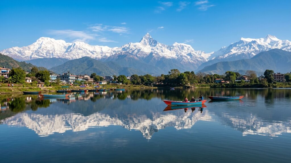
Overview The absolute best time to visit Pokhara and Phewa Lake is during the post-monsoon autumn season from October to November and the spring season from March to April. During autumn, the atmospheric air over the Himalayan foothill valley is washed completely clean by monsoon rains, offering mirror-like reflections of the iconic Mount Machapuchare (Fishtail) and the snow-capped Annapurna range across the tranquil waters of Phewa Lake. Daytime temperatures remain pleasant between 15°C and 25°C, creating ideal conditions for wooden boat rides to Tal Barahi Temple, lakeside walks, and paragliding from Sarangkot. Spring (March–April) brings blooming pink and red rhododendrons, warm sunshine (18°C–28°C), and crystal-clear morning skies. While winter (December to February) brings cold mornings (4°C–8°C) with fog that burns off by midday into sharp mountain panoramas, the monsoon months (June to August) bring torrential downpours exceeding 3,500 mm annually, obscuring mountain peaks and restricting boating activities on the lake. Local Logistical Advice for Indore Travelers Planning a vacation from Indore to Pokhara requires understanding key transit options, climate transitions, and local connectivity protocols: 1. Transit & Route Options from Indore Air Route (Fastest & Most Convenient): Board a morning flight from Indore’s Devi Ahilya Bai Holkar Airport (IDR) to Kathmandu’s Tribhuvan International Airport (KTM) with a seamless layover at New Delhi (DEL) via IndiGo or Air India (total transit time: 6 to 8 hours). From Kathmandu, take a scenic 25-minute domestic flight directly to Pokhara International Airport (PKR) via Yeti Airlines or Buddha Air, offering breathtaking aerial views of the Langtang and Ganesh Himal ranges. Overland & Train Route (Budget-Friendly Scenic Route): Board an overnight train such as the Malwa Express or Gorakhpur Express from Indore Junction (INDB) to Gorakhpur Railway Station (GKP) in Uttar Pradesh. From Gorakhpur, hire a private AC taxi or take a shared cruiser to the Sonauli / Belahiya Indo-Nepal Border (approx. 3 hours). After crossing immigration checkposts, proceed via private cab along the Siddhartha Highway through Palpa to Pokhara (approx. 7 to 8 hours, 180 km). 2. Climate Transition: From Malwa Plateau to Himalayan Valley Travelers departing from Indore’s tropical semi-arid climate (where summers frequently exceed 40°C and winters are mild) will experience a distinct transition in Pokhara. Nestled at an elevation of 827 meters directly beneath the 8,000-meter Annapurna massif, Pokhara has a humid sub-tropical highland climate. Humidity is significantly higher than in Central India, and temperature drops occur swiftly at sunset during winter months. Even in bright sunny weather, high-altitude UV intensity requires adequate sun protection. 3. International Mobile Connectivity & Tourist SIM Card Guidelines Domestic Indian SIM cards (Jio, Airtel, Vodafone-Idea) enter international roaming mode immediately upon crossing the border or landing in Nepal. Standard Indian voice and data plans will not work in Pokhara without activating expensive international roaming packs. Mandatory Tourist SIM Acquisition: Travelers must purchase a local tourist SIM card—Ncell or Nepal Telecom (NTC)—immediately upon arrival at Tribhuvan International Airport (Kathmandu arrivals hall) or at designated telecom counters near Pokhara Lakeside (Baidam). Required Documentation: Carry your original Indian Passport or Voter ID Card, one photocopy of the identity document, and 1 passport-sized photograph. Cost & Packages: A standard tourist SIM costs approximately NPR 300 to NPR 500 (~INR 190 to INR 315) and includes pre-loaded data (10GB to 25GB) valid for 7 to 14 days along with local calling balance for easy driver and hotel coordination. 4. Identity Documents & Currency Guidelines Accepted ID Proofs: Indian citizens do not require a visa for Nepal. However, you must carry either your original Indian Passport (valid for at least 6 months) OR your original Voter Identity Card issued by the Election Commission of India. *Aadhaar cards, PAN cards, and Indian driving licenses are NOT accepted by airport immigration counters.* Currency Usage: Indian Rupee currency notes of INR 100, 50, 20, and 10 are accepted universally across Pokhara hotels, cafes, boat stands, and taxis. Official Nepalese banking regulations restrict the usage of INR 500 notes; carry INR 100 denomination notes or convert currency at authorized bank booths along Lakeside. Complete Details & Practical Guidelines Month-by-Month Weather, Boating & Mountain Clarity Matrix Month Avg Temp (°C) Rain & Humidity Mountain View Clarity Phewa Lake Boating Conditions Key Festivals & Local Events January 4°C – 16°C Dry / Very Low High (Morning fog clears by 10 AM) Calm cold water; crisp afternoon boating Maghe Sankranti (Sweet treats & holy dips) February 7°C – 20°C Dry / Mild High; crystal-clear blue afternoon skies Excellent; gentle breeze, smooth water Maha Shivaratri (Bindhyabasini Temple rites) March 12°C – 25°C Low / Mild Very High; spring bloom in surrounding hills Ideal; warm sunshine, calm surface Holi / Fagu Purnima (Color festival at Lakeside) April 15°C – 29°C Low to Moderate High early morning; slight haze by midday Perfect; early morning reflections of Fishtail Nepali New Year / Navavarsha (Street fairs) May 18°C – 31°C Moderate / Squalls Moderate; pre-monsoon cloud build-up Good in morning; avoid late afternoon winds Buddha Jayanti (World Peace Pagoda rituals) June 20°C – 30°C High (>500 mm) Low; peak clouds obscure high ranges Restricted during rain downpours Roparai / Asar 15 (Paddy Plantation Mud Festival) July 21°C – 29°C Very High (>800 mm) Low; heavy monsoon cover Caution; high lake water levels, rain halts Saune Sankranti & Teej Preparations August 21°C – 29°C Very High (>700 mm) Low to Moderate; lush green landscape Caution; choppy water during thunderstorms Teej (Women’s saris & dancing) & Gai Jatra September 19°C – 28°C Moderate (Tapering) Moderate to High (Clears by end-Sept) Improving; smooth waters returning Indra Jatra & Dashain Festivities onset October 15°C – 26°C Low / Dry Peak 100% Clarity; washed blue skies Pristine mirror reflections; peak boating Dashain Festival (Nepal’s biggest celebration) November 11°C – 22°C Very Low / Dry Peak 100% Clarity; sharp peak contours Tranquil mirror surface; golden hour rides Tihar / Deepawali (Lakeside Light Festival) December 7°C – 19°C Very Low / Cold High; mist over water burns off mid-morning Pleasant afternoon boating; morning mist Pokhara Street Festival (New Year

Tour Packages & Guides

Historical Significance and Architecture of Elephant Falls

Overview Elephant Falls, situated just 12 kilometers southwest of Shillong city center in the Upper Shillong zone of East Khasi Hills, is one of Northeast India’s most iconic natural landmarks. Historically revered by the indigenous Khasi people as *Ka Kshaid Lai Pateng Khohsiew* (meaning “The Three-Step Waterfall”), this majestic site encapsulates centuries of tribal heritage, colonial history, tectonic geological shifts, and rich ecological biodiversity. The waterfall earned its popular English moniker during the British colonial era due to a massive dark basalt rock outcrop near the main cascade that bore an uncanny resemblance to a seated elephant. Although the devastating Great Assam Earthquake of 1897 destroyed this natural stone monolith, the historic name endured. Today, Elephant Falls stands as an architectural masterpiece of nature—a three-tiered cascade descending through ancient slate ledges and dense Khasi pine woodland (*Pinus kesiya*). For travelers booking an itinerary via Indore to Meghalaya Tour Packages, understanding the cultural history, tectonic legacy, and geological tiers of Elephant Falls transforms a simple sightseeing stop into an enriching journey through Meghalaya’s living heritage. Local Logistical Advice for Indore Travelers Planning a journey from the flat, dry Malwa plateau of Indore to the misty highland pine forests of Upper Shillong requires practical logistical preparation. Travel Path Holiday ensures every aspect of your transit from Central India to Meghalaya is seamlessly coordinated. Flight & Rail Connectivity from Indore: Air Routes: Depart from Indore’s Devi Ahilya Bai Holkar Airport (IDR) to Lokpriya Gopinath Bordoloi International Airport in Guwahati (GAU). Major carriers like IndiGo and Air India offer convenient daily connecting flights via New Delhi (DEL), Kolkata (CCU), or Mumbai (BOM) with total travel times ranging between 4.5 to 6.5 hours. Alternatively, seasonal feeder flights connect Kolkata directly to Shillong Umroi Airport (SHL), located 30 km from Shillong city. Train Routes: For slow-travel enthusiasts from Madhya Pradesh, direct trains like the Ahilyanagari Express or connecting routes via Howrah Junction (HWH) to Kamakhya Junction (KYQ) in Guwahati provide rail access. Mountain Highway Transfer: Upon landing at Guwahati Airport, travel in a private, air-conditioned vehicle booked through Travel Path Holiday along National Highway 6 (NH6). The 100-kilometer mountain drive takes approximately 3 to 3.5 hours, bypassing scenic landscapes like Umiam Lake (Barapani) before reaching Upper Shillong. Climate Shift & Thermal Adaptation: Indore travelers accustomed to tropical dry summer temperatures exceeding 38°C to 42°C will experience an immediate climate contrast upon arriving in Upper Shillong, where temperatures range from a pleasant 15°C to 22°C in summer and drop to a crisp 4°C to 10°C in winter. Even during peak summer months (April to June), carry light woolens or windproof jackets for cool mountain evenings. During the monsoon season (May to October), heavy downpours transform the waterfall into a roaring spectacle; sturdy waterproof footwear and quality raincoats are essential. For seasonal packing checklists, consult our Packing Guide for Elephant Falls. Prepaid SIM Cards & National Roaming: Travelers from Indore do not need to purchase local SIM cards. Standard prepaid SIM cards from Madhya Pradesh (Jio, Airtel, and Vi) function under national roaming across Meghalaya. Airtel and Jio offer strong 4G and 5G network coverage at Elephant Falls, the ticket complex, and surrounding Upper Shillong areas. Pure Vegetarian Dining Options: Indori travelers seeking pure vegetarian food will find clean, hand-vetted vegetarian options near the Elephant Falls entrance plaza. Local stalls serve freshly cooked vegetarian dishes, piping hot vegetable Maggi, fried bread rolls, potato snacks, and steaming cups of ginger tea—perfect for warming up after exploring the misty cascades. Detailed food options can be explored in our guide on Local Food in Elephant Falls. Complete Details & Practical Guidelines 1. Indigenous Khasi Heritage & Nomenclature: *Ka Kshaid Lai Pateng Khohsiew* Long before British cartographers documented the site, the indigenous Khasi inhabitants of the East Khasi Hills held this natural cascade in high cultural regard. In the Khasi language: *Ka Kshaid* translates directly to “The Waterfall.” *Lai Pateng* means “Three Consecutive Steps or Tiers.” *Khohsiew* refers to “Knee-like steps” or descended terraces. Native Khasi folklore attributes sacred natural power to the mountain streams descending from Shillong Peak (*Lum Shillong*—the highest point in Meghalaya at 1,965 meters above sea level). The pristine waters flowing through Elephant Falls were historically considered a vital natural lifeline, nourishing downstream villages and feeding into the regional Umshing River catchment. Local tribal elders preserved oral legends highlighting how the three distinct water steps symbolized the harmony between human life, mountain spirits, and the natural elements. “` +————————————————————————-+ KA KSHAID LAI PATENG KHOHSIEW (The Three-Step Waterfall of Upper Shillong) +————————————————————————-+ v [ Tier 1: Upper Cascade ] –> Broad, gentle stream amid pine canopy v [ Tier 2: Middle Cascade ] –> Narrow ledge through dark basalt rocks v [ Tier 3: Lower Cascade ] –> Grand sheet of roaring water & plunge pool “` 2. British Colonial Era & The Great Assam Earthquake of 1897 During the mid-19th century, when the British East India Company and subsequently the British Raj established Shillong as the administrative capital of Assam Province (earning it the moniker “Scotland of the East” due to its rolling green hills and damp climate), British officers surveyed the Upper Shillong region. The Origin of the English Name: Near the left flank of the lowest and main cascade stood a massive, dark natural rock formation composed of weathered basalt. Shape-crafted by thousands of years of water erosion, the stone outcrop closely resembled the silhouette of a seated elephant with a prominent head and trunk. Impressed by this natural landmark, colonial administrators officially designated the location as “Elephant Falls.” The Tectonic Cataclysm of June 12, 1897: On June 12, 1897, one of the most violent earthquakes in Indian recorded history—the Great Assam Earthquake (estimated magnitude 8.0 to 8.3 on the Richter scale)—struck the region. Epicentered in the Shillong Plateau, the massive tremors caused widespread geological destabilization, triggering massive rockslides and altering river channels across East Khasi Hills. Destruction of the Elephant Rock: The intense seismic shockwaves completely sheared the elephant-shaped rock monolith, causing it to

Tour Packages & Guides

Emergency Numbers, Hospitals & Tourist Police in Laitlum Canyons

Overview Perched on the dramatic ridgelines of the East Khasi Hills at an elevation of nearly 2,000 meters, Laitlum Canyons (meaning “End of Hills” in the local Khasi language) offers some of the most breathtaking, cliff-side panoramas in North-East India. Located approximately 24 km hilltop-south of Shillong near Smit village, this offbeat paradise features deep green ravines, dramatic drop-offs, swirling mountain mist, and the famous 3,000-step stair trail descending to the isolated village of Rasong. While the sweeping canyon views draw travelers from across India, the high-altitude terrain, sudden fog blanketing, narrow single-lane roads, and steep unprotected cliff edges require essential safety awareness. Knowing the exact emergency helpline in Laitlum Canyons, nearby medical trauma centers, police outposts, and mountain rescue protocols ensures a safe and worry-free experience for families, honeymooners, and senior travelers departing from Central India. For travelers journeying from Indore, understanding local emergency contacts and medical infrastructure is a vital part of trip preparation. While Laitlum Canyons is remote, it is well-supported by the nearby Smit Police Outpost, Smit Primary Health Centre (PHC), the 24/7 108 EMRI Ambulance Network, and Meghalaya’s premier tertiary care hospital—NEIGRIHMS Shillong—located just 15 km away. This comprehensive safety guide compiled by Travel Path Holiday provides an exhaustive list of verified emergency numbers, primary healthcare coordinates, village Dorbar rescue protocols, road safety rules, and essential mobile roaming guidelines tailored for Indori travelers exploring the edge of the Khasi hills. Local Logistical Advice for Indore Travelers 1. Climate & Altitude Shift: Central India to the High Canyon Ridge Departing from the warm, flat plateau climate of Indore (approx. 550 meters elevation), travelers arrive at the cool, windswept ridge of Laitlum Canyons (approx. 1,950 meters elevation). Day temperatures in Indore often hover around 30°C to 35°C, whereas Laitlum experiences sharp mountain chills ranging from 8°C to 18°C in winter and brisk 15°C to 22°C conditions during summer days. Sudden Weather Shift Alert: Strong gusty winds and sudden dense fog can roll over the canyon edge in under five minutes, dropping visibility to less than 5 meters and causing rapid temperature dips. Packing Essentials for Indori Travelers: Always keep a windproof jacket, fleece layer, sturdy non-slip trekking shoes, and a pocket flashlight in your daypack when stepping onto the Laitlum viewpoint. 2. Flight & Transit Coordinates from Indore to Laitlum Reaching Laitlum Canyons involves transit from Indore to Guwahati or Shillong, followed by a scenic mountain highway drive: Air Travel via Guwahati Airport (GAU): Take a morning flight from Indore’s Devi Ahilya Bai Holkar Airport (IDR) to Lokpriya Gopinath Bordoloi International Airport in Guwahati (GAU), with a quick single layover at New Delhi (DEL) or Kolkata (CCU) on IndiGo or Air India (total flight time: 5.5 to 7 hours). From Guwahati, take a private SUV via the Shillong Bypass directly toward Smit and Laitlum (approx. 125 km / 3.5 to 4 hours). Air Travel via Shillong Airport (SHL – Umroi): Direct feeder flights connect Kolkata to Umroi Airport. Landing at Umroi places you just 42 km (1.5 hours) away from Laitlum Canyons via the scenic Shillong bypass road. Rail Option via Indore Junction: The direct Indore – Kamakhya Express (Train No. 19305) runs weekly from Indore Junction (INDB) to Kamakhya (KYQ) in Guwahati (46-hour journey), ideal for long-duration holiday planners. 3. Mobile Network Coverage & MP Prepaid SIM Roaming National Roaming Status: Standard prepaid mobile SIM cards issued in Madhya Pradesh (Jio, Airtel, Vi, BSNL) work seamlessly across Meghalaya under national roaming. You do not need a specialized postpaid connection to access mobile networks in East Khasi Hills. Signal Strength at Laitlum Ridge vs Canyon Gorge: Both Jio and Airtel provide strong 4G cellular coverage and GPS connectivity at the main Laitlum Canyons viewpoint and parking area. However, if you trek down the 3,000 steps toward Rasong village inside the deep canyon ravine, cellular signals will drop significantly or become unavailable. Always inform your driver or local guide before descending the valley stairs. 4. Mountain Driving & Chauffeur Vehicle Selection The 6 km narrow approach road from Smit village to Laitlum Canyons consists of tight curves, steep gradients, and limited passing bays. Self-driving rented cars are strongly discouraged due to blind curves and frequent afternoon fog. Travel Path Holiday provides experienced local mountain chauffeurs driving heavy-duty vehicles like the Toyota Innova Crysta or Mahindra XUV700, equipped with fog lamps and terrain expertise. Complete Details & Practical Guidelines Essential Emergency Helplines for Laitlum Canyons & Shillong Region Keep these emergency contact numbers saved on your mobile device before heading from Shillong toward Smit and Laitlum Canyons: Emergency Service / Authority Direct Contact Number Operational Hours Coverage & Location Details National Emergency Response Support System (ERSS) 112 24/7 Toll-Free Unified helpline for Police, Fire, and Ambulance Meghalaya 108 Emergency Ambulance (EMRI) 108 24/7 Toll-Free Quick-response medical dispatch from Smit & Shillong Smit Police Outpost (Nearest Jurisdiction) 0364-2560233 / 112 24/7 Station Duty Located at Smit Village (~6 km from Laitlum Viewpoint) East Khasi Hills District Police Control Room 0364-2222277 / 0364-2222215 24/7 Control Room District HQ in Shillong for urgent security & police support Shillong Tourist Police Hub 0364-2224400 / 0364-2222277 24/7 Assistance Specialized tourist safety unit based in Police Bazar, Shillong Meghalaya State Disaster Management Authority (MSDMA) 1070 / 0364-2502098 24/7 Emergency Mountain rescue, landslide assistance & emergency response Shillong Fire & Emergency Services 101 / 0364-2222222 24/7 Dispatch Fire rescue and vehicular accident response unit Women Helpline Meghalaya 181 / 1091 24/7 Toll-Free Specialized emergency assistance for female travelers Primary Health Centers & Major Referral Hospitals Near Laitlum Canyons In the event of sudden altitude sickness, slip-and-fall injuries along canyon trails, or acute medical emergencies, medical facilities are accessible within short driving distances from Laitlum: #### 1. Smit Primary Health Centre (PHC) Distance from Laitlum: ~6 km (12 to 15 minutes drive). Location: Central Market Area, Smit Village. Services: First-aid treatment, wound dressing, basic trauma stabilization, oxygen support, and primary doctor consultation. Serves as the immediate triage point for minor trekking injuries before transferring patients to

Tour Packages & Guides

Pre-Wedding Shoot & Couple Photography in Double Decker Living Root Bridge

Overview Tucked deep inside the emerald rainforests of Sohra (Cherrapunji) in Meghalaya, the Umshiang Double Decker Living Root Bridge in Nongriat village stands as one of the world’s most extraordinary natural backdrops for a pre-wedding shoot and couple photography. Crafted over generations by indigenous Khasi artisans who painstakingly guided the living aerial roots of *Ficus elastica* (Indian rubber trees) across the roaring Umshiang River, this two-tiered botanical masterpiece radiates an ethereal, fairy-tale charm. For couples seeking iconic, otherworldly frames—where ancient living root spans hang over crystal-clear turquoise pools, cascading waterfalls, and mist-shrouded jungle canopies—a pre-wedding shoot here offers unmatched romantic grandeur. Executing a high-end couple photography session at the Double Decker Root Bridge requires strategic planning beyond standard vacation photography. Located at the base of a tropical river gorge accessible via a steep 3,500-step stone staircase from Tyrna village, this shoot demands physical preparation, careful wardrobe logistics, lighting synchronization, gear humidity protection, and strict adherence to local Khasi community regulations. Whether you are aiming for dramatic trailing gown portraits on the upper root span or candid intimate moments beside turquoise natural swimming pools, this comprehensive guide provides everything you need to execute a flawless romantic shoot in Meghalaya. Local Logistical Advice for Indore Travelers Planning a pre-wedding photography expedition from Central India to the mist-laden valleys of Meghalaya involves seamless transit coordination, equipment management, and weather adaptation. For travelers departing from Indore, Travel Path Holiday recommends structuring your itinerary with dedicated transit days to ensure couples and photography crews arrive fully rested before undertaking the Nongriat valley descent. 1. Air Transit & Route Coordinates from Indore Departure Airport: Depart from Indore’s Devi Ahilya Bai Holkar Airport (IDR). Connecting Flight Options: Book early morning direct or single-stop connecting flights via Kolkata (CCU) or New Delhi (DEL) to Guwahati’s Lokpriya Gopinath Bordoloi International Airport (GAU) or Shillong Airport (SHL) at Umroi. Popular airlines like IndiGo operating flight series 6E offer convenient morning departures from Indore with layovers of 1.5 to 2.5 hours in Delhi or Kolkata, reaching Guwahati by early afternoon (total travel time approx. 5.5 to 7 hours). Guwahati to Shillong Scenic Drive: Upon landing at Guwahati Airport, board a comfortable private SUV for the 100-km drive to Shillong via National Highway 6 (NH6). The 3-hour journey takes you through the lush East Khasi Hills with a scenic stop at Umiam Lake (Barapani). Shillong to Sohra (Cherrapunji): From Shillong, Sohra lies 54 km south (approx. 2 hours drive) via the stunning Mawkdok Dympep Valley bridge corridor. Sohra to Tyrna Basehead: Tyrna village, the starting point for the Nongriat trek, is located 20 km from central Sohra town (approx. 45 minutes by road). 2. Physical & Climate Transition Indore’s climate on the Malwa plateau is characterized by dry tropical heat and high solar clarity. Transitioning to Sohra’s subtropical highland rainforest ecosystem exposes travelers to high relative humidity (80% to 95%), sudden mountain rain squalls, and cooler valley breezes (15°C to 24°C). The 3,500-step descent into Nongriat works muscles intensely in humid air. Couples from Indore should build mild cardiovascular stamina prior to the trip, maintain active hydration with electrolytes, and pack lightweight, breathable transit clothing alongside specialized shoot attire. 3. Mobile Connectivity & National Roaming (Prepaid SIM Cards) If you are traveling with a standard prepaid SIM card registered in Madhya Pradesh (Airtel, Jio, or Vodafone Idea), your connection will work seamlessly under national roaming across Assam, Guwahati, Shillong, and main Sohra town. However, once you descend into the deep limestone gorge of Nongriat village, cellular signals from all major networks drop significantly or become entirely unavailable due to the steep surrounding canyon walls. Pro Tip for Photographers: Download offline maps (Google Maps / Maps.me) and save shoot schedules, shot lists, and emergency contacts on your mobile devices before leaving Tyrna. Coordinate arrival times with your local Khasi guide and TPH chauffeur prior to stepping off the grid in Nongriat valley. Complete Details & Practical Guidelines 1. Top Scenic Spots for Couple & Pre-Wedding Photography #### A. Umshiang Double Decker Living Root Bridge The centerpiece of your shoot is the two-tiered living bridge spanning the Umshiang River. Lower Root Span: The lower bridge hangs directly over the rushing river, framed by massive buttress roots and hanging tendrils. Position the couple in the middle of the span while shooting from the riverbank below with a wide-angle lens (16mm–35mm) to capture the scale of the jungle. Upper Root Span: Positioned higher in the lush canopy, the upper span offers natural framing through intertwined aerial roots. Shooting from the lower bridge looking upward towards the upper bridge creates an extraordinary layered depth of field with the sunlight filtering through leaves. #### B. Turquoise River Pools & Boulders Directly beneath and slightly downstream from the bridge lie pristine natural limestone swimming pools filled with clear, turquoise-tinted mountain water. Water Reflection Shots: During calm morning hours (6:30 AM to 8:30 AM), the water surface acts as a natural mirror reflecting the green root arches and sky. Granite Outcrop Posing: Smooth, moss-patterned granite boulders sitting in the turquoise water provide secure, dry perches for intimate couple portraits, hand-in-hand poses, and candid romantic moments. #### C. Steel Wire Suspension & Bamboo Hanging Bridges The trail extending from Nongriat toward Rainbow Falls features two high, narrow steel wire suspension bridges swaying over deep river gorges. Cinematic Leading Lines: These narrow suspension bridges create incredible leading lines. Position the bride in a flowing dress walking away or looking back toward the groom while the camera shoots along the axis of the wooden planking. #### D. Rainbow Falls Trail & Cascades (1.5 Hours Further) For adventurous couples willing to extend their trek, Rainbow Falls is located 1.5 hours past Nongriat village. Prismatic Water Spray: Dropping off a massive cliff into a giant plunge pool, the heavy mist generated by the waterfall creates vivid solar rainbows on bright sunny mornings between 10:00 AM and 12:00 PM, offering a high-drama climax frame for pre-wedding albums. 2. Permit Requirements, Local Village Dorbar & Etiquette

Tour Packages & Guides

ATM, Cash & Mobile Connectivity Guidelines in Mawlynnong Cleanest Village

Overview Famed across the globe as “Asia’s Cleanest Village,” Mawlynnong in the East Khasi Hills of Meghalaya offers travelers from Indore a tranquil getaway into manicured flower-lined pathways, bamboo skywalks, and living root bridges. However, because Mawlynnong is an offbeat, community-managed eco-village situated near the Indo-Bangladesh border, practical financial and digital infrastructure operates under rural mountain conditions. Understanding the realities of mobile network in Mawlynnong Cleanest Village, ATM locations, cash requirements, and UPI signal reliability is essential before embarking on your journey. There are zero ATMs inside Mawlynnong village, and while major cellular networks like Reliance Jio 4G and Bharti Airtel 4G provide reliable voice and data coverage in the central village, UPI digital payments (Google Pay, PhonePe, Paytm) frequently fail due to weather-induced network congestion or hill power cuts. Furthermore, village entry taxes, parking fees, homestay balances, living root bridge tickets, and local bamboo handicraft purchases require physical currency. This comprehensive guide outlines everything Indori travelers need to know about cash planning, nearest working ATMs in Pynursla and Shillong, mobile operator performance, and power backup survival tips. Local Logistical Advice for Indore Travelers Planning a smooth expedition from Central India to the southern ridges of Meghalaya requires thoughtful alignment of transit routes, cash management, and device prep. Here is how travelers departing from Indore can execute a hassle-free journey: Flight Options & Air Connectivity: Take a flight from Indore’s Devi Ahilya Bai Holkar Airport (IDR) to Lokpriya Gopinath Bordoloi International Airport (GAU) in Guwahati. Premier domestic airlines operate convenient 1-stop connecting flights via New Delhi (DEL) or Kolkata (CCU) with total flight durations ranging between 4.5 and 6.5 hours. Alternatively, travelers can catch regional connecting flights from Kolkata to Shillong Airport (SHL – Umroi). Train Routes: For train travelers from Madhya Pradesh, direct rail links connect Indore Junction (INDB) to Guwahati (GHY) or Howrah (Kolkata). The Indore–Guwahati Express (15645) or Kolkata-bound express trains provide comfortable AC 2-Tier and AC 3-Tier journeys across the Gangetic belt into North-East India. Road Transfers & ATM Stopover Strategy: From Guwahati or Shillong, hire a private chauffeured AC vehicle (such as an Innova Crysta or Fortuner). Drive along National Highway 6 (NH6) to Shillong (100 km, ~3.5 hours), then proceed along the scenic Shillong–Pynursla–Mawlynnong highway (78 km, ~2.5 to 3 hours). Crucial Tip: Make your mandatory cash withdrawal in Shillong or at the town of Pynursla (28 km before Mawlynnong), as no banking kiosks exist past Pynursla along the border highway. Climate Transition & Gear Prep: Travelers from Indore transition from Malwa’s tropical dry semi-arid climate (where summer heat touches 40°C+) to Mawlynnong’s humid subtropical hill environment. Mawlynnong experiences pleasant summers (20°C to 26°C), intense monsoon downpours from June to September, and chilly, misty winters (8°C to 18°C). Rain and moisture can damage unsealed paper currency and electronics; carry waterproof ziplock pouches for your physical cash, currency notes, and smartphones. National Roaming on MP Prepaid SIM Cards: If you carry a standard prepaid mobile SIM card (Jio, Airtel, Vi) registered in Madhya Pradesh, national roaming operates seamlessly across Meghalaya without any need for postpaid conversion, special regional recharges, or local tourist SIM cards. Complete Details & Practical Guidelines 1. ATM Availability & Strategic Cash Withdrawal Planning Mawlynnong remains a self-governed tribal eco-village where digital credit card terminals and bank branches do not exist. Having sufficient physical cash on hand is non-negotiable for every traveler. Zero ATMs in Mawlynnong Village: There are no ATMs, cash deposit machines, or micro-banking outlets within Mawlynnong or neighboring hamlets like Riwai and Nohwet. Primary Cash Stop: Pynursla Town (28 km away): Located approximately 45 to 60 minutes away by road along the Shillong–Dawki highway, Pynursla is the last commercial township before descending toward Mawlynnong. Pynursla houses State Bank of India (SBI) and HDFC Bank ATMs. However, because Pynursla serves as the sole banking hub for dozens of surrounding Khasi villages, these ATMs frequently encounter long queues, offline network links, or cash exhaustion during weekend rushes and festival seasons. Ultimate Cash Reserve Hub: Shillong (78 km away): The state capital, Shillong (specifically commercial centers like Police Bazar and Laitumkhrah), offers fully operational 24/7 ATMs from major nationalized and private banks (SBI, HDFC, ICICI, Axis, PNB). Travelers are strongly advised to withdraw all necessary physical currency while in Shillong before embarking on the day trip or overnight stay in Mawlynnong. Recommended Cash Budget Per Day: Village Entry Tax & Vehicle Parking: ₹50 to ₹100 per car (cash collected at the entry barrier by village council representatives). Sightseeing & Heritage Entry Fees: ₹40 per person for Nohwet Living Root Bridge, ₹20 per person for Riwai Bamboo Skywalk / Balancing Rock. Homestay Accommodation Balance: ₹1,500 to ₹3,500 per night (most homestays demand physical cash upon check-in/checkout). Dining & Refreshments: ₹250 to ₹500 per person per meal at local village tea stalls and traditional Khasi eateries. Handicrafts & Souvenirs: ₹300 to ₹2,000 for hand-woven bamboo baskets, organic wild honey, Khasi brooms, and wooden artifacts. Recommended Total Cash Reserve: Carry between ₹5,000 and ₹10,000 in physical cash per family/couple for a 2-day excursion covering Mawlynnong, Dawki, and Shnongpdeng. 2. Digital Payments, UPI Signal Reliability & POS Card Machines While digital India initiatives have reached rural Meghalaya, digital transactions in hill villages depend entirely on wireless cellular data stability. UPI (Google Pay, PhonePe, Paytm) Status: Many local village homestays, souvenir stalls, and dining shops display printed UPI QR code stands. When mobile networks are functioning smoothly, UPI transactions process within seconds. Why UPI Fails Frequently in Mawlynnong: *Weather Interference:* Heavy monsoonal rain and fog disrupt micro-wave transmission links connecting rural cell towers to main switching centers. *Power Outages:* Village power cuts shut down local cellular base transceiver stations (BTS) once backup battery systems drain (typically after 2 to 3 hours). *Optical Fiber Cuts:* Landslides along the mountainous Shillong-Dawki highway occasionally sever underground fiber optic cables, leading to complete digital blackouts across the region lasting several hours. Card Swipe Machines (POS Terminals): Credit and debit card swipe terminals are non-existent in Mawlynnong. Local homestays and village

You have been successfully Subscribed! Ops! Something went wrong, please try again.

About Us

Travel Path Holiday is a full-service travel company dedicated to delivering seamless, personalized, and memorable travel experiences. We specialize in crafting customized journeys for both corporate and leisure travelers, ensuring every trip is stress-free and enjoyable.

Destinations

Kashmir

Manali

Leh-Ladakh

Nepal

Bhutan

Blog

  • All Post
  • Adventure, Trekking & Road Trips
  • Andaman
  • Bali Honeymoon
  • Bhutan Honeymoon
  • Dubai Honeymoon
  • Family & Leisure
  • Goa Honeymoon
  • Gujarat
  • Himachal Honeymoon
  • Himachal Pradesh
  • Honeymoon & Romance
  • India Travel Guides
  • Kashmir Honeymoon
  • Kerala Honeymoon
  • Nepal Honeymoon
  • Rajasthan Honeymoon
  • Seasonal & Monsoon Specials
  • Sikkim & Northeast
  • Singapore Honeymoon
  • Spiritual & Pilgrimage
  • Thailand
  • Tour Packages & Guides
  • Uttarakhand Honeymoon

Travel Path Holiday, Indore | © 2026 Travel Path Holiday. All Rights Reserved. | Website crafted by Amit Nayak, India

Scroll to Top

