Adventure, Trekking & Road Trips

Valley of Flowers National Park, Uttarakhand: Peak July Trekking & Flora Guide

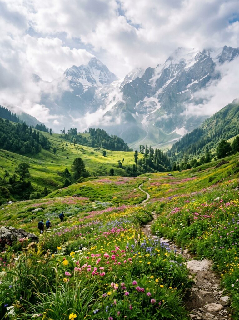
Imagine standing at an altitude of 3,658 meters in the heart of the Western Himalayas, surrounded by a vibrant, endless carpet of blue, pink, purple, and yellow alpine flowers. Mist floats gently across the meadows, snow-capped peaks tower in the background, and the crisp mountain air is filled with the fresh scent of wild blossoms and rain. This is the Valley of Flowers National Park in Uttarakhand, a UNESCO World Heritage Site that transforms into a real-life botanical fairy tale during the monsoon season. While the park is open from June to September, July is widely considered the absolute best time to visit. It is when the monsoon rains breathe life into the dormant seeds, initiating the peak blooming season. If you are an adventure enthusiast, nature photographer, or someone looking to cross off one of the world’s most beautiful treks from your bucket list, this is your ultimate guide. In this comprehensive guide, we cover everything you need to plan your Valley of Flowers trek in July—including a detailed day-by-day itinerary, essential safety guidelines, flora highlights, and expert packing tips. — Valley of Flowers Trek: Quick Facts Before diving into the detailed itinerary, here is a quick overview of the trek to help you prepare: Parameter Details :— :— Location Chamoli District, Uttarakhand, India Altitude 3,658 meters (12,000 feet) to 4,389 meters (14,400 feet) at Hemkund Sahib Trek Distance Approximately 38 km (round trip from Govindghat) Difficulty Level Moderate (Suitable for beginners with good physical fitness) Best Time to Visit July to August (Peak blooming period) Base Camp Ghangaria (a small village with basic hotels and guesthouses) Nearest Railway Station Yog Nagari Rishikesh Railway Station (YNRK) – 273 km from Govindghat Nearest Airport Jolly Grant Airport, Dehradun – 290 km from Govindghat — Peak Flora: What Blooms in the Valley in July? The Valley of Flowers is home to over 500 species of wild alpine flowers. The landscape changes its colors every few weeks as different species bloom and fade. In July, the valley shifts from green to shades of blue, pink, and white. Here are the iconic flowers you can spot during your July trek: Himalayan Blue Poppy (*Meconopsis aculeata*): Often called the “Queen of Himalayan Flowers,” this rare, striking blue flower with delicate petals is a prized sight for trekkers in July. Brahmakamal (*Saussurea obvallata*): The state flower of Uttarakhand, usually found at higher altitudes (above 4,000 meters) on the way to Hemkund Sahib. It blooms in late July and holds deep religious significance. Himalayan Bellflower (*Campanula latifolia*): Beautiful bell-shaped violet-blue flowers that line the trails in dense clusters. Himalayan Marsh Orchid (*Dactylorhiza hatagirea*): Locally known as *Hathajari*, this medicinal orchid blooms with bright purple spikes. Sunflowers and Daisies: Vast fields of golden wild sunflowers (*Senecio*) and white anemones paint the meadow, contrasting beautifully with the grey monsoon skies. — Detailed 6-Day Valley of Flowers Trek Itinerary This carefully curated 6-day itinerary is designed to give you ample time for acclimatization, exploration, and safety, starting and ending in the spiritual hub of Rishikesh. Day 1: Rishikesh to Govindghat (Drive: 273 km | 9–10 hours) Your Himalayan adventure begins with an early morning drive from Rishikesh. The route follows the Alaknanda and Ganga rivers, taking you through the holy confluences (Panch Prayag)—Devprayag, Rudraprayag, and Karnaprayag. Scenic Highlights: Watch the dramatic meeting of the Bhagirathi and Alaknanda rivers at Devprayag, where the holy Ganges is officially formed. Road Conditions: The roads are generally well-maintained, but monsoon showers can cause occasional delays due to minor landslides. Evening: Reach Govindghat, a bustling town situated on the banks of the Alaknanda River. Check into your hotel, attend a brief orientation, and enjoy a warm dinner. Overnight Stay: Hotel in Govindghat. Day 2: Govindghat to Ghangaria via Pulna (Drive: 4 km | Trek: 10 km | 5–6 hours) Wake up to the sound of roaring rivers. After a hearty breakfast, take a short 4 km drive to Pulna village, which is the starting point of the trek. The Trek: The trail from Pulna to Ghangaria is a well-paved stone path that runs parallel to the gushing Laxman Ganga river. The trail is clean, shaded by dense pine and oak forests, and dotted with small dhabas selling hot tea, Maggi, and fresh fruits. Ghangaria Base Camp: Ghangaria is a scenic hamlet that serves as the base camp for both the Valley of Flowers and the holy shrine of Hemkund Sahib. No vehicles are allowed past this point. Alternative Transport: If you prefer not to walk, mules, porters, and helicopter services (subject to weather conditions) are available from Govindghat/Pulna to Ghangaria. Overnight Stay: Guesthouse/Hotel in Ghangaria. Day 3: Ghangaria to Valley of Flowers and Back (Trek: 8 km round trip | 6–7 hours) Today is the day you’ve been waiting for! Start your day by 7:00 AM to make the most of the clear morning weather. Entering the Park: Cross the Laxman Ganga bridge and clear the Forest Department checkpoint. The trail immediately narrows, winding through dense forests of birch and rhododendrons before opening up into the wide-open glacial valley. Exploring the Valley: Once inside the valley, the trail becomes relatively flat. You can walk for kilometers amidst towering mountains, waterfalls cascading down rock faces, and millions of blooming flowers. Do not miss the grave of Joan Margaret Legge, a British botanist who lost her life here in 1939 while studying the flora. Important Rule: Camping or staying overnight inside the National Park is strictly prohibited. You must start your return trek to Ghangaria by 2:00 PM to cross the exit gate before dark. Overnight Stay: Guesthouse/Hotel in Ghangaria. Day 4: Ghangaria to Shri Hemkund Sahib and Back (Trek: 12 km round trip | 7–8 hours) Prepare yourself for a steep climb today as you visit Hemkund Sahib, the highest Gurudwara in the world, situated next to a pristine glacial lake at 4,329 meters. The Trail: The trail is a steep zig-zag stone pathway. Take slow, steady steps to cope with the thin mountain
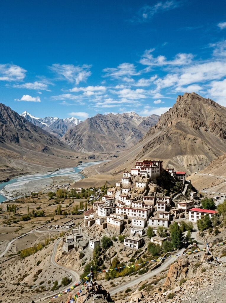
Key Monastery and snow mountains in Spiti Valley Himachal Pradesh
Adventure, Trekking & Road Trips

Spiti Valley in July: Escape the Rain in India’s Cold Desert Mountain Valley

If you are someone who loves mountains but hesitates to plan a Himalayan getaway in July due to the fear of heavy monsoon rains, landslides, and road blockages, we have good news for you. Tucked away in the northeastern part of Himachal Pradesh lies Spiti Valley, a pristine, high-altitude cold desert that remains virtually dry throughout the monsoon season. Spiti, which translates to “The Middle Land” (the land between India and Tibet), lies in the rain-shadow region of the Great Himalayas. The towering mountain ranges block the rain-bearing monsoon clouds from entering the valley. As a result, while the plains of India are drenched and the foothills of Himachal experience heavy downpours, Spiti enjoys clear blue skies, bright sunshine, and dry roads. July is widely considered the absolute peak and best time to visit Spiti Valley. In this comprehensive guide, we will cover the routes, permits, must-visit spots, a detailed 8-day itinerary, and crucial preparation tips for your dream Spiti adventure. — Spiti Valley Quick Travel Info Before packing your bags, here are the essential details of Spiti Valley in July: Feature Details July Temperature 10°C to 22°C (Days are warm and sunny; nights are cold, dropping to 5°C) Monsoon Status Rain-shadow zone. Negligible rainfall inside the valley. Road Status Both entry points (via Shimla and via Manali/Kunzum Pass) are fully open. Best Travel Mode High-clearance SUV (4×4 or 4×2 like Scorpio, Innova) or Adventure Motorcycle. Permits Required None for Indian nationals. Foreign nationals require an Inner Line Permit (ILP). — The Two Entry Routes to Spiti Valley To visit Spiti, you can either take the Shimla Route or the Manali Route. We highly recommend executing a “Full Circuit” trip: entering from Shimla and exiting from Manali. This ensures gradual altitude gain, minimizing the risk of Altitude Sickness. “`mermaid graph LR A[Shimla Route] –>|Gradual Climb / 1000 km / Open All Year| B(Kaza – Capital of Spiti) C[Manali Route] –>|Steep Climb / Kunzum Pass / Open June-Oct| B B –>|Exits via| C “` Route 1: The Shimla Route (Via Kinnaur) Path: Delhi/Chandigarh ➔ Shimla ➔ Sarahan ➔ Sangla (Sangla Valley) ➔ Kalpa ➔ Nako ➔ Tabo ➔ Kaza. Why it’s great: The ascent is gradual. You start at 2,000 meters in Shimla and slowly climb to 3,650 meters in Kaza over 3–4 days. This gives your body ample time to acclimatize to the thin air. Scenery: You transition from lush green pine forests in Shimla and Kinnaur to the barren, moon-like landscapes of Spiti. Route 2: The Manali Route (Via Atal Tunnel & Kunzum Pass) Path: Delhi/Chandigarh ➔ Manali ➔ Atal Tunnel ➔ Gramphu ➔ Batal ➔ Kunzum Pass (14,931 feet) ➔ Kaza. Why it’s great: It is much shorter, taking only 8 to 10 hours from Manali to Kaza. The Catch: The altitude jump is sudden (from 2,050m in Manali to 3,650m in Kaza, crossing a 4,500m pass). The road from Gramphu to Batal is a dirt track consisting of gravel, boulders, and water crossings (chattus) made of melted glacial water. — Must-Visit Highlights of Spiti Valley in July 1. Key Monastery (Kye Gompa) The most iconic image of Spiti Valley is the Key Monastery. Perched on a volcanic-shaped hill at an altitude of 4,166 meters, this 1,000-year-old Tibetan Buddhist monastery looks like a fortress of white blocks stacked on top of one another. Monsoon Highlight: The clear July skies provide a stunning contrast to the whitewashed walls of the monastery and the turquoise Spiti River flowing below. 2. Chandratal Lake (The Moon Lake) Situated at 4,300 meters, this crescent-shaped alpine lake is a sight to behold. In July, the snow around the lake has completely melted, and the lake water reflects different shades of blue and green depending on the time of day. The Experience: Camping in dome tents under a canopy of millions of stars. The campsites are located 2 km away from the lake to protect its ecology. 3. Hikkim: The Highest Post Office in the World Located at 4,400 meters, Hikkim is home to the world’s highest operational post office. Must-Do: Buy postcards from Kaza, write letters to your loved ones, drive up to Hikkim, and mail them. It takes about 2 to 3 weeks for the letters to reach their destination, stamped with the unique Hikkim seal. 4. Komic: The Highest Motorable Village Just a short drive from Hikkim lies Komic, situated at 4,587 meters (15,027 feet). The village features a small monastery (Komic Lundup Banzar Karo Gompa) and a local cafe that proudly claims to serve hot food at the world’s highest motorable location. 5. Langza: The Fossil Village Famous for the giant, colorful statue of Lord Buddha overlooking the clay houses of the village. Langza is also known for marine fossils. Millions of years ago, Spiti was under the Tethys Ocean, and today, you can easily find fossilized seashells in the rocks around the village. 6. Tabo and Dhankar Monasteries Tabo Monastery: Founded in 996 AD, it is a UNESCO World Heritage Site famous for its ancient mud clay statues and priceless wall frescoes. It is often called the “Ajanta of the Himalayas.” Dhankar Monastery: Built precariously on a cliff edge overlooking the confluence of the Spiti and Pin Rivers. The structure is fragile but visually jaw-dropping. — Detailed 8-Day Spiti Valley Full Circuit Itinerary Here is the ideal day-by-day route designed for maximum safety, comfort, and sightseeing: Day Route Highlights Night Stay Day 1 Chandigarh to Shimla / Narkanda Scenic drive, transition into lower hills Narkanda Day 2 Narkanda to Sangla / Chitkul Drive along Sutlej River, visit Chitkul (last village of India) Chitkul / Sangla Day 3 Sangla to Kalpa Visit Roghi suicide point, view Kinner Kailash peak Kalpa Day 4 Kalpa to Kaza (via Nako & Tabo) View Nako Lake, explore 1000-year-old Tabo Monastery Kaza Day 5 Kaza local sightseeing Visit Key Monastery, Kibber village, and Chicham Bridge Kaza Day 6 Kaza High Villages tour Visit Hikkim (Post Office), Komic (Highest village), Langza Kaza Day 7 Kaza to

Char Dham Yatra pilgrimage circuit in Uttarakhand
Spiritual & Pilgrimage

Planning Char Dham Yatra in Monsoon: Safety Tips, Route Updates & Complete Guide

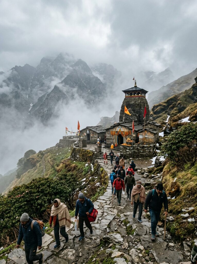
The Char Dham Yatra—comprising the four sacred shrines of Yamunotri, Gangotri, Kedarnath, and Badrinath nestled in the Garhwal Himalayas of Uttarakhand—is one of the most spiritually significant pilgrimages in Hinduism. Every year, millions of devotees embark on this journey to seek blessings and wash away their sins. The pilgrimage season runs from May to November. However, the arrival of the monsoon in July and August brings a unique set of circumstances. The mountains are washed clean, the valleys bloom in vibrant green, and the temples are wrapped in a mystical shroud of mist. But the heavy rain also brings challenges: landslides, flash floods, slippery trekking trails, and road blockages. Is it possible to complete the Char Dham Yatra in monsoon? Yes, it is entirely possible and can be a deeply rewarding experience—provided you are well-prepared, follow safety protocols, and travel with a reliable tour operator. In this comprehensive guide, we cover everything you need to know about planning a safe and successful Char Dham Yatra during the monsoon season, including route overviews, essential safety tips, and packing requirements. — Char Dham Yatra: Quick Reference Guide Here is a quick summary of the four holy shrines, including their altitudes and trek distances: Dham Deity Altitude Base Town Trek Distance (One Way) Key Highlight :— :— :— :— :— :— Yamunotri Goddess Yamuna 3,293 m (10,800 ft) Janki Chatti 6 km Divya Shila & Surya Kund hot springs Gangotri Goddess Ganga 3,415 m (11,200 ft) Gangotri Town 0 km (Road access) Bhagirathi river, Gangotri Temple Kedarnath Lord Shiva 3,584 m (11,750 ft) Gaurikund 16–18 km Jyotirlinga temple, Mandakini Valley Badrinath Lord Vishnu 3,300 m (10,830 ft) Badrinath Town 0 km (Road access) Tapt Kund hot springs, Neelkanth Peak — The Pros and Cons of a Monsoon Yatra Traveling to the Himalayas in July has both distinct advantages and challenges: The Advantages: 1. Fewer Crowds: The massive rush of pilgrims seen in May and June decreases significantly in July. You can experience peaceful *Darshan* at the temples without standing in 8-hour queues. 2. Stunning Scenery: The natural beauty of Uttarakhand is at its peak. The waterfalls are roaring, and the mountains are covered in lush green vegetation. 3. Cheaper Rates: Since it is considered the “off-season,” hotel rates, helicopter shuttle tickets, and transport costs are often lower. The Challenges: 1. Landslides: Heavy rain can trigger rockfalls and landslides, particularly on landslide-prone stretches like the Lambagarh zone (near Badrinath) and Sirobagarh (near Srinagar). 2. Trek Safety: The 16 km trek to Kedarnath becomes slippery and muddy. Mule movement slows down, and trekking takes longer. 3. Flight Delays: Helicopter services to Kedarnath from Guptkashi, Phata, and Sersi are frequently delayed or cancelled due to low visibility, rain, and heavy fog. — Essential Safety & Planning Tips for a Monsoon Yatra If you plan to undertake the Char Dham Yatra in monsoon, these safety guidelines are non-negotiable: 1. Mandatory Biometric Registration Before starting your journey, you must register online on the official Uttarakhand Tourism portal (registrationandtouristcare.uk.gov.in). Carry physical printouts of your registration slip, as mobile networks can be unreliable in the mountains. 2. Keep 2 to 3 Buffer Days in Your Itinerary Do not plan a tight, back-to-back schedule. Heavy rains can cause road blockages that take 4 to 12 hours for the Border Roads Organisation (BRO) to clear. Having buffer days ensures you do not miss your return train or flight. 3. Hire a Professional Driver & Reliable Vehicle Never attempt to self-drive or hire inexperienced city drivers. Mountain driving in the rain requires exceptional skill, quick reflexes, and knowledge of the terrain. Vehicles should have high ground clearance (like a Bolero, Innova, or Tempo Traveler) and tires with excellent grip. 4. Monitor Weather and Road Updates Daily Stay updated by checking the weather forecasts from the India Meteorological Department (IMD) and road status updates from the Uttarakhand Police social media handles. If a “Red Alert” or warning of heavy rainfall is issued, stay at your current hotel and do not travel. 5. Pack a Heavy-Duty Rain Poncho and Proper Footwear Umbrellas are useless on windy mountain treks. Buy a thick, waterproof poncho that covers you and your backpack. Wear high-traction trekking shoes with waterproof or water-resistant layers. Pack plenty of spare socks in zip-lock bags. — Standard 10-Day Char Dham Monsoon Route & Safety Guide Here is how a safe, slow-paced Char Dham Yatra is typically structured during the monsoon: “`mermaid graph TD A[Haridwar / Rishikesh] –> B[Barkot / Yamunotri] B –> C[Uttarkashi / Gangotri] C –> D[Guptkashi / Phata] D –> E[Kedarnath Shrine] E –> F[Pipalkoti / Joshimath] F –> G[Badrinath Shrine] G –> H[Rudraprayag / Srinagar] H –> I[Rishikesh / Haridwar] “` Day 1: Haridwar to Barkot (220 km | 7–8 hours): The journey starts with a drive along the Yamuna River. Watch out for road conditions near Mussourie and Yamuna Bridge. Day 2: Barkot to Yamunotri and back (Drive: 45 km | Trek: 6 km one way): The trek path from Janki Chatti is paved but can get slippery. Walk slowly, particularly on the descent. Return to Barkot for the night. Day 3: Barkot to Uttarkashi (90 km | 4 hours): A relatively short drive. Visit the historic Vishwanath Temple in Uttarkashi. Day 4: Uttarkashi to Gangotri and back (100 km one way | 4 hours): Drive through the gorgeous Harsil Valley. Gangotri is accessible by road, making it the easiest Dham to visit. Return to Uttarkashi. Day 5: Uttarkashi to Guptkashi (220 km | 8–9 hours): A long drive connecting the Yamuna/Ganga valley to the Mandakini valley. Watch for road updates near Tehri. Day 6: Guptkashi to Gaurikund and Trek to Kedarnath (Drive: 35 km | Trek: 16 km): Start your trek by 5:00 AM. In July, carry a high-quality walking stick. If using a helicopter, be prepared for flight delays; have a backup plan to trek or stay overnight at Guptkashi if flights are grounded. Day 7: Kedarnath to Gaurikund and return to Guptkashi (Trek: 16 km |

Holy Amarnath cave temple yatra route and mountains
Spiritual & Pilgrimage

Amarnath Yatra 2026: Registration, Route Information & Preparation Tips

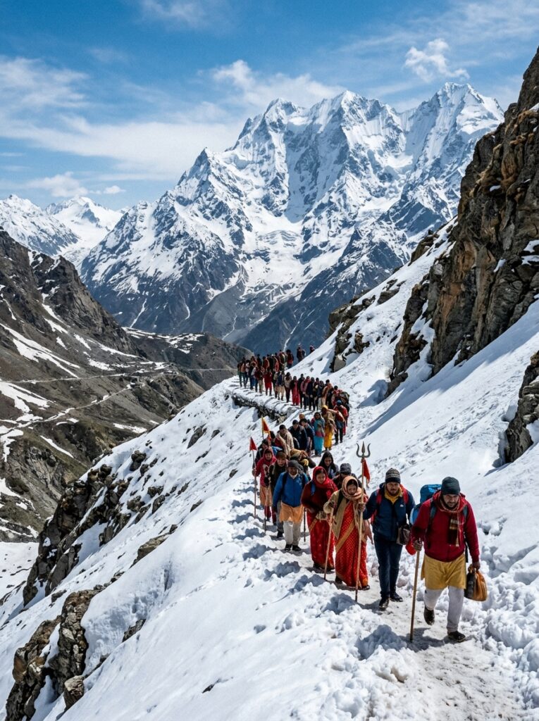
Every year, between the months of July and August, lakhs of devotees from around the world embark on one of the most sacred and physically demanding pilgrimages in Hinduism: the Amarnath Yatra. Situated at an altitude of 3,888 meters (12,756 feet) in a narrow gorge in the union territory of Jammu and Kashmir, the holy Amarnath Cave houses a natural ice stalagmite, revered as the Ice Lingam of Lord Shiva. The ice lingam waxes and wanes with the phases of the moon. Witnessing this divine form of Baba Barfani is a lifetime dream for many, but the journey to the cave is not a walk in the park. It requires traversing rugged terrain, facing unpredictable weather, and dealing with extreme high-altitude conditions. Whether you are planning to trek the traditional path or take a helicopter, this ultimate Amarnath Yatra guide covers registration, routes, helicopter bookings, physical fitness, and packing tips to ensure your pilgrimage is smooth and spiritually fulfilling. — Amarnath Yatra Overview Here is a quick snapshot of the key facts about the Yatra: Feature Details Location Anantnag District, Jammu & Kashmir (3,888 meters altitude) Primary Deity Lord Shiva (Baba Barfani / Ice Lingam) Duration Typically 45 to 60 days (Starting late June/early July to Shravan Purnima in August) Starting Points Pahalgam (Traditional Route) or Baltal (Short Route) Age Limits 13 years to 70 years (No children under 13, no adults over 70, no pregnant women beyond 6 weeks) Key Requirements Compulsory Health Certificate (CHC) and Yatra Permit — Step 1: Compulsory Health Certificate & Registration Process Due to the extreme altitude and thin air, the Shri Amarnathji Shrine Board (SASB) mandates that every pilgrim obtain a Compulsory Health Certificate (CHC) before registering for the Yatra. How to Get the Compulsory Health Certificate (CHC) 1. Authorized Doctors: Download the official CHC form from the SASB website. You can only get it signed by doctors or hospitals authorized by your state government for the Amarnath Yatra. 2. Medical Checks: The doctor will check your blood pressure, ECG, and general fitness to ensure you do not suffer from respiratory diseases, heart conditions, or severe hypertension. 3. Validity: The CHC must be issued after the official date announced by SASB (usually in March or April). Online & Offline Registration Steps Online Registration: Visit the SASB official portal. Upload your photo, the scanned copy of your CHC, and pay the registration fee online. Once approved, you can download your official Yatra Permit (RFID-enabled card). Offline Registration (Bank Branches): You can also register through designated branches of Punjab National Bank (PNB), Jammu & Kashmir Bank, and YES Bank by submitting the CHC, application form, photos, and registration fee. RFID Cards (Mandatory): From recent years, SASB has made RFID tracking cards compulsory. You must collect your RFID card at designated counters in Jammu or Srinagar before starting the trek. No pilgrim is allowed past domestic checkpoints without it. — Step 2: Choosing Your Route (Pahalgam vs. Baltal) There are two distinct routes to reach the Amarnath Cave. Choosing the right one depends on your physical stamina, time availability, and age. “`mermaid graph TD A[Srinagar] –>|90 km| B(Baltal Route) A –>|95 km| C(Pahalgam Route) B –>|14 km steep trek / 1 Day| D[Amarnath Holy Cave] C –>|Drive 16 km| E[Chandanwari] E –>|Trek 12 km steep| F[Sheshnag] F –>|Trek 4.6 km| G[Mahagunas Pass 14,500 ft] G –>|Trek 6.4 km| H[Panchtarni] H –>|Trek 6 km| D “` Route 1: The Pahalgam Route (Traditional & Scenic) This is the traditional route taken by sages and pilgrims for centuries. It starts from Pahalgam (Nunwan Base Camp), which is about 95 km from Srinagar. The Journey: Chandanwari (16 km drive from Pahalgam) ➔ Pissu Top ➔ Sheshnag ➔ Mahagunas Pass (the highest point at 14,500 feet) ➔ Panchtarni ➔ Holy Cave (total trek distance is around 32 km one-way). Time Taken: 3 to 4 days of trekking. Difficulty: Moderate. While the route is longer, the incline is gradual, making it easier for acclimatization. Why Choose It: Beautiful alpine meadows, lake views (Sheshnag Lake), and plenty of time for your body to adjust to high altitudes. Route 2: The Baltal Route (Short & Steep) This route starts from Baltal (near Sonamarg), which is about 90 km from Srinagar. The Journey: Baltal Base Camp ➔ Domel ➔ Barari Marg ➔ Sangam ➔ Holy Cave (total trek distance is 14 km one-way). Time Taken: 1 to 2 days. Fit pilgrims can complete a same-day return journey (28 km total). Difficulty: High. The path is narrow, extremely steep, and prone to sudden rockfalls or mudslides during rains. Why Choose It: If you have limited time or prefer a short, challenging trek. — Step 3: Helicopter Booking & Logistics If trekking is physically impossible or you are short on time, taking a helicopter is a highly convenient option. Helicopter Routes: Baltal Route: Helicopters fly from Neelgrath (Baltal) to Panjtarni. From Panjtarni, it is a 6 km walk/pony ride to the cave. Pahalgam Route: Helicopters fly from Pahalgam to Panjtarni. Booking Rules: Bookings must be made online via the official SASB portal. Tickets sell out within minutes of release, so keeping track of dates is vital. A valid Compulsory Health Certificate (CHC) is still required to board the helicopter. Carry a printout of your helicopter ticket, registration card, and original ID card (Aadhaar or Passport). — Step 4: Physical Preparation & Acclimatization Tips Do not underestimate the physical demands of this trek. Thin air, low oxygen levels, and cold winds can cause Acute Mountain Sickness (AMS). 1. Physical Training (Start 2 months before the Yatra) Cardio: Walk 4–5 km daily. Practice climbing stairs or walking uphill. Breathing Exercises: Practice Pranayama or deep-breathing exercises to improve lung capacity. Strength Training: Do squats and core exercises to prepare your legs for long descents. 2. Packing Essentials Clothing: Heavy woolens, thermals (2 pairs), windproof jacket, waterproof raincoat or poncho (weather changes in minutes), woolen gloves, cap, and extra socks. Footwear: Broken-in trekking shoes with a good grip. Normal sports

Dal Lake houseboats and shikhara ride in Srinagar Kashmir
Family & Leisure

The Ultimate Kashmir Tour Guide: 7-Day Custom Itinerary from Indore

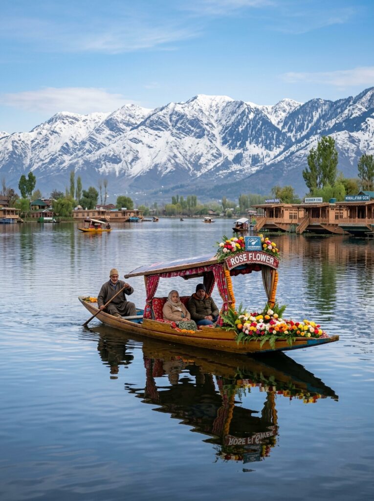
Are you dreaming of escaping the bustling streets of Indore and stepping into a paradise of snow-capped mountains, serene lakes, and whispering pine forests? Look no further than Kashmir—often hailed as “Heaven on Earth.” Whether you are planning a romantic honeymoon, a memorable family vacation, or an adventure trip with friends, a trip to the Kashmir Valley offers an experience that stays with you forever. However, planning a trip from Indore to a destination over 1,500 km away can feel overwhelming. How do you travel? What should your itinerary look like? How can you avoid tourist traps? In this comprehensive guide, we present a customizable 7-Day Kashmir tour package from Indore designed to make your travel seamless, luxurious, and completely stress-free. Kashmir 7-Day Itinerary Summary Day Destination Key Highlights Accommodation Type Day 1 Srinagar Houseboat Check-in, Shikara Ride on Dal Lake Premium Houseboat Day 2 Srinagar Mughal Gardens, Shankaracharya Temple Luxury Hotel Day 3 Gulmarg Gondola Ride, Snow Sports, Khilanmarg Luxury Hotel Day 4 Pahalgam Saffron Fields, Avantipura Ruins, Lidder River Riverside Resort Day 5 Pahalgam Betaab Valley, Aru Valley, Chandanwari Riverside Resort Day 6 Srinagar Return to Srinagar, Shopping at Lal Chowk Luxury Hotel Day 7 Departure Srinagar Airport Transfer, Fly back to Indore – Detailed Day-by-Day Itinerary Day 1: Arriving in Srinagar – The Magic of Dal Lake Your journey begins as you board a flight from Devi Ahilyabai Holkar Airport in Indore to Srinagar International Airport (usually with a short layover in New Delhi). As your flight descends into the Srinagar Valley, you will be greeted by the breathtaking sight of the snow-clad Pir Panjal mountain range. Upon arrival, a representative from Travel Path holiday will welcome you and transfer you to a traditional wooden houseboat docked on the quiet waters of Dal Lake or Nigeen Lake. Day 2: Srinagar Local Sightseeing – Mughal Elegance & Spiritual Heights Wake up to the gentle chirping of birds over the lake. After breakfast, head out for a full day of sightseeing in Srinagar. TIP Pro Tip for Travelers: If you are visiting in late March or April, we will customize your package to include a visit to the Indira Gandhi Memorial Tulip Garden—the largest tulip garden in Asia, showcasing millions of vibrant blooms. Day 3: Srinagar to Gulmarg – The Meadow of Flowers After an early breakfast, take a scenic 2-hour drive (approx. 50 km) to Gulmarg, India’s premier ski destination and home to some of the highest green golf courses in the world. Day 4: Gulmarg to Pahalgam – Saffron Valleys & Ancient Ruins Today, you will head southeast towards Pahalgam, the “Valley of Shepherds” (approx. 140 km, a 4-hour drive). Day 5: Pahalgam Sightseeing – Valleys of Paradise Pahalgam is a haven for nature lovers. After breakfast, hire a local union vehicle (included in our premium packages) to visit the three iconic valleys of the region. Day 6: Pahalgam to Srinagar – Final Shopping & Cultural Immersion After breakfast, drive back to Srinagar. Use this day to explore anything you missed and do some final souvenir shopping. Day 7: Srinagar to Indore – Goodbye Paradise Enjoy your final breakfast overlooking the mountains. Pack your bags along with wonderful memories of your Kashmiri getaway. Our driver will pick you up and drop you off at the Srinagar Airport for your return flight back to Indore. Best Time to Visit Kashmir from Indore Kashmir is a year-round destination, but the experience changes completely depending on when you go: Why Book Your Kashmir Package with Travel Path holiday? Planning a trip to Kashmir requires reliable transport, hotel bookings with good heating facilities, and guides who know the local terrain. At Travel Path holiday, we offer: Let us Plan Your Dream Kashmir Vacation Ready to experience the snows of Gulmarg and the waters of Dal Lake? Don’t leave your vacation to guesswork. Get a Free Customized Quote Today! Let our travel designers customize the perfect Kashmir package for your budget and schedule. 👉 💬 Chat with a Travel Expert on WhatsApp 👉 Fill out our Quick Trip Planner Form (Get a personalized itinerary via email within 24 hours!)

Family & Leisure

Himachal Pradesh: Where Nature Meets Faith – Tourism and Pilgrimage Explained

Himachal Pradesh is a land that speaks in silence. Its mountains tell stories, its rivers carry legends, and its temples reflect centuries of belief. Located in the heart of the western Himalayas, Himachal Pradesh offers a rare travel experience where modern tourism and ancient spirituality exist side by side. Unlike destinations that focus only on leisure or religion, Himachal has two clear identities. One attracts travelers looking for scenic beauty, adventure, and relaxation. The other draws pilgrims seeking faith, peace, and spiritual connection. Together, these two sides make Himachal Pradesh one of India’s most meaningful destinations. What Makes Himachal Pradesh Special?Himachal Pradesh is not about fast travel or crowded cities. It is about slowing down, breathing clean air, and reconnecting—with nature or with belief. People visit Himachal Pradesh for many reasons: Whether someone travels with family, friends, or alone, Himachal offers depth—not just sightseeing. Side One: The Tourist Side of Himachal Pradesh This side of Himachal focuses on leisure, adventure, and natural beauty. Hill stations, valleys, rivers, and mountain passes create unforgettable travel memories. Shimla – Heritage, Hills, and Comfort Shimla is one of the most well-known hill stations in India. Once the summer capital during British rule, it still carries a classic charm. Wooden houses, old churches, and scenic walking paths define the city. Visitors enjoy: Shimla is suitable for travelers who want mountain beauty without leaving comfort behind. Manali – Where Adventure Lives Manali represents the energetic side of Himachal Pradesh. Surrounded by tall peaks and flowing rivers, it is a favorite among young travelers and adventure lovers. Popular experiences include:- Manali balances excitement with natural calm, making it one of the most visited places in the state. Dharamshala and McLeod Ganj – Mountains with Meaning Dharamshala offers something different from typical hill stations. Here, nature blends with culture and mindfulness. The area is strongly influenced by Tibetan traditions and Buddhist philosophy Travelers come here to: This region attracts people who travel not just to see, but to feel. Dalhousie and Khajjiar – Slow Travel Destinations Dalhousie is ideal for travelers who prefer silence over crowds. The town is surrounded by forests and offers beautiful viewpoints without heavy traffic or noise. Nearby Khajjiar, with its open meadows and forest views, feels untouched and calm. These places are best suited for families, couples, and senior travellers Spiti Valley – The Untamed Himalayas Spiti Valley shows the raw side of Himachal Pradesh. The landscape is dramatic, open, and powerful. Life here is simple, shaped by nature and tradition. Visitors are drawn to: Spiti is not for luxury travel, but for meaningful exploration. Side Two: The Pilgrimage and Spiritual Side of Himachal Pradesh Himachal Pradesh is often called Dev Bhoomi, meaning Land of the Gods. This name comes from the strong presence of sacred sites across the state. Faith here is not limited to temples—it is part of daily life. Kangra Region – Power and Devotion The Kangra region holds immense religious importance. It is known for temples dedicated to Goddess Shakti, visited by devotees from across India. Major spiritual centers include: Faith here is deep, personal, and enduring. Chamba – Living Tradition of Worship Chamba reflects Himachal’s spiritual history through its temples, art, and festivals. The town has preserved religious traditions that date back centuries. Pilgrims and visitors experience: Chamba shows how spirituality and culture grow together. Naina Devi – Belief on the Mountain Peak Naina Devi is a sacred destination for devotees of the Goddess. Located on a hilltop, the journey itself is considered an act of devotion. People visit this temple for: Faith here is powerful and deeply emotional. Manikaran Sahib – Shared Faith, Shared Space Manikaran Sahib is unique because it is sacred to more than one religion. Located in the Parvati Valley, it represents harmony and service. The site is known for: It stands as a symbol of unity in diversity. Rewalsar – A Place of Spiritual Balance Rewalsar Lake is surrounded by temples, monasteries, and gurudwaras. It is respected by Hindus, Buddhists, and Sikhs alike. Visitors come here for: This place shows that faith does not divide—it connects. Tourism and Pilgrimage: Two Paths, One Destination Himachal Pradesh does not separate tourism and pilgrimage. Instead, both grow together. A traveler may come for adventure and leave with peace.A pilgrim may arrive for faith and discover nature. Best Time to Visit Himachal Pradesh Each season offers a different experience. Final Thoughts Himachal Pradesh is not a destination you rush through. It is a place you absorb—slowly and deeply. Its mountains invite adventure, while its sacred sites invite reflection. With its tourist charm on one side and spiritual depth on the other, Himachal Pradesh offers something rare: a journey that satisfies both the traveler and the seeker.

You have been successfully Subscribed! Ops! Something went wrong, please try again.

About Us

Travel Path Holiday is a full-service travel company dedicated to delivering seamless, personalized, and memorable travel experiences. We specialize in crafting customized journeys for both corporate and leisure travelers, ensuring every trip is stress-free and enjoyable.

Destinations

Kashmir

Manali

Leh-Ladakh

Nepal

Bhutan

Blog

  • All Post
  • Adventure, Trekking & Road Trips
  • Andaman
  • Bali Honeymoon
  • Bhutan Honeymoon
  • Dubai Group Tour
  • Dubai Honeymoon
  • Family & Leisure
  • Goa Honeymoon
  • Gujarat
  • Himachal Honeymoon
  • Himachal Pradesh
  • Honeymoon & Romance
  • India Travel Guides
  • Kashmir Honeymoon
  • Kerala Honeymoon
  • Nepal Honeymoon
  • Rajasthan Honeymoon
  • Seasonal & Monsoon Specials
  • Sikkim & Northeast
  • Singapore Honeymoon
  • Spiritual & Pilgrimage
  • Thailand
  • Tour Packages & Guides
  • Uttarakhand Honeymoon

Travel Path Holiday, Indore | © 2026 Travel Path Holiday. All Rights Reserved. | Website crafted by Amit Nayak, India

Scroll to Top