
Sikkim & Northeast

Historical Significance and Architecture of Yumthang Valley of Flowers

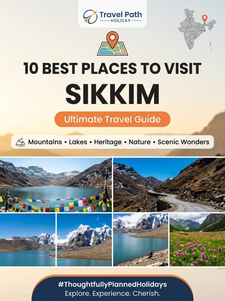
Overview Situated at an elevation of 11,800 feet (3,596 meters) in the North Sikkim district, the Yumthang Valley of Flowers is a high-altitude alpine wonderland renowned globally for its dramatic glacial landscape, natural sulfur hot springs, and vibrant floral biodiversity. Framed by snow-clad Himalayan peaks such as Mount Pauhunri and Shimbha, the history of Yumthang Valley of Flowers is deeply intertwined with the indigenous pastoral traditions of the local Lachungpa community, who have utilized these high-altitude meadows as seasonal grazing pastures (*Yarsa*) for centuries. Beyond its natural grandeur, the valley holds profound botanical, geological, and architectural significance. It forms the core of the Shingba Rhododendron Sanctuary—documented as early as 1849 by famous British botanist Sir Joseph Dalton Hooker—and features geothermal springs (*Men-chu*) revered for their ancient therapeutic properties. The vernacular architecture of the region, visible in the stone-and-timber herder huts (*Goths*), traditional wooden footbridges across the torrential Yumthang Chu river, and the Dzumsa indigenous self-governance administrative system, reflects centuries of human adaptation to extreme Himalayan conditions. For travelers journeying from Indore and Central India, understanding the history, structural geography, thermal hydrology, and ecological importance of Yumthang transforms a simple sightseeing excursion into an enriching, culturally immersive expedition. Local Logistical Advice for Indore Travelers Transit Route from Indore to North Sikkim Reaching Yumthang Valley from the Malwa plateau requires a well-planned multi-leg journey combining air or rail travel with scenic high-altitude mountain drives: Flight Connections from Indore (IDR): Depart from Indore’s Devi Ahilya Bai Holkar Airport (IDR) on a morning flight to Bagdogra Airport (IXB) in West Bengal. Daily connecting flights operate via New Delhi (DEL) or Kolkata (CCU), with total flying and layover times averaging 5.5 to 7.5 hours. Rail Options: Travelers preferring train journeys can board the weekly Indore–Kamakhya Express (Train 19305) directly to New Jalpaiguri (NJP), or opt for daily express trains from Indore to Howrah Junction (HWH) and connect onward to NJP. Overland Highway Journey to Gangtok: From Bagdogra Airport or NJP Railway Station, travel by private SUV (such as an Innova Crysta) along NH10 through the scenic Teesta River valley to reach Gangtok (125 km / 4.5 to 5 hours drive). Gangtok to Lachung & Yumthang Expedition: Reaching Yumthang requires a 2-day North Sikkim circuit. Day 1 involves a 120 km mountain drive (6 to 7 hours) from Gangtok via Mangan and Chungthang to reach Lachung village (8,800 ft), where all overnight lodges and guest houses are located. On Day 2, an early morning 25 km drive (1 to 1.5 hours) brings you directly to Yumthang Valley (11,800 ft). Climate Transition & Altitude Adaptation Indore residents accustomed to Central India’s warm, tropical dry climate (where temperatures typically range from 25°C to 42°C) face a dramatic microclimatic shift in North Sikkim. Yumthang Valley experiences severe sub-zero temperatures (-5°C to -15°C) during winter months (December to February), with heavy snowfall blanketing the valley floor. During the spring bloom season (late March to June), temperatures range between a crisp 5°C and 15°C. At an altitude of 11,800 feet, atmospheric pressure and oxygen concentration are noticeably lower than in Indore. Adequate acclimatization overnight at Gangtok (5,400 ft) and Lachung (8,800 ft) is mandatory to prevent high-altitude fatigue and mountain sickness. Mobile Connectivity & Cash Logistics National Roaming: Standard prepaid SIM cards issued in Madhya Pradesh (MP) work perfectly under national roaming across Sikkim. Network Availability: Mobile networks (Airtel, Jio, and BSNL) provide reliable voice and data coverage in Gangtok and Mangan. However, signals become weak beyond Chungthang and drop to zero inside Yumthang Valley. Cash Preparedness: Because mobile internet is unavailable inside Yumthang Valley, UPI digital payments cannot function at roadside stalls or hot spring entry gates. Furthermore, ATMs are unavailable beyond Mangan. Indori travelers must withdraw sufficient physical Indian Rupee (INR) cash in Gangtok for local food, hot beverages, boot rentals, and incidental expenses. Complete Details & Practical Guidelines Historical Roots & The Indigenous Dzumsa Governance #### 1. Pastoral Grazing Grounds of the Lachungpas Long before Yumthang gained international fame as a botanical tourism destination, it functioned as the primary high-altitude summer grazing land (*Yarsa*) for the Lachungpas—the indigenous Tibetan-origin Bhotia community inhabiting the Lachung Valley. Seasonal Transhumance: For generations, Lachungpa pastoralists practiced seasonal transhumance. During harsh winter months, villagers kept their herds of yaks, cattle, and sheep in lower valley settlements near Lachung. As snow melted in late spring, herders drove their livestock up to the nutrient-rich alpine meadows of Yumthang. Economic Lifeline: The high-altitude grasses and medicinal herbs of Yumthang provided vital sustenance for yaks, which yielded butter, cheese (*Chhurpi*), wool, leather, and draft power essential for survival in high-Himalayan terrain. #### 2. The Dzumsa Self-Governance System The socio-historical organization of Yumthang’s pastoral lands is anchored in the Dzumsa—a unique, centuries-old traditional self-governance system recognized by the State Government of Sikkim under local self-government laws. Leadership by the Pipon: Unlike conventional panchayats, the Dzumsa is headed by an elected village headman called the *Pipon*, along with a council of village elders (*Gyapon*). Pastoral Land Management: The Dzumsa historically determined grazing schedules, allocated pasture rights among families, regulated forest timber usage, and settled community disputes. Even today, eco-tourism operations, vehicle entries, and shop leases in Yumthang Valley are regulated in consultation with the Lachung Dzumsa to ensure local community benefit and environmental protection. #### 3. Sir Joseph Dalton Hooker’s 1849 Expedition The recorded botanical and geographic history of Yumthang Valley entered western scientific literature in 1849 through the historic expedition of Sir Joseph Dalton Hooker, the famed English botanist and director of the Royal Botanic Gardens, Kew. Botanical Discovery: Hooker spent months exploring the Sikkim Himalayas, traveling up the Teesta and Lachung river valleys to Yumthang. He documented dozens of endemic flora species, particularly wild rhododendrons, primulas, and orchids. Publication Impact: Hooker’s landmark publication, *Himalayan Journals* (1854), introduced Yumthang’s extraordinary floral diversity to the world, laying the foundation for modern conservation efforts in North Sikkim. Shingba Rhododendron Sanctuary & Botanical Conservation #### 1. Sanctuary Establishment & Boundaries In 1984, recognizing the ecological vulnerability and immense botanical wealth

Sikkim & Northeast

Emergency Numbers, Hospitals & Tourist Police in Pelling Pemayangtse Monastery

Overview Perched at an elevation of 6,800 to 7,200 feet (2,072 to 2,195 meters) in the Gyalshing (West Sikkim) district, Pelling and the sacred, 300-year-old Pemayangtse Monastery are among the most revered cultural and scenic destinations in the Eastern Himalayas. Offering breathtaking, front-row panoramas of the mighty Mount Kanchenjunga massif, this historic monastery circuit attracts nature lovers, heritage enthusiasts, and families alike. While West Sikkim is widely recognized as one of India’s safest and most welcoming travel regions, high-altitude mountain terrain, winding ghat roads, and sudden weather shifts make safety readiness essential. If you are looking for an emergency helpline in Pelling Pemayangtse Monastery, having immediate access to verified local contact details ensures total peace of mind: National Integrated Emergency Number: 112 (Connects directly to Sikkim Police, Fire, and Medical Dispatchers). Pelling Police Outpost: +91-3595-258223 (Handles local security, tourist assistance, lost items, and traffic management near Pemayangtse). Gyalshing District Hospital (SDRH Geyzing): +91-3595-250826 / +91-3595-250244 (Located 9 km from Pelling; primary 24/7 trauma, casualty, and emergency oxygen facility in West Sikkim). Medical Ambulance Network: 108 (Sikkim Toll-Free Medical Ambulance Helpline). Sikkim Tourist Police Helpline: 1091 / +91-3592-202022 (Dedicated assistance for international and domestic tourists across Sikkim). Whether you are exploring the ancient wooden sculptures of Pemayangtse Monastery, trekking down to the neighboring Rabdentse Ruins, or navigating the scenic mountain highways from Gangtok or Bagdogra, being equipped with verified emergency protocols is indispensable. This comprehensive guide outlines local police contacts, medical facilities, mountain rescue operations, road safety advice, and essential logistical tips specifically tailored for travelers departing from Central India. Local Logistical Advice for Indore Travelers Planning a peaceful Himalayan retreat from the Malwa plateau in Indore to the serene heights of West Sikkim requires thoughtful planning. Transitioning from Indore’s tropical dry climate to the crisp, sub-alpine air of Pelling requires careful attention to flight connections, altitude adjustment, mobile roaming, and dietary comfort. Flight and Highway Coordinates from Indore Air Routes via Devi Ahilya Bai Holkar Airport (IDR): The most efficient flight connection from Indore is flying from IDR to Bagdogra International Airport (IXB) in West Bengal. Leading carriers including IndiGo, Air India, and Vistara offer daily flights with convenient layovers at New Delhi (DEL) or Kolkata (CCU), with total travel times ranging from 4.5 to 6.5 hours. Alternatively, seasonal flights connect to Pakyong Airport (PYG) near Gangtok. Scenic Mountain Highway Drive: From Bagdogra Airport (IXB) or New Jalpaiguri Railway Station (NJP), Pelling is located approximately 135 km away. The drive takes around 5 to 5.5 hours, traversing National Highway 10 (NH10) along the Teesta River up to Melli, before taking the West Sikkim state highway via Jorethang and Legship up to Geyzing and Pelling. Train Options from Central India: Travelers who prefer rail journeys can board direct trains from Indore Junction (INDB) or Ujjain Junction (UJN), such as the Kamakhya Express (19305), or travel via Howrah/Sealdah to NJP, where private luxury cabs provide onward transfers to West Sikkim. Climate Transition & Altitude Acclimatization Travelers departing from Indore (situated at approximately 550 meters elevation) undergo a noticeable atmospheric change upon reaching Pelling and Pemayangtse Monastery (over 2,100 meters / 6,800 feet elevation). Temperature Differential: While daytime temperatures in Indore often range between 25°C and 38°C, Pelling experiences cool, mountain weather (10°C to 20°C in summer, and 0°C to 10°C in winter). Evening temperatures drop rapidly, especially along exposed monastery ridges. Altitude Adjustment: Though Pelling does not typically induce severe acute mountain sickness (AMS) compared to extreme passes like Nathula or Gurudongmar, the sudden shift in elevation can cause mild headache, fatigue, or breathlessness in senior citizens and young children. Taking it easy on your arrival day and sipping warm water helps your body adjust naturally. Mobile Connectivity & Roaming Guidelines A frequent query for travelers from Madhya Pradesh is whether mobile phones function seamlessly under national roaming in Sikkim: National Roaming Confirmation: Standard prepaid SIM cards issued in Madhya Pradesh (Jio, Airtel, Vi) work perfectly under national roaming in Sikkim. Unlike sensitive border zones in Jammu & Kashmir or Ladakh, domestic prepaid cards remain active throughout Sikkim without requiring local SIM purchases. Signal Variations in Forest Corridors: While Upper Pelling town, Geyzing bazaar, and main hotel belts enjoy stable 4G/5G mobile data, signal strength may fluctuate in dense forest trails surrounding Pemayangtse Monastery, Rabdentse Ruins, and Changey Waterfall. It is strongly recommended to save critical emergency numbers offline on your smartphone and carry printed vouchers. Custom Vegetarian Dining & Health Protection Indori travelers who adhere to strict vegetarian dietary habits can travel with complete ease: Dietary Comfort: Pelling and Geyzing offer a wide variety of restaurants providing hand-vetted vegetarian options and freshly cooked pure vegetarian dishes, including familiar North Indian thalis, warm lentils, vegetable soups, and freshly prepared momos. Hydration & Hydration Thermos Arrangements: Drinking cold water in high-altitude environments can irritate the throat. Travel Path Holiday ensures that all vehicle bookings include insulated thermoses for hot drinking water, keeping you hydrated and comfortable during long sight-seeing drives across West Sikkim. Complete Details & Practical Guidelines Key Emergency Helplines & Police Outposts in West Sikkim West Sikkim is governed administratively under the Gyalshing District (formerly West Sikkim District). The Sikkim Police Department maintains dedicated tourist-friendly outposts across key sightseeing hubs. “` West Sikkim Safety & Emergency Network +————————————————————————-+ NATIONAL EMERGENCY HELPLINE : 112 (Police, Fire, Ambulance Dispatch) [Pelling Police Outpost] [Gyalshing SP Office / District HQ] Ph: +91-3595-258223 Ph: +91-3595-250888 / 250763 [Gyalshing District Hospital] DEL/CCU -> IXB/PYG) ↓ Commercial Luxury Fleet (Innova Crysta) + Trained Mountain Chauffeurs ↓ Hand-Vetted Pure Vegetarian Meals & Thermos Warm Water Support ↓ 24/7 Real-Time Ground Monitoring & Emergency Medical Coordination +————————————————————————-+ “` 1. In-Person Consultation at Indore Office Visit our physical travel lounge in Indore to design your itinerary with expert travel specialists: Office Location: Commercial Plaza, Vijay Nagar, Opposite C21 Mall, Indore, Madhya Pradesh. Tailored Itinerary Planning: We carefully structure your daily travel schedule to ensure relaxed sight-seeing, ample acclimatization time, and easy road transfers without exhausting mountain drives. 2. Dedicated Mountain

Sikkim & Northeast

Pre-Wedding Shoot & Couple Photography in Lachen Gurudongmar Lake

Overview Planning a pre-wedding shoot in Lachen Gurudongmar Lake offers couples one of the most surreal, high-altitude romantic backdrops in all of Asia. Situated at an astounding altitude of 17,800 feet above sea level in North Sikkim, Gurudongmar Lake presents a dramatic canvas of crystal-clear turquoise waters framed by snow-capped Himalayan peaks, sacred prayer flags fluttering against deep blue skies, and vast stark alpine desert terrain. Further down the valley, the picturesque village of Lachen charms couples with rustic pine chalets, mist-draped wooden cottages, and roaring emerald torrents along the Teesta River basin. For engaged couples and photography enthusiasts traveling from Indore, executing a high-altitude couple portrait session requires meticulous preparation. Navigating sensitive border security permits, severe sub-zero temperatures, thin oxygen levels, strict drone bans, and long mountain journeys from Gangtok demands expert local coordination. This comprehensive guide details every essential aspect of planning your romantic photography expedition—from wardrobe styling and lighting timelines to travel logistics from Indore, permit paperwork, safety protocols, and professional ground support provided by Travel Path Holiday. Local Logistical Advice for Indore Travelers Flight and Overland Route Coordinates from Indore Couples embarking from Indore’s Devi Ahilya Bai Holkar Airport (IDR) have streamlined air connectivity to access North Sikkim: Primary Flight Route (Indore to Bagdogra): Take an early morning flight from Indore (IDR) to Bagdogra International Airport (IXB) with a quick layover in New Delhi (DEL) or Kolkata (CCU). Direct connecting flights via Kolkata allow you to land at Bagdogra by early afternoon (total transit time approximately 4.5 to 6 hours). Alternate Airport (Pakyong PYG): During favorable weather seasons, direct seasonal flights from Kolkata operate into Pakyong Airport (PYG) near Gangtok, reducing overland drive time significantly. Railway Options: For couples preferring train travel from Central India, board the direct trains running from Indore Junction (INDB) to Howrah/Sealdah or connect via New Jalpaiguri (NJP) station (such as the Kamakhya Express or connecting routes through Howrah). Overland Mountain Journey: 1. Bagdogra/NJP to Gangtok: A 125 km scenic drive along National Highway 10 (NH10) hugging the roaring Teesta River (approx. 4.5 to 5 hours in a private vehicle). 2. Gangtok to Lachen: A 120 km mountain route ascending through Mangan and Chungthang (approx. 6 to 7 hours). The drive passes dramatic waterfalls, pine forests, and high-altitude river bends. Climate Transition & Acclimatization Strategy Travelers departing from Indore’s warm, dry Malwa plateau (where temperatures average 25°C to 40°C) must prepare for a radical climate shift when entering North Sikkim: Lachen Village (8,830 ft): Cool to freezing alpine weather, ranging from -2°C to 12°C depending on the season. Mist and evening frosts are common. Gurudongmar Lake (17,800 ft): Extreme high-altitude Arctic condition. Temperatures drop between 5°C to -15°C even during peak spring and autumn months, accompanied by biting wind chills and significantly reduced atmospheric oxygen. Acclimatization Rule: Never travel directly to Gurudongmar Lake. Spend at least one full night in Lachen village (8,830 ft) to let your body adjust before ascending to 17,800 feet early the next morning. Mobile Connectivity & Roaming for Central India Travelers A crucial piece of logistical reassurance for couples from Madhya Pradesh: standard prepaid SIM cards issued in MP work perfectly under national roaming throughout Sikkim. Cellular Networks: Airtel and Jio provide stable 4G data coverage across Gangtok, Mangan, and Lachen village. High-Altitude Signal Drop: Be aware that cellular network towers end near Thangu Valley (13,000 ft). At Gurudongmar Lake (17,800 ft), there is zero mobile reception. Ensure all digital shot lists, pose references, audio tracks, and itinerary details are downloaded for offline access before leaving Lachen. Complete Details & Practical Guidelines 1. Premier Couple Photography & Pre-Wedding Shoot Locations #### A. Gurudongmar Lake Landscape Backdrop (17,800 ft) Visual Appeal: One of the highest freshwater lakes in the world, sacred to both Buddhists and Sikhs. The partially frozen turquoise water reflects the towering snow-clad peaks of the Mt. Siniolchu range under a piercing blue sky. Signature Frames: *Prayer Flag Silhouette:* Couples standing hand-in-hand along the wooden viewing deck framing bright Buddhist prayer flags fluttering against the frozen lake shore. *Alpine Infinity Horizon:* Wide-angle landscape portraits capturing the vast plateau backdrop where stark earth meets glacial waters. Optimal Timing: 7:30 AM to 9:30 AM. After 10:30 AM, fierce gale-force winds sweep across the plateau, making outdoor shoots uncomfortable and dangerous. #### B. Lachen Wooden Cottages & Alpine Village Chalets Visual Appeal: Traditional Sikkimese pine wood chalets, hand-carved balconies, stone pathways, and mist-shrouded pine hillsides. Signature Frames: *Cozy Chalet Porch:* Morning candid shots featuring the couple holding steaming mugs of tea on a rustic wooden balcony overlooking fog-draped valleys. *Pine Lane Walk:* Romantic walks along quiet village trails framed by ancient pine trees and traditional timber homes. Optimal Timing: Early morning (6:00 AM – 7:30 AM) or golden afternoon light (3:30 PM – 5:00 PM) before sunset. #### C. Teesta & Lachen Chu River Valleys Visual Appeal: Deep mountain gorges, emerald-green rushing river waters, dramatic suspension bridges, and forested mountain walls along the road from Chungthang to Lachen. Signature Frames: *Suspension Bridge Romance:* Couples posed midway across wooden-planked iron suspension bridges with the white-water river churning below. *Riverbank Boulders:* Artistic portraits on smooth riverbed rocks with pine-covered cliffs rising into the backdrop. 2. Mandatory Permits & Border Security Regulations North Sikkim shares an international border with Tibet/China and is categorized as a sensitive military border zone. Photography crews and couples must comply with strict state and defense permit protocols: “` [Gangtok Tourism Office] ➔ [Mangan District Magistrate] ➔ [North Sikkim Army Checkpoints] │ │ └── Issued Protected Area Permit (PAP) ─────────────────────┘ “` 1. Protected Area Permit (PAP) & Inner Line Permit (ILP): Every civilian traveler must obtain a valid PAP issued by the Tourism & Civil Aviation Department and Sikkim Police Headquarter. Permit Requirements: Original Government Photo ID: Voter ID Card or Passport ONLY (Note: Indian Army checkpoints at North Sikkim do NOT accept Aadhaar Cards or Driving Licenses for North Sikkim PAP clearance). 4 physical passport-sized photographs per individual. 2. Commercial Crew Permits & Equipment Clearance: If

Sikkim & Northeast

ATM, Cash & Mobile Connectivity Guidelines in Lachung Snow Valley

Overview Planning a trip to Lachung Snow Valley, Yumthang Valley (11,800 feet), and Zero Point (15,300 feet) in North Sikkim is an extraordinary experience, but navigating financial transactions and digital communication in these remote high-altitude border regions requires thorough preparation. A common question among travelers planning their itinerary is regarding the availability of the mobile network in Lachung Snow Valley, ATM locations, and whether digital UPI payments like PhonePe or Google Pay work in the mountains. To put it plainly: There are NO functioning ATMs in Lachung village, Yumthang Valley, or Zero Point. The nearest reliable ATMs are located in Gangtok (125 km away), with only a highly unreliable single State Bank of India (SBI) kiosk in Chungthang (23 km before Lachung) that frequently suffers from prolonged power outages or cash exhaustion. Furthermore, while Jio 4G and Airtel 4G provide decent coverage in main Lachung village, mobile data drops to absolute zero as you ascend toward Yumthang Valley and Zero Point. Carrying physical cash currency is 100% mandatory for village stays, snow gear rentals, driver tips, roadside tea stalls, and local food shacks. At Travel Path Holiday (TPH), we ensure our clients from Indore and Central India embark on their North Sikkim journey fully prepared—combining pre-booked logistics, local cash strategies, and seamless connectivity guidance so you never get stranded in the snow. Local Logistical Advice for Indore Travelers 1. Flight & Train Routes from Indore to Sikkim Travelers departing from Malwa can reach Sikkim through streamlined air and rail connections managed by TPH: By Air (Recommended): Take a morning flight from Indore’s Devi Ahilya Bai Holkar Airport (IDR) to Bagdogra Airport (IXB) in West Bengal, connecting via New Delhi (DEL) or Kolkata (CCU) on IndiGo or Air India (total transit time 4.5 to 6 hours). Alternatively, seasonal flights operate to Pakyong Airport (PYG) near Gangtok. From Bagdogra or Pakyong, TPH arranges a private vehicle transfer along the scenic Teesta River to Gangtok. By Train: Board direct train services from Indore Junction to Howrah/Kolkata (such as the Ahilyanagari Express), followed by an overnight train from Sealdah or Howrah to New Jalpaiguri (NJP). From NJP, a 4.5-hour hill drive leads to Gangtok. 2. The High-Altitude Mountain Transit to North Sikkim Lachung is located 125 km north of Gangtok, accessible via a dramatic 6 to 7-hour road journey passing through Mangan and Chungthang: Protected Area Permits (PAP): Because North Sikkim shares sensitive international borders with China (Tibet), standard Indian tourists require a Protected Area Permit issued by Sikkim Police and the Tourism Department. TPH handles all permit approvals in Gangtok—simply provide 2 passport photos and valid government ID proofs (Aadhaar Card or Voter ID). Vehicle Mandate: West Bengal commercial cabs and personal private cars are strictly prohibited beyond Gangtok. TPH allocates Sikkim-registered 4WD mountain vehicles (Mahindra Scorpio, Xylo, or Innova Crysta) driven by mountain-certified local Sikkimese drivers. 3. Climate Transition from Indore to High-Altitude Cold Indore travelers used to a tropical dry climate (where winter stays at a pleasant 15°C to 28°C and summer exceeds 38°C) must prepare for drastic high-altitude cold: Lachung Village (8,800 ft): Night temperatures range between -5°C and 5°C in winter (December to March) and stay crisp at 8°C to 16°C in summer (April to June). Zero Point (15,300 ft): Experiences severe sub-zero conditions down to -15°C with heavy snowfall, strong glacial winds, and thin atmospheric oxygen. Thermal innerwear, heavy down jackets, insulated waterproof gloves, and woolen beanies are essential. 4. MP Prepaid SIM Card Functionality (National Roaming) A major query from Madhya Pradesh travelers is whether their mobile connection will work in North Sikkim: National Roaming Confirmation: Standard prepaid SIM cards registered in Madhya Pradesh (Jio, Airtel, BSNL) work perfectly under national roaming in Sikkim. You do NOT need to purchase a local tourist SIM card or convert your prepaid number to postpaid upon arriving in Sikkim. Signal Performance: In Gangtok and main Lachung village, MP prepaid SIM cards connect to 4G roaming networks automatically. 5. Pure Vegetarian Dining & Indori Dietary Comforts Remote mountain hamlets often pose dining challenges for travelers from Central India. TPH pre-arranges homestays and mountain lodges in Lachung that provide freshly cooked pure vegetarian dishes and hand-vetted vegetarian options/dining. You can enjoy hot Indori-style poha, aloo parathas, dal-rice, steaming vegetable thukpa, and hot ginger tea prepared fresh in hygienic mountain kitchens. Complete Details & Practical Guidelines Mobile Network Coverage in Lachung Snow Valley & Surrounding Belts Mobile connectivity in North Sikkim varies significantly depending on your exact geographical location and service provider. Once your vehicle crosses the Army Checkpost at Chungthang and climbs toward Lachung, signals begin to fluctuate. “` ┌─────────────────────────────────────────────────────────────────────────────┐ │ NORTH SIKKIM CONNECTIVITY MAP │ └─────────────────────────────────────────────────────────────────────────────┘ Gangtok (100% 4G) ──► Mangan (4G/3G) ──► Chungthang (3G/2G) ──► Lachung Village (Basic 4G) │ ┌─────────────────────┴─────────────────────┐ ▼ ▼ Yumthang Valley (Patchy 2G/Zero) Zero Point (TOTAL BLACKOUT) “` #### Detailed Network Breakdown by Cellular Operator Location / Region Altitude Jio 4G Coverage Airtel 4G Coverage BSNL Coverage Vi (Vodafone Idea) Gangtok City 5,400 ft Excellent 4G (High Speed) Excellent 4G (High Speed) Good 3G / 4G Good 4G Mangan Town 3,950 ft Reliable 4G Reliable 4G Good 3G Moderate 3G Chungthang Junction 5,600 ft Moderate 4G Moderate 4G Reliable 3G / 2G Weak / Spotty Lachung Village (Main) 8,800 ft Best Performance (4G voice & basic data near market) Moderate Performance (Spotty 4G near hotel clusters) Basic 2G/3G (Emergency calls) Minimal / No Signal Yumthang Valley 11,800 ft Intermittent / Zero Data Intermittent / Zero Data Occasional Emergency 2G No Signal Zero Point (Yumesamdong) 15,300 ft ZERO SIGNAL (Complete Blackout) ZERO SIGNAL (Complete Blackout) ZERO SIGNAL (Complete Blackout) ZERO SIGNAL (Complete Blackout) Mt. Katao Border Area 12,500 ft ZERO SIGNAL (Complete Blackout) ZERO SIGNAL (Complete Blackout) ZERO SIGNAL (Complete Blackout) ZERO SIGNAL (Complete Blackout) ATM Availability & Strategic Cash Management #### The Reality of Banking in North Sikkim Many travelers assume they can withdraw cash via ATMs upon reaching Lachung village. However, high-altitude terrain, frequent power disruptions, and winter line freezing make operating ATMs extremely

Sikkim & Northeast

Local Shopping Guide in Tsomgo Lake: Authentic Souvenirs

Overview Tsomgo Lake (popularly known as Changu Lake), perched at a breath-taking altitude of 12,400 feet above sea level in East Sikkim, is world-famous not only for its glacial turquoise waters and dramatic Himalayan panoramas, but also for hosting one of the most vibrant high-altitude souvenir markets in India. Situated just 38 kilometers from Gangtok along the historic Silk Route corridor leading toward Nathula Pass, the colorful lakeside bazaar offers a captivating cultural immersion into Tibetan, Bhutia, and Nepalese craftsmanship. For travelers visiting from Indore and Central India, shopping in Tsomgo Lake is far more than a simple retail pause—it is an opportunity to acquire authentic mountain keepsakes directly from local mountain artisans. From hand-carved Sikkimese prayer wheels and embossed porcelain tea cups to heavy Yak wool mufflers, aromatic organic black cardamom, and hand-woven wool carpets, this mountain market holds treasures that preserve the rich heritage of the Eastern Himalayas. Travel Path Holiday (TPH) has compiled this detailed shopping guide to help you identify genuine handicrafts, navigate high-altitude market logistics, understand realistic price points, and bring home authentic souvenirs from your Sikkim holiday. Local Logistical Advice for Indore Travelers Planning a high-altitude trip from the warm Malwa plateau of Indore to the alpine heights of Tsomgo Lake requires well-coordinated travel logistics and sensible preparation. Air Transit from Indore: Fly from Indore Devi Ahilya Bai Holkar Airport (IDR) to Bagdogra Airport (IXB) in West Bengal. Convenient connecting flights operate daily via Delhi (DEL) or Kolkata (CCU) on airlines like IndiGo and Air India, departing IDR early in the morning. Alternatively, seasonal flight connections land at Pakyong Airport (PYG) near Gangtok. From Bagdogra, Travel Path Holiday arranges a comfortable 4 to 4.5-hour private cab transfer (Toyota Innova Crysta) along NH10 through the scenic Teesta River valley up to Gangtok. Train Route Options: Travelers preferring rail journeys can board direct or connecting trains from Indore Junction (INDB) or nearby Bhopal (BPL) to New Jalpaiguri Railway Station (NJP), followed by a pre-arranged private mountain vehicle transfer to Gangtok. Gangtok to Tsomgo Lake Drive: Tsomgo Lake is located 38 km steep uphill from Gangtok (approximately a 2-hour drive through scenic mountain hairpin bends along Jawaharlal Nehru Road). Non-Sikkim taxies are restricted on this high-altitude border route; TPH provides dedicated Sikkim-registered mountain vehicles driven by expert local drivers. Protected Area Permits (PAP): Because Tsomgo Lake lies in a restricted military border zone near Nathula Pass, a Protected Area Permit (PAP) issued by Sikkim Tourism and the Sikkim Police Checkpost is mandatory. TPH handles all permit processing on your behalf—travelers simply need to share 2 passport-sized photographs and a valid government photo ID (Aadhaar Card or Voter ID) with our team 72 hours before departure. Climate Transition & Attire: Indori travelers accustomed to a warm, tropical dry climate (25°C to 38°C) will experience a sharp temperature drop at 12,400 feet, where alpine conditions range from sub-zero chills (-5°C to 8°C) with brisk mountain winds and ice flurries. Layer up in thermal innerwear, heavy fleece jackets, windproof coats, woolen caps, and insulated gloves before stepping out of your vehicle at the lake parking stand. Mobile Network & Roaming: Travelers from Madhya Pradesh can rest easy knowing that standard MP prepaid SIM cards (Airtel, Jio, Vi, and BSNL) work seamlessly under national roaming across Sikkim, including Gangtok and the Tsomgo Lake visitor complex. You do not need to buy a separate local SIM card. However, high-altitude weather can occasionally cause data signal fluctuations near the market stalls. Cash Currency Advisory: While some vendor stalls accept UPI payments, cellular data connectivity at 12,400 feet can be intermittent. Carry sufficient physical Indian currency (INR 100, 200, and 500 notes) to ensure smooth purchases at the market. Complete Details & Practical Guidelines The wooden shopping stalls at Tsomgo Lake line the stone-paved walkway adjacent to the Yak ride staging point and warm food stalls. Here is an in-depth breakdown of the top 5 authentic souvenirs to buy at Tsomgo Lake, along with detailed product insights, current pricing, and buyer inspection tips. 1. Sikkimese Prayer Wheels (Mani Chokhor) Spiritual symbols deeply rooted in Himalayan Tibetan Buddhism, hand-held prayer wheels (*Mani Chokhor*) are among the most sacred and sought-after souvenirs available at Tsomgo Lake. Craftsmanship & Meaning: Each prayer wheel consists of a central wooden or bone handle supporting a cylinder made of embossed brass, copper, or silver-plated alloy. Inside the hollow cylinder is a tightly wound paper scroll printed with thousands of repetitions of the sacred Buddhist mantra *”Om Mani Padme Hum”*. Varieties Available: Stalls offer classic hand-held spinning prayer wheels, ornate brass table-top models, and decorative wall-hanging prayer wheels set in hand-carved wooden frames. Price Range: Standard white-metal hand prayer wheels range from ₹350 to ₹700; hand-carved copper and brass prayer wheels inlaid with synthetic turquoise and coral stones cost between ₹1,200 and ₹2,500. Inspection Tip: Hold the handle firmly and spin the metal cylinder in a clockwise direction. A well-crafted prayer wheel should rotate smoothly and quietly without wobbling, while the attached metal counterweight swings in steady rhythm. 2. Traditional Sikkim Cups & Tea Sets (Chaki / Thungku) Tea drinking is an essential ritual in Sikkimese households. Bringing home traditional mountain tea cups adds distinct Himalayan charm to your daily tea routine in Indore. Design & Utility: Traditional Sikkim cups comprise a fine porcelain inner bowl fitted inside a hand-carved wooden or embossed metal outer casing, covered with an intricate matching lid (*Chaki*). The outer metal covers feature raised motifs of sacred snow lions, double dragons (*Druk*), lotus blossoms, and eternal knot symbols. Practical Use: Designed to retain heat while protecting your hands from hot Butter Tea (*Suja*) or orthodox Sikkim Temi black tea, these cups also double as striking decor items for display units and dining rooms. Price Range: Individual porcelain cups with ornate metal lids range from ₹250 to ₹500; complete matching 6-piece ceramic and brass tea sets with an embossed teapot range from ₹1,800 to ₹4,000. Packaging Tip: Ask the vendor to double-wrap your cups in protective

Sikkim & Northeast

Seniors & Kids Safe Travel Guidelines in Nathula Pass Border

Overview Standing at a formidable elevation of 14,140 feet (4,310 meters) above sea level along the Indo-China border in East Sikkim, Nathula Pass offers one of the most thrilling high-altitude border experiences in Asia. However, for multi-generational families traveling with senior citizens and young children, ascending to an altitude where available oxygen levels drop by nearly 40% compared to sea level requires meticulous health planning, gradual acclimatization, and strict safety adherence. When planning senior citizen travel in Nathula Pass Border, families must account for steep concrete staircases, freezing sub-zero winds, wet icy pathways, and rapid barometric changes. From understanding viewing gallery safety rails and avoiding physical overexertion to stocking portable oxygen canisters and knowing the exact emergency medical infrastructure—including Indian Army high-altitude medical posts and Gangtok’s premier STNM Hospital—this comprehensive safety guide is designed to protect your loved ones. Created by the editorial and logistics specialists at Travel Path Holiday, this guide ensures that Indori families can experience the wonder of the Himalayan border comfortably, safely, and with complete peace of mind. Local Logistical Advice for Indore Travelers Traveling from the low-altitude Malwa plateau in Indore (altitude approx. 550 meters) to the extreme high-altitude terrain of Nathula Pass (14,140 feet) represents a massive environmental transition. For senior citizens whose cardiovascular systems adapt more slowly, and young children whose bodies are sensitive to sudden atmospheric shifts, proper route planning from Central India is essential. Flight, Train & Road Coordinates from Indore Air Travel via Indore (IDR): The most comfortable and time-efficient route for multi-generational families departing from Indore is flying from Devi Ahilya Bai Holkar Airport (IDR) to Bagdogra International Airport (IXB) in West Bengal. Major airlines including IndiGo and Air India operate convenient connecting flights via New Delhi (DEL) or Kolkata (CCU), with total travel durations ranging between 4.5 to 6.5 hours. During specific operational seasons, connecting flights to Pakyong Airport (PYG) (30 km from Gangtok) may also be available. Comfortable Highway Transfer (NH10): From Bagdogra Airport or New Jalpaiguri Railway Station (NJP), Gangtok lies 125 km away. The 4.5 to 5.5-hour drive winds through the Teesta River Valley along National Highway 10. For seniors and kids, avoid cramped shared taxis. Travel Path Holiday arranges private, well-cushioned commercial vehicles like the Toyota Innova Crysta, ensuring a smooth, shock-absorbent ride up the winding mountain roads. Rail Connection Options: Senior citizens who prefer train travel can take the Indore-Howrah Shipra Express (22911) or the Kamakhya Express (19305) from Indore Junction (INDB) or Ujjain Junction (UJN) to Howrah/NJP, followed by a private high-comfort cab transfer up to Gangtok. Climate Transition & Acclimatization Protocol for Indori Travelers Malwa to Himalaya Shock: Indore’s dry, tropical climate (typically 22°C to 38°C) contrasts sharply with Nathula’s sub-zero alpine conditions, where temperatures frequently plunge between 0°C and -10°C even during spring afternoons. Mandatory 48-Hour Gangtok Acclimatization: Senior citizens and young children should never travel directly from Bagdogra to Nathula Pass on the same day or next morning. A minimum stay of 24 to 48 hours in Gangtok (5,410 feet) is mandatory. This pause allows red blood cells to adjust to lower barometric pressure before ascending to 14,140 feet. Mobile Connectivity & MP Prepaid SIM Roaming Guidelines National Roaming Confirmation: Families traveling from Madhya Pradesh can rest assured that standard prepaid SIM cards registered in MP (Indore telecom circle – Airtel, Jio, Vi) work perfectly under national roaming in Sikkim. Unlike Jammu & Kashmir or Ladakh—where non-local prepaid SIM cards are blocked—Sikkim follows standard national roaming regulations. Border Coverage Gaps: While 4G/5G mobile signals are strong throughout Gangtok, coverage becomes spotty past Tsomgo Lake and completely drops near the high-altitude Nathula border post. Ensure physical printed copies of permits, emergency contacts, hotel vouchers, and medical prescriptions are kept in hand baggage. Pure Vegetarian Dining & Hydration Logistics Dietary Comfort for Indori Palates: Finding hygienic, familiar food is vital for seniors and children at high altitudes. Gangtok offers numerous dining establishments serving hand-vetted vegetarian options and freshly cooked pure vegetarian dishes. High-Altitude Thermos Support: Cold water can trigger throat infections and stomach cramps at high elevations. TPH vehicle bookings include heavy-duty insulated thermos flasks filled with hot drinking water or warm herbal tea to keep seniors and kids hydrated throughout the steep 54 km ascent from Gangtok. Complete Details & Practical Guidelines “` Nathula Pass Senior & Kid Elevation Profile +—————————————————————+ Gangtok (5,410 ft) : Base station for acclimatization Tsomgo Lake (12,310 ft) : Mid-way rest stop & tea break Baba Mandir (13,123 ft) : Army shrine & hot water stop Nathula Border (14,140 ft) : ~40% lower oxygen level & steps +—————————————————————+ “` 1. High-Altitude Physics, Oxygen Drop & AMS Symptoms at 14,140 Feet At an elevation of 14,140 feet, atmospheric barometric pressure drops drastically. The effective oxygen available per breath is approximately 40% lower than at sea level or in Indore. This creates an environment where Acute Mountain Sickness (AMS) can manifest rapidly if precautions are ignored. #### Identifying AMS Symptoms in Senior Citizens Senior travelers may experience pre-existing cardiovascular or respiratory sensitivities. Watch closely for early signs: Persistent throbbing headache across the temples or forehead Uncharacteristic fatigue, lightheadedness, or sudden dizziness Shortness of breath while walking on flat ground Nausea, vomiting, or loss of appetite Tightness in the chest or elevated resting pulse rate #### Identifying AMS Symptoms in Young Children Young children (especially under 8 years old) may not be able to articulate high-altitude discomfort verbally. Parents should monitor for: Unusual irritability, continuous crying, or extreme fussiness Refusal to eat snacks or drink water Extreme lethargy, excessive drowsiness, or reluctance to stand up Rapid, shallow breathing or pale/bluish lips and fingernails #### Immediate Action & Portable Oxygen Canister Usage Portable Oxygen Canisters (Oxygize / O2 Cans): Available in Gangtok pharmacies and authorized tourist shops for approximately ₹500 to ₹700 per canister. These lightweight, portable oxygen cans supply 3-5 minute bursts of pure oxygen through an attached breathing mask. They provide vital temporary relief while descending. Medical Consultation: Senior citizens with hypertension, diabetes, or cardiac conditions

Sikkim & Northeast

Weekend Getaway from Indore to Gangtok MG Marg: Itinerary

Overview Trading the dry heat of Malwa’s plateau for the crisp, pine-scented air of the Eastern Himalayas is the ultimate refreshing break for Central Indian travelers. A weekend trip to Gangtok MG Marg from Indore offers the perfect blend of high-altitude serenity, rich Tibetan Buddhist heritage, and vibrant promenade culture. Nestled at an elevation of 5,410 feet, Gangtok serves as the gateway to Sikkim’s natural wonders, with its crown jewel—Mahatma Gandhi Marg (MG Marg)—standing out as India’s first vehicle-free, litter-free pedestrian boulevard. Lined with Victorian-style lamp posts, flower-laden benches, artisanal boutiques, and cozy mountain cafes, MG Marg comes alive every evening with local music and mountain hospitality. This curated 3-Day/2-Night weekend itinerary from Indore takes you from the bustling streetscapes of MG Marg to the spiritual halls of Rumtek Monastery, soaring heights on the Gangtok Cable Car, and the lush cascades of Ban Jhakri Waterfalls, all while ensuring comfortable transit and hand-vetted pure vegetarian dining options throughout your journey. Local Logistical Advice for Indore Travelers Planning a seamless weekend getaway from Indore to Sikkim requires precise travel coordination to maximize your time in the mountains. Below are key practical logistics for travelers departing from Madhya Pradesh: Flight Routes & Timings: Depart from Indore’s Devi Ahilya Bai Holkar Airport (IDR) on an early morning flight (typically via IndiGo or Air India) with a short layover in New Delhi (DEL) or Kolkata (CCU). Aim to land at Bagdogra Airport (IXB) near Siliguri by 11:30 AM or 12:30 PM. Alternatively, direct connecting flights to Sikkim’s Pakyong Airport (PYG, ~30 km from Gangtok) operate seasonally, though Bagdogra remains the most reliable all-weather airport choice. Bagdogra to Gangtok Mountain Transit: From Bagdogra Airport, Gangtok is located approximately 125 kilometers away. The scenic drive via National Highway 10 (NH10) runs alongside the roaring turquoise waters of the Teesta River. Pre-booking a private Innova Crysta ensures a smooth 4.5 to 5-hour hill climb. You will cross the West Bengal–Sikkim border checkpost at Rangpo, where quick permit checks take under 10 minutes. Railway Connections: For travelers seeking an extended weekend or rail journey, superfast trains connect Indore Junction (IDR) and Bhopal (Habibganj/Rani Kamlapati) to New Jalpaiguri (NJP). From NJP railway station, Gangtok is a 4.5-hour private cab drive. However, for a 3-Day/2-Night weekend window, air travel via Bagdogra is strongly recommended. Climate & Clothing Transition: Transitioning from Indore’s tropical semi-arid climate (25°C to 38°C) to Gangtok’s temperate mountain climate requires smart layering. Temperatures in Gangtok range between 10°C and 20°C in spring and autumn, dropping to 5°C or lower on winter evenings. Pack thermal innerwear, light fleece jackets, a windbreaker, comfortable sneakers for walking on MG Marg’s cobblestone pathways, and a compact rain umbrella for sudden mountain drizzles. Mobile Network & Roaming: Travelers from MP will be glad to know that standard prepaid SIM cards (Airtel, Jio, and Vi) registered in Madhya Pradesh work seamlessly under national roaming across Gangtok and surrounding tourist zones. High-speed 4G/5G data, voice calls, and digital UPI payments function smoothly throughout MG Marg and major hotel hubs. Complete Details & Practical Guidelines 3-Day / 2-Night Gangtok & MG Marg Weekend Itinerary #### Day 1: Flight from Indore to Bagdogra, Teesta River Drive & MG Marg Promenade Experience Morning Flight & Arrival: Board your early flight from Indore (IDR) connecting via Kolkata/Delhi to arrive at Bagdogra (IXB) around mid-day. Your private chauffeur will meet you at the terminal arrivals. Scenic Teesta Highway Drive (12:00 PM – 04:30 PM): Ascend into the Eastern Himalayan foothills along NH10. Pause near the iconic Coronation Bridge at Sevoke or at Teesta Bazaar for fresh mountain tea and panoramic photos of the Teesta river valley. Cross the Rangpo border entry gate into Sikkim. Hotel Check-In & Refreshment (05:00 PM): Arrive in Gangtok and check into your hotel located within walking distance of MG Marg. Unwind with a steaming cup of Sikkim Temi Tea. Evening MG Marg Promenade Walk (06:00 PM – 09:30 PM): Step out onto the paved, vehicle-free boulevard of MG Marg. Admire the illuminated fountains, ornate bench seating, and festive mountain vibe. Handicraft Shopping: Explore Sikkim Government Handicraft Emporium and local boutiques to buy authentic Tibetan Thangka paintings, hand-carved wooden folding tables (*Choktse*), prayer wheels, handwoven woolens, organic Temi Tea, and handmade brass souvenirs. Pure Vegetarian Evening Dining: Enjoy a relaxed dinner at hand-vetted pure vegetarian outlets along MG Marg, such as Rasoi Pure Veg Restaurant or Sikkim Agarwal Pure Veg. Savor piping hot vegetable steamed momos, Tibetan vegetable thukpa with fresh mountain greens, paneer specialities, and freshly fried gulab jamuns. #### Day 2: Rumtek Monastery, Gangtok Cable Car & Ban Jhakri Waterfalls Morning Spiritual Visit to Rumtek Monastery (08:30 AM – 11:30 AM): After breakfast, drive 24 kilometers southwest of Gangtok to Rumtek Monastery (Dharma Chakra Centre), the seat of the Gyalwang Karmapa. Marvel at the traditional Tibetan monastic architecture, vibrant wall frescoes, sacred golden stupas, and peaceful prayer halls set against rolling green mountain ridges. Gangtok Cable Car Aerial Ropeway (12:00 PM – 01:30 PM): Return to Gangtok and head to the Deorali Ropeway Station. Ride the Gangtok Cable Car (ticket approx. ₹160 per person) for a 1-kilometer bi-cable zigzag ride to Tashiling Secretariat. Enjoy thrilling 360-degree aerial views of Gangtok town, deep green ravines, and the snow-capped peak line of Mt. Kanchenjunga. Afternoon Exploration at Ban Jhakri Waterfalls & Energy Park (02:00 PM – 04:30 PM): Proceed to Ban Jhakri Falls, a stunning 100-foot natural cascading waterfall located inside a lush 2-acre landscaped park. Walk across footbridges, admire traditional ethnic Sikkimese Shamanic (Jhakri) stone sculptures, and enjoy the tranquil forest atmosphere. Cultural Stops: En route back, pause at the Namgyal Institute of Tibetology to view rare Buddhist manuscripts and bronzes, and circumambulate the neighboring Do-Drul Chorten stupa with its 108 prayer wheels. Evening Leisure & Cafe Culture (05:30 PM – 09:00 PM): Spend your second evening back on MG Marg. Relax at cozy mountain cafes like The Baker’s Cafe or Cafe Live & Loud, sipping warm chocolate or herbal teas while listening to

Sikkim & Northeast

Packing Guide for Yumthang Valley of Flowers: Summer vs Winter Wear

Overview Nestled at an altitude of 11,690 feet (3,568 meters) in North Sikkim, Yumthang Valley—popularly known as the “Sikkim Valley of Flowers”—is a breathtaking alpine sanctuary where snow-capped Himalayan peaks frame sprawling valleys, hot thermal springs, and dense rhododendron forests. For travelers departing from Central India, particularly from Indore and the broader Malwa region, visiting Yumthang is a spectacular shift in landscape, elevation, and climate. While Indore experiences warm, tropical dry weather for most of the year, Yumthang Valley presents extreme alpine conditions where temperatures plummet below freezing during winter and stay crisp and cool throughout the summer bloom. Preparing an accurate packing list for Yumthang Valley of Flowers is the single most critical step in ensuring your high-altitude holiday is comfortable, safe, and memorable. During the freezing winter season (December to March), sub-zero winds, heavy snowfall, and icy trails necessitate heavy down jackets, high-grade thermal innerwear, fleece-lined waterproof boots, and insulated gloves. Conversely, during the vibrant summer bloom (April to June), the valley warms up to a pleasant temperature range, requiring breathable layering, light cardigans, fleece jackets, waterproof footwear for damp trails, and UV protection. This comprehensive packing guide offers concrete season-by-season clothing advice, footwear guidelines, high-altitude health recommendations, and practical logistical tips designed specifically for Indori travelers exploring North Sikkim. Local Logistical Advice for Indore Travelers Transit Coordinates: Flying and Rail Routes from Indore Reaching North Sikkim from Madhya Pradesh involves traversing across Central India to the Eastern Himalayas. Here are the most efficient transit routes from Indore to your North Sikkim starting point: Flight Connections (Fastest Route): Board a direct or single-layover flight from Indore’s Devi Ahilya Bai Holkar Airport (IDR) to Bagdogra International Airport (IXB) in West Bengal or Pakyong Airport (PYG) in Sikkim. A convenient choice is the morning IndiGo flight departing Indore at 06:40 AM with a brief layover at New Delhi (DEL) or Kolkata (CCU), landing at Bagdogra by 11:30 AM. From Bagdogra, Gangtok is a 4.5 to 5-hour drive (120 km via NH10). Train Connections (Budget Friendly): Travelers preferring rail travel can take the Indore–Kamakhya Express (19305) directly towards the North-East, or take the Shipra Express (22911) from Indore Junction (INDB) to Howrah Junction (HWH) in Kolkata. From Howrah or Sealdah, multiple daily trains including the Howrah–NJP Shatabdi Express or Padatik Express connect directly to New Jalpaiguri (NJP) railway station. Onward Drive to Yumthang: From Gangtok, Yumthang Valley is located 140 km north. The journey requires a two-day itinerary with an overnight halt at Lachung village (8,610 ft). The 110 km drive from Gangtok to Lachung takes 6 to 7 hours along the North Sikkim Highway, followed by a 26 km uphill drive (1.5 hours) from Lachung to Yumthang Valley the next morning. “` +———————————————————————————–+ INDORE TO YUMTHANG TRANSIT ROUTE +———————————————————————————–+ 1. INDORE (IDR Airport / INDB Station) v [Flight via DEL/CCU ~5.5 hrs OR Train to NJP ~30-36 hrs] 2. BAGDOGRA AIRPORT (IXB) / NEW JALPAIGURI (NJP) v [NH10 Scenic Mountain Highway ~120 km 4.5 to 5 hrs] 3. GANGTOK (7,100 ft) — Overnight Stay & Permit Clearance v [North Sikkim Highway ~110 km 6 to 7 hrs] 4. LACHUNG VILLAGE (8,610 ft) — Overnight Base Camp v [Uphill Drive ~26 km 1.5 hrs] 5. YUMTHANG VALLEY OF FLOWERS (11,690 ft) & ZERO POINT (15,300 ft) +———————————————————————————–+ “` Climate Transition & Temperature Differences Travelers moving from Indore’s low-humidity, tropical climate (where summer temperatures hover between 32°C and 42°C and winter temperatures rarely drop below 10°C) must prepare for drastic atmospheric shifts: Indore Baseline: 12°C to 40°C across the year, high solar exposure, flat terrain. Yumthang Valley Summer (April–June): Daytime 8°C to 18°C; Nighttime 2°C to 6°C. High UV intensity, spring showers. Yumthang Valley Winter (Dec–March): Daytime -2°C to 5°C; Nighttime -15°C to -5°C. Sub-zero winds, heavy snow cover, frozen lakes. Mobile Network & SIM Card Guidelines (National Roaming) A common query among Central India travelers is whether mobile connectivity will function in North Sikkim border zones. MP Prepaid SIM Compatibility: Standard prepaid SIM cards purchased in Madhya Pradesh (MP) work perfectly under national roaming throughout Sikkim. Unlike Jammu & Kashmir or Ladakh where domestic prepaid SIMs get blocked, standard MP prepaid lines remain fully functional. Network Performance: Airtel, BSNL, and Jio operate seamlessly in Gangtok, Mangan, and Chungthang. As you approach Lachung and Yumthang Valley, BSNL and Airtel provide the most resilient voice and data signals. Beyond Yumthang Valley towards Zero Point (Yumesamdong at 15,300 ft), cellular signals drop completely due to military border restrictions and extreme altitude. It is advisable to complete all urgent calls and downloading of digital travel passes while at your hotel in Lachung. Gear Sourcing: Shopping in Indore vs Local Rentals in Lachung Buy in Indore: High-quality base layers (merino wool or thermal synthetic sets), polar fleece sweaters, woolen caps, neck warmers, UV sunglasses, and thermal socks should be purchased in Indore prior to departure. Reliable winterwear stores can be found along MG Road, near Treasure Island Mall, Malhar Mega Mall, and local woolen markets around Rajwada. Rent in Lachung/Yumthang: Heavy snow rubber gumboots, extra heavy floor-length windproof coats, and snow sticks can easily be rented at local shops in Lachung Market or at the Yumthang Checkpost for nominal fees ranging between ₹100 and ₹200 per day. Renting heavy boots locally saves significant luggage weight during your flight from Indore. Complete Details & Practical Guidelines Seasonal Comparison: Summer vs Winter at Yumthang Valley Feature / Requirement Summer Season (April to June) Winter Season (December to March) Daytime Temperature 8°C to 18°C -2°C to 5°C Nighttime Temperature 2°C to 8°C -15°C to -5°C Primary Attraction Blooming Rhododendrons, Primulas, Lush Greenery Snow-covered alpine landscapes, frozen rivers, Zero Point snow play Base Layers Light cotton/synthetic t-shirts + 1 light thermal top Heavy duty thermal innerwear top & bottom (Merino wool / fleece-lined) Outerwear Light cardigan, polar fleece jacket, windbreaker Heavy down jacket (-10°C to -20°C rated), waterproof parka Footwear Comfortable waterproof hiking shoes with tread soles Insulated snow boots or heavy rented rubber gumboots with thick wool socks

Sikkim & Northeast

Hidden Gems and Quiet Spots in Pelling Pemayangtse Monastery: Offbeat Guide

Overview Perched at an elevation of 2,150 meters (7,200 feet) in the scenic West Sikkim hills, Pelling is world-renowned for its front-row views of the mighty Mount Kanchenjunga (8,586 meters). While most commercial travel itineraries usher visitors through quick photographic pitstops at crowded viewpoints, the true soul of West Sikkim lies in its serene, sacred sanctuary walks and undisturbed offbeat corners. At the center of this spiritual landscape stands Pemayangtse Monastery—one of Sikkim’s oldest and most prestigious Nyingma Buddhist monasteries, established in 1705 by Lhatsun Chenpo. Beyond its famous three-story main shrine and intricate wooden carvings, Pelling holds a treasure trove of hidden quiet spots, moss-draped ancient walking trails, wish-fulfilling lakes, organic orange orchards, and traditional tribal villages. For travelers journeying from Indore and Central India, stepping into Pelling is an invitation to swap the noisy rhythms of urban life for pristine Himalayan silence, crisp mountain air, and profound cultural immersion. Whether you wish to walk the meditative cobble paths of Sanga Choeling, meditate on the misty banks of Khecheopalri Lake, or wander through the royal stone ruins of Rabdentse, this offbeat guide curated by Travel Path Holiday brings you the finest hidden gems in and around Pelling and Pemayangtse Monastery. Local Logistical Advice for Indore Travelers Planning a journey from the Malwa plateau of Indore to the high Himalayas of West Sikkim requires well-coordinated travel logistics. Here is everything Indori travelers need to know to ensure a comfortable and hassle-free transit. Flight Coordinates from Indore (IDR) Departure Airport: Devi Ahilya Bai Holkar Airport (IDR), Indore. Arrival Airport: Bagdogra International Airport (IXB), West Bengal (the primary and most reliable gateway for Sikkim). Alternatively, seasonal flights connect to Pakyong Airport (PYG) near Gangtok, though Bagdogra offers maximum flight frequency. Connecting Flight Routes: Direct or 1-stop flights operate daily from Indore to Bagdogra via New Delhi (DEL), Kolkata (CCU), or Mumbai (BOM) on IndiGo, Air India, and Vistara. Travel Duration: Average flight duration ranges between 4.5 to 6.5 hours depending on layover duration in Delhi or Kolkata. Train Route Alternative (Indore to NJP) Railway Gateway: New Jalpaiguri Railway Station (NJP) near Siliguri. Train Connection: Travel via the Indore–Kamakhya Weekly Express (19305) or take direct superfast trains from Indore to Howrah/Sealdah (Kolkata) and transfer to the Shatabdi Express or Vande Bharat Express to NJP. Transit Time: Approximately 34 to 36 hours overall train travel. Scenic Mountain Drive: NJP / Bagdogra to Pelling Distance: Approximately 135 km to 145 km. Driving Route: Bagdogra/NJP → Siliguri → Sevoke Coronation Bridge → Teesta Bazaar → Melli → Jorethang → Legship → Geyzing → Pelling. Drive Time: 5 to 6 hours in a private luxury SUV (Innova Crysta recommended for smooth handling along winding mountain turns). Pitstop Recommendation: Enjoy fresh coconut water or hill tea near Teesta Bazaar before commencing the climb into West Sikkim via Jorethang. Climate Transition & Clothing Guidance Climate Contrast: Indore experiences a tropical dry climate with hot summers (35°C to 42°C) and mild dry winters. Pelling, in contrast, offers a crisp temperate mountain climate with summer temperatures between 15°C and 22°C, autumn temperatures around 10°C to 18°C, and chilly winter nights dropping to 2°C to 8°C. Packing Essentials: Indori travelers should pack layered woolens, thermal innerwear, windproof down jackets, light fleece sweaters, sturdy non-slip walking shoes, a waterproof rain poncho or umbrella (for unpredictable mountain showers), and UV-protection sunglasses. Mobile Connectivity & National Roaming Clarification Prepaid Mobile SIM Compatibility: Unlike Union Territories like Jammu & Kashmir or Ladakh where domestic prepaid SIMs are blocked, standard MP prepaid SIM cards (Airtel, Jio, and Vodafone Idea) work perfectly under national roaming across Pelling, Pemayangtse, Geyzing, and West Sikkim. You will enjoy strong 4G/5G data network coverage in Pelling town and Pemayangtse Monastery grounds, though signal strength may dip slightly along remote forest trails. Entry Permits & Identity Documentation Indian Citizens (from MP): Standard Indian nationals do not require an Inner Line Permit (ILP) to visit Pelling, Pemayangtse Monastery, or Rabdentse Ruins. However, carry 4 original government photo IDs (Aadhaar Card, Voter ID, or Passport) and 6 passport-size photographs, which are required if extending your tour to restricted border zones in North or East Sikkim. Complete Details & Practical Guidelines 1. Pemayangtse Monastery: Sacred Sanctuary & Hidden Quiet Corners Established in 1705, Pemayangtse (meaning “Sublime Perfect Lotus”) is the mother monastery of the Nyingma order in Sikkim. Historically, only “Ta-Sang” or pure-monks of royal descent were permitted to worship here. While tourists usually visit the main prayer hall, several offbeat corners offer deep spiritual quietude. Architectural Marvel (*Zandog Palri*): On the top floor of the main shrine sits a breathtaking 7-tiered wooden structure depicting *Zandog Palri*—the heavenly palace of Guru Padmasambhava. Handcrafted over five years by a single lama, Dungzin Rinpoche, using painted wood without a single metal nail, this masterpiece demands quiet, slow contemplation. Hidden Monastery Gardens & Chortens: Behind the main monastery building, a secluded stone path leads into an old pine grove dotted with ancient stone chortens covered in moss. Sitting on the stone benches here at 8:00 AM allows you to listen to monks chanting their morning prayers accompanied by traditional long brass horns (*dungchen*) echoing across the valley. Best Quiet Hours: 7:00 AM – 8:30 AM before sightseer tourist buses arrive. Practical Information: Location: 2 km from Pelling main market on the Geyzing road. Entry Fee: ₹20 per person. Etiquette: Remove footwear before entering prayer halls, walk clockwise around chortens and prayer wheels, and maintain strict quietness. Photography is strictly prohibited inside the main temple sanctuary. 2. Sanga Choeling Monastery: Offbeat Ridge Hike & Panoramic Views Perched on a high mountain ridge directly opposite Pelling, Sanga Choeling Monastery (“The Island of Guhyasamaja”) was constructed in 1697 and stands as one of the oldest monastic sites in Sikkim. The Offbeat Forest Walk: Unlike commercial sites accessible directly by vehicle, Sanga Choeling requires a peaceful 45-minute uphill walking trek (approx. 2 km) starting near the lower Pelling helipad. The cobblestone pathway winds through dense pine, oak, and rhododendron forests where mist

Sikkim & Northeast

Pony Ride, Cab & Boat Booking Rates in Lachen Gurudongmar Lake

Overview Navigating the majestic, high-altitude landscapes of North Sikkim requires precise planning, especially when budgeting for local transport, gear rentals, and activity tariffs. For travelers journeying to Lachen, Thangu Valley, and the sacred Gurudongmar Lake (situated at a breathtaking altitude of 17,800 feet), understanding the official union booking rates for cabs, porters, heavy winter gear, and trekking sticks is vital. Additionally, visitors exploring nearby circuits like Tsomgo (Changu) Lake often seek clarity on official yak and pony ride tariffs, as well as strict local regulations regarding boating in Sikkim’s alpine waters. Because North Sikkim is a sensitive border region adjoining Tibet, transport operates strictly under regulated taxi unions and Sikkim Tourism driver syndicates. Furthermore, sacred high-altitude lakes such as Gurudongmar Lake and Tsomgo Lake carry profound spiritual reverence, rendering motorized or paddle boating strictly illegal on their waters. This comprehensive guide provides Indori travelers with verified, transparent booking tariffs, luggage porter rates, high-altitude gear costs, and practical logistical guidance for an effortless expedition organized by Travel Path Holiday. Local Logistical Advice for Indore Travelers Transit Coordinates from Central India to Sikkim Traveling from Indore (altitude ~550 meters above sea level) to the freezing heights of North Sikkim requires seamless multi-modal transit planning: Air Travel Options from Indore: Depart from Indore’s Devi Ahilya Bai Holkar Airport (IDR) on morning flights to Bagdogra International Airport (IXB) in West Bengal—the primary gateway to Sikkim. Daily connecting flights operated by IndiGo, Air India, and Vistara route efficiently through New Delhi (DEL) or Kolkata (CCU) with total travel times ranging from 4.5 to 6.5 hours. Alternatively, seasonal flights connect Indore via Kolkata to Sikkim’s Pakyong Airport (PYG) near Gangtok (subject to clear mountain weather). Railway Routes: Travelers preferring train journeys can board the *Narmada Express* or *Ahilyanagari Express* from Indore Junction (INDB) to Howrah/Kolkata, transferring to high-speed trains like the *Howrah-New Jalpaiguri Vande Bharat Express* or *Shatabdi Express* arriving at New Jalpaiguri Railway Station (NJP). Total rail journey time spans approximately 32 to 36 hours. Road Highway Transit: From Bagdogra Airport (IXB) or NJP Station, travelers take a 4.5 to 5-hour drive (125 km) along National Highway NH10 through Sevoke and Teesta Bazaar to reach Gangtok. The expedition to Lachen spans another 120 km north from Gangtok via Mangan and Chungthang, requiring 6 to 7 hours of rugged mountain driving in authorized 4WD vehicles. Climate Transition & Acclimatization Indore’s tropical dry plateau climate contrasts sharply with North Sikkim’s alpine environment. While Indore experiences ambient temperatures between 20°C and 38°C, Lachen rests at 9,000 feet with temperatures dropping between -2°C and 12°C. Gurudongmar Lake, perched at 17,800 feet, experiences extreme sub-zero conditions (-15°C to 5°C) with low atmospheric pressure and roughly 45% of sea-level oxygen. Travelers from Indore must spend at least one acclimatization night in Gangtok (5,400 ft) and another in Lachen (9,000 ft) before ascending to Gurudongmar Lake. Prepaid SIM Cards & Connectivity Rules Travelers from Madhya Pradesh often inquire about mobile network roaming. Standard prepaid SIM cards registered in MP (Airtel, Jio, BSNL) work seamlessly under national roaming in Sikkim. In Gangtok, Rangpo, and lower Sikkim, 4G and 5G network coverage from Airtel and Jio is fast and reliable. In North Sikkim (Lachen village), BSNL and Airtel provide functional voice connectivity and basic data, while Jio operates at central points. Beyond Thangu military post up to Gurudongmar Lake, cellular signals drop completely. Travelers should finalize all cab bookings, porter arrangements, and rental gear settlements in Lachen or Gangtok prior to departure. Complete Details & Practical Guidelines 1. Official Lachen to Gurudongmar Taxi Union Rates & Reserved Cab Tariffs All tourist vehicles traveling from Gangtok to Lachen, Thangu Valley, Chopta Valley, and Gurudongmar Lake operate under the North Sikkim Taxi Drivers Association and Sikkim Transport Department union guidelines. Sedan cars (Hatchbacks, Swift Dzire) are strictly forbidden beyond Mangan due to low ground clearance, rough boulder tracks, and water crossings. Only heavy utility vehicles with high ground clearance and optional 4WD are permitted. Route Circuit Permitted Vehicle Types Official Reserved Tariff Range Inclusions & Details 2 Days / 1 Night Circuit:Gangtok – Lachen – Gurudongmar Lake – Gangtok Mahindra Scorpio, Xylo, Tata Sumo Gold, Bolero MaxiCab ₹14,000 – ₹18,000 (Per Cab) Driver allowance, fuel, toll charges, and standard Sikkim Protected Area Permits (PAP) for up to 6 passengers. 3 Days / 2 Nights North Circuit:Gangtok – Lachen – Gurudongmar – Lachung – Yumthang – Gangtok Mahindra Scorpio, Xylo, Bolero 4WD ₹22,000 – ₹28,000 (Per Cab) Complete North Sikkim dual-valley circuit covering both Lachen and Lachung loops. Luxury SUV Reserved Option:Gangtok – Lachen – Gurudongmar (2D/1N) Premium Mahindra Scorpio S11 / Toyota Innova Crysta (up to Lachen) ₹26,000 – ₹32,000 (Per Cab) Enhanced suspension comfort; transfer to 4WD Scorpio at Lachen for the Gurudongmar rocky trail if required by road conditions. Shared Cab Seat Tariff:Gangtok Taxi Stand – Lachen – Gurudongmar (2D/1N) Tata Sumo Gold / Mahindra Bolero ₹3,000 – ₹4,200 (Per Seat) Shared seat basis inclusive of basic lodge stay and vegetarian meals arranged by union operators. Kala Patthar / Chopta Valley Detour Add-on Reserved SUV ₹1,500 – ₹2,500 (Per Cab Extra) Direct cash add-on paid to the union driver for the snow point detour near Thangu. *Note: Cab tariffs experience seasonal surges of 15% to 20% during peak spring (April–June) and autumn (October–December) seasons.* “` Gangtok (5,400 ft) ──[120 km / 6-7 hrs]──> Lachen (9,000 ft) ──[30 km / 2 hrs]──> Thangu (13,000 ft) ──[38 km / 2.5 hrs]──> Gurudongmar Lake (17,800 ft) “` 2. Tsomgo (Changu) Lake Yak Ride & Pony Ride Official Tariffs While Gurudongmar Lake features no animal rides to protect its sacred plateau environment, nearby Tsomgo Lake (12,400 ft on the Gangtok-Nathula Highway) is famous for its colorfully decorated Yaks and mountain ponies managed by the local Pokhari Conservation Committee and Sikkim Tourism Union. #### Official Yak Ride Rates at Tsomgo Lake Short Photo Session (Mounted on Yak): ₹150 – ₹250 per person (Includes traditional pose with yak herder assisting). Lakeside Perimeter Track Ride (10–15 Minutes): ₹400 – ₹600

You have been successfully Subscribed! Ops! Something went wrong, please try again.

About Us

Travel Path Holiday is a full-service travel company dedicated to delivering seamless, personalized, and memorable travel experiences. We specialize in crafting customized journeys for both corporate and leisure travelers, ensuring every trip is stress-free and enjoyable.

Destinations

Kashmir

Manali

Leh-Ladakh

Nepal

Bhutan

Blog

  • All Post
  • Adventure, Trekking & Road Trips
  • Andaman
  • Bali Honeymoon
  • Bhutan Honeymoon
  • Dubai Honeymoon
  • Family & Leisure
  • Goa Honeymoon
  • Gujarat
  • Himachal Honeymoon
  • Himachal Pradesh
  • Honeymoon & Romance
  • India Travel Guides
  • Kashmir Honeymoon
  • Kerala Honeymoon
  • Nepal Honeymoon
  • Rajasthan Honeymoon
  • Seasonal & Monsoon Specials
  • Sikkim & Northeast
  • Singapore Honeymoon
  • Spiritual & Pilgrimage
  • Thailand
  • Tour Packages & Guides
  • Uttarakhand Honeymoon

Travel Path Holiday, Indore | © 2026 Travel Path Holiday. All Rights Reserved. | Website crafted by Amit Nayak, India

Scroll to Top
