
Bhutan Honeymoon

Photography and Sunset Spots in Punakha Suspension Bridge: Guide

Overview The Punakha Suspension Bridge—stretching 180 meters across the rush of the turquoise Pho Chhu river—is one of the most iconic landscape and sunset photography spots in the Kingdom of Bhutan. Draped in hundreds of fluttering prayer flags (*Lungta*) and set against the dramatic backdrop of the Punakha Valley’s terraced hills, this historic footbridge offers photographers an extraordinary palette of texture, color, and depth. Located just a short drive from the majestic Punakha Dzong (*Pungtang Dechen Photrang Phodrang*), the area surrounding the bridge and the river confluence provides golden hour lighting, crystal-clear water reflections, and authentic cultural perspectives. For photography enthusiasts, content creators, and travelers seeking breathtaking visual memories, mastering the angles, timing, exposure settings, and local aviation regulations around Punakha is essential. This guide covers prime photography vantage points across Punakha Suspension Bridge and Punakha Dzong, exact camera settings for capturing silky river reflections, golden hour timing, cultural photography etiquette, and strict drone laws enforced in Bhutan. Local Logistical Advice for Indore Travelers Planning a photography expedition to Bhutan from Central India requires structured travel coordinates. Departures from Indore demand clear alignment between flight legs, overland road journeys, climate adjustments, and mobile connectivity. Direct Transit Options from Indore (IDR) to Paro (PBH) Air Route via Delhi or Kolkata: Fly from Indore’s Devi Ahilya Bai Holkar Airport (IDR) to Indira Gandhi International Airport (DEL) in New Delhi or Netaji Subhash Chandra Bose International Airport (CCU) in Kolkata. From Delhi or Kolkata, catch connecting international flights operated by Drukair (Royal Bhutan Airlines) or Bhutan Airlines directly into Paro International Airport (PBH). Overland Route via Bagdogra: Take a domestic flight from Indore to Bagdogra Airport (IXB) in West Bengal or an express train to New Jalpaiguri (NJP) or Hasimara. From Bagdogra, hire a pre-arranged private vehicle for a 4-hour scenic drive to the Indian border town of Jaigaon, crossing into Phuntsholing, Bhutan, to clear regional entry permits. Driving Route & Distance to Punakha Valley From Paro International Airport or the capital city of Thimphu, Punakha is accessed via a scenic drive along the East-West Highway: Distance: Approximately 125 km from Paro (or 75 km from Thimphu). Travel Time: 3.5 to 4 hours by private vehicle. Dochula Pass Transit: The drive crosses the famous Dochula Pass (3,100 meters), home to 108 memorial chortens (*Druk Wangyal Chortens*). On clear days, Dochula offers panoramic views of the snow-capped Eastern Himalayas—an ideal morning photography stop en route to Punakha. Climate Transition: Indore vs. Punakha Valley Travelers transitioning from Indore’s tropical dry savanna climate (where temperatures range from 30°C to 42°C in summer and 12°C to 28°C in winter) will find Punakha’s climate distinctly comfortable: Elevation: Punakha sits at a lower altitude of approximately 1,200 to 1,300 meters, making it significantly warmer than Thimphu or Paro. Spring (March to May): Day temperatures range between 18°C and 26°C. Purple jacaranda trees bloom around Punakha Dzong in April and May, creating stunning color contrast against the white fortress walls. Autumn (September to November): Crisp skies, pleasant sunshine (16°C to 24°C), and crystal-clear river waters ideal for reflection photography. Winter (December to February): Mild daytime temperatures (14°C to 18°C) with cool evenings (4°C to 8°C). Warm layered clothing and heavy jackets are recommended for golden hour sessions along the riverbanks. Bhutan Sustainable Development Fee (SDF) & Entry Permits SDF for Indian Nationals: Under Bhutanese regulations, Indian passport and voter ID holders pay a Sustainable Development Fee (SDF) of ₹1,200 per adult per night (children aged 6 to 12 pay ₹600 per night). Permit Clearance: Entry permits are issued online in advance or at the entry checkpoints in Phuntsholing and Paro. Carry original valid passports or Voter Cards along with passport-sized color photographs. Mobile Connectivity & Local Prepaid SIMs Standard Indian prepaid SIM cards (Airtel, Jio, Vi registered under the MP telecom circle) do not operate under domestic national roaming in Bhutan. To upload high-resolution photographs, access navigation, and keep in touch: Purchase a local tourist prepaid SIM or eSIM from TashiCell or B-Mobile upon arrival at Paro International Airport or the Phuntsholing entry gate. Packages cost approximately Nu/INR 200 to Nu/INR 500 and provide generous 4G data allowances valid across the Punakha Valley. Complete Details & Practical Guidelines Prime Photography & Sunset Spots in Punakha “` [ Punakha Valley Vantage Overview ] +——————————————————-+ Punakha Suspension Bridge (180m length, prayer flags, high-angle river) +—————————+—————————+ v Pho Chhu River (Male) +—————————+—————————+ Pho Chhu Pebble Riverbanks & Shorelines (Low-angle long-exposures & framing under bridge) +—————————+—————————+ v +—————————+—————————+ Pho Chhu & Mo Chhu Confluence (Sangam Point) (Punakha Dzong reflections, Jacarandas, Golden Hour) +——————————————————-+ “` #### 1. The Western Bridgehead of Punakha Suspension Bridge Vantage Point: Standing at the western wooden ramp of the bridge looking across toward the village of Shengana. Compositional Elements: The wooden planks and steel cables create natural leading lines that pull the viewer’s eye through the frame. Flanking lines of colorful Buddhist prayer flags add vibrant reds, blues, greens, yellows, and whites. Best Time: Early morning (7:00 AM – 8:30 AM) when wind speeds are low (minimizing bridge motion and flag flutter) and soft directional sunlight lights up the valley floor. #### 2. Pebble Riverbanks of the Pho Chhu (Below the Bridge) Vantage Point: Follow the marked footpath down to the gravel and pebble riverbanks directly beneath the suspension bridge. Compositional Elements: Shoot looking upward to capture the dramatic span of the bridge towering high above the turquoise water. Position smooth river boulders in the foreground for added depth. Best Time: Mid-to-late afternoon (3:30 PM – 4:45 PM), when side-lighting illuminates the bridge structure and accentuates water ripples. #### 3. Pho Chhu & Mo Chhu Confluence (Sangam & Punakha Dzong Sunset Spot) Vantage Point: Positioned along the eastern embankment where the Pho Chhu (male river) merges with the Mo Chhu (female river), approximately 1.2 km downstream from the suspension bridge. Compositional Elements: The majestic Punakha Dzong sits gracefully at the point of confluence. During golden hour, the low sun casts a warm amber glow across the whitewashed fortress walls,

Tour Packages & Guides

Cultural Etiquette and Traditions in Phobjikha Valley cranes

Overview Phobjikha Valley (often referred to as Gangtey) is one of Bhutan’s most breathtaking high-altitude glacial valleys, sitting at an elevation of 3,000 meters in the Wangdue Phodrang district. Renowned for its serene landscapes, ancient monasteries, and rich Mahayana Buddhist heritage, the valley holds a deeply sacred place in Bhutanese culture. It is anchored by the 17th-century Gangtey Goemba (Monastery), the main seat of the Pema Lingpa tradition of Tibetan Buddhism. Equally sacred is Phobjikha’s ecological identity as the winter roosting sanctuary for the endangered Black-necked Crane (*Grus nigricollis*), locally revered as *Thrung Thrung Karmo* or “Heavenly Birds.” For travelers visiting this pristine habitat, understanding local cultural etiquette, Dzong dress codes, temple silence protocols, photography restrictions, wildlife conservation rules, and traditional greetings is essential. Adhering to these time-honored traditions ensures a deeply respectful and enriching journey through the Land of the Thunder Dragon. Local Logistical Advice for Indore Travelers Planning a journey from Central India to the high Himalayas of Bhutan requires careful logistical preparation, especially when navigating transit, altitude shifts, and connectivity. Transit Coordinates from Indore (IDR): Travelers departing from Indore can fly out of Devi Ahilya Bai Holkar Airport (IDR). Take a domestic connecting flight to New Delhi (DEL) or Kolkata (CCU), which serve as the primary international gateways for flights to Paro International Airport (PBH) operated by Drukair and Bhutan Airlines. Alternatively, for a scenic overland journey, take a train from Indore Junction (such as the Indore-Howrah Express) toward Kolkata or New Alipurduar/Hasimara in West Bengal, followed by a short 30-minute road drive to the Jaigaon-Phuentsholing border gate. From Phuentsholing or Paro, your journey continues overland via Thimphu and Punakha, crossing the dramatic Dochula Pass (3,100m) and Lawala Pass before descending into Phobjikha Valley (approximately 6 to 7 hours by road from Thimphu). Climate Transition & Altitude Preparation: Transitioning from Indore’s tropical dry plateau climate to Phobjikha Valley’s alpine climate (~3,000 meters above sea level) requires appropriate wardrobe planning. While Indore experiences mild winters around 20°C to 25°C, Phobjikha Valley plunges into freezing temperatures between November and February, often ranging from 5°C during the day down to -5°C or -10°C at night. Pack high-quality thermal innerwear, heavy down jackets, fleece layers, woolen beanies, insulated gloves, and windproof trekking trousers. Mobile Connectivity & Prepaid SIM Cards: Indian domestic prepaid SIM cards (Airtel, Jio, Vi) do not work under standard roaming in Bhutan. Upon arrival at Paro International Airport or the Phuentsholing entry checkpost, travelers should purchase a local Bhutanese tourist SIM card (TashiCell or B-Mobile) or activate a digital eSIM. You will need to present your passport copy and Bhutan entry permit. While 4G connectivity is reliable near Gangtey village, signal strength can drop along remote wetland trails in Phobjikha Valley, making offline maps advisable. Complete Details & Practical Guidelines 1. Dzong & Monastery Dress Codes (Gross National Dress Protocol) Monasteries (*Goembas*) and fortress-monasteries (*Dzongs*) in Bhutan are active spiritual and administrative centers. While Bhutanese citizens are mandated to wear their national dress—the *Gho* for men and *Kira* for women, accompanied by ceremonial scarves (*Kabney* and *Rachu*)—foreign travelers and Indian visitors are expected to maintain formal, full-coverage attire. Upper Body Apparel: Wear shirts or jackets with full sleeves and modest high collars. Shoulders, upper arms, and collarbones must be completely covered. Tank tops, sleeveless shirts, low-cut tops, and transparent fabrics are strictly prohibited. Lower Body Apparel: Wear full-length trousers, dark jeans, or full-length skirts extending to the ankles. Shorts, capris, three-quarter pants, and tight athletic leggings are not allowed inside monastery complexes like Gangtey Goemba. Footwear Etiquette: Wear comfortable closed-toe walking shoes or hiking boots with socks. Shoes must be removed before entering any main shrine room (*Lhakhang*). Always place shoes neatly on the designated shelves outside temple doors. Accessories & Headwear: Remove caps, hats, beanies, sunglasses, and gloves before entering temple courtyards or altar halls. Umbrellas must be folded before stepping into sacred enclosures. 2. Silence Codes & Sacred Movement around Religious Monuments Reverence in Bhutanese culture is expressed through quiet conduct and intentional body language around sacred structures. Clockwise Circumambulation (Kora): Always walk around religious monuments—including chortens (stupas), mani stone walls, prayer wheels, and temple buildings—in a clockwise direction. Walking counter-clockwise is considered spiritually inappropriate in Nyingma and Drukpa Kagyu traditions. Spinning Prayer Wheels: Spin prayer wheels in a clockwise direction using your right hand while maintaining a quiet, meditative posture. Silence & Low Volume in Shrines: Keep conversations to a quiet whisper inside altar rooms. Turn mobile phones completely off or switch them to silent mode prior to stepping into any sacred space. Seating & Body Posture: If permitted to sit inside a shrine room or during monk chanting sessions, sit cross-legged on floor mats with your legs tucked under. Never point the soles of your feet toward Buddha statues, sacred altars, or officiating monks, as foot soles are considered the unholiest part of the body. Sacred Objects: Never touch statues, ritual instruments, thangka scroll paintings, or butter lamps. 3. Photography Permissions & Drone Regulations Capturing the beauty of Phobjikha Valley and Gangtey Monastery must be balanced with cultural sensitivity and privacy. Exterior vs. Interior Photography: Photography and videography are permitted in open monastery courtyards and exterior grounds. However, photography inside inner sanctums, shrine rooms, and altar chambers is strictly prohibited. Look for warning signs or check with your certified local guide. Photographing Monks & Local Residents: Always seek verbal permission before taking close-up portraits of monks, village elders, or children. A polite smile accompanied by *”Kuzu zangpo la, photo okay?”* builds immediate rapport. Avoid photographing monks while they are performing sacred rituals or eating. Strict Drone Restrictions: Operating unmanned aerial vehicles (drones) anywhere in Bhutan is strictly regulated by the Bhutan Civil Aviation Authority (BCAA). Drone flights over Gangtey Goemba, residential villages, and the protected Phobjikha Crane Conservation Zone are completely banned to protect wildlife and maintain monastic privacy. Unauthorized drone usage results in immediate confiscation and heavy penalties. 4. Wildlife Reserve Etiquette: Protecting Black-necked Cranes Phobjikha Valley is a globally recognized Ramsar

Bhutan Honeymoon

Best Honeymoon Resorts in Thimphu Dzong for Couples

Overview Thimphu Dzong (the capital valley of the Kingdom of Bhutan) offers an enchanting blend of ancient Himalayan serenity, vibrant royal heritage, and breathtaking high-altitude mountain scenery, making it one of the world’s most romantic honeymoon destinations. For newly married couples seeking an intimate escape away from crowded commercial hill stations, Thimphu presents an extraordinary array of luxury honeymoon resorts and heritage retreats. Nestled amidst whispering blue-pine forests, overlooking the winding Wangchu River or facing the majestic illuminated fortress of Tashichho Dzong, these properties redefine romance. From ultra-exclusive sanctuaries featuring private infinity reflection pools and centuries-old traditional wood-burning *Bukhari* stoves to modern five-star havens equipped with hydronic central heating and radiant underfloor warmth, staying in Thimphu Dzong ensures uncompromised comfort even during chilly Himalayan nights. Couples can indulge in traditional Bhutanese *Dotsho* (herbal hot stone baths), private starlit candlelight dining featuring hand-vetted vegetarian options, and private monastic blessings for a prosperous union. This definitive guide details the top honeymoon resorts in Thimphu Dzong, complete with room amenities, heating capabilities, candlelight dining setups, tariff breakdowns, and seamless travel logistics tailored for couples departing from Central India. Local Logistical Advice for Indore Travelers Planning an international honeymoon from Indore to the Land of the Thunder Dragon requires smooth transit coordination, climate acclimatization, and mobile connectivity setup. Here are concrete, actionable travel guidelines for couples traveling from Madhya Pradesh: Flight and Overland Route Coordinates from Indore (IDR) Air Transit via Kolkata/Delhi: The fastest and most comfortable route from Indore is flying from Devi Ahilya Bai Holkar Airport (IDR) to Netaji Subhash Chandra Bose International Airport, Kolkata (CCU) or Indira Gandhi International Airport, Delhi (DEL) via early morning flights (operated by Air India or IndiGo). From Kolkata or Delhi, board an international connecting flight on Drukair (Royal Bhutan Airlines) or Bhutan Airlines directly into Paro International Airport (PBH). Upon landing in Paro, your private chauffeured vehicle arranged by Travel Path Holiday will take you on a scenic 1.5-hour drive (approx. 50 km) along the paring river highways straight into Thimphu Valley. Overland Scenic Entry: Alternatively, couples planning a relaxed multi-stop journey can travel by air or train (such as the Malwa Express or Ahilya Nagari Express connecting routes) to Bagdogra Airport (IXB) or New Jalpaiguri (NJP) / Hashimara (HSA) in West Bengal. From there, a private 4-hour drive brings you to the Indian border town of Jaigaon and Phuentsholing, Bhutan. After smooth immigration clearance, enjoy a stunning 4.5-hour mountain highway drive (165 km) past pine-clad peaks directly into Thimphu Dzong. Climate Transition & Winterization Essentials Temperature Shift: Travelers departing from Indore’s dry, tropical climate (where daytime temperatures often exceed 30°C to 35°C for much of the year) will experience an immediate transition upon reaching Thimphu’s altitude of 2,320 meters (7,612 feet). Seasonal Conditions: Spring (March to May) and Autumn (September to November) offer crisp, clear days with temperatures ranging between 10°C and 22°C, while evening temperatures drop swiftly to 4°C–8°C. Winters (December to February) bring severe mountain chills, with night temperatures frequently plunging below freezing (-5°C to 3°C). Heating Importance: Selecting a resort with verified central radiator heating, double-pane insulated windows, and radiant underfloor heating is essential. For winter departures, packing layered thermals, cashmere scarves, and windproof outer jackets ensures you remain warm during evening outdoor candlelight dinners. For comprehensive weather patterns throughout the year, review our detailed guide on the Best Time to Visit Thimphu Dzong. International SIM Cards & Mobile Connectivity Roaming Status: Standard Indian prepaid mobile SIM cards issued in Madhya Pradesh (such as Airtel, Jio, or Vi) do not operate in Bhutan under regular national roaming. Local Tourist SIM Setup: Upon arrival at Paro International Airport’s main terminal or the Phuentsholing entry gate, couples should purchase a local Bhutanese Tourist SIM or eSIM from B-Mobile (Bhutan Telecom) or TashiCell. A 15-day tourist SIM card costs between Nu/INR 500 and Nu/INR 1,100 ($6 to $13), providing robust 4G data coverage across Thimphu Dzong to easily share your honeymoon photos and stay connected with family back in Indore. Custom Vegetarian Meal Arrangements Dietary Comfort: Indori travelers accustomed to pure vegetarian meals will find Bhutanese luxury resorts exceptionally accommodating. Top properties in Thimphu Dzong offer hand-vetted vegetarian options/dining, featuring freshly cooked pure vegetarian dishes, light sattvik preparation options without onion or garlic upon prior request, and authentic North Indian flatbreads prepared by specialized in-house chefs. Complete Details & Practical Guidelines 1. Top Luxury & Heritage Honeymoon Resorts in Thimphu Dzong #### A. Six Senses Thimphu (“Palace in the Sky”) Perched grandly on the mountainside of Chunimading, Six Senses Thimphu is affectionately nicknamed the “Palace in the Sky.” Overlooking the timbered valley of Thimphu and the distant majestic outline of Tashichho Dzong, this ultra-luxury resort combines traditional Dzong-inspired grand timber architecture with sleek modern minimalism. Honeymoon & Romantic Features: Floor-to-ceiling glass windows in every suite offering panoramic mountain vistas, private infinity reflection pools that merge into the horizon, outdoor fire pits for romantic starlit evenings, and couple’s treatment suites in the world-renowned Six Senses Spa. Heating & Climate Control: Comprehensive radiant underfloor heating, automated central hydronic climate control, and double-glazed floor-to-ceiling thermal glass panels ensuring cozy indoor warmth regardless of outdoor sub-zero chills. Candlelight & Culinary Dining: Private candlelit dining setups floating over the reflection pond or held inside a secluded pine forest pavilion. The culinary team crafts bespoke multi-course menus, including exquisite hand-vetted vegetarian options/dining paired with non-alcoholic artisanal botanical elixirs or fine international wines. Tariff Range: ₹95,000 – ₹1,65,000 per night (subject to 10% service charge and applicable taxes). #### B. Amankora Thimphu Set within a secluded blue-pine forest in the upper Motithang area of Thimphu Dzong, Amankora Thimphu is a sanctuary of peace, understated luxury, and deep Bhutanese heritage. Built in the style of a traditional Dzong fortress with whitewashed rammed-earth walls and soaring timber roofs, it offers couples complete privacy and serenity. Honeymoon & Romantic Features: Intimate suite layouts featuring terrazzo soaking tubs placed alongside expansive window seats, secluded forest courtyards, guided private morning forest walks, and customized couple’s

Bhutan Honeymoon

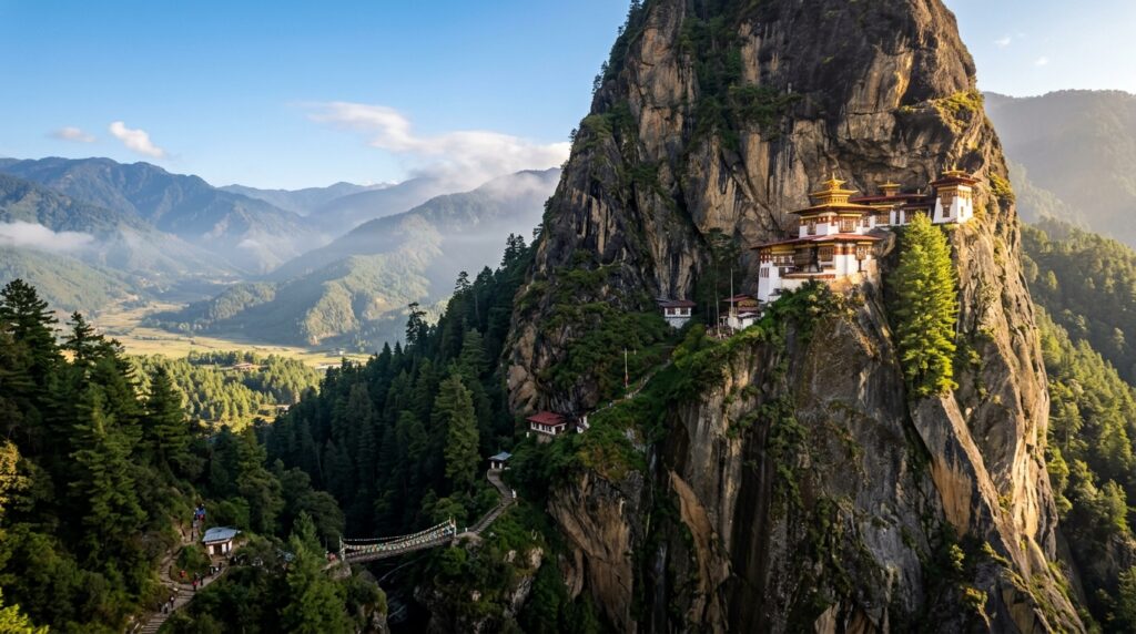
Things to Avoid in Paro Tigers Nest: Tourist Safety Guidelines

Overview Perched on a sheer granite cliff face 900 meters above the pine-scented Paro Valley (at an elevation of 3,120 meters above sea level), Taktsang Palphug Monastery, world-renowned as Tiger’s Nest, stands as Bhutan’s most iconic spiritual sanctuary and trekking experience. According to 8th-century Himalayan lore, Guru Rinpoche (Padmasambhava) flew to this cave on the back of a tigress to meditate, consecrating the mountain as sacred ground. While ascending to this architectural marvel is a bucket-list dream for travelers departing from Central India, the high-altitude terrain, steep cliffside pathways, and strict monastic decorum require careful physical preparation and cultural awareness. Mistakes such as rushing the 9-kilometer round-trip hike without proper acclimatization, improper pony usage on steep declines, wearing inadequate footwear, violating sacred temple dress codes, or taking unauthorized interior photographs can turn a spiritual pilgrimage into a hazardous or distressing experience. As Indore’s premier custom travel advisory, Travel Path Holiday (TPH) has crafted this definitive safety guide detailing the critical things to avoid at Paro Tiger’s Nest. Designed specifically for Indori travelers, this guide provides essential advice on high-altitude safety, trail logistics, monastic etiquette, and climate adjustments to ensure your journey is safe, comfortable, and deeply rewarding. Local Logistical Advice for Indore Travelers 1. Flight & Transit Coordinates from Indore For travelers departing from Indore’s Devi Ahilya Bai Holkar Airport (IDR), reaching Paro involves crossing international borders into a high-altitude alpine environment: Air Routes via Delhi or Kolkata: Take a early morning connection from Indore (IDR) to Indira Gandhi International Airport in Delhi (DEL) or Netaji Subhash Chandra Bose International Airport in Kolkata (CCU). From DEL or CCU, board an international connecting flight operated by Bhutan’s national carriers—Drukair or Bhutan Airlines—into Paro International Airport (PBH). Single-PNR Booking Advantage: Always ensure your flights from Indore to Paro are ticketed under a single PNR or coordinated with adequate buffer windows. This guarantees that your checked luggage is seamlessly transferred and protects you against missed connections caused by domestic flight delays. Overland Train/Road Option: Travelers who prefer ground transit can board the *Malwa Express* or connecting express trains from Indore Junction (INDB) to Hasimara Railway Station in West Bengal. From Hasimara, a short 30-minute taxi ride brings you to the border town of Phuentsholing, where you complete immigration before driving 4 to 5 hours up the scenic mountain highways to Paro. 2. Climate & Altitude Transition (Indore to Paro) Indore lies in the Malwa plateau at an altitude of approximately 553 meters, characterized by a warm, dry tropical climate. In contrast, Paro town sits at 2,250 meters, and the Tiger’s Nest summit reaches 3,120 meters above sea level. Oxygen & Temperature Drop: As you ascend from Indore’s ambient warmth to Paro’s high altitude, air density and oxygen pressure decrease significantly. Morning temperatures on the trail frequently drop below 5°C during spring and autumn, while winter temperatures can dip near freezing. Acclimatization Rule: NEVER schedule the Tiger’s Nest hike on Day 1 or Day 2 of your Bhutan itinerary. Attempting a 3,120-meter trek immediately after arriving from Central India increases the risk of altitude sickness. Travel Path Holiday structures your tour to place the Taktsang hike on Day 4 or Day 5, after you have acclimatized during lower-elevation sightseeing in Thimphu (2,320 m) and Punakha (1,300 m). 3. Prepaid SIM Cards & Mobile Connectivity No Domestic Indian Roaming: Standard prepaid SIM cards from Airtel, Jio, or Vi issued in Madhya Pradesh will not work under standard Indian domestic tariffs in Bhutan. Upon crossing the border or landing in Paro, they automatically switch to expensive international roaming rates. Buy a Local Tourist SIM: Upon arrival at Paro International Airport or the Phuentsholing immigration gate, purchase a local tourist SIM or eSIM from TashiCell or B-Mobile. A 30-day tourist data card costs approximately Nu. 500 (~INR 500) and provides reliable 4G connectivity across Paro Valley and the lower sections of the Tiger’s Nest trail. 4. Sustainable Development Fee (SDF) Clearances All Indian nationals visiting Bhutan must pay the official Sustainable Development Fee (SDF) of INR 1,200 per adult per night (children aged 6 to 12 receive a 50% discount; children under 6 are exempt). Travel Path Holiday pre-clears all SDF permits and entry vouchers before your departure from Indore, eliminating paperwork delays at airport immigration. 5. Pure Vegetarian Dining Logistics Bhutanese local cuisine relies heavily on local spices, chilies (*Ema Datshi*), and non-vegetarian stews. For Indori travelers who prefer hand-vetted vegetarian options or freshly cooked pure vegetarian dishes prepared without onion or garlic, TPH coordinates directly with partner resort kitchens in Paro. We arrange hot thermoses of herbal ginger-lemon tea and fresh vegetarian energy packs for your trekking day. Complete Details & Practical Guidelines “` =================================================================================== TAKTSANG (TIGER’S NEST) TRAIL PROFILE =================================================================================== Trailhead (Ramthangkha) Mid-Way Cafeteria Monastery Summit Elevation: 2,600 m Elevation: 2,940 m Elevation: 3,120 m ———————– ———————- ——————- [START] —> 2.0 km Uphill —> [REST & PONY STOP] —> 700 Stone Steps —> [TEMPLE] (Dirt Switchbacks) (Cliff Gorge & Bridge) =================================================================================== “` 1. Steep Climbing & Trail Hazards: Critical Mistakes to Avoid The trail to Tiger’s Nest covers approximately 4.5 kilometers uphill (9 kilometers round trip) with a total vertical elevation gain of over 550 meters. The terrain transitions from dusty pine-forest dirt tracks to rocky slopes, ending in a flight of over 700 narrow stone steps cut directly into the cliff side. Avoid Rushing the Ascent: Pushing a rapid pace during the initial dirt switchbacks causes sudden exhaustion, elevated heart rates, and muscle strain. Maintain a steady, rhythmic breathing pace. Take small, measured steps and schedule 2-minute standing breaks every 20 minutes. Avoid Wearing Casual or Smooth-Soled Shoes: DO NOT attempt this hike in flat sneakers, canvas shoes, slip-ons, or un-broken-in leather footwear. The trail contains loose gravel, exposed tree roots, and damp mud. Wear sturdy, ankle-high trekking boots with deep rubber lug soles (Vibram treads) to prevent slipping and protect your ankles from roll injuries. Avoid Trekking Without Walking Poles: Hiking without trekking poles places excessive impact on your knees and

Bhutan Honeymoon

Luxury Resorts in Dochula Pass: Premium Stays & Villas

Planning a Luxury Bhutan Getaway from Indore? Dochula Pass sits at an elevation of 3,100 meters (10,170 feet) along the mountain highway between Thimphu and Punakha. Staying in a luxury resort or alpine villa around this pass offers uninterrupted views of the snow-capped Eastern Himalayas, including Bhutan’s highest peak, Gangkar Puensum (7,570m). Travel Path Holiday arranges complete high-end packages featuring pre-cleared SDF permits, flight bookings from Indore, luxury heated vehicle transfers, and hand-picked resort reservations with central heating. > * Call TPH Indore: Consult Travel Path Holiday Indore * Primary Destination Hub: Explore our customized Indore to Bhutan Tour Packages Overview Perched at a commanding altitude of 3,100 meters (10,170 feet) on the mountain highway connecting Thimphu and Punakha, Dochula Pass is celebrated worldwide for its 108 memorial stupas—the Druk Wangyal Chortens—and its mesmerizing, 180-degree panoramic vista of the snow-capped Himalayan ranges. While many day-tourists stop briefly at the pass for photographs before descending down to Punakha or returning to Thimphu, discerning travelers choose to anchor their Bhutanese vacation in the luxury resorts, mountain lodges, and high-altitude private villas situated in and around the Dochula Pass corridor. Staying near Dochula Pass places you in the heart of Bhutan’s tranquil cloud forests and pine-forested ridges. Awakening to sub-zero alpine mists yielding to brilliant morning sunlight over 7,000-meter peaks is an experience matched by very few mountain destinations on earth. However, due to the high elevation and mountain winds, temperatures at Dochula Pass often hover between 5°C and 15°C during spring and autumn, dropping well below freezing (-5°C to 2°C) during winter nights. To ensure absolute warmth and refined comfort, top-tier accommodations around Dochula Pass and its surrounding ridges feature state-of-the-art climate control systems—ranging from hydronic underfloor radiant heating and double-glazed floor-to-ceiling panoramic glass walls to traditional Bhutanese *bukhari* (wood-burning stove) fireplaces. This comprehensive guide covers the finest luxury stays, villa categories, room amenities, night tariffs, and essential logistical advice tailored for travelers departing from Indore and Central India. Local Logistical Advice for Indore Travelers Planning a seamless luxury holiday from Indore to the high-altitude terrain of Dochula Pass requires careful flight routing, climate adjustments, SIM card management, and local currency preparation. Below are actionable coordinates compiled by Travel Path Holiday’s local travel advisors. 1. Flight & Transit Routes from Indore (IDR) to Bhutan Travelers departing from Indore’s Devi Ahilya Bai Holkar Airport (IDR) have two primary entry choices to reach Bhutan: Option A: Direct Air Route via Delhi/Kolkata (Recommended) Segment 1: Board an early morning domestic flight from Indore (IDR) to New Delhi (DEL) or Kolkata (CCU) via IndiGo or Air India. Segment 2: Catch a connecting international flight operated by Drukair (Royal Bhutan Airlines) or Bhutan Airlines from Delhi or Kolkata to Paro International Airport (PBH). Ground Transfer to Dochula: From Paro Airport, your private chauffeur in a luxury SUV (such as a Toyota Innova Crysta or Fortuner) will drive you through Thimphu to Dochula Pass—a scenic 2-hour drive (approx. 65 km) over smooth tarmac winding through blue pine forests. Option B: Air-cum-Overland Route via Bagdogra (IXB) Segment 1: Fly from Indore (IDR) to Bagdogra Airport (IXB) in West Bengal (connecting through Delhi). Segment 2: Take a private chauffeured transfer from Bagdogra across the border into Phuentsholing, Bhutan (approx. 4.5 hours drive). Segment 3: Ascend from Phuentsholing up the mountain highway to Thimphu and Dochula Pass (approx. 5.5 to 6 hours drive). Sustainable Development Fee (SDF) & Entry Permits: Indian citizens are required to pay the Sustainable Development Fee (SDF) of INR 1,200 per adult per night (children aged 6 to 12 pay INR 600/night). Travel Path Holiday pre-pays your SDF and clears your entry permits prior to your departure from Indore, eliminating queue times at Paro Airport or Phuentsholing border control. 2. Altitude Transition & Climate Preparedness Indore lies on the Malwa Plateau at an elevation of approximately 550 meters, characterized by warm to dry tropical weather for most of the year. Transitioning to Dochula Pass at 3,100 meters (10,170 feet) involves a dramatic shift in altitude and climate. Acclimatization Strategy: We recommend spending your first 1 or 2 nights at Paro (2,250m) or Thimphu (2,320m) before overnighting at high-altitude pass resorts (3,100m). This gradual ascent ensures smooth acclimatization without altitude discomfort. Packing for Altitude Chill: Even during summer months (May–July), evening temperatures at Dochula Pass drop to 10°C–12°C. For autumn and winter trips (October–February), heavy thermal baselayers, down jackets, cashmere scarves, and thermal socks are mandatory. 3. Prepaid SIM Cards & Mobile Connectivity Standard Indian mobile SIM cards (Airtel, Jio, Vi) cease domestic roaming upon crossing the Bhutanese border unless international roaming packages are activated prior to departure. Local Tourist SIM / eSIM: Upon arrival at Paro International Airport or the Phuentsholing immigration office, travelers can easily obtain a local tourist SIM card or eSIM from TashiCell or B-Mobile. Cost & Packages: A tourist SIM card costs approximately BTN / INR 500, which includes 10 GB to 15 GB of high-speed 4G data valid for 7 to 14 days. Resort Wi-Fi: All luxury resorts near Dochula Pass provide complimentary high-speed Wi-Fi across their guest rooms, villas, and public lounges, ensuring seamless connectivity with family back in MP. 4. Currency & Financial Logistics The local currency is the Bhutanese Ngultrum (BTN), which is officially pegged 1:1 with the Indian Rupee (INR). Indian Rupee currency notes of ₹100 and ₹500 are widely accepted across all shops, restaurants, and resorts in Bhutan. Luxury resorts accept international credit cards (Visa/Mastercard), but carrying ₹15,000 to ₹25,000 in cash is advisable for tipping driver-guides and purchasing authentic local handicrafts along the pass. Complete Details & Practical Guidelines Top Luxury Resorts, Eco-Lodges & Premium Cottages Near Dochula Pass Choosing the right accommodation near Dochula Pass depends on your preference for immediate pass proximity versus luxury mountain ridge sanctuaries situated along the Thimphu-Dochula-Punakha highway corridor. Here is an in-depth review of the top high-end stay options: “` +———————————————————————————–+ DOCHULA PASS LUXURY RESORT BELT [ Thimphu Valley ] [ Dochula Pass (3,100m) ] [ Punakha Valley

Tour Packages & Guides

Local Food in Chele La Pass: What and Where to Eat

Overview Standing at an altitude of 3,988 meters (13,084 feet) above sea level, Chele La Pass is the highest motorable road pass in Bhutan, offering jaw-dropping panoramic vistas of the snow-capped Mount Jomolhari and the lush valleys of Paro and Haa. Beyond its misty prayer flags and mountain breezes, exploring the local food in Chele La Pass is an unforgettable culinary adventure. The mountain air, biting wind chill, and high altitude naturally work up a hearty appetite, making rustic Bhutanese comfort food a warm necessity. Visitors can indulge in traditional staples such as Ema Datshi (spicy green chillies cooked in rich cheese broth), Kewa Datshi (comforting potato cheese curry), organic Bhutanese Red Rice, steamed Haa Hoentay (buckwheat dumplings), and piping-hot Suja (salted mountain butter tea). Whether you are stopping at high-altitude summit food vans or cozy traditional timber cafes along the Paro-Haa highway, discovering what and where to eat around Chele La Pass ensures your high-altitude journey is both culturally enriching and thoroughly delicious, with plentiful hand-vetted vegetarian options/dining suited for travelers from Central India. Local Logistical Advice for Indore Travelers Planning a high-altitude mountain trip to Bhutan from Indore requires thoughtful logistical preparation, especially regarding flight connections, climate adaptation, mobile connectivity, and meal arrangements. Here is practical advice for travelers departing from Madhya Pradesh: Flight Coordinates & Transit Routing from Indore: Travelers departing from Indore will fly out of Devi Ahilya Bai Holkar Airport (IDR). Because Paro International Airport (PBH) is Bhutan’s sole international airport, seamless layovers are booked via Indira Gandhi International Airport, New Delhi (DEL) or Netaji Subhash Chandra Bose International Airport, Kolkata (CCU). A typical itinerary features a morning flight from IDR to DEL (approx. 1 hour 40 minutes on IndiGo or Air India), followed by a direct Drukair or Bhutan Airlines flight to Paro (approx. 2 hours 20 minutes). Travel Path Holiday arranges single-PNR tickets to guarantee smooth baggage transfer across transits. Drastic Climate & Altitude Shift: Indore lies in a tropical dry zone at an elevation of roughly 550 meters, with daytime temperatures usually ranging between 28°C and 40°C. In sharp contrast, Chele La Pass soars to nearly 4,000 meters. Daytime temperatures at the summit remain crisp even in summer (8°C to 14°C) and plummet well below freezing (-5°C to -15°C) with biting wind chill during winter months. Layering is non-negotiable—pack thermal base layers, a windproof fleece or down jacket, woolen caps, and insulated gloves. Altitude Acclimatization & Meal Timing Strategy: Because driving directly from Indore’s low elevation to 3,988 meters can trigger Acute Mountain Sickness (AMS), spend at least two consecutive nights acclimatizing in Paro town (2,200 meters) before embarking on the 35 km serpentine drive up Chele La Highway. Eat light, carbohydrate-heavy meals like Bhutanese red rice and Kewa Datshi prior to the climb, and avoid heavy overeating right before negotiated mountain curves. Prepaid SIM Card & Mobile Connectivity Notice: Standard Indian prepaid SIM cards (Jio, Airtel, Vi registered in MP) do not operate under regular domestic roaming once you cross into Bhutan. International travelers must either activate an international roaming pack prior to departure or purchase a local TashiCell or B-Mobile tourist SIM card upon landing at Paro Airport or in Paro town center. Carrying a valid passport and your Bhutan SDF entry permit is mandatory for instant SIM activation. Hand-Vetted Vegetarian Dining Preparedness: For Indori travelers who adhere strictly to vegetarian dietary practices, Bhutan is exceptionally welcoming. Traditional Bhutanese cuisine is naturally centered around fresh farm produce, wild mountain mushrooms, cheese, and red rice. Travel Path Holiday pre-arranges hand-vetted vegetarian options/dining at trusted mountain eateries along the route to guarantee clean, un-contaminated, pure vegetarian meals cooked in separate kitchen setups. Complete Details & Practical Guidelines 1. Signature Bhutanese Traditional Foods at Chele La Pass Eating at nearly 13,000 feet altitude is a uniquely sensory experience. The intense mountain cold makes rich, spicy, and steaming hot dishes taste extraordinarily comforting. Here are the top traditional dishes you must taste around Chele La Pass: #### Ema Datshi (Chilli Cheese) What It Is: Ema Datshi is Bhutan’s celebrated national dish. “Ema” means chilli and “Datshi” means cheese. Fresh green or dried red mountain chillies are split open and simmered in a warm, flavorful broth of local yak or cow milk cheese, garlic, and butter. Flavor Profile: Fiery, creamy, and deeply aromatic. For Indian Palates: Indori food lovers who appreciate spicy food will love authentic Ema Datshi. If you prefer milder heat, local pass vendors can prepare a “mild chilli” version using thick, non-spicy bell peppers or sweet green chillies. #### Kewa Datshi (Potato Cheese Curry) What It Is: “Kewa” translates to potato. Sliced mountain potatoes are stewed slowly with local cheese, onions, butter, and a touch of green chilli. Flavor Profile: Mild, rich, savory, and immensely comforting. Why Try It: It is one of the most popular hand-vetted vegetarian options for families and children, providing essential carbohydrates for high-altitude energy. #### Bhutanese Red Rice (Yufam) What It Is: Medium-grain unpolished red rice grown in the mineral-rich glacial soil of Paro Valley. Flavor Profile: Slightly nutty, firm-textured, and reddish-pink in color. Nutritional Value: Packed with complex carbohydrates and minerals, red rice is the foundational base for all Bhutanese Datshi gravies and digests easily in alpine mountain weather. #### Haa Hoentay (Buckwheat Dumplings) What It Is: A rare culinary specialty originating from the adjoining Haa Valley, frequently served fresh at Chele La Pass stalls. These heart-shaped dumplings are crafted from organic buckwheat dough and stuffed with dried turnip greens, cottage cheese, amaranth seeds, and fragrant mountain herbs. Preparation: Available steamed or light pan-fried. Vegetarian Note: Hoentay is 100% vegetarian, incredibly flavorful, and pairs brilliantly with local chilli salsa. #### Shamu Datshi (Mushroom Cheese Stew) What It Is: Wild forest mushrooms (such as chanterelles or local oyster mushrooms) cooked in traditional cheese gravy. Flavor Profile: Earthy, creamy, and rich in natural umami. #### Suja (Bhutanese Salted Butter Tea) What It Is: Made from brick tea leaves churned with fresh mountain yak butter or cow butter

Tour Packages & Guides

Budget Planning Guide for a Vacation to Haa Valley

Planning a Budget Trip to Haa Valley from Indore? Haa Valley is Bhutan’s most authentic, pristine, and culturally preserved district. Traveling on a budget to Haa Valley requires clear financial planning around the Sustainable Development Fee (SDF), local homestay bookings, transport across Chele La Pass, and hiking permits. Travel Path Holiday helps Indori travelers optimize every rupee for an unforgettable Himalayan getaway. Overview Planning a budget trip to Haa Valley offers travelers from Indore an unparalleled window into Bhutan’s untouched high-mountain culture, sacred monasteries, and alpine pine forests without inflating travel expenses. Tucked away in the western corner of Bhutan near the border of Tibet, Haa Valley was only opened to foreign tourists in 2002, making it one of the least commercialized valleys in the Kingdom. For budget-conscious travelers, Haa is a hidden sanctuary: authentic village homestays replace pricey luxury resorts, local farmhouse dining replaces expensive hotel buffets, and scenic alpine trails offer free, breathtaking adventures. With proper financial planning—spanning the Sustainable Development Fee (SDF) of INR 1,200 per night, shared or private SUV transport across the stunning Chele La Pass (3,988 meters), cozy traditional homestay tariffs, and regional permits—an immersive 3-day to 4-day excursion into Haa Valley can easily fit within a practical budget. This comprehensive guide covers exact cost breakdowns, local dining expenses, transit strategies from Indore, hiking permit guidelines, and money-saving travel advice. Local Logistical Advice for Indore Travelers 1. Air and Overland Transit Options from Indore Traveling from Malwa’s commercial hub in Indore to the serene heights of Haa Valley involves two major travel routes: Flight Route (Fastest & Convenient): Take an early morning flight from Indore’s Devi Ahilya Bai Holkar Airport (IDR) to Indira Gandhi International Airport, Delhi (DEL) or Netaji Subhash Chandra Bose International Airport, Kolkata (CCU). From Delhi or Kolkata, connect on a direct international flight operated by Drukair or Bhutan Airlines to Paro International Airport (PBH). *Pro-tip for Indori Travelers:* Book your IDR-DEL/CCU flight on a single PNR or allow at least 3 to 4 hours layover to clear luggage transfer before catching the morning flight to Paro. From Paro Airport, Haa Valley is roughly 65 km away via the scenic Chele La Pass (approx. 2.5 to 3 hours drive by private cab). Train & Overland Route (Maximum Budget Savings): Board an express train from Indore Junction (INDB) to Howrah / Kolkata or New Jalpaiguri (NJP) / Hasimara Railway Station. From Hasimara or NJP, take a short road transfer (cab or local bus) to the Indo-Bhutan border town of Phuentsholing. After completing border entry clearance at Phuentsholing, travel overland via the Phuentsholing–Chhukha–Thimphu–Haa highway (approx. 165 km, 6 to 7 hours drive). 2. Climate Transition: From Indore’s Heat to High-Altitude Alpine Chills Indore’s tropical dry climate features warm summers reaching 38°C–42°C and mild winters. Haa Valley, situated at an altitude of over 2,700 meters (8,900 feet), experiences cool alpine weather year-round: Summer (May to August): Daytime temperatures range between 15°C and 22°C, accompanied by frequent high-altitude rains. Soft thermals and lightweight waterproof jackets are essential. Autumn (September to November): Crisp, crystal-clear mountain skies with daytime temps around 10°C to 16°C and night temperatures dropping to 2°C–5°C. Heavy woolens are mandatory. Winter (December to February): Severe sub-zero temperatures (0°C to -8°C) with occasional snowfall over Chele La Pass. Heavy thermal layers, down jackets, and insulated gloves are non-negotiable. 3. Prepaid Tourist SIM Cards & Connectivity Standard Indian prepaid SIM cards (Airtel, Jio, Vi from MP circle) cease operating once you cross into Bhutan under national roaming limits. Local Tourist SIM Purchase: Upon arrival at Paro Airport or Phuentsholing border immigration, purchase a local tourist SIM card or eSIM from TashiCell or B-Mobile. Cost: Standard tourist SIM packs cost approximately BTN/INR 200 to INR 500, which includes 5GB to 15GB of 4G data valid for 7 to 14 days. Coverage in Haa: TashiCell and B-Mobile provide solid 4G/LTE connectivity in Haa town and major village homestays, though signal strength may dip along high mountain trekking trails. International roaming packages can also be activated prior to departing Indore, but local tourist SIMs remain far more economical. Complete Details & Practical Guidelines 1. Sustainable Development Fee (SDF) Guidelines for Indian Travelers The Sustainable Development Fee is mandatory for all foreign tourists visiting Bhutan, designed to preserve the country’s pristine environment and cultural heritage. Standard Tariff for Indian Nationals: INR 1,200 per adult per night. Child Concessions: Children aged 6 to 12 receive a 50% discount (INR 600 per night). Children under 6 years of age are completely exempt from the SDF. Pre-Payment & Permits: The SDF must be pre-paid online during the entry permit application process. Travel Path Holiday handles all pre-payment logistics and permit approvals directly so your entry documents are ready before departure from Indore. Budget Impact: For a 3-night stay in Haa Valley, the SDF totals INR 3,600 per adult. Factoring this fee into your initial itinerary budget avoids any last-minute surprises. 2. Haa Valley Homestay Pricing & Accommodations Staying in a traditional Bhutanese homestay is the single best way to keep your trip affordable while experiencing authentic Bhutanese village life. Unlike expensive luxury resorts in Paro or Thimphu, Haa Valley’s homestays offer warm hospitality, wood-fired *bukhari* heaters, and home-cooked meals. Budget Homestays (INR 1,500 – INR 2,500 per night for 2 adults): *Features:* Cozy wooden rooms, shared or attached traditional bathrooms, complimentary hot Tibetan tea, and stunning views of the Haa Chu river or surrounding apple orchards. *Top Recommended Villages:* Dumchoe Village, Noba Village, and Katsho Village. Mid-Range Heritage Homestays (INR 2,800 – INR 4,200 per night): *Features:* Private en-suite bathrooms, traditional hot stone bath availability (on request for ~INR 800–1,200 per session), and spacious wood-paneled rooms with handcrafted Bhutanese textiles. Inclusions: Most homestay tariffs include home-cooked breakfast and traditional dinner, significantly slashing your daily food expenditures. 3. Food & Dining Costs in Haa Valley Dining in Haa Valley is centered around fresh mountain produce, buckwheat specialties, and hearty winter broths. Average Meal Cost: INR 250 – INR 450 per meal per

Tour Packages & Guides

Top 10 Things to Do in Phobjikha Valley cranes: Sightseeing Itinerary

Overview Nestled at an elevation of 3,000 meters (9,800 feet) in the Wangdue Phodrang district of central Bhutan, Phobjikha Valley (also widely known as Gangtey Valley) is a breathtaking, U-shaped glacial valley that feels worlds away from urban life. Famous globally as the winter nesting sanctuary of the rare, endangered Black-necked Cranes (*Grus nigricollis*), this serene alpine wetland combines untouched nature, 17th-century Buddhist spirituality, and traditional Bhutanese valley life. Every year between late October and mid-March, hundreds of majestic cranes migrate here from the high Tibetan Plateau, circling the historic Gangtey Monastery three times upon arrival and departure as if performing a sacred *kora*. For travelers from Central India seeking an authentic, off-the-beaten-path Himalayan retreat, Phobjikha Valley offers an enchanting itinerary. From walking the famed Gangtey Nature Trail and visiting the Crane Conservation Centre to experiencing traditional hot stone baths (*Dotsho*) and staying in wooden farmhouses warmed by *bukhari* stoves, Phobjikha presents a rare blend of eco-tourism and cultural immersion. This definitive guide curated by Travel Path Holiday outlines the top 10 things to do in Phobjikha Valley, along with practical logistical advice tailored specifically for travelers departing from Indore. Local Logistical Advice for Indore Travelers Planning a journey from the flat plateau of Malwa to the high-altitude glacial meadows of Phobjikha requires strategic transit planning, climate adjustments, and permit management. Here is everything Indori travelers need to know before embarking on this Himalayan trip. 1. Reaching Bhutan & Phobjikha Valley from Indore Air Travel Route (Fastest Option): Board a direct flight from Indore’s Devi Ahilya Bai Holkar Airport (IDR) to Kolkata (CCU) or New Delhi (DEL). From Kolkata or Delhi, take a connecting flight operated by Drukair (Royal Bhutan Airlines) or Bhutan Airlines directly into Paro International Airport (PBH). Overland Route via West Bengal Border: For travelers preferring a scenic rail-and-road trip, take the *Malwa Express* or *Karma Bhumi Express* from Indore Junction to Howrah/New Jalpaiguri or Hasimara Railway Station (located just 18 km from the Indo-Bhutan border at Jaigaon/Phuentsholing). After completing entry immigration at Phuentsholing, hire a private driver to travel inland. On-Ground Highway Transit to Phobjikha: From Paro Airport, Phobjikha Valley is approximately 165 km away (a 6.5 to 7-hour mountain drive via Dochula Pass and Wangdue Phodrang). From Thimphu, it is 135 km (5 hours), and from Punakha, it is 78 km (3 hours). Vehicles must cross the scenic Lawala Pass (3,300m) before descending into the tranquil Phobjikha bowl. 2. Climate Shift & High-Altitude Preparedness Indore’s tropical dry climate (with pleasant winter averages around 15°C to 28°C) contrasts sharply with Phobjikha’s sub-alpine conditions. At 3,000 meters, Phobjikha experiences sub-zero night temperatures (-1°C to -8°C) between November and February, with frost covering the valley floor each morning. Summer temperatures (May to August) range between a cool 10°C and 18°C. Packing Essentials: Central Indian travelers should pack thermal base layers, heavy down jackets, woolen caps, thermal socks, windproof jackets, and comfortable waterproof hiking boots for nature trails. 3. SIM Cards & Mobile Connectivity Warning Mobile Network Notice: Indian prepaid SIM cards (Airtel, Jio, Vi) from Madhya Pradesh do not work under national roaming anywhere in Bhutan. Upon arrival at Phuentsholing border or Paro Airport, purchase a local Bhutanese tourist SIM card (TashiCell or B-Mobile). A standard 14-day tourist SIM with 5GB to 10GB of data costs approximately Nu./₹500. Internet connectivity in Phobjikha Valley is available in major lodges and farmstays, though speeds may fluctuate in remote trail areas. 4. Sustainable Development Fee (SDF) & Entry Permits Indian passport holders are required to pay a Sustainable Development Fee (SDF) of ₹1,200 per adult per night (and ₹600 per child aged 6–12 per night). Additionally, traveling east beyond Thimphu and Punakha into the Wangdue Phodrang region requires a regional route permit. Travel Path Holiday arranges all SDF clearances, route permits, and private luxury vehicle approvals (Innova Crysta or Fortuner) seamlessly prior to your departure from Indore. 5. Currency & Payment Guidelines The Bhutanese Ngultrum (Nu.) is pegged 1:1 with the Indian Rupee (INR). Indian currency notes (₹100, ₹200, ₹500) are accepted across all farmstays, shops, and restaurants in Phobjikha Valley. Note that digital UPI payments (GPay, PhonePe) used in Indore do not operate directly in Bhutan, so carrying adequate physical INR cash is recommended. Complete Details & Practical Guidelines Top 10 Things to Do in Phobjikha Valley #### 1. Visit the Black-necked Crane Information Centre & Birdwatching Sanctuary Located in Gangtey, the Royal Society for Protection of Nature (RSPN) Crane Centre is the focal point for eco-tourism in the valley. The facility features informative exhibits detailing the migratory patterns of the Black-necked Cranes (*Grus nigricollis*), roosting ecology, and local conservation initiatives. Key Highlights: The centre houses high-powered spotting scopes and optical telescopes pointing toward the roosting wetlands below. Visitors can watch a gripping 15-minute conservation documentary film and meet “Karma,” a rescued resident crane cared for by sanctuary naturalists. Best Time for Spotting: Mid-November to mid-February, early mornings and late afternoons when cranes fly between feeding grounds and roosting marshlands. Entry Fee: Nu./₹150 per person. Operating Hours: 9:00 AM – 5:00 PM (Daily). #### 2. Hike the Scenic Gangtey Nature Trail (Tenkhor Hike) The Gangtey Nature Trail is arguably the most famous and accessible day hike in Bhutan. Starting from the hilltop courtyard of Gangtey Monastery, this gentle 5.5-kilometer trail winds downhill through flower-filled meadows, dense blue pine forests, and bamboo groves, offering uninterrupted vistas of the vast open valley floor. Route Details: Gangtey Monastery → Semchubara Village → Blue Pine Forest → Khewang Lhakhang. Difficulty & Duration: Easy; approximately 1.5 to 2 hours of easy walking. Suitable for families, seniors, and casual walkers. Highlights: Panoramic photo viewpoints overlooking the crane roosting area, wooden footbridges crossing mountain streams, and fresh alpine air. #### 3. Explore the 17th-Century Gangtey Monastery (Gangteng Sanga Choeling) Perched on a forested ridge overlooking the entire expanse of Phobjikha Valley, Gangtey Monastery is a masterwork of traditional Bhutanese architecture and the principal seat of the Pema Lingpa tradition of Nyingma Buddhism. Founded in 1613 by

Bhutan Honeymoon

Best Time to Visit Thimphu Dzong: Month-by-Month Weather Guide

Overview The best time to visit Thimphu Dzong (officially known as *Tashichho Dzong*), the majestic fortress and administrative seat of Bhutan’s capital, is during the autumn months of September to November and the spring months of March to May. During autumn, Thimphu experiences brilliant azure skies, daytime temperatures between 15°C and 22°C, crisp mountain air, and the celebrated Thimphu Tshechu festival, where monks and laymen perform sacred masked Cham dances in the dzong’s grand courtyard. Spring brings mild weather, daytime temperatures around 18°C, and spectacular floral blooms of wild rhododendrons and magnolias across the surrounding Wangchu river valley. While Thimphu Dzong is open year-round to visitors outside of government office hours, choosing the right month significantly influences your experience. Winter (December to February) brings cold, sunny days and sub-zero nights with zero tourist crowds, whereas the summer monsoon (June to August) brings heavy afternoon downpours and lush green valley vistas. This comprehensive month-by-month weather, temperature, festival, and logistics guide helps travelers plan an unforgettable Himalayan journey to Bhutan’s grandest monastic fortress. Local Logistical Advice for Indore Travelers Traveling from the dry, tropical plains of Malwa in Madhya Pradesh to the high-altitude Himalayan valley of Thimphu (situated at 2,320 meters / 7,610 feet above sea level) requires careful logistical planning. Here are concrete, actionable travel coordinates for Indori travelers: Flight and Transit Routes from Indore 1. Air Route via New Delhi (DEL) or Kolkata (CCU): Depart from Indore Devi Ahilya Bai Holkar Airport (IDR) on an early morning flight to Indira Gandhi International Airport, New Delhi (DEL) or Netaji Subhash Chandra Bose International Airport, Kolkata (CCU). Board connecting international flights operated by Bhutan’s national carrier Drukair or Bhutan Airlines to Paro International Airport (PBH). Total flight transit time from Indore to Paro is typically 8 to 12 hours including layovers. From Paro Airport, Thimphu Dzong is a comfortable 1.5-hour drive (50 km) along the scenic Paro-Thimphu highway. 2. Overland Route via Hasimara / Phuentsholing: Take a long-distance express train from Indore Junction (such as the Ahilyanagari Express or connecting trains via Howrah) to Hasimara Railway Station (WB) or New Jalpaiguri (NJP). Alternatively, fly from Indore (IDR) to Bagdogra Airport (IXB) near Siliguri. Proceed by taxi to the Jaigaon-Phuentsholing border gate (approx. 4 hours from Bagdogra). After clearing immigration at Phuentsholing, complete a scenic 4.5-hour uphill drive (165 km) via Gedu and Chhuzom to reach Thimphu. Climate & Altitude Transition Temperature Shift: Indore experiences hot summers exceeding 40°C and mild winters around 10°C to 28°C. In contrast, Thimphu sits in an alpine mountain valley where daytime temperatures rarely exceed 26°C even in summer, and winter night temperatures routinely plunge to -2°C or lower. Acclimatization Tip: Indori travelers should carry layered thermal wear, windproof jackets, moisture-wicking inner layers, and UV protection sunblock. Even during pleasant autumn afternoons (20°C), temperatures drop precipitously as soon as the sun dips behind the surrounding ridges of Tashichho Dzong at 5:00 PM. Mobile Connectivity & Prepaid SIM Cards National Roaming Advisory: Standard Indian prepaid SIM cards (Jio, Airtel, Vi) do not operate under national roaming once you enter Bhutanese territory. Local SIM / eSIM Purchase: Upon landing at Paro International Airport or arriving at the Phuentsholing border office, purchase a local tourist SIM card or eSIM from TashiCell or B-Mobile. Registration requires presenting your Indian Passport or Voter Identity Card along with a nominal fee of ~100 to 200 Nu (including data talktime packages). High-speed 4G data works reliably throughout Thimphu town and Tashichho Dzong grounds. Currency Parity & Card Usage Indian Rupee Acceptance: The local currency is the Bhutanese Ngultrum (Nu), which is pegged 1:1 with the Indian Rupee (INR). Cash INR notes of ₹100 and ₹500 denomination are accepted everywhere in Thimphu for souvenirs, dining, and taxis. However, INR ₹2,000 notes are not accepted. Credit/debit cards incur a 3% to 5% international transaction surcharge, so carrying adequate cash INR is strongly advised. Complete Details & Practical Guidelines Sustainable Development Fee (SDF) & Entry Regulations Bhutan enforces a “High Value, Low Impact” tourism policy to preserve its delicate Himalayan ecosystems and rich cultural heritage. All international visitors must pay the Sustainable Development Fee (SDF): SDF Rate for Indian Passport Holders: Indian nationals (holding a valid Indian Passport with minimum 6 months validity or an original Voter ID card) pay a concessional Sustainable Development Fee of ₹1,200 INR per night per adult. Child Concessions: Children aged 6 to 12 receive a 50% discount (₹600 INR per night), while children under 6 years of age are exempt from the SDF. International Travelers (Non-Indian Passports): Non-Indian foreign tourists pay an SDF of $100 USD per night per adult (reduced from the previous rate of $200 USD), plus entry visa processing fees. Entry Permits: Indian tourists must obtain an online Entry Permit before travel or at the Phuentsholing/Paro immigration counters, supported by pre-confirmed hotel vouchers, SDF payment proof, and certified local guide bookings. Where SDF Money Goes: The fee directly finances Bhutan’s free national healthcare system, free public education, green carbon-neutral infrastructure, and the meticulous restoration of heritage monuments like Thimphu Dzong. Visiting Hours & Cultural Etiquette for Thimphu Dzong Tashichho Dzong serves a dual purpose: it houses the throne room and offices of His Majesty the King of Bhutan, government ministries, and the summer headquarters of the central monastic body (*Dratshang*). Visiting Hours for Tourists: Monday to Friday: 5:00 PM to 6:00 PM (Winter: 5:00 PM to 6:00 PM; Summer: 5:30 PM to 6:30 PM) after government administrative offices close. Saturdays, Sundays & National Holidays: 9:00 AM to 5:00 PM. Flag Lowering Ceremony: Visitors arriving between 5:00 PM and 5:30 PM can witness the formal retreat and flag-lowering ceremony conducted by royal military guards accompanied by traditional horn calls. Strict Dress Code: Guests must wear formal, modest attire. Full-length trousers or formal skirts covering knees, collared long-sleeve shirts or jackets are mandatory. Sleeveless tops, shorts, mini-skirts, caps, hats, umbrellas, and flip-flops/open sandals are strictly prohibited inside the dzong complex. Bhutanese locals wear traditional attire (*Gho* for men with white

Bhutan Honeymoon

How to Reach Punakha Suspension Bridge from Indore: Flight & Train Routes

Overview Spanning 160 meters across the roaring turquoise waters of the Pho Chhu River, the Pakha Suspension Bridge (commonly known as the Punakha Suspension Bridge) is one of the longest and most breathtaking suspension bridges in Bhutan. Connecting the historic Punakha Dzong with the scenic agricultural villages of Shengana, Samdingkha, and Punakha Valley, walking across this suspension bridge draped in colorful Buddhist prayer flags (*lungta*) offers an unforgettable alpine experience. For travelers departing from Indore and Central India, reaching this iconic landmark requires navigating air or rail gateways into Eastern India, crossing the Himalayan border at Phuntsholing or landing at Paro, and taking a spectacular mountain drive across the 3,100-meter Dochula Pass. This comprehensive guide outlines every logistical detail from Indore to the Punakha Suspension Bridge—including flight schedules, train connections, entry permits, road routes, and practical travel guidelines. Local Logistical Advice for Indore Travelers Traveling from the Malwa plateau to the serene valleys of Bhutan requires well-coordinated travel itineraries across air, rail, and mountain road networks. 1. Air Travel Routes from Indore (IDR) Flying is the quickest and most convenient way for Indori travelers to reach Bhutan: Option A: Indore to Paro via Kolkata (Most Preferred) Flight 1 (Domestic): Board a morning flight from Devi Ahilya Bai Holkar Airport (IDR) to Netaji Subhash Chandra Bose International Airport, Kolkata (CCU). Direct or 1-stop flights operate daily via IndiGo and Air India (approx. 2 to 3.5 hours). Flight 2 (International): From Kolkata (CCU), take a direct flight operated by Drukair (Royal Bhutan Airlines) or Bhutan Airlines to Paro International Airport (PBH). Flight duration is approximately 1 hour 15 minutes. Onward Drive to Punakha: From Paro Airport, hire a private SUV to Punakha via the Thimphu-Punakha Highway (approx. 125 km / 4 to 4.5 hours drive). Option B: Indore to Paro via New Delhi Flight 1 (Domestic): Fly from Indore (IDR) to Indira Gandhi International Airport, New Delhi (DEL) (approx. 1 hour 30 minutes direct flight). Flight 2 (International): Board a non-stop Drukair or Bhutan Airlines flight from Delhi (DEL) to Paro (PBH) (approx. 2 hours 20 minutes). Option C: Indore to Bagdogra (Fly + Border Road Route) Flight: Fly from Indore (IDR) to Bagdogra Airport (IXB) in West Bengal via a connecting flight in Kolkata or Delhi. Road Connection: Take a pre-booked taxi from Bagdogra to the Indo-Bhutan border at Jaigaon / Phuntsholing (approx. 170 km / 4.5 to 5 hours drive). After immigration clearance at Phuntsholing, continue by road to Thimphu and Punakha. 2. Train Travel Routes from Indore (INDB) For travelers who prefer rail journeys across North and Eastern India: Option A: Indore to Hasimara (Nearest Railway Station to Bhutan Border) Leg 1: Board the Indore-Howrah Shipra Express (Train No. 22911/12295) from Indore Junction (INDB) to Kolkata (Howrah). Leg 2: From Howrah or Sealdah Station, board the Kanchankanya Express (13149) or Uttarbanga Express to Hasimara Railway Station (HSA) in West Bengal. Hasimara is located just 18 km (30–40 minutes auto/taxi drive) from the Jaigaon-Phuntsholing border gate. Option B: Indore to New Jalpaiguri (NJP) Take a train connection from Indore (INDB) to New Jalpaiguri Junction (NJP) via Kolkata or New Delhi rail corridors. From NJP Station, hire a private cab or shared taxi to Jaigaon/Phuntsholing (approx. 125 km / 3.5 to 4 hours drive). 3. Highway Road Coordinates: Phuntsholing to Punakha If entering Bhutan via the land border at Phuntsholing, your road journey to the Punakha Suspension Bridge covers two major legs: Leg 1: Phuntsholing to Thimphu (165 km / 5.5 to 6 hours) winding through steep subtropical mountains, waterfalls, and immigration checkpoints at Gedu and Chukha. Leg 2: Thimphu to Punakha (74 km / 2.5 to 3 hours) ascending to Dochula Pass (3,100 meters elevation) before descending into the warm, subtropical Punakha Valley (1,200 meters elevation). Total Border-to-Bridge Distance: Approx. 240 km (8 to 9 hours scenic mountain drive). 4. Climate Transition & Packing Essentials Indore rests on the Malwa plateau at ~550 meters elevation with a dry, tropical climate. Traveling to Bhutan brings significant elevation changes: Paro & Thimphu Valleys: Elevated between 2,200 and 2,350 meters, offering crisp, cool mountain air. Dochula Pass: High mountain pass at 3,100 meters elevation where winds are chilly and temperatures drop significantly (especially from October to March). Punakha Valley: Sits at a lower elevation of 1,200 meters with a warmer, semi-tropical microclimate. Clothing Advice: Indori travelers should dress in layers—thermal innerwear and a heavy windproof jacket for the mountain pass, paired with breathable cotton shirts for Punakha Valley walks. Sturdy, closed-toe walking shoes with non-slip rubber soles are essential for crossing the swaying suspension bridge safely. 5. Mobile Connectivity & Tourist SIM Cards Standard Indian domestic SIM cards (Jio, Airtel, Vi) automatically switch to international roaming upon crossing the border or landing in Paro: Local Tourist SIMs: Obtain a local TashiCell or B-Mobile tourist SIM card or eSIM upon arrival at Paro International Airport or the Phuntsholing Pedestrian Terminal. Cost & Activation: A 30-day tourist SIM costs approximately Nu. 200 to Nu. 500 (₹200 to ₹500) and includes generous mobile data bundles (5GB to 15GB). Carry a physical photocopy of your Indian Passport or Voter ID and approved entry permit for instant activation. Complete Details & Practical Guidelines 1. Permit Clearance & SDF Regulations for Indian Passport Holders Indian nationals enjoy special travel privileges in Bhutan, but must strictly abide by entry permit regulations: Mandatory Travel Documents: Indian citizens must present an Original Indian Passport (with at least 6 months remaining validity) OR an Original Voter Identity Card issued by the Election Commission of India. *Note: Aadhar cards, PAN cards, and driving licenses are NOT accepted for immigration entry permits.* Children under 18 without a passport must carry an original birth certificate along with a valid school identity card. Sustainable Development Fee (SDF): All Indian tourists must pay an SDF of ₹1,200 (Nu. 1,200) per adult per night. Children aged 6 to 12 receive a 50% concession (₹600 per night), while children below 6 years are exempt. Entry Permit: Issued at Paro

You have been successfully Subscribed! Ops! Something went wrong, please try again.

About Us

Travel Path Holiday is a full-service travel company dedicated to delivering seamless, personalized, and memorable travel experiences. We specialize in crafting customized journeys for both corporate and leisure travelers, ensuring every trip is stress-free and enjoyable.

Destinations

Kashmir

Manali

Leh-Ladakh

Nepal

Bhutan

Blog

  • All Post
  • Adventure, Trekking & Road Trips
  • Andaman
  • Bali Honeymoon
  • Bhutan Honeymoon
  • Dubai Honeymoon
  • Family & Leisure
  • Goa Honeymoon
  • Gujarat
  • Himachal Honeymoon
  • Himachal Pradesh
  • Honeymoon & Romance
  • India Travel Guides
  • Kashmir Honeymoon
  • Kerala Honeymoon
  • Nepal Honeymoon
  • Rajasthan Honeymoon
  • Seasonal & Monsoon Specials
  • Sikkim & Northeast
  • Singapore Honeymoon
  • Spiritual & Pilgrimage
  • Thailand
  • Tour Packages & Guides
  • Uttarakhand Honeymoon

Travel Path Holiday, Indore | © 2026 Travel Path Holiday. All Rights Reserved. | Website crafted by Amit Nayak, India

Scroll to Top

