
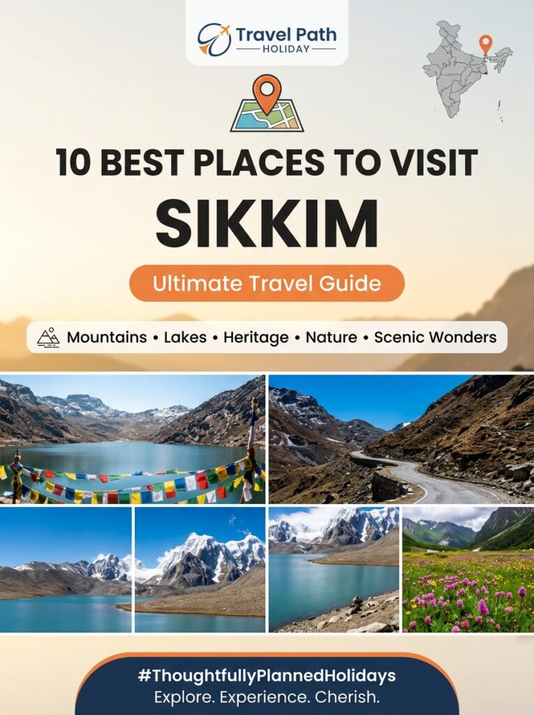
Sikkim & Northeast

Local Food in Yumthang Valley of Flowers: What and Where to Eat

Overview Nestled at an altitude of 11,800 feet (3,596 meters) in North Sikkim, the breathtaking Yumthang Valley of Flowers is world-renowned for its snow-capped Himalayan peaks, hot thermal springs, and vibrant spring rhododendron blooms. However, exploring this high-altitude alpine paradise requires more than just warm winter layers—it demands the right fuel for your body. The food landscape of Yumthang and its primary base village, Lachung, is a comforting fusion of indigenous Sikkimese, Tibetan, and Nepalese culinary traditions designed specifically to provide metabolic warmth, energy, and hydration in sub-zero mountain weather. From steaming bowls of herb-infused Thukpa and handmade mountain Momos to probiotic Gundruk soup, crispy Sael Roti, and salty Suja (butter tea), local food near Yumthang Valley of Flowers offers an authentic taste of high-Himalayan culture. For travelers journeying from Indore and Central India, knowing what dishes to try, where dining shacks are located, and how to secure hand-vetted vegetarian options in this remote sanctuary is essential for a safe, nourishing, and unforgettable adventure. Local Logistical Advice for Indore Travelers Transit Route from Indore to North Sikkim Traveling from Malwa’s central plateau to the high-altitude valleys of North Sikkim involves a multi-stage, highly rewarding journey: Air Travel from Indore (IDR): Board a morning flight from Indore’s Devi Ahilya Bai Holkar Airport (IDR) to Bagdogra Airport (IXB) in West Bengal. Convenient one-stop connecting flights operate via New Delhi (DEL) or Kolkata (CCU) with a total travel duration ranging between 5.5 and 7.5 hours. Rail Connection: Travelers preferring rail journeys can book the weekly Indore–Kamakhya Express (Train 19305) directly to New Jalpaiguri (NJP), or take an express train via Howrah Junction (HWH) to NJP. Overland Drive to Gangtok: From Bagdogra Airport or NJP Railway Station, hire a private pre-arranged SUV (such as an Innova Crysta) along NH10 following the Teesta River to reach Gangtok (125 km / 4.5 to 5 hours drive). Gangtok to Lachung & Yumthang: Reaching Yumthang requires a dedicated 2-day North Sikkim circuit. Day 1 involves a scenic 6 to 7-hour drive (120 km) from Gangtok via Mangan and Chungthang to reach Lachung village (8,800 ft), where all overnight accommodations and primary lodge kitchens are based. On Day 2, an early morning 25 km drive (1 to 1.5 hours) brings you to Yumthang Valley (11,800 ft). Climate Transition & Altitude Adaptation Indore travelers accustomed to Central India’s warm tropical dry climate (where temperatures range from 25°C to 42°C) experience a sharp environmental transition in North Sikkim. Yumthang Valley’s alpine climate drops to sub-zero levels (-5°C to -15°C) during freezing winter months (December to February) and remains crisp (5°C to 15°C) during the spring bloom season (April to June). At 11,800 feet, thinner air and chilling winds accelerate fatigue and heat loss. Steaming noodle soups, fermented rice breads, and salty butter teas served across local food stalls near Yumthang serve a vital physiological purpose: keeping your body core warm, hydrated, and energized for high-altitude sightseeing. Mobile Connectivity & Cash Logistics National Roaming: Standard prepaid SIM cards issued in Madhya Pradesh (MP) work seamlessly under national roaming in Sikkim. Coverage Limits in North Sikkim: While mobile networks (Airtel, Jio, BSNL) provide stable signal in Gangtok and Mangan, network coverage drops significantly beyond Chungthang and is virtually non-existent inside Yumthang Valley. Cash Essential for Dining: Due to non-existent mobile internet in Lachung and Yumthang, digital UPI payments consistently fail at local food stalls. ATMs are unavailable beyond Mangan. Indori travelers must withdraw sufficient physical INR cash in Gangtok to pay for roadside meals, hot beverages, local snacks, and warm clothing rentals. Complete Details & Practical Guidelines Must-Try Sikkimese & High-Altitude Dishes Near Yumthang #### 1. Thukpa (Noodle Soup) What It Is: A classic Tibetan noodle soup prepared with handmade wheat noodles, fresh mountain vegetables (cabbage, carrots, spinach, and seasonal wild greens), simmered in a piping hot, ginger-garlic vegetable broth. Why Eat It Here: Sitting beside a wood-burning stove in Lachung or Yumthang while holding a steaming bowl of Thukpa restores body warmth instantly and clears cold sinuses. Average Cost: ₹120 to ₹200 per bowl. #### 2. Mountain Momos (Steamed Dumplings) What It Is: Delicately folded steamed dumplings stuffed with finely minced mountain cabbage, local paneer, or seasoned cottage cheese (Chhurpi), served with a fiery chutney made from Dalle Khorsani (Sikkim’s famous red cherry pepper) and roasted tomatoes. Vegetarian Availability: Freshly prepared vegetable and paneer momos are widely available across homestays in Lachung and roadside wooden shacks near Yumthang. Average Cost: ₹100 to ₹180 per plate (6–8 pieces). #### 3. Gundruk & Gundruk Ko Jhol What It Is: Gundruk is an age-old fermented leafy green vegetable preparation (made from rayo saag, mustard, or radish leaves). Dried under the sun and fermented in earthen pots, it is cooked into a tangy, deeply flavorful soup served alongside steamed white rice. Health Benefits: Rich in natural probiotics and minerals, Gundruk soup aids high-altitude digestion and prevents stomach sluggishness often caused by cold weather and long mountain drives. Average Cost: ₹150 to ₹220 per bowl when served with traditional thali meals. #### 4. Sael Roti (Sel Roti) with Aloo Dum What It Is: A traditional ring-shaped, crispy fermented rice bread prepared by deep-frying ground rice batter blended with mild spices and ghee. How It Is Served: Crispy on the outside and soft inside, Sael Roti is typically paired with fiery Sikkimese-style Aloo Dum (spiced potato curry) or dipped into boiling hot butter tea. It is a favorite morning breakfast snack at high-altitude roadside shacks. Average Cost: ₹30 to ₹60 per piece; ₹100 for a combo with Aloo Dum. #### 5. Chhurpi Preparations (Local Himalayan Cheese) Soft Chhurpi: Traditional cottage cheese made from yak or cow milk, sautéed with wild mountain ferns (*Niguru*) or onion-tomato masala to create a savory side dish. Hard Smoked Chhurpi: Sun-dried, hardened cheese cubes that locals chew continuously during mountain treks to generate saliva, maintain stamina, and ward off altitude dryness. Average Cost: ₹80 to ₹150 per portion. #### 6. Suja (Himalayan Salted Butter Tea) What It Is: A rich, comforting beverage

Sikkim & Northeast

Luxury Resorts in Pelling Pemayangtse Monastery: Premium Stays & Villas

Planning a Premium Luxury Getaway to Pelling from Indore? Pelling is West Sikkim’s crown jewel hill station, perched at an elevation of 2,150 meters (7,050 feet) directly opposite the colossal Mount Kanchenjunga massif (8,586m). Staying in a luxury resort or private villa around the historical 300-year-old Pemayangtse Monastery offers unobstructed, front-row views of snow-draped Himalayan peaks, serene virgin pine forests, and rich Buddhist heritage. Travel Path Holiday custom-designs complete Sikkim luxury vacations from Indore—including direct flight connections, private Innova Crysta / Fortuner SUV transfers, guaranteed Kanchenjunga-view room allocations, effective room heating amenities, and hand-vetted pure vegetarian dining setups. > * Call TPH Indore: Consult Travel Path Holiday Indore * Primary Destination Hub: Explore our customized Indore to Sikkim Tour Packages Overview Perched on a high mountain ridge in West Sikkim at an altitude of 2,150 meters (7,050 feet), Pelling is world-renowned for offering the closest, most dramatic views of Mount Kanchenjunga—the third-highest mountain peak on earth. At the spiritual heart of this ridge sits Pemayangtse Monastery, one of Sikkim’s oldest, most revered Nyingma Buddhist monasteries, established in 1705. The pristine mountain corridor surrounding Pemayangtse Monastery and Upper Pelling has evolved into West Sikkim’s premier luxury resort zone, attracting discerning travelers, couples, and multi-generational families who seek tranquility, refined hospitality, and world-class Himalayan panoramas. Unlike crowded commercial tourist hubs, luxury resorts situated around the Pemayangtse Monastery ridge offer a serene sanctuary surrounded by ancient oak forests, rhododendron groves, and prayer-flag-adorned ridges. Awakening early in the morning to witness “Alpenglow”—the golden phenomenon where the first rays of sunlight illuminate the snow-capped summit of Mount Kanchenjunga (8,586m), Mount Kabru (7,412m), and Mount Pandim (6,691m)—is a transformative experience best enjoyed from a heated private balcony or panoramic glass-walled suite. However, high-altitude mountain living presents distinct environmental conditions. Winter night temperatures in Pelling frequently drop between 0°C and 4°C, accompanied by heavy frost, while spring and autumn evenings carry a crisp mountain chill (8°C to 14°C). To ensure absolute warmth and luxury, top-tier stays in Pelling feature advanced climate comfort systems, including oil-filled radiant heaters, electric blowers, traditional wood-burning *bukhari* fireplaces, heated mattress covers, and traditional Sikkimese herbal hot stone baths (*Menchu*). This comprehensive guide provides an in-depth exploration of the top luxury resorts, heritage villas, room amenities, view points, tariff structures, and actionable travel logistics designed specifically for travelers departing from Indore and Madhya Pradesh. Local Logistical Advice for Indore Travelers Planning a smooth, luxury holiday from Indore to the high-altitude terrain of West Sikkim requires coordinated flight bookings, mountain transit routing, climate preparation, and clear mobile connectivity knowledge. Below is essential operational advice curated by Travel Path Holiday’s local travel experts. 1. Flight & Transit Routes from Indore (IDR) to Pelling Travelers departing from Indore’s Devi Ahilya Bai Holkar Airport (IDR) have streamlined air and rail connectivity options to reach West Sikkim: Option A: Flight to Bagdogra Airport (IXB) – Most Convenient Segment 1: Take an early morning domestic flight from Indore (IDR) to Bagdogra Airport (IXB) in West Bengal, connecting seamlessly via New Delhi (DEL) or Kolkata (CCU) on IndiGo or Air India (approx. 4.5 to 6 hours total transit time). Segment 2 (Ground Transfer): Upon arrival at Bagdogra Airport, your private luxury SUV (Toyota Innova Crysta or Fortuner arranged by TPH) will greet you. The chauffeured drive to Pelling spans 140 km (approx. 4.5 to 5 hours) via Melli, Jorethang, and Geyzing, winding through the lush Teesta and Rangit river valleys up into the cool pine ridges of West Sikkim. Option B: Flight to Pakyong Airport (PYG) – Regional Air Connection Segment 1: Fly from Indore (IDR) to Kolkata (CCU), followed by a daily regional flight to Pakyong Airport (PYG) near Gangtok (subject to seasonal flight schedules and clear weather). Segment 2 (Ground Transfer): From Pakyong Airport, a private luxury cab transfer takes approx. 4 hours (115 km) to reach Pelling via Ravangla. Option C: Train Route via New Jalpaiguri (NJP) Train Booking: Board direct or connecting train services from Indore Junction (INDB) or Bhopal Junction to New Jalpaiguri Railway Station (NJP)—such as the Kamakhya Express or connecting superfast express trains via Delhi/Kolkata. Ground Transfer: From NJP station, a private 135 km mountain SUV drive brings you directly to your luxury resort in Pelling. Road Transit & Vehicle Comfort: The mountain highway ascending from Jorethang to Pelling features scenic hairpin turns. TPH exclusively assigns well-maintained, heavy-duty luxury vehicles (Innova Crysta / Fortuner) driven by licensed mountain drivers who understand local gradient dynamics, ensuring a smooth, nausea-free journey for senior citizens and children. 2. Altitude Transition & Climate Adaptation Indore sits on the Malwa Plateau at an altitude of 550 meters, enjoying a warm, tropical climate for most of the year. Transitioning to Pelling at 2,150 meters (7,050 feet) involves a noticeable change in elevation and atmospheric temperature. Acclimatization & Temperature Variations: Pelling’s air is crisp and pure. While summer days (May–June) are pleasant at 18°C–24°C, autumn (September–November) daytime temperatures average 12°C–18°C, dropping to 6°C at night. Winter (December–February) brings daytime averages of 8°C–12°C and cold night temperatures of 0°C–4°C. Packing Checklist: Travelers from Central India should pack thermal innerwear baselayers, heavy woolen sweaters, fleece-lined jackets, windcheaters, woolen beanies, insulated gloves, and lip balm. Layering is key, as indoor luxury suites remain cozy while outdoor viewing decks require full cold-weather protection. 3. Prepaid SIM Cards & Mobile Connectivity (Domestic Roaming) A common misconception among mountain travelers is that mobile SIM cards stop working in Sikkim. National Roaming Confirmation: Because Sikkim is a full state within the Union of India, standard prepaid SIM cards from Madhya Pradesh (Airtel, Jio, BSNL) work perfectly under national roaming across Pelling, Pemayangtse Monastery, Geyzing, and Gangtok. Network Performance: Airtel and Jio provide strong 4G and 5G network coverage in Pelling town and across all major luxury resort properties, enabling smooth video calls, streaming, and online work. BSNL provides reliable backup coverage during transit through remote valley roads. Resort Wi-Fi: All premium resorts listed near Pemayangtse Monastery offer complimentary high-speed optical fiber Wi-Fi throughout guest rooms, luxury

Sikkim & Northeast

Budget Planning Guide for a Vacation to Lachen Gurudongmar Lake

Overview Planning a budget trip to Lachen and Gurudongmar Lake requires clear financial planning, an understanding of high-altitude logistics, and knowledge of North Sikkim’s strict transit regulations. Located at an altitude of 17,800 feet near the Indo-China border, Gurudongmar Lake is one of the highest accessible alpine lakes in the world. Reaching this sacred, turquoise-water wonder requires journeying through Lachen, a peaceful Himalayan village situated at 8,800 feet in North Sikkim. Because North Sikkim operates under regulated taxi union tariffs and protected border permit mandates, casual spontaneous travel is not possible. For travelers departing from Central India, executing a cost-effective yet safe itinerary involves balancing flight/train connections from Indore, local homestay pricing, room heater surcharges, Sikkim Police Protected Area Permits (PAP), and reserved versus shared 4WD vehicle tariffs. At Travel Path Holiday (TPH), we specialize in structuring transparent, cost-optimized Sikkim itineraries that remove hidden costs while ensuring maximum comfort and safety at high altitudes. Local Logistical Advice for Indore Travelers 1. Transit & Route Coordinates from Indore Departing from Indore (Devi Ahilya Bai Holkar Airport – IDR), travelers heading to North Sikkim have two primary transit routes: By Air (Fastest & Convenient): Board a morning flight from Indore (IDR) to Bagdogra Airport (IXB) in West Bengal. Direct flights with quick 1.5 to 2.5-hour layovers operate via Delhi (DEL) or Kolkata (CCU) through IndiGo and Air India, with total flight durations ranging between 5.5 and 7 hours. Standard round-trip airfares from Indore to Bagdogra average ₹11,500 to ₹16,500 per person when booked 45 to 60 days in advance. By Rail (Budget Friendly): Board connecting long-distance express trains from Indore Junction (IDR) or Ujjain Junction (UJN) to New Jalpaiguri Railway Station (NJP) near Siliguri. Train journeys take approximately 30 to 34 hours. Sleeper Class fares range between ₹750 and ₹950, while 3AC/2AC berths cost between ₹1,800 and ₹2,800 per person. Onward Mountain Drive: From Bagdogra Airport or NJP Station, Gangtok lies 125 km away (a 4.5-hour drive along Highway NH10 via Teesta Bazaar). Reserved private cabs (such as an Innova Crysta or Mahindra Xylo) cost ₹3,800 to ₹4,800 one way, while shared public taxis from Siliguri Stand to Gangtok cost ₹400 to ₹600 per seat. 2. Climate & Altitude Adaptation: Indore vs North Sikkim Travelers accustomed to Indore’s tropical dry climate—where ambient temperatures range from 20°C in winter to 40°C in summer—will experience extreme atmospheric and thermal changes in North Sikkim: Lachen Village (8,800 ft): Daytime temperatures range from 5°C to 14°C in summer (May to June) and plunge to -5°C to 4°C in winter (November to March). Gurudongmar Lake (17,800 ft): Temperatures remain sub-zero year-round, dropping between -10°C and -20°C in peak winter and early spring, accompanied by intense mountain wind chills and significantly lower atmospheric oxygen levels. Acclimatization Protocol: To prevent Acute Mountain Sickness (AMS), all itineraries mandate spending a mandatory overnight stay in Lachen before driving up to Gurudongmar Lake at 4:00 AM. Warm thermal innerwear, windproof down jackets, heavy fleece, insulated gloves, and woollen caps are absolute necessities for Indori travelers. 3. Prepaid SIM Cards & Mobile Connectivity for MP Travelers Travelers from Madhya Pradesh frequently inquire whether their mobile connections will function in Sikkim: National Roaming Confirmation: Standard prepaid SIM cards issued in Madhya Pradesh (MP circle) work under national roaming across Sikkim. You do not need to purchase a local tourist SIM card upon arrival. Network Performance: Jio and Airtel prepaid SIMs deliver strong 4G signals in Gangtok, Mangan, and Lachen village. BSNL provides reliable emergency coverage across mountain highways. High-Altitude Blackouts: Past the Thangu Army Checkpost (13,000 ft) toward Gurudongmar Lake, all mobile networks drop completely due to extreme altitude and military security protocols. Ensure you complete all essential calls and download offline maps or digital documents before departing Lachen homestays. Complete Details & Practical Guidelines 1. Lachen Homestay & Hotel Pricing Breakdown Accommodations in Lachen are predominantly family-run wooden homestays and basic eco-lodges, as luxury high-rise construction is prohibited in this ecologically sensitive zone. Accommodation Category Expected Rate (Per Night / 2 Adults) Meal Inclusions Amenities Available Standard Mountain Homestay ₹2,000 – ₹3,500 AP Plan (Dinner + Breakfast) Clean rooms, attached western bath, hot water bucket Deluxe Wooden Cottage ₹4,000 – ₹6,500 MAP Plan (Breakfast + Dinner) Room blowers, electric blankets, timber panelling, valley views Premium Eco-Resort ₹7,000 – ₹10,500 AP Plan (All Meals Included) Central heating, hot showers, premium bedding, tea maker #### Room Heater & Heating Surcharges: Air Conditioning (AC): AC is nonexistent and completely unnecessary in Lachen’s freezing climate. Room Heaters & Blowers: Standard homestay room tariffs do not include electric room heaters due to low-voltage mountain power grids. Homestay owners charge an additional ₹300 to ₹500 per room/night for electric room blowers or oil radiators, payable in cash directly to the host. Electric Blankets & Water Bags: Many homestays provide electric heating blankets for ₹200 per night or offer hot water rubber bags for ₹50 to ₹100. “` [Gangtok Hub (5,400 ft)] ──(120 km / 6 hrs)──> [Lachen Homestay (8,800 ft)] ──(67 km / 3 hrs)──> [Gurudongmar Lake (17,800 ft)] “` 2. Taxi Union Mandates & Transport Pricing North Sikkim transport is heavily regulated by local driver unions and the Sikkim Tourism Department to ensure safety on steep terrain: Vehicle Mandate: Outside state cabs (including West Bengal registered vehicles from NJP/Bagdogra) and small hatchback cars are strictly forbidden in North Sikkim. Only heavy 4WD high-clearance Sikkim-registered vehicles—such as Mahindra Scorpio, Mahindra Xylo, Tata Sumo, or Bolero—are permitted. Gangtok – Lachen – Gurudongmar (2 Days / 1 Night Circuit Tariffs): Exclusive Reserved Vehicle (Scorpio / Xylo): ₹14,500 – ₹18,000 total per vehicle. This includes complete round-trip transport from Gangtok, driver allowances, fuel, tolls, and Sikkim Police permit facilitation. Shared Seat Option (Sumo / Bolero): ₹3,200 – ₹4,200 per seat. This budget option bundles shared vehicle transport (6-8 passengers), basic 1-night homestay accommodation, dinner, and breakfast. 3 Days / 2 Nights Circuit (Lachen + Gurudongmar + Lachung + Yumthang Valley): Exclusive Reserved Vehicle: ₹22,000 – ₹28,000 total per vehicle. Shared Seat

Sikkim & Northeast

Top 10 Things to Do in Lachung Snow Valley: Sightseeing Itinerary

Overview Nestled at an elevation of 8,800 feet (2,700 meters) in the crown of North Sikkim, Lachung Snow Valley is one of the most picturesque mountain destinations in the Eastern Himalayas. Surrounded by soaring snow-capped Himalayan peaks, roaring alpine rivers, ancient waterfalls, and dense pine forests, Lachung serves as the gateway to the legendary Yumthang Valley (The Valley of Flowers) and Zero Point (Yumesamdong at 15,300 feet). Whether you are looking to throw snowballs at Zero Point, soak in therapeutic sulphur hot springs, explore historic Buddhist monasteries, or marvel at roaring waterfalls like Bhim Nala, Lachung offers an unforgettable alpine adventure. For travelers journeying from Indore and Central India, reaching Lachung represents a dramatic leap from the tropical plains of Madhya Pradesh to the crisp, freezing mountain air of Sikkim. At Travel Path Holiday (TPH), we specialize in organizing seamless, hassle-free Sikkim tours tailored specifically for Indori travelers—handling everything from flight bookings out of Indore, high-altitude Protected Area Permits (PAP), private 4WD mountain vehicles, and hand-vetted pure vegetarian dining setups in remote mountain hamlets. Local Logistical Advice for Indore Travelers 1. Flight & Train Route Options from Indore to Sikkim Reaching North Sikkim from Malwa requires a multi-stage journey through Bengal and Gangtok: By Air (Recommended & Fastest): Board a morning flight from Indore’s Devi Ahilya Bai Holkar Airport (IDR) to Bagdogra Airport (IXB) in West Bengal, connecting via New Delhi (DEL) or Kolkata (CCU) on carriers like IndiGo or Air India (total air travel time is around 4.5 to 6 hours including layover). Alternatively, seasonal flights operate directly to Pakyong Airport (PYG) near Gangtok. From Bagdogra, TPH arranges a private 4 to 5-hour scenic drive along the Teesta River to Gangtok. By Train: For travelers preferring rail journeys, board direct train services from Indore Junction to Howrah/Kolkata (e.g., Ahilyanagari Express), then connect on an overnight train (such as the Darjeeling Mail or Shatabdi Express) from Sealdah/Howrah to New Jalpaiguri (NJP). From NJP, a 4.5-hour road journey takes you up to Gangtok. 2. Mountain Transit: Gangtok to Lachung (125 km / 6 to 7 Hours) Lachung is located 125 kilometers north of Gangtok. Due to steep terrain, narrow mountain passes, and river crossings, the drive takes 6 to 7 hours. Protected Area Permits (PAP): North Sikkim shares international borders with China (Tibet). Standard tourists cannot visit Lachung without a Protected Area Permit issued by the Sikkim Police and Tourism Department. TPH manages all permit approvals on your behalf in Gangtok—simply provide 2 passport-size photographs and valid government ID proofs (Aadhaar Card or Voter ID) at least 72 hours before your travel date. Vehicle Allocation: Outside vehicles and West Bengal taxis are strictly prohibited beyond Gangtok. TPH hires dedicated Sikkim-registered 4WD mountain cabs (Mahindra Scorpio, Xylo, or Innova Crysta) with seasoned local Sikkimese drivers trained in winter snow handling and rough terrain driving. 3. Climate & Seasonal Weather Transition Traveling from Indore’s tropical dry climate (where winter temperatures stay pleasant at 15°C to 28°C and summer climbs past 38°C) to North Sikkim requires careful preparation: Winter & Early Spring (December to March): Temperatures in Lachung drop between -5°C and 5°C, while Zero Point experiences heavy sub-zero conditions down to -15°C with deep snowfall. Heavy woolens, thermal innerwear, down jackets, windcheaters, fleece gloves, and insulated boots are mandatory. Spring & Summer (April to June): Pleasant weather in Lachung (8°C to 18°C), making it ideal for viewing blooming rhododendrons in Yumthang Valley. However, Zero Point retains snow patches well into May. Monsoon (July to September): High rainfall causes heavy landslides and temporary road closures. TPH generally advises Indori travelers to avoid North Sikkim trips during peak July-August monsoons. 4. Mobile Connectivity & National Roaming Clarifications MP Prepaid SIM Functionality: Travelers from MP will be glad to know that standard prepaid SIM cards from Madhya Pradesh work perfectly under national roaming throughout Sikkim, including Gangtok and main Lachung village. You do not need to buy local SIM cards upon arrival. Network Performance in North Sikkim: In Lachung village, Jio and BSNL provide the most reliable 4G voice and data connectivity. Airtel works in select spots near the main market, while Vi (Vodafone Idea) has minimal reception. Zero Connectivity Belts: Once you cross Yumthang Valley toward Zero Point (Yumesamdong) or Mt. Katao, mobile signals drop to zero across all networks. TPH recommends informing family back home in Indore prior to departing Lachung village each morning, carrying offline maps, and keeping adequate physical cash since digital UPI payments fail in zero-network pockets. 5. Pure Vegetarian Dining & Indori Palette Comforts Finding comfortable food in remote border villages can concern travelers from Central India. TPH pre-books accommodations in Lachung that provide freshly cooked pure vegetarian dishes and hand-vetted vegetarian options/dining. You can enjoy hot Indori-style poha, aloo parathas, dal-tadka, steamed rice, and piping hot ginger tea cooked fresh in mountain kitchens to keep you warm. Complete Details & Practical Guidelines Top 10 Things to Do in Lachung Snow Valley “` ┌──────────────────────────────────────────┐ │ Lachung Snow Valley Circuit Map │ └────────────────────┬─────────────────────┘ │ ┌───────────────────────┴───────────────────────┐ │ │ ┌──────────▼──────────┐ ┌──────────▼──────────┐ │ Yumthang Valley │ │ Mt. Katao Peak │ │ (Valley of Flowers) │ │ (Snow Sports Hub) │ └──────────┬──────────┘ └─────────────────────┘ │ ┌──────────▼──────────┐ │ Zero Point │ │ (15,300 ft Snow Zone)│ └─────────────────────┘ “` #### 1. Play in the High-Altitude Snow at Zero Point (Yumesamdong) Located 23 km further up from Yumthang Valley at a staggering altitude of 15,300 feet, Zero Point (Yumesamdong) is the place where the civilian road terminates near the Indo-China border. Covered in snow for almost 9 to 10 months of the year, it is the ultimate snow playground in Sikkim. Indori tourists can indulge in snowball fights, build snowmen, walk across frozen stream beds, and capture dramatic Himalayan photos against towering glaciated peaks. #### 2. Drive Through the Mesmerizing Yumthang Valley (Valley of Flowers) Situated at 11,800 feet, Yumthang Valley is a breathtaking alpine meadow framed by the Lachung Chu river and snow-clad mountains. Known as Sikkim’s “Valley of Flowers,” Yumthang transforms into a vivid rainbow

Sikkim & Northeast

How to Reach Tsomgo Lake from Indore: Flight & Train Routes

Overview Reaching the glacial waters of Tsomgo Lake (also known as Changu Lake) from Indore is one of the most rewarding high-altitude journeys in India. Perched at an elevation of 12,400 feet (3,780 meters) in East Sikkim, this revered oval-shaped lake lies roughly 40 km northeast of Sikkim’s capital city, Gangtok, along the historic Jawaharlal Nehru Road leading toward Nathu La Pass. For travelers departing from Indore and the Malwa region, reaching Tsomgo Lake involves a three-stage transit: flying from Devi Ahilya Bai Holkar Airport (IDR) to Bagdogra International Airport (IXB) in West Bengal (or Pakyong Airport PYG), taking a scenic 4.5 to 5.5-hour mountain road journey along National Highway 10 to Gangtok, and finally taking a local 4WD Sikkim-registered commercial cab up the steep mountain curves to Tsomgo Lake. Because Tsomgo Lake falls within a restricted military border area, all domestic tourists must secure a Protected Area Permit (PAP) issued by Sikkim Tourism and local authorities before traveling beyond Gangtok. Local Logistical Advice for Indore Travelers Traveling from the central plains of Madhya Pradesh to the high Himalayan folds of East Sikkim requires careful transit planning and acclimatization. Here is concrete, actionable logistical advice for Indori travelers planning their trip from Indore to Tsomgo Lake: Flight Routes from Indore (IDR to IXB / PYG) Primary Failsafe Airport — Bagdogra International Airport (IXB): Located near Siliguri, West Bengal, Bagdogra is the most reliable entry point for Sikkim. IndiGo, Air India, and Air India Express operate daily 1-stop connecting flights from Indore’s Devi Ahilya Bai Holkar Airport (IDR) via New Delhi (DEL), Kolkata (CCU), or Mumbai (BOM). Recommended Timings: Book morning departures from IDR (around 06:45 AM or 08:30 AM). Flights with layovers at Delhi or Kolkata land at Bagdogra between 01:30 PM and 03:00 PM. This schedule ensures you can complete your 125 km road drive to Gangtok in daylight before evening fog settles along the Teesta River valley. Total Flight & Layover Duration: Approximately 5.5 to 7.5 hours. Seasonal Direct Airport — Pakyong Airport (PYG): Located just 30 km from Gangtok, Pakyong Airport offers regional connectivity from Kolkata and Delhi. While flying into Pakyong reduces road travel from 5 hours to 1 hour, flight operations are frequently suspended or diverted due to low cloud cover and mountain fog. Travel Path Holiday advises Indori travelers to keep Bagdogra (IXB) as their primary booking for guaranteed scheduling. Train Routes from Indore (DADN / INDB to NJP) Direct Train Route — Kamakhya Express (Train No. 19305): Originating from Dr. Ambedkar Nagar (DADN) / Indore Junction (INDB), the Kamakhya Express provides a direct railway link from Central India to New Jalpaiguri Railway Station (NJP). It departs weekly on Thursday mornings and reaches NJP by Friday evening, covering roughly 1,550 km. Fastest Connecting Train Routes via New Delhi or Kolkata: Via New Delhi: Take the fast Indore–New Delhi Superfast / Rajdhani Express from INDB to New Delhi (NDLS), then board the New Delhi–New Jalpaiguri Vande Bharat Express or the Dibrugarh Rajdhani Express to NJP. Via Kolkata (Howrah / Sealdah): Take the Shipra Express or Indore–Howrah Weekly Express from INDB to Howrah Junction, followed by an overnight train (such as the Shatabdi Express or Padatik Express) from Sealdah to NJP. Road Transfer from NJP: From NJP Railway Station, pre-arranged private taxis take 4.5 to 5 hours to reach Gangtok. Climate Transition & Acclimatization Strategy Plains to Alpine Elevation: Indori travelers transition from Indore’s tropical dry plateau climate (elevation ~550 meters) to Gangtok (5,400 feet) and finally to Tsomgo Lake at 12,400 feet. The temperature drops dramatically from Indore’s warm ambient weather to sub-zero conditions (-5°C to 10°C) at Tsomgo Lake during winter and spring (December to April), when the lake stays frozen. Summer temperatures (May to June) range between 10°C and 18°C. Acclimatization Rules: Never travel directly from Bagdogra/NJP to Tsomgo Lake on the same day. Spend at least one full night in Gangtok (5,400 ft) to allow your body to acclimatize to reduced atmospheric oxygen levels before climbing higher. Pack multi-layered thermal innerwear, heavy windproof jackets, woolens, gloves, and UV-protection sunglasses. Mobile Connectivity & National Roaming MP Prepaid SIM Functionality: Standard prepaid SIM cards from Madhya Pradesh (Airtel, Jio, and BSNL) work seamlessly under national roaming in Sikkim and West Bengal. You do not need to convert your phone number to postpaid or purchase a local SIM card upon arrival. Signal Strength: Airtel and Jio offer strong 4G data and voice signal throughout Siliguri, Rangpo, and Gangtok. Along the JN Road ascent to Tsomgo Lake, mobile network signals fluctuate due to high mountain geography, though BSNL and Airtel retain basic voice coverage near military transit posts and the lake drop-off point. Complete Details & Practical Guidelines 1. Step-by-Step Route Breakdown: Indore to Tsomgo Lake Route Segment Travel Mode Starting Point Destination Point Distance Approx. Duration Estimated Cost per Person / Cab Phase 1 (Air) Flight (1-stop via DEL/CCU) Indore (IDR) Bagdogra (IXB) ~1,500 km 5.5 – 7.5 hrs ₹5,500 – ₹11,000 (airfare) Phase 1 (Rail) Train (Kamakhya Exp / Connect) Indore (INDB) New Jalpaiguri (NJP) ~1,550 km 32 – 36 hrs ₹1,200 – ₹3,500 (train fare) Phase 2 (Highway) Mountain SUV / Cab IXB Airport / NJP Gangtok Base ~125 km 4.5 – 5.5 hrs ₹3,500 – ₹5,000 (private cab) Phase 3 (High Altitude) Sikkim Union SUV (4WD) Gangtok Tsomgo Lake ~40 km 2.0 – 2.5 hrs ₹3,000 – ₹4,500 (cab + permit) 2. Protected Area Permit (PAP) Requirements & Documentation Because Tsomgo Lake sits in an environmentally fragile and militarily sensitive border zone close to the Indo-China frontier, access is strictly regulated: Required Documents for Permits: 2 recent passport-sized photographs per traveler. Original valid Government Photo ID proof (Voter ID Card or Passport are preferred by Sikkim checkposts; Aadhaar Card is accepted for adult domestic travelers; PAN Cards are strictly invalid for permit verification). Permit Application Process: Permits are issued by the Sikkim Tourism & Civil Aviation Department and the Sikkim Police Clearance Desk in Gangtok. Permits must be applied through a

Sikkim & Northeast

Best Time to Visit Nathula Pass Border: Month-by-Month Weather Guide

Overview Standing at an astounding elevation of 14,140 feet (4,310 meters) above sea level, Nathula Pass is one of the highest motorable border passes in the world and an iconic destination in East Sikkim. Situated along the historic Old Silk Route, just 54 kilometers from the capital city of Gangtok, this high-altitude Indo-China border post offers travelers an unforgettable encounter with snow-capped Himalayan peaks, military history, and sweeping alpine vistas. If you are determining the best time to visit Nathula Pass Border, the ideal window depends on the kind of experience you seek: Peak Spring and Early Summer (April to June): Offers pleasant mountain weather (5°C to 15°C), melting snow corridors, blooming alpine flowers, and maximum road accessibility. Autumn (October to November): Delivers crystal-clear blue skies, crisp sub-zero morning air, and the sharpest, most unobstructed views of the Eastern Himalayas and border defense outposts. Winter Wonderland (December to February): Brings heavy snowfall, sub-zero temperatures (-10°C to 3°C), and frozen lakes, though border passes are subject to military road clearances during heavy snowstorms. Monsoon (July to September): Characterized by torrential rains, heavy mountain fog, and landslide risks along the Jawaharlal Nehru Road; visiting is generally discouraged during peak monsoon. Whether you wish to walk along snow-lined mountain passes, pay homage at the revered Baba Harbhajan Singh Mandir, or witness the majestic frozen expanse of Tsomgo (Changu) Lake, timing your journey accurately is crucial. This comprehensive month-by-month guide provides detailed weather patterns, permit requirements, high-altitude health precautions, and practical logistics specifically crafted for travelers departing from Central India. Local Logistical Advice for Indore Travelers Planning an expedition from the Malwa plateau in Indore to the extreme high-altitude terrain of East Sikkim requires structured coordination. Transitioning from Indore’s tropical dry climate to the sub-zero alpine winds of Nathula Pass demands careful preparation regarding flight connections, acclimatization, communication, and meal arrangements. Flight and Train Coordinates from Indore Air Routes via Devi Ahilya Bai Holkar Airport (IDR): The fastest way to reach Sikkim from Indore is by flying from IDR to Bagdogra International Airport (IXB) in West Bengal. Major carriers such as IndiGo, Air India, and Vistara operate daily connecting flights via New Delhi (DEL) or Kolkata (CCU), with total travel times ranging between 4.5 to 6.5 hours. During select seasons, operational flights also connect to Pakyong Airport (PYG), located just 30 km from Gangtok. Highway Transfer to Gangtok: From Bagdogra Airport or New Jalpaiguri Railway Station (NJP), Gangtok lies approximately 125 km away. The drive takes 4.5 to 5 hours along National Highway 10 (NH10), winding through the scenic Teesta River valley. Train Options: For travelers preferring rail travel, connect from Indore Junction (INDB) or Ujjain Junction (UJN) via long-distance services like the Kamakhya Express (19305) or route through Howrah/Sealdah to NJP, followed by a private cab transfer up to Gangtok. Climate Transition & Acclimatization Protocol Travelers departing from Indore (approx. 550 meters elevation) face a sudden altitude jump when visiting Nathula Pass (14,140 feet / 4,310 meters). Mandatory Acclimatization: Always spend at least 24 to 48 hours in Gangtok (5,410 feet) before ascending to Nathula Pass. This overnight stay allows your body to adjust gradually to lower oxygen levels and changing barometric pressure. Temperature Adjustment: While daytime temperatures in Indore frequently range between 25°C and 38°C, Nathula Pass experiences wind-chill factors that drop temperatures below freezing even during summer afternoons. Thermal layering is non-negotiable. Mobile Connectivity & Roaming Guidelines A common concern for travelers from Madhya Pradesh is whether mobile networks remain functional in remote border areas: National Roaming Confirmation: Standard prepaid SIM cards issued in Madhya Pradesh (Jio, Airtel, Vi) work perfectly under national roaming in Sikkim. Unlike the Union Territories of Jammu & Kashmir or Ladakh—where outside prepaid SIMs get deactivated—Sikkim operates under standard Indian telecom roaming regulations. Border Signal Drop: While Gangtok and main highway towns enjoy strong 4G/5G coverage, signal strength naturally drops near the high-altitude border at Nathula Pass due to defense restrictions and terrain isolation. Ensure you carry physical copies of permits, hotel vouchers, and sufficient cash for local expenses. Customized Pure Vegetarian Dining Along the Highway Indori travelers with strict vegetarian preferences need not worry about food availability in Sikkim’s high-altitude zones: Dietary Comfort: Gangtok features numerous restaurants providing hand-vetted vegetarian options and freshly cooked pure vegetarian dishes. High-Altitude Refreshments: During the 54 km uphill drive from Gangtok to Nathula, roadside stalls near Tsomgo Lake serve piping hot vegetarian noodle soups (thukpa), vegetable momos, and hot tea/coffee. Travel Path Holiday ensures all vehicle bookings include insulated thermoses for hot drinking water to keep you comfortable throughout the high-altitude climb. Complete Details & Practical Guidelines Month-by-Month Weather & Visiting Conditions for Nathula Pass To help you choose the ideal time for your Sikkim itinerary, here is an in-depth breakdown of seasonal weather, snowfall patterns, and border visibility throughout the year. “` Nathula Pass Seasonal Snapshot (14,140 ft) +——————————————————-+ Apr – Jun : Spring/Summer (5°C to 15°C) – PEAK Jul – Sep : Monsoon (8°C to 16°C) – LANDSLIDE RISK Oct – Nov : Autumn (0°C to 10°C) – CLEAR VIEWS Dec – Mar : Winter (-10°C to 3°C) – HEAVY SNOW +——————————————————-+ “` #### 1. April to June (Spring & Early Summer) – Peak Tourist Season Average Temperature: Day: 5°C to 15°C | Night: -2°C to 4°C Weather Conditions: Spring brings pleasant sunshine, melting snow walls, and clear mountain air. Massive snowbanks still line the sides of Jawaharlal Nehru Road during April, gradually yielding to alpine rhododendron and primula blooms by late May. Road & Access Status: Roads are usually clear and well-maintained by the Border Roads Organisation (BRO). Army permits are consistently approved, subject to normal weather conditions. Traveler Verdict: Best time for families, senior citizens, and first-time travelers from Indore seeking comfortable temperatures and accessible snow sight-seeing. #### 2. July to September (Monsoon Season) – High Rainfall & Fog Average Temperature: Day: 8°C to 16°C | Night: 3°C to 8°C Weather Conditions: East Sikkim experiences heavy rainfall during the monsoon months. Dense fog reduces

Nepal Honeymoon

Historical Significance and Architecture of Muktinath Temple

Overview Perched at a breathless altitude of 3,710 meters (12,172 feet) in the Mustang region of Nepal, Muktinath Temple stands as one of the ancient world’s most venerated spiritual sanctuaries. Deeply embedded in Hindu and Tibetan Buddhist traditions, the temple embodies the supreme concept of *Mukti*—spiritual liberation from the endless cycle of rebirth (*Samsara*). For Hindu pilgrims across India and the globe, Muktinath is celebrated as *Mukti Kshetra* (“the arena of salvation”) and holds an exalted position as the 106th among the 108 *Divya Desams*—the sacred abodes of Lord Vishnu praised by the Tamil Azhwar saints, and notably the only *Divya Desam* situated outside the geopolitical borders of India. Simultaneously, Tibetan Buddhists revere the complex as *Chumig Gyatsa*, which translates to “Hundred Waters,” venerating it as a sacred tantric place where the great master Padmasambhava (Guru Rinpoche) meditated on his journey to Tibet in the 8th century. Architecturally, Muktinath Temple is a masterpiece of classical Nepalese pagoda design, featuring a three-tiered brass-gilded roof, intricate wooden fretwork, and a sanctum housing a life-sized bronze idol of Lord Vishnu alongside Sri Devi, Bhoo Devi, and Buddhist deities—a living testament to religious harmony. Behind the main pagoda flow 108 bull-headed stone water spouts (*Mukti Dhara*) spilling ice-cold glacier water from the High Himalayas, while the nearby Jwala Mai Temple houses a subterranean natural gas flame burning continuously over underground water streams. Located along the ancient Kali Gandaki River bed—the exclusive global source of sacred *Shaligram* fossils—Muktinath is not merely a monument, but a living pilgrimage matrix. For travelers departing from Central India, understanding the history of Muktinath Temple, its architectural nuances, ritual protocols, and high-altitude logistics transforms a challenging mountain journey into a smooth, life-affirming pilgrimage. Local Logistical Advice for Indore Travelers Traveling from the plateau of Malwa in Indore to the alpine heights of the Trans-Himalayan Mustang district requires thoughtful transit planning, altitude management, and document preparation. Central Indian travelers moving from Indore’s tropical dry climate (where elevations average 550 meters above sea level) to Muktinath’s alpine, semi-arid environment (3,710 meters) face dramatic variations in air pressure, oxygen density, and daytime temperatures. 1. Air and Road Travel Coordinates from Indore Aerial Transit (Recommended for Comfort): Leg 1 (Indore to New Delhi): Take an early morning direct flight from Indore’s Devi Ahilya Bai Holkar Airport (IDR) to Indira Gandhi International Airport (DEL), New Delhi (approx. 1 hour 30 minutes on IndiGo or Air India). Leg 2 (New Delhi to Kathmandu): Board an international connecting flight from Delhi (DEL) to Tribhuvan International Airport (KTM) in Kathmandu (approx. 1 hour 45 minutes via Air India, IndiGo, or Nepal Airlines). Leg 3 (Kathmandu to Pokhara): Take a short 25-minute domestic flight from Kathmandu to Pokhara Regional International Airport (PKR) or travel via a pre-booked private vehicle along the Prithvi Highway (approx. 6 to 7 hours). Leg 4 (Pokhara to Jomsom & Muktinath): Fly from Pokhara Airport to Jomsom Airport (JMO)—a brief, scenic 20-minute flight through the deep Kali Gandaki Gorge between the Annapurna and Dhaulagiri mountain ranges. From Jomsom, Muktinath (Ranipauwa village) is reached via a 1.5-to-2-hour 4×4 Jeep ride (approx. 25 km). From the Jeep drop-off point, a 20-to-30-minute uphill paved walk or horse/pony ride leads directly to the temple gate. Overland / Train Transit (Budget & Senior-Friendly Highway Route): Take an overnight train from Indore Junction (INDB) to Gorakhpur Junction (GKP) in Uttar Pradesh (such as the Malwa Express or weekly special trains, taking approximately 22 to 26 hours). From Gorakhpur, hire a private taxi to the Sunauli Indo-Nepal border crossing (approx. 95 km, 2.5 hours). Complete Nepal vehicle entry permits (*Bhansar*) and passport/Voter ID verification at the border checkpoint. Drive from Bhairahawa/Sunauli to Pokhara (approx. 180 km, 6 to 7 hours), overnight in Pokhara, and proceed to Jomsom via 4×4 Scorpio or Bolero Jeep along the Beni-Jomsom Highway (approx. 155 km, 8 to 9 hours of rugged mountain driving). 2. Climate & Acclimatization Guidance Indore vs. Mustang Climate Shift: While Indore experiences warm summers (30°C to 42°C) and mild winters (10°C to 25°C), Muktinath experiences alpine mountain conditions. Daytime temperatures in Muktinath range from 10°C to 18°C in spring and autumn, but drop below freezing (-5°C to -12°C) during winter nights. High-Altitude Acclimatization: Going directly from Indore (550m) to Muktinath (3,710m) introduces risk of Acute Mountain Sickness (AMS). Travelers are strongly advised to spend at least one night in Pokhara (820m) and one night in Jomsom (2,743m) before ascending to Muktinath. Stay hydrated (drink 3 to 4 liters of warm water daily), avoid alcohol, and consult your personal physician in Indore regarding preventive medication like Acetazolamide (Diamox). 3. Local Tourist SIM Card & eSIM Connectivity National Roaming Warning: Standard Indian prepaid SIM cards (Airtel, Jio, VI) lose mobile network signals once you cross into Nepal or travel north of Pokhara. Acquiring Local Connectivity: Upon arrival at Kathmandu’s Tribhuvan International Airport (KTM), visit the official telecom counters in the arrival terminal to purchase an Ncell Tourist SIM or Nepal Telecom (NTC) SIM / eSIM. Requirements: Present your original Indian Passport or Voter ID card along with a passport-sized photograph. A 7-day to 14-day tourist data package costs between NPR 500 and NPR 1,200 (approx. INR 310 to INR 750) and provides reliable 4G data coverage in Kathmandu, Pokhara, Jomsom, and around the Muktinath shrine area. 4. Financial Logistics & Currency Rules Currency Acceptance: Indian Rupees (INR) are widely accepted across Nepal. Notes of denomination ₹100 are freely usable everywhere. However, by Reserve Bank of India and Nepal Rastra Bank regulations, Indian banknotes of ₹200, ₹500, and ₹2000 are restricted in Nepal. Currency Exchange: Convert INR into Nepalese Rupees (NPR) at official exchange booths in Kathmandu, Pokhara, or Jomsom for local market transactions. The fixed exchange rate is 1 INR = 1.60 NPR. Complete Details & Practical Guidelines “` MUKTINATH TEMPLE COMPLEX (3,710m) ┌───────┐ │ GAJUR │ (Brass Finial) ├───┬───┤ ┌┴───┴───┴┐ (Three-Tiered Pagoda) ┌┴─────────┴┐ ┌┴───────────┴┐ ┌┴─────────────┴┐ │ SANCTUM (GARBHAGRIHA) │ │ Lord Vishnu / Avalokiteshvara │ └───────────────┘ │ ┌────────────────────────────────────────┴────────────────────────────────────────┐ ▼ ▼ ┌─────────────────────────┐ ┌─────────────────────────┐ │

Nepal Honeymoon

Emergency Numbers, Hospitals & Tourist Police in Sarangkot Sunrise

Overview Navigating emergencies during a high-altitude dawn excursion requires immediate access to verified contacts and clear local protocols. For travelers visiting Sarangkot Sunrise Viewpoint (1,600 meters above sea level) in Pokhara, Nepal, emergency response is anchored by nationwide helplines such as the Nepal Police (100) and Tourist Police Nepal (1144 / +977-61-461087), alongside multi-specialty medical institutions in Pokhara city including Manipal Teaching Hospital (+977-61-526416) and Fishtail Hospital (+977-61-527092). Whether you are navigating early morning mountain fog along narrow hairpin bends, seeking emergency ambulance dispatch (102), or verifying adventure paragliding safety standards, having an active local tourist SIM card and knowing Pokhara’s emergency network ensures complete peace of mind. This comprehensive guide outlines all emergency numbers, hospital facilities, tourist police support, and road safety rules tailored specifically for travelers departing from Indore and Central India. Local Logistical Advice for Indore Travelers Planning an itinerary from Indore to Pokhara and Sarangkot requires careful coordination regarding flight transit, mountain weather adaptations, and international telecom setups: 1. Transit & Route Options from Indore Air Transit (Fastest & Direct Connection): Board a morning flight from Indore’s Devi Ahilya Bai Holkar Airport (IDR) to Kathmandu’s Tribhuvan International Airport (KTM) with a connection at New Delhi (DEL) via IndiGo or Air India (approx. 6 to 8 hours total transit time). From Kathmandu, take a 25-minute domestic connecting flight via Yeti Airlines or Buddha Air to Pokhara International Airport (PKR). Sarangkot is located a 45-minute drive from Pokhara Airport. Overland Train & Highway Route (Budget Choice): Take an overnight train such as the Malwa Express or Gorakhpur Express from Indore Junction (INDB) to Gorakhpur Railway Station (GKP) in Uttar Pradesh. From Gorakhpur, board a private cab to the Sonauli Indo-Nepal Border (3 hours). After completing immigration checkpost verification, hire a private AC cab via the Siddhartha Highway to Pokhara (180 km, approx. 7 to 8 hours). 2. Climate Transition: From Malwa Plateau to Himalayan Sarangkot Ridge Travelers transitioning from Indore’s tropical semi-arid climate (where temperatures frequently exceed 40°C in summer and winters remain gentle) will encounter distinct high-altitude atmospheric shifts at Sarangkot. Perched at 1,600 meters above sea level overlooking the Annapurna range, Sarangkot experiences sharp pre-dawn temperature drops—falling between 2°C and 6°C during winter mornings (December to February) and 12°C to 16°C in spring and autumn. Pre-dawn wind gusts on the open observation tower can induce sudden chills. Packing thermal inner layers, windbreakers, heavy jackets, and gloves is essential for early morning viewing trips. 3. International Mobile Connectivity & Tourist SIM Card Guidelines Standard Indian prepaid SIM cards (Jio, Airtel, Vodafone-Idea) from Madhya Pradesh enter international roaming mode upon entering Nepal. Data plans will not work automatically without expensive international roaming packs, which can leave you disconnected during emergency situations on Sarangkot hill. Mandatory Tourist SIM Acquisition: Secure a local tourist SIM card—Ncell or Nepal Telecom (NTC)—immediately upon landing at Kathmandu Airport (arrivals counter) or at telecom outlets along Pokhara Lakeside (Baidam). eSIM Option: If using an eSIM-compatible smartphone, activate a digital Ncell/NTC tourist eSIM online prior to departure or at Kathmandu airport for instant network access. Required Documents: Carry your original Indian Passport or Voter Identity Card, 1 document photocopy, and 1 passport-sized photograph. Cost: Prepaid tourist packages cost NPR 300 to NPR 600 (~INR 190 to INR 375), providing 10GB to 30GB data valid for 7 to 14 days and local calling minutes for emergency speed-dials. 4. Identity Documents & Currency Guidelines Accepted ID Proofs: Indian nationals do not require a visa to enter Nepal. However, you must carry either your original Indian Passport (valid for a minimum of 6 months) OR your original Voter ID Card issued by the Election Commission of India. *Aadhaar cards, PAN cards, and Indian driving licenses are NOT accepted by airport immigration counters.* Currency Usage: Indian currency notes of INR 100, 50, 20, and 10 are accepted universally across Sarangkot entry booths, Pokhara hotels, cafes, and taxis. Official Nepalese banking rules restrict the usage of INR 500 notes; carry sufficient INR 100 notes or exchange currency at authorized bank exchange booths along Pokhara Lakeside. Complete Details & Practical Guidelines Comprehensive Emergency Numbers Directory for Sarangkot & Pokhara Keep these direct helpline numbers saved in your mobile phone before taking the dawn drive up Sarangkot hill: Emergency Service Direct Helpline Number Alternate Local Contact Operating Hours Nepal Police (National) 100 +977-61-520033 (Pokhara Central) 24/7 Tourist Police Helpline (Nationwide) 1144 +977-1-4247041 (HQ Kathmandu) 24/7 Tourist Police Station (Pokhara – Baidam) +977-61-461087 +977-9856038888 (Duty Officer) 24/7 Ambulance Service (Red Cross Pokhara) 102 +977-61-521102 / +977-61-520102 24/7 Nepal Fire Brigade (Pokhara) 101 +977-61-520101 24/7 Nepal Traffic Police (Pokhara) 103 +977-61-520400 24/7 Manipal Teaching Hospital (Emergency) +977-61-526416 +977-61-526420 24/7 ER & Trauma Fishtail Hospital (Emergency & ICU) +977-61-527092 +977-61-532454 24/7 ER & Ambulance Gandaki Medical College (Emergency) +977-61-526044 +977-61-538595 24/7 ER & Trauma Western Regional Hospital (Government) +977-61-520057 +977-61-524038 24/7 Casualty Desk Sarangkot Primary Health Post +977-61-692122 Local Village Center Desk 8:00 AM – 5:00 PM Armed Police Force SAR (Search & Rescue) 1114 +977-1-4511414 24/7 Emergency SAR Tourist Police Assistance in Pokhara & Sarangkot The Nepal Tourist Police is a dedicated unit operating under the Ministry of Culture, Tourism and Civil Aviation and Nepal Police, specifically trained to assist international travelers. Primary Location: The Pokhara Tourist Police base station is situated at Lakeside, Baidam (near the main tourist strip and police post), approximately 11 km down from Sarangkot. Key Responsibilities & Support Services: Lost Property & Theft Reports: Assisting in filing official police reports for misplaced passports, cameras, wallets, or luggage at Sarangkot view points or hotel rooms. Fraud & Overcharging Resolution: Handling disputes regarding unmetered taxi fares, illegal tour agents, or ticket scalping at sunrise entry gates. Emergency Safety Interventions: Coordinating emergency mountain transfers, road accident responses, and search-and-rescue protocols. Paragliding & Adventure Disputes: Verifying operator permits and addressing safety non-compliance issues with paragliding agencies operating off Sarangkot takeoff points. Major Hospitals & Medical Facilities Serving Sarangkot While Sarangkot village has a small health post capable of providing basic first aid

Nepal Honeymoon

Pre-Wedding Shoot & Couple Photography in Lumbini Birthplace of Buddha

Overview Planning a pre wedding shoot in Lumbini Birthplace of Buddha offers engaged couples and photography enthusiasts an extraordinary blend of spiritual serenity, ancient UNESCO World Heritage architecture, and diverse global monastic designs. Spread across a sprawling 3-square-mile master plan designed by Japanese architect Kenzo Tange, Lumbini presents a tranquil backdrop far removed from crowded, commercialized photo venues. Couples traveling from Indore can frame their romantic journey against the sacred reflections of the Mayadevi Temple Puskarini Pond, the soaring white marble grandeur of the World Peace Pagoda (Vishwa Shanti Stupa), and the ornate international monasteries representing Thailand, Myanmar, Cambodia, Germany, and China. To execute a flawless, high-end pre-wedding photography session in Lumbini, couples must navigate specific local logistics—including obtaining Lumbini Development Trust (LDT) photography permits, respecting strict Civil Aviation Authority of Nepal (CAAN) drone restrictions, adhering to cultural dress codes, and arranging seamless border transit from Central India. This definitive guide details every aspect of couple photography in Lumbini, offering actionable advice on spot selection, lighting schedules, permit fees, crew logistics, and local tourist SIM setup for an unforgettable creative experience. Local Logistical Advice for Indore Travelers Departure Coordinates & Transit Options from Indore For couples and photography crews departing from Indore (IDR), reaching Lumbini in southern Nepal’s Rupandehi District is smooth and accessible via both air and overland routes: 1. Flight Route via Delhi & Bhairahawa / Kathmandu: Take a morning domestic flight from Indore’s Devi Ahilya Bai Holkar Airport (IDR) to Indira Gandhi International Airport in Delhi (DEL) (1 hour 30 minutes). Connect on an international flight from Delhi to Tribhuvan International Airport in Kathmandu (KTM) (1 hour 40 minutes). From Kathmandu, take a brief 35-minute domestic flight (operated by Yeti Airlines or Buddha Air) to Gautam Buddha International Airport (BWA) in Bhairahawa. Bhairahawa Airport is located just 22 kilometers (a 30-minute private cab ride) from the Lumbini Monastic Zone, making it the fastest route for transporting delicate wardrobe trunks and professional camera gear. 2. Train + Dedicated Private Cab Route via Gorakhpur & Sonauli (Recommended for Shoot Crews): Train Segment: Board an overnight train from Indore Junction (INDB) to Gorakhpur Junction (GKP) in Uttar Pradesh (such as the Gorakhpur Express or via Bhopal/Kanpur transit). 2AC and 3AC tickets cost between ₹1,250 and ₹2,200 INR per passenger. Gorakhpur to Sonauli Border: At Gorakhpur Railway Station, board a pre-booked private Innova Crysta or Tempo Traveller arranged by Travel Path Holiday to drive directly to the Sonauli border (95 km; approx. 2.5 to 3 hours). Border Crossing to Lumbini: After completing quick passport/Voter ID verification at Indian Customs and Nepal Immigration in Belahiya, your private vehicle crosses into Nepal and reaches Lumbini Bazaar in just 45 minutes (26 km). Having a dedicated vehicle allows your crew to securely store multiple wardrobe changes, lighting stands, and makeup equipment throughout the shoot days. Climate Transition: Indore Plateau to Terai Subtropical Plains Indore sits elevated on the Malwa plateau (550 meters above sea level) with dry semi-arid weather. Lumbini lies in the fertile Terai plains at an altitude of just 150 meters, creating distinct environmental conditions that impact photography shoot timing: Golden Shoot Season (October to March): Ideal for couple photography. Daytime temperatures hover between a comfortable 20°C and 26°C with clear blue skies and soft sunlight. December and January mornings often feature dense, dreamy mist hanging over the central water canal—perfect for ethereal fog portraits—followed by bright, crisp afternoon sun. Summer Shoot Season (April to June): Temperatures rise to 38°C–40°C with higher humidity. If scheduling a summer pre-wedding shoot, break your production schedule into two shifts: 6:00 AM to 9:00 AM for soft early morning light, and 4:30 PM to 6:30 PM for golden hour sunset shots, reserving mid-day hours for indoor styling and rest in air-conditioned hotel suites. Monsoon Season (July to September): Rainy spells bring vivid greenery and lush reflection puddles around monastic gardens. However, carry rain protection covers for camera lenses and waterproof gear bags. Border Formalities, Passports & Vehicle Bhansar for Indian Crews Identity Proof: Indian nationals do not require a visa to enter Nepal under the 1950 Indo-Nepal Friendship Treaty. However, every team member—including the couple, photographer, makeup artist, and assistants—must carry an original Indian Passport (valid for 6+ months) or an original Voter ID card issued by the Election Commission of India. *Note: Aadhaar Cards, Driving Licenses, and PAN cards are strictly not accepted by Nepalese border control officers.* Vehicle Custom Pass (Bhansar): If your photography team is traveling in a private Indian cab or production vehicle from MP/UP, you must purchase a daily customs pass called Bhansar at the Belahiya border customs booth. The fee is approx. NPR 500 to NPR 650 per day (approx. ₹315 to ₹400 INR) for an Innova or SUV. Ensure the Bhansar permit covers all planned days of your shoot to avoid penalties upon exit. Currency & Payments: Indian Rupee currency notes of ₹10, ₹20, ₹50, ₹100, and ₹500 are freely accepted across Lumbini and Bhairahawa at the fixed official rate of 1 INR = 1.60 NPR (e.g., ₹1,000 INR = NPR 1,600). Keep crisp ₹100 and ₹500 notes for paying local entry fees, e-rickshaw hires, and crew meals. Prepaid Tourist SIM & eSIM Setup on Arrival Standard Indian mobile SIM cards (Jio, Airtel, Vi) automatically lose data connectivity or incur steep international roaming charges upon crossing the Nepal border. Smooth communication between the couple, lead photographer, lighting technicians, and driver across Lumbini’s expansive 3-square-mile park requires instant local cellular service: Purchase Locations: Acquire a Nepalese tourist SIM card from Ncell or Nepal Telecom (NTC) at the Belahiya border immigration office or inside Gautam Buddha International Airport (BWA) upon arrival. Requirements: 1 passport-size color photograph and 1 physical copy of your original Passport or Voter ID. Activation takes roughly 5 to 10 minutes. Cost & Data Packages: A physical SIM card costs NPR 100 to NPR 150 (approx. ₹60 to ₹95 INR). 7-day to 14-day high-speed 4G data packages (15 GB to 25 GB) cost NPR 300 to NPR

Nepal Honeymoon

ATM, Cash & Mobile Connectivity Guidelines in Everest View Point Nagarkot

Overview Perched at an elevation of 2,175 meters (7,136 feet) on the eastern rim of the Kathmandu Valley, Nagarkot stands as Nepal’s premier mountain viewpoint, celebrated for its 360-degree vistas of eight Himalayan ranges, including sunrise views of Mount Everest on clear mornings. While Nagarkot is renowned for its tranquil ridge-top resorts, fresh pine forests, and historic hiking trails, managing practical day-to-day logistics like cash withdrawals, digital payments, and cellular data can prove challenging for unprepared travelers. Because Nagarkot is a secluded mountain destination located 32 kilometers east of Kathmandu, urban banking infrastructure is minimal, and payment methods popular in India operate under strict local limitations. For travelers departing from Central India, navigating the financial and telecommunications landscape in Nagarkot is critical to ensuring a seamless, stress-free Himalayan retreat. Understanding the reliability of the mobile network in Everest View Point Nagarkot, the scarcity of local ATMs, the strict cash requirement at roadside cafes and souvenir stalls, and the limitations of Indian UPI digital wallets will save you from unexpected logistical hassles. This comprehensive guide provides concrete, verified advice on carrying physical currency, activating local tourist SIM cards upon landing at Kathmandu airport, comparing Ncell and NTC coverage, and securing smooth transactions during your stay, backed by the expert local travel team at Travel Path Holiday Indore. Local Logistical Advice for Indore Travelers Planning a smooth international holiday to Nagarkot from Madhya Pradesh requires careful attention to flight connections, high-altitude climate changes, mobile SIM procurement, and currency rules. Below are concrete logistical guidelines tailored specifically for travelers departing from Indore. Flight Coordinates & Transit from Indore (IDR) Flight Connections: Depart from Devi Ahilya Bai Holkar Airport (IDR) in Indore on an early morning domestic flight (operated by IndiGo or Air India) to Indira Gandhi International Airport (DEL) in New Delhi (approx. 1 hour 25 minutes flight time). Connecting Flight to Kathmandu: From Delhi Terminal 3, take a direct international flight to Tribhuvan International Airport (KTM) in Kathmandu via Air India, IndiGo, Vistara, or Nepal Airlines (approx. 1 hour 45 minutes flight time). With a standard 2-to-3-hour Delhi layover, total travel time from Indore to Kathmandu ranges between 5 and 7 hours. Kathmandu Airport to Nagarkot Drive: Upon landing at Tribhuvan International Airport (KTM), Nagarkot lies 32 kilometers to the east. The scenic uphill drive takes approximately 1.5 to 2 hours via the Kathmandu-Bhaktapur Highway (Araniko Highway) and the winding Nagarkot hill road. Travel Path Holiday arranges pre-booked private SUV transfers (such as Toyota Innova Crysta or Mahindra Scorpio) to ensure a comfortable journey. Climate Transition: From Indore Tropics to Nagarkot Alpine Chills Temperature Contrast: Travelers from Indore transition from Malwa’s tropical dry climate (where ambient temperatures frequently range from 25°C to 40°C) to Nagarkot’s cool mountain environment at 2,175 meters altitude. Seasonal Profiles: Autumn (October to November) & Spring (March to April): Clear skies and pleasant daytime temperatures (14°C to 22°C), while early morning pre-dawn temperatures drop to 6°C–10°C. Winter (December to February): Sharp, crystal-clear Himalayan views, but morning and night temperatures drop significantly to between 1°C and 5°C. Monsoon (June to September): Cloud cover and heavy rainfall; view tower panoramas are often obscured, though lush green terraced valleys emerge. Packing Essentials: Heavy woolens, thermal innerwear, a windproof outer jacket, fleece sweaters, warm socks, and gloves are essential for early morning sunrise watches at the Nagarkot View Tower. High-altitude cold weather also drains smartphone batteries rapidly; carry a high-capacity power bank during hikes. Mobile Connectivity & Local Tourist SIM/eSIM on Arrival Local SIM Necessity: Standard Indian prepaid mobile SIM cards (Jio, Airtel, Vi) do not function in Nepal under domestic plans. While international roaming can be enabled, data roaming rates are expensive and signal connectivity on high-altitude ridges can be patchy. Airport Counter Activation: Indian travelers are strongly advised to purchase a local tourist SIM card or eSIM immediately upon arrival at Tribhuvan International Airport (KTM) in Kathmandu. Both Nepal Telecom (NTC) and Ncell operate official tourist desks in the airport arrival lounge. Documentation Needed: Present your physical Indian Passport or original Indian Voter ID card along with one passport-sized photograph. Data Packages: A 7-day or 14-day tourist SIM card with 10 GB to 25 GB of high-speed 4G data costs between NPR 500 and NPR 1,200 (approx. ₹315 to ₹750 INR), providing reliable internet access across Nagarkot’s viewpoints and hiking trails. Currency Regulations & Cash Setup for Central Indian Travelers Indian Rupee (INR) Usage: Indian currency notes of ₹100, ₹50, ₹20, and ₹10 denominations are legally accepted and widely circulated across shops, cafes, and hotels in Nagarkot. However, high-denomination Indian notes (₹200 and ₹500) face legal restrictions in Nepal and are frequently rejected by local vendors and banks. Pegged Exchange Rate: The currency exchange rate is officially pegged at 1 INR = 1.60 NPR (Nepali Rupees), meaning ₹100 INR equals 160 NPR. Nagarkot Community Entry Fee: Foreign tourists and SAARC nationals pay a modest Nagarkot village development fee of NPR 339 per person (approx. ₹212 INR), collected at the road checkpoint entering the Nagarkot municipality. Identification: Indian citizens do not require a visa to enter Nepal, but must carry a valid Indian Passport or original Election Commission Voter ID for airport immigration and hotel check-ins. Complete Details & Practical Guidelines Financial & Cellular Overview of Nagarkot Hill Station “` +—————————————+ Kathmandu Airport Arrival (KTM) – Activate Local Tourist SIM/eSIM – Withdraw NPR Cash / Exchange INR +——————-+——————-+ 32 km Drive +——————-v——————-+ Nagarkot Hill Station (2,175m) +——————-+——————-+ +——————————–+——————————–+ +——–v——–+ +——–v——–+ +——–v——–+ High-End Hotel Local Tea Stall Nagarkot View Credit Cards & Cafes: Cash Tower: Strong (3.5% Fee) Only (NPR/INR) NTC/Ncell 4G +—————–+ +—————–+ +—————–+ “` ATM Availability & Scarcity in Nagarkot Unlike urban centers like Kathmandu, Lalitpur, or Pokhara, Nagarkot has very limited ATM infrastructure. 1. Sole ATM Availability: Nagarkot town currently features only one primary ATM (operated intermittently by Nepal Investment Mega Bank or Nabil Bank) located near the central Nagarkot bus stand intersection. 2. Frequent Outages & Cash Exhaustion: Due to high tourist volumes, power fluctuations, and remote

You have been successfully Subscribed! Ops! Something went wrong, please try again.

About Us

Travel Path Holiday is a full-service travel company dedicated to delivering seamless, personalized, and memorable travel experiences. We specialize in crafting customized journeys for both corporate and leisure travelers, ensuring every trip is stress-free and enjoyable.

Destinations

Kashmir

Manali

Leh-Ladakh

Nepal

Bhutan

Blog

  • All Post
  • Adventure, Trekking & Road Trips
  • Andaman
  • Bali Honeymoon
  • Bhutan Honeymoon
  • Dubai Honeymoon
  • Family & Leisure
  • Goa Honeymoon
  • Gujarat
  • Himachal Honeymoon
  • Himachal Pradesh
  • Honeymoon & Romance
  • India Travel Guides
  • Kashmir Honeymoon
  • Kerala Honeymoon
  • Nepal Honeymoon
  • Rajasthan Honeymoon
  • Seasonal & Monsoon Specials
  • Sikkim & Northeast
  • Singapore Honeymoon
  • Spiritual & Pilgrimage
  • Thailand
  • Tour Packages & Guides
  • Uttarakhand Honeymoon

Travel Path Holiday, Indore | © 2026 Travel Path Holiday. All Rights Reserved. | Website crafted by Amit Nayak, India

Scroll to Top

