
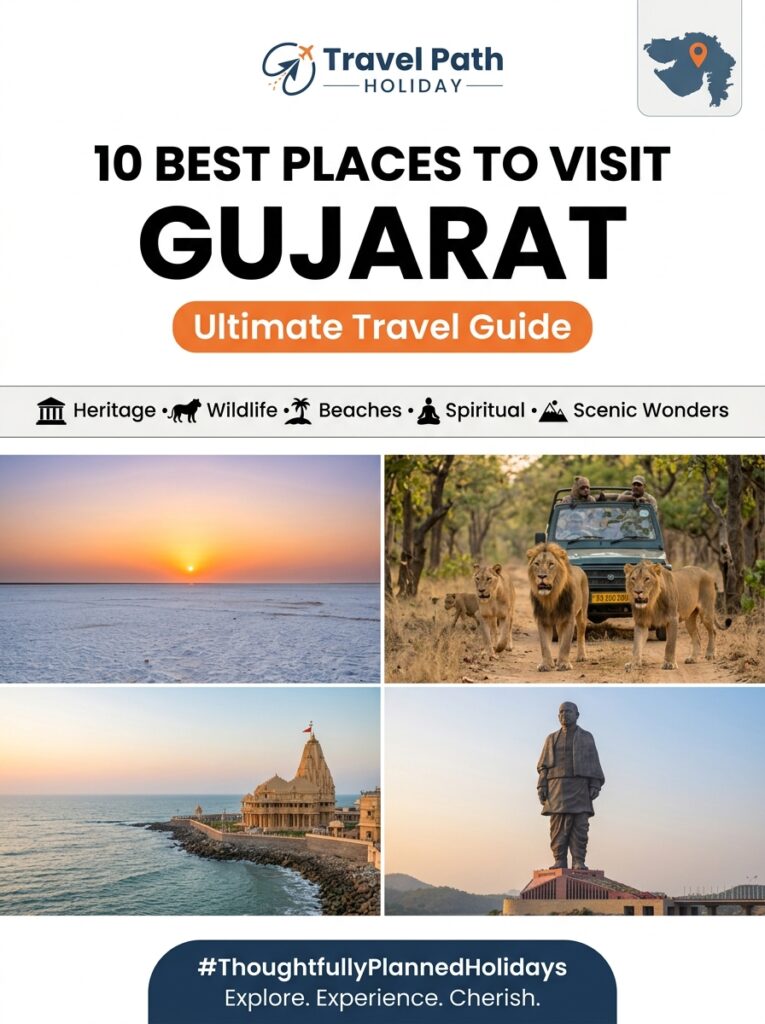
Gujarat

Local Food in Adalaj Stepwell: What and Where to Eat

Overview Adalaj Stepwell (*Adalaj Ni Vav*), located just 18 kilometers north of central Ahmedabad and 15 kilometers south of Gandhinagar, stands as one of Western India’s most extraordinary architectural wonders. Built in 1498 by Queen Rudabai, this five-story subterranean sandstone stepwell combines intricate Solanki carvings with cool underground corridors. However, for food lovers visiting from Madhya Pradesh, exploring the local food in Adalaj Stepwell is as compelling as marveling at its historical masonry. Indori travelers—accustomed to the rich savory flavors of poha-jalebi, Sev Usal, and late-night street delicacies at Sarafa Bazaar—will discover a distinctive culinary philosophy surrounding Adalaj. The local food around Adalaj Stepwell captures the heart of North Gujarati culinary traditions, balancing sweet, salty, and subtle tangy flavors. From roadside morning *farsan* stalls serving melt-in-the-mouth *Dhokla* and silky rolled *Khandvi* right outside the monument gate, to highway *dhabas* and grand thali houses offering unlimited traditional Gujarati Thalis featuring sweet-sour *Gujarati Kadhi*, seasonal *Ringan Bharta*, and velvety *Shrikhand*, Adalaj offers a delightful feast. Whether you are seeking hand-vetted vegetarian options/dining prepared without onion or garlic, or looking to indulge in authentic Kathiyawadi rustic gravies, this comprehensive culinary guide explains what to eat, where to eat, and how to seamlessly fit local food experiences into your heritage excursion. Local Logistical Advice for Indore Travelers Planning a culinary and heritage trip from Indore to Adalaj Stepwell requires straightforward logistical coordination across transport, climate adjustments, and local connectivity. 1. Reaching Adalaj Stepwell from Indore Direct Flights (Indore to Ahmedabad Airport): Fly from Indore’s Devi Ahilya Bai Holkar Airport (IDR) to Sardar Vallabhbhai Patel International Airport, Ahmedabad (AMD). IndiGo operates daily direct non-stop flights taking approximately 1 hour and 10 minutes. Upon landing at AMD airport, Adalaj Stepwell is just 15 km away—a smooth 25-minute drive via Airport Road and the SP Ring Road. Overnight Express Trains: Several direct trains connect Indore Junction (INDB) with Ahmedabad Junction (ADI) and Gandhinagar Capital (GNC). The *Indore – Gandhinagar Capital Express (19310)* departs Indore at 23:00 and arrives at Gandhinagar Capital station at 07:45 AM, making it the most convenient option for morning travelers. Alternatively, the *Shanti Express (19309)* and *Avantika Express* offer comfortable overnight travel. Arriving early allows you to head straight to Adalaj for a fresh morning *farsan* breakfast by 8:30 AM. Self-Drive / Private Cab Road Route: Driving from Indore to Adalaj covers approximately 390 kilometers via National Highway 47 (NH47). The route takes you through Dhar, Jhabua, Dahod, Godhra, and Kathwada before taking the Ahmedabad SP Ring Road toward Adalaj. Total driving time is roughly 7 to 8 hours over smooth four-lane highways with excellent highway food stops near Dahod and Godhra. 2. Climate Transition & Strategic Dining Hours Indore enjoys a dry tropical Malwa climate with cool evening breezes, whereas the Ahmedabad-Gandhinagar corridor experiences semi-arid weather. Summer temperatures (April to June) frequently reach 40°C to 44°C, while winter months (November to February) bring pleasant day temperatures between 16°C and 28°C. Subterranean Cooling vs. Outdoor Dining: While the interior tiers of Adalaj Stepwell remain 4°C to 5°C cooler than the ambient ground temperature, stepwell exploration should still be scheduled during early morning hours (8:30 AM – 11:00 AM). Meal Timing Strategy: Enjoy fresh breakfast snacks like *Fafda-Jalebi* or *Khaman* right outside the stepwell around 9:00 AM, proceed inside for sightseeing during cooler hours, and transition to air-conditioned heritage thali halls or shaded highway *dhabas* along SG Highway between 1:00 PM and 3:30 PM for a relaxed lunch. 3. Mobile Connectivity & National Roaming Travelers departing from Madhya Pradesh can rest assured that all standard prepaid mobile SIM cards (Airtel, Jio, Vi) work seamlessly across Gujarat under national roaming without requiring extra configurations or special packs. Full 4G and 5G network coverage is available throughout the Adalaj Stepwell complex, SG Highway, and Gandhinagar. Complete Details & Practical Guidelines Essential Dishes to Try near Adalaj Stepwell #### A. Signature Farsan (Savory Breakfast & Snacks) Khandvi: Delicate, paper-thin rolls made of tempered gram flour (*besan*) and spiced buttermilk, garnished with mustard seeds, fresh grated coconut, and coriander. It is light, healthy, and widely available at local morning stalls near Adalaj. Khaman & Khatta Dhokla: Unlike the sweet yellow nylon khaman, traditional Gujarati *Khatta Dhokla* is a steamed, fermented batter cake made from rice and urad dal, lightly seasoned with black pepper and chili flakes. It provides a wholesome, oil-free morning snack. Fafda-Jalebi with Papaya Sambharo: A classic Gujarati breakfast staple. Crisp, long strips of seasoned chickpea flour (*Fafda*) served alongside warm, syrup-dripping *Jalebis*, accompanied by fried green chillies and shredded raw papaya salad (*Sambharo*). Muthiya & Patra: *Patra* consists of colocasia leaves coated with spiced chickpea paste, rolled, steamed, and pan-fried. *Muthiya* are steamed dumplings made from wheat flour, fenugreek leaves (*methi*), and bottle gourd (*dudhi*). #### B. The Traditional Gujarati Thali Experience An authentic Gujarati Thali is a multi-course vegetarian feast served on a large stainless steel or brass platter (*kansa*). The dishes are expertly balanced according to Ayurvedic principles of taste (sweet, salty, sour, spicy, bitter, and astringent): 1. Farsan Starters: Servings of 2 to 3 freshly cooked snacks (e.g., *Khandvi*, *Lilva Kachori*, or *Samosa*). 2. Seasonal Sabzis (Curries): *Sev Tameta nu Shaak*: Sweet and spicy tomato gravy topped with crispy chickpea noodles (*sev*), a favorite among Indori travelers. *Ringan no Olo*: Roasted eggplant mash cooked with green garlic, tomatoes, and regional spices. *Undhiyu* (Winter Special): A slow-cooked winter stew of mixed root vegetables, raw bananas, eggplant, and fenugreek dumplings cooked with sesame and coconut. *Bhindi Sambhariya*: Stuffed okra infused with roasted chickpea powder and aromatic spices. 3. Breads: Delicate, paper-thin *Phulka Rotlis* brushed with ghee, alongside thick millet breads (*Bajra no Rotlo*) served with homemade white butter (*Makhan*) and organic jaggery (*Gud*). 4. Dals & Kadhi: *Gujarati Kadhi*: A signature sweet-and-tangy light curry prepared with fresh yogurt, gram flour, ginger, and curry leaves. *Gujarati Tuver Dal*: Sweetened lentil soup simmered with peanuts, kokum, and jaggery. 5. Rice & Khichdi: Fragrant steamed Basmati rice or comforting *Vaghareli Khichdi* (spiced rice and lentil mash)

Gujarat

Luxury Resorts in Ahmedabad Sabarmati Ashram: Premium Stays & Villas

Overview When traveling from Indore to Ahmedabad to experience Mahatma Gandhi’s iconic Sabarmati Ashram and the city’s rich cultural heritage, selecting the right luxury resort or premium stay is essential for a relaxing, high-end getaway. Situated along the banks of the Sabarmati Riverfront, Ashram Road, and the surrounding upscale enclaves, Ahmedabad boasts a sophisticated collection of 5-star luxury hotels, eco-resort villas, and meticulously restored heritage mansions. Whether your itinerary demands temperature-controlled outdoor pools, serene wellness spas offering holistic therapies, 24/7 central air conditioning, or freshly prepared pure vegetarian fine dining, these luxury resorts near Sabarmati Ashram provide an unmatched refuge. This comprehensive guide, curated by Travel Path Holiday Indore, provides Indori travelers with complete details on top-rated luxury stays, premium villa properties, spa facilities, climate control amenities, and realistic booking tariffs, alongside smooth logistical advice for journeys departing from Central India. Local Logistical Advice for Indore Travelers Planning a luxury trip from Indore to Ahmedabad requires choosing the right transit route to match your comfort and itinerary preferences. Here is a breakdown of logistical options: 1. Air Travel (Indore to Ahmedabad Direct Flights) Flight Route: Depart from Indore Devi Ahilya Bai Holkar Airport (IDR) to Sardar Vallabhbhai Patel International Airport, Ahmedabad (AMD). Direct daily flights operated by IndiGo take approximately 1 hour and 10 minutes. Airport-to-Resort Transit: Sardar Vallabhbhai Patel International Airport is conveniently located just 10 to 12 km from Sabarmati Ashram and Ashram Road luxury hotels. A pre-arranged luxury cab transfer takes roughly 15 to 20 minutes via the Airport Road and Sabarmati Riverfront corridor. 2. Rail Connectivity from Indore Junction Train Options: Direct express trains link Indore Junction (INDB) with Ahmedabad Junction (ADI) and Sabarmati Junction (SBT). Key trains include the *Indore – Gandhinagar Capital Express (19310)*, *Shanti Express (19309/19310)*, and *Avantika Express*. Travel Duration: Night trains offer a restful 8-to-9-hour journey, arriving early morning in Ahmedabad—ideal for seamless hotel check-ins. 3. Highway Drive via Private Luxury SUV Road Route: The road journey spans approximately 385 km via National Highway 47 (NH47), passing through Dhar, Jhabua, and Godhra before reaching Ahmedabad. Travel Duration & Comfort: Driving takes about 7 to 8 hours. Travel Path Holiday provides chauffeur-driven Innova Crysta and Fortuner vehicles equipped with high-efficiency multi-zone climate control, ensuring a smooth, stress-free road trip from your doorstep in Indore. 4. Climate Transition & Seasonal Comfort Indore vs. Ahmedabad Climate: While Indore experiences a warm tropical plateau climate, Ahmedabad features semi-arid weather with summer temperatures frequently climbing above 40°C to 44°C between April and June. High-capacity air conditioning, shaded garden pools, and spa relaxation are vital during these months. Best Travel Window: The ideal season for Indori visitors is October to March, when temperatures range between a pleasant 14°C and 28°C—perfect for exploring Sabarmati Ashram, Riverfront promenades, and city heritage sites. 5. Mobile Connectivity & National Roaming Prepaid SIM Cards: Travelers departing from Madhya Pradesh can rely on standard prepaid SIM cards (Jio, Airtel, Vi). Domestic national roaming operates seamlessly across Ahmedabad and Gujarat without requiring extra activation or additional roaming charges. Complete Details & Practical Guidelines Top Luxury Resorts & Premium Stays Near Sabarmati Ashram #### 1. Hyatt Regency Ahmedabad (Ashram Road) Location & Proximity: Situated directly on Ashram Road, overlooking the Sabarmati Riverfront, just 3.5 km (a 7-minute drive) from Sabarmati Ashram. Luxury Amenities: 212 opulent rooms and suites with floor-to-ceiling river view windows, a temperature-controlled outdoor swimming pool, 24/7 central HVAC air conditioning, and a 24-hour fitness center. Spa & Wellness: The in-house *Serena Spa* offers soothing Ayurvedic therapies, Swedish deep-tissue massages, and facial treatments. Dining & Pure Vegetarian Options: Features multi-cuisine dining with dedicated pure vegetarian preparation areas and hand-vetted dietary options for guest comfort. Approximate Booking Tariffs: ₹9,000 – ₹22,000 per night (plus applicable taxes). #### 2. The House of MG (Heritage Grand Hotel & Villas) Location & Proximity: Located in the historic city center near Bhadra Fort, approximately 4.5 km from Sabarmati Ashram via Ashram Road. Luxury Amenities: A restored 1924 textile tycoon mansion featuring grand heritage suites, private courtyard apartments, dual-zone quiet split air conditioning, and an indoor swimming pool (The Lotus Pool). Spa & Wellness: *The Lotus Spa* specializes in traditional herbal wraps, reflexology, and aromatherapy sessions. Dining & Pure Vegetarian Options: Home to the world-famous *Agashiye* rooftop restaurant and *Green House* courtyard café, serving authentic 100% pure vegetarian Gujarati thalis and freshly prepared satvik dishes (prepared without onion or garlic upon request). Approximate Booking Tariffs: ₹8,500 – ₹18,000 per night. #### 3. ITC Narmada, a Luxury Collection Hotel (Vastrapur / SG Highway) Location & Proximity: Situated in the upscale Vastrapur area along SG Highway, roughly 9 km (an 18-minute drive) from Sabarmati Ashram via the Riverfront Road. Luxury Amenities: Architectural styling inspired by Gujarat’s historic stepwells and textile weaving heritage. Features high-end luxury suites, temperature-regulated pool facilities, and smart room climate controls. Spa & Wellness: *Kaya Kalp – The Royal Spa* provides regal wellness rituals, signature body scrubs, and hydrotherapy. Dining & Pure Vegetarian Options: Offers *Royal Vega*, an exclusive fine-dining pure vegetarian restaurant showcasing regional heritage recipes with hand-vetted vegetarian options. Approximate Booking Tariffs: ₹12,000 – ₹28,000 per night. #### 4. Taj Skyline Ahmedabad (Sindhubhavan Road) Location & Proximity: Located in the modern commercial hub on Sindhubhavan Road, approximately 12 km from Sabarmati Ashram. Luxury Amenities: High-rise luxury tower offering signature Taj hospitality, temperature-controlled indoor pool, premium suites with panoramic city views, and silent central AC systems. Spa & Wellness: The renowned *Jiva Spa* delivers holistic Indian wellness treatments, meditative therapies, and essential oil massages. Dining & Pure Vegetarian Options: All-day dining with extensive pure vegetarian buffets and customized culinary arrangements. Approximate Booking Tariffs: ₹10,500 – ₹25,000 per night. #### 5. Glade One Golf Resort & Luxury Villas (Sanand Outskirts) Location & Proximity: Nestled in the serene outskirts near Sanand, approximately 25 km (a 35-minute drive) from Sabarmati Ashram. Luxury Amenities: Exclusive resort surrounded by manicured greenery, featuring private plunge pool villas, a 9-hole Gary Player-designed golf course, private butler service, and powerful villa climate control. Spa

Gujarat

Budget Planning Guide for a Vacation to Gir Forest Lion Safari

Planning a budget trip to Gir Forest Lion Safari is one of the most thrilling yet cost-effective wildlife adventures for travelers departing from Indore and Central India. As the sole natural habitat of the majestic Asiatic Lion (*Panthera leo persica*), Sasan Gir in Gujarat draws nature enthusiasts, photographers, and families throughout the year. However, navigating safari permit slots, mandatory Gypsy vehicle rentals, eco-guide charges, seasonal resort rates, and transit logistics can quickly lead to unexpected expenses if not planned meticulously. This comprehensive budget guide breaks down every cost component—from official government permits (Core Jungle Trail vs. Devalia Zone) to hotel tiers, authentic Kathiyawadi meal expenses, and direct travel coordinates from Indore—helping you execute a seamless, highly memorable, and financially optimized wildlife holiday. Local Logistical Advice for Indore Travelers Traveling from Indore to Sasan Gir requires strategic planning across transport routes, climate adjustments, and local connectivity to keep your trip within budget. 1. Transport Options & Transit Rates from Indore Direct Train Connectivity (Most Budget-Friendly): The *Indore – Veraval Mahamana Express (Train No. 19320)* operates weekly, connecting Indore Junction directly to Junagadh (60 km from Gir) and Veraval (45 km from Gir). Sleeper class tickets cost approximately ₹450 to ₹550 per person, while 3rd AC fares range between ₹1,200 and ₹1,400 per person. Alternatively, travelers can take the *Avanthika Express* or daily express trains to Rajkot and take a connecting regional express or private cab. Flight Coordinates: Fly directly from Indore Devi Ahilya Bai Holkar Airport (IDR) to Rajkot Hirasar Airport (HSR), Diu Airport (DIU), or Ahmedabad Sardar Vallabhbhai Patel International Airport (AMD). Rajkot is the most practical aviation hub, located 160 km (approx. 3.5 to 4 hours drive) from Sasan Gir. One-way flight tickets from Indore to Rajkot typically range between ₹4,500 and ₹7,500 per person when booked 3 to 4 weeks in advance. Road Trip Coordinates: Driving from Indore to Sasan Gir covers approx. 790 km via NH47 and NH27 (Route: Indore -> Dhar -> Jhabua -> Godhra -> Ahmedabad Bypass -> Rajkot -> Junagadh -> Sasan Gir). Driving time takes 14 to 16 hours. Toll expenses total approximately ₹1,100 one-way, while fuel costs for an SUV or Sedan average ₹9,000 to ₹11,000 for the round trip. 2. Climate & Seasonal Transition Indore’s dry tropical climate transitions into Sasan Gir’s semi-arid deciduous forest ecosystem. Winter Season (November to February): Temperatures range between 10°C and 25°C. Pleasant morning breezes make this peak wildlife season. Early morning safaris require light woolens or windcheaters. Summer Season (March to June): Temperatures frequently soar between 38°C and 44°C. While hot, summer is the best period for lion sightings as animals congregate around open forest waterholes. Light cotton apparel, sun protection, and hydration packs are essential. Monsoon Closure: Note that the Gir Core Jungle Trail remains closed to tourists every year from June 16 to October 15 due to the monsoon breeding season. 3. Prepaid SIM & Mobile Network Connectivity Travelers from Madhya Pradesh can use standard prepaid SIM cards (Jio, Airtel, Vi) without any national roaming complications across Gujarat. High-speed 4G/5G signals are reliable around Sasan Gir town, resort hubs, and nearby railheads like Junagadh and Veraval. However, network signals naturally drop inside the deep core forest safari tracks. Complete Details & Practical Guidelines 1. Gir Safari Permits: Core Jungle Trail vs. Devalia Interpretation Zone Understanding the permit ecosystem is the single most critical factor when planning a budget trip to Gir Forest Lion Safari. All permits must be booked via the official Gujarat Forest Department portal (*girlion.gujarat.gov.in*). Safari Category Operating Days Online Permit Fee (Per Vehicle Slot up to 6 Adults) Sighting Experience Recommended Traveler Profile Gir Jungle Trail (Core Forest) Weekdays (Mon-Fri) ₹800 – ₹1,000 Authentic wilderness across 13 core forest routes Wildlife lovers, photographers, family groups Gir Jungle Trail (Core Forest) Weekends & Holidays ₹1,000 – ₹1,300 Deep forest tracking of wild lion prides Peak-season travelers Devalia Interpretation Zone (Gypsy) Weekdays & Weekends ₹500 – ₹800 Fenced natural eco-park; high sighting probability Short weekenders, travelers with toddlers Devalia Bus Safari (Eco-Bus) Weekdays & Weekends ₹150 – ₹200 (per head) 30-minute guided bus tour inside Devalia Park Solo budget travelers & backpackers *Note: Core safari permits open online exactly 90 days in advance at 8:00 AM. Booking early guarantees standard government rates and prevents relying on expensive last-minute agent packages.* 2. Mandatory On-Ground Safari Expenses In addition to the online forest permit, travelers must pay fixed vehicle, guide, and camera charges on arrival at the Sinh Sadan Safari Reception Center: Registered Open Forest Gypsy Rental: ₹2,500 to ₹3,000 per safari slot (shared by up to 6 adult passengers in 1 vehicle). Mandatory Eco-Guide Charges: ₹600 to ₹800 per safari slot, payable directly to the assigned eco-guide. DSLR & Professional Camera Fees: Standard mobile phone cameras incur zero charges. Carrying professional cameras or telephoto lenses (above 300mm) attracts a camera permit fee of ₹500 to ₹1,000 per camera per session. Budget Calculation Example (Core Safari for 6 Travelers): Forest Permit: ₹800 + Gypsy Rental: ₹2,500 + Guide Fee: ₹600 = ₹3,900 Total per Gypsy. Per Head Cost (Group of 6): ₹650 per person. Per Head Cost (Couple traveling privately): ₹1,950 per person. 3. Accommodation Budget Tiers in Sasan Gir Sasan Gir offers a wide range of accommodation options catering to every budget segment: Budget Homestays & Eco-Lodge Stays (₹1,500 – ₹3,000 per night): Located around Sasan Gir town, Talala Road, and near the railway station. Features clean air-conditioned rooms, private bath, and home-cooked meals. *Ideal for budget-conscious families and student groups.* Mid-Range Wildlife Resorts & Heritage Cottages (₹3,500 – ₹7,000 per night): Situated near the Hiran River or forest buffer line. Includes swimming pool access, garden lawns, buffet breakfast, and dinner. *Ideal for couples and families seeking comfort with nature views.* Luxury Sanctuary Retreats (₹12,000 – ₹28,000+ per night): Top-tier properties such as *Woods at Sasan*, *The Fern Gir Forest Resort*, and *Aramness Gir*. Offers private plunge pools, organic farm dining, wellness spas, and curated jungle experiences. 4. Food & Dining Expenses

Gujarat

Top 10 Things to Do in Rann of Kutch Tent City: Sightseeing Itinerary

Overview The Rann of Kutch, one of the world’s largest salt deserts, transforms into a vibrant cultural hub during the annual Rann Utsav. Set against the stark, pristine backdrop of the white salt flats, the Tent City at Dhordo serves as the primary base for travelers looking to immerse themselves in this magical landscape. If you are seeking the ultimate bucket-list experiences, understanding the best things to do in Rann of Kutch Tent City is the key to planning an unforgettable vacation. From watching the sun melt into the horizon on the salt flats to exploring magnetic hills and shopping for authentic handicrafts, this comprehensive sightseeing itinerary covers everything you need to know. Local Logistical Advice for Indore Travelers For travelers departing from Indore, planning a trip to the Rann of Kutch requires a strategic approach to routing and scheduling. Located approximately 800 km away, the journey from Indore to the salt desert can be executed via flights, trains, or a scenic road trip. By Air: The fastest way to reach Bhuj (the gateway to Kutch) from Indore is by flight. While there are no direct flights from Devi Ahilyabai Holkar Airport (IDR) to Bhuj Airport (BHJ), you can book connecting flights. Some routes feature convenient flight layovers at Delhi (DEL) or Mumbai, while others connect via Ahmedabad (AMD). Alternatively, you can take a direct flight from Indore to Ahmedabad and cover the remaining 330 km to Bhuj via a premium private cab or a comfortable overnight train. By Train: Direct train connectivity is available from Indore Junction to Ahmedabad. From Ahmedabad, the Ala Hazrat Express or the Bhuj Express will take you straight to Bhuj, from where the Tent City offers scheduled pick-ups. Rann Utsav Permit Online Process: To enter the White Rann, every tourist must obtain a mandatory government permit. While you can obtain this at the Bhirandiyara check post en route, the queue can be incredibly long during peak season. We highly recommend using the official online portal (rannpermit.com) to secure your permits in advance. Keep your Aadhaar card and vehicle details handy. Tent City Booking Tips: The Tent City Dhordo operates from November to February. Booking 3 to 4 months in advance is critical, especially if you wish to align your stay with a full moon night when the salt desert glows under the night sky. Ensure your booking includes all-inclusive meals, transfers from Bhuj, and guided sightseeing. Complete Details & Practical Guidelines Here are the top 10 things to do in Rann of Kutch Tent City and its surrounding areas to maximize your sightseeing itinerary: 1. Witness the Ethereal Sunset and Sunrise at the White Desert The absolute highlight of visiting the Rann of Kutch is standing in the middle of the endless white salt crust as the sky changes colors. The Tent City provides regular camel cart and bus transfers to the viewing platforms. Walking onto the salt flats during sunset, when the landscape turns shades of orange, pink, and purple, is a surreal experience. Sunrise is equally spectacular and far less crowded, offering a peaceful moment to capture stunning photographs. 2. Experience the Luxury of Rann Utsav Tent City Living in the Tent City is an adventure in itself. Spread across a massive area, the cluster of tents is divided into various categories, from premium air-conditioned Swiss cottages to cozy non-AC tents. The tents are beautifully decorated with local Kutchi embroideries and block-printed fabrics. Staying here gives you direct access to the main activity areas, exhibition stalls, and dining halls, ensuring you are always close to the action. 3. Enjoy Cultural Folk Performances Every evening, the Tent City comes alive with traditional cultural folk performances. Professional artists from across Gujarat and Rajasthan perform energetic dances like Garba, Dandiya, and the Kutchi Gajayo. The mesmerizing Sufi music and local folk instruments, played under the open starlit sky, create an unforgettable ambiance. These performances offer a deep dive into the local heritage, which you can read more about in our guide on Cultural Etiquette and Traditions in Rann of Kutch Tent City. 4. Savour Kutchi Cuisine with Hand-Vetted Vegetarian Options/Dining The dining halls at the Tent City serve massive buffets showcasing authentic Gujarati and Kutchi culinary traditions. Indore travelers, known for their love of rich flavors, will appreciate the variety of dishes on offer, including Bajra na Rotla with ghee, Ringan no Oro (roasted eggplant), Kadi-Khichdi, and sweets like Jalebi and Churma Ladoo. Recognizing the dietary preferences of Indore families, Travel Path Holiday coordinates with the organizers to ensure hand-vetted vegetarian options/dining are consistently available, guaranteeing high standards of hygiene and authentic taste. 5. Visit Kalo Dungar (Black Hill) and Experience the Magnetic Hill Phenomenon Located about 90 km from the Tent City, Kalo Dungar is the highest point in Kutch. It offers a panoramic view of the entire Great Rann, stretching all the way to the India-Pakistan border. At the peak, you can visit the historic 400-year-old Dattatreya Temple. Kalo Dungar is also famous for its unique “magnetic hill” effect, where vehicles parked in neutral gear appear to roll uphill due to optical illusions and gravitational anomalies. 6. Shop for Authentic Kutchi Handicrafts Kutch is a paradise for art lovers. You can explore the shopping arcade within the Tent City or take a short excursion to handicraft villages like Bhujodi and Gandhi nu Gam. Popular items to shop for include: Ajrakh Block Printing: Intricately dyed cotton and silk fabrics. Rogan Art: A rare oil-based painting technique practiced by a single family in Nirona village. Copper Bells: Melodious hand-carved metal bells. Kutchi Embroidery: Mirror work and leather goods crafted by local tribal communities. 7. Try Adventure Activities in the Adventure Zone For thrill-seekers, the Tent City hosts an array of adventure sports. You can rent All-Terrain Vehicles (ATVs) to ride across the desert sands, go paramotoring for a bird’s-eye view of the white salt desert, or take a hot air balloon ride to see the massive scale of the Rann Utsav. 8. Explore Traditional

Tour Packages & Guides

Historical Significance and Architecture of Chele La Pass

Overview Standing grandly at an elevation of 3,988 meters (13,084 feet) above sea level, Chele La Pass (Chele La) is celebrated as the highest motorable mountain pass in the Kingdom of Bhutan. Carved across a dramatic ridge dividing the fertile Paro Valley from the serene, secluded Haa Valley, Chele La is far more than a scenic high-altitude stopover—it is a living monument to Himalayan heritage, sacred Buddhist architecture, and ancient trade history. For travelers departing from Central India and Indore, ascending to this mountain ridge provides a breath-taking transition from urban landscapes to pristine alpine heights. From its sacred forests of vertical prayer poles (*Darchor*) and stone chortens to the awe-inspiring, snow-capped panorama of Mount Jomolhari (7,326m), understanding the history of Chele La Pass enriches every step of your Himalayan journey. Local Logistical Advice for Indore Travelers 1. Flight & Transit Coordinates from Indore (IDR) Planning your journey to Chele La Pass from Indore requires a well-structured travel itinerary: Air Travel via Delhi or Kolkata: Depart from Indore’s Devi Ahilya Bai Holkar Airport (IDR) on an early morning flight to Indira Gandhi International Airport (DEL) in New Delhi or Netaji Subhash Chandra Bose International Airport (CCU) in Kolkata. From Delhi or Kolkata, take a connecting flight operated by Drukair or Bhutan Airlines directly into Paro International Airport (PBH). The flight landing at Paro is renowned as one of the most stunning aerial descents in the world, offering views of the Eastern Himalayas. Overland Highway Route: For road-trip enthusiasts from Malwa, take an express train (such as the Kshipra Express or Indb Ghy Express) or a flight from Indore to Bagdogra / Siliguri. From Siliguri, drive 150 km to the border town of Jaigaon / Phuntsholing. After completing Bhutan entry immigration, embark on a scenic 160 km drive along the Thimphu-Paro highway. Reaching Chele La from Paro: Chele La Pass is located 35 km from Paro town center. The drive takes approximately 1.5 to 2 hours along the winding Chele La Highway, climbing through dense forests of blue pine, hemlock, and fir. 2. Climate Transition & High-Altitude Adaptation From Malwa Plateau to Himalayan Chills: Travelers from Indore transition from a tropical dry climate (where average temperatures range between 22°C and 38°C) to an extreme high-altitude alpine environment at 3,988 meters. Weather Conditions: Even during summer months (May to August), ambient temperatures at Chele La range between 5°C and 15°C, accompanied by sharp alpine winds. In winter (November to February), temperatures plummet to between -10°C and 2°C, with frequent heavy snowfall completely blanketing the pass. Acclimatization & Clothing: To prevent Altitude Sickness (Acute Mountain Sickness), spend at least 24 to 48 hours acclimatizing in Paro (2,200m) or Thimphu (2,320m) before driving up to Chele La. Wear multi-layered winter clothing—thermal innerwear, heavy fleece jackets, windproof down coats, woolen caps, thermal socks, and insulated gloves. 3. Tourist SIM Cards & Mobile Connectivity International Roaming Warning: Standard Indian prepaid SIM cards (such as Jio, Airtel, or Vi registered in Madhya Pradesh) operate seamlessly up to the border town of Jaigaon under national roaming, but lose cellular service upon crossing into Bhutan unless expensive international roaming packages are pre-activated. Local Tourist SIM Recommendation: Upon arrival at Paro International Airport or the Phuntsholing immigration gate, purchase a local tourist eSIM or physical SIM card from TashiCell or B-Mobile (Bhutan Telecom). Present your passport or Bhutan Entry Permit for instant activation. A local data plan ensures reliable 4G data coverage for navigation, emergency communication, and sharing real-time mountain photos along high-altitude routes like Chele La Pass. For more detailed connectivity tips, read our ATM, Cash & Mobile Connectivity Guidelines. Complete Details & Practical Guidelines 1. Historical Significance: Ancient Trade Route & Border Sentinel Before the construction of Bhutan’s modern motorable roads in the late 20th century, mountain passes served as the vital lifelines connecting isolated Himalayan valleys. The history of Chele La Pass is deeply rooted in trade, cultural exchange, and military defense: The High-Altitude Trade Artery: Historically, Chele La was the primary alpine foot-pass connecting the agricultural communities of Paro Valley with the high-altitude pastoralists of Haa Valley. For centuries, nomadic yak herders (*Brokpas*) and regional merchants navigated this rugged 3,988-meter pass on foot alongside heavily laden yak caravans. Traded Commodities: Caravans from Haa brought rock salt imported from Tibet, dried yak cheese (*Chhurpi*), yak butter, hand-spun wool, and timber down to Paro. In return, Paro merchants exchanged red rice, dried fish, woven textiles, barley, and bronze utensils. Strategic Defense Ridge: Due to its command over both valleys and its proximity to the western frontier near Tibet’s Chumbi Valley, Chele La served as a natural lookout post. Local feudal lords (*Penlops*) maintained armed sentries along the ridge to monitor regional movements and protect valley settlements against historical invasions. 2. Sacred Architecture of Prayer Flags (Dar Cho & Lung ta) As you reach the crest of Chele La Pass, the surrounding landscape is transformed into a shimmering forest of colorful fabric. In Bhutanese Vajrayana Buddhism, high mountain passes (*La-tsho*) are considered sacred mountain boundaries where protective deities reside. The architecture of prayer flags at Chele La is both spiritually symbolic and aesthetically striking: “` +——————————————————-+ THE FIVE SACRED ELEMENTS OF LUNG TA PRAYER FLAGS +——————————————————-+ COLOR ELEMENT BUDDHA FAMILY +———-+——————-+————————+ Blue Space & Sky Akshobhya White Air & Clouds Vairochana Red Fire Amitabha Green Water & Nature Amoghasiddhi Yellow Earth Ratnasambhava +——————————————————-+ “` Darchor / Darshing (Vertical Flag Poles): Chele La is world-famous for its dense clusters of Darchor—tall vertical wooden poles (ranging from 10 to 30 feet in height) topped with long strips of white cotton fabric. Planted in honor of deceased family members or to generate spiritual merit (*Karma*), these poles are crowned with small wooden carved swords (*Khadga*) to cut through ignorance. Horizontal Lung Ta (Wind Horse Flags): Strung horizontally across the mountain ridge are thousands of colorful Lung ta flags. Each flag is block-printed using hand-carved wooden blocks featuring sacred mantras (such as *Om Mani Padme Hum*), prayers for health and peace, and

Bhutan Honeymoon

Emergency Numbers, Hospitals & Tourist Police in Dochula Pass

Overview Perched at a commanding elevation of 3,100 meters (10,170 feet) along the mountain highway connecting Thimphu and Punakha, Dochula Pass is one of Bhutan’s most breathtaking landmark destinations. Celebrated for its 108 memorial stupas—known as the Druk Wangyal Chortens—and sweeping 360-degree views of the snow-capped Eastern Himalayas, the pass is an essential highlight on any journey through the Himalayan Kingdom. However, traversing this high-altitude mountain corridor presents unique safety considerations, including rapid weather shifts, sudden fog, sub-zero winter temperatures, steep mountain switchbacks, and potential altitude sickness. Whether you require immediate medical care, roadside breakdown assistance, tourist police intervention, or guidance on navigating high-altitude mountain highways, having verified local emergency contacts is crucial for a safe trip. Knowing the official emergency helpline in Dochula Pass and the surrounding Thimphu-Punakha sector ensures that any unforeseen health or travel issue is resolved swiftly. Crafted specifically for travelers departing from Central India, this comprehensive guide by Travel Path Holiday (TPH) details national emergency hotlines, nearby hospital referral networks in Thimphu and Paro, tourist police checkpost services, mountain driving safety guidelines, and high-altitude health protocols to safeguard your Bhutan adventure. Local Logistical Advice for Indore Travelers 1. Flight & Transit Coordinates from Indore Travelers departing from Indore’s Devi Ahilya Bai Holkar Airport (IDR) must cross international boundaries into Bhutan’s high-altitude alpine terrain: Air Transit via Delhi or Kolkata: Take a morning flight from Indore (IDR) to Indira Gandhi International Airport in Delhi (DEL) or Netaji Subhash Chandra Bose International Airport in Kolkata (CCU). From DEL or CCU, board a connecting flight operated by Bhutan’s national carriers—Drukair or Bhutan Airlines—into Paro International Airport (PBH). Single-PNR & Buffer Recommendation: Ensure your domestic and international sectors are booked on a single PNR or scheduled with a minimum 4-hour layover window to safeguard against flight delays and facilitate automated baggage transfer. Overland Highway Route: Alternatively, board the *Malwa Express* or connecting express trains from Indore Junction (INDB) to Hasimara Railway Station in West Bengal. From Hasimara, take a 30-minute taxi ride to the border town of Phuentsholing, complete immigration procedures, and proceed via a scenic 5-hour drive to Thimphu before crossing Dochula Pass. 2. Climate & Altitude Transition (Indore to Dochula Pass) Indore sits on the Malwa plateau at an elevation of approximately 553 meters, featuring a warm tropical dry climate. In contrast, Dochula Pass reaches 3,100 meters above sea level: Rapid Altitude Jump: Ascending from 553 meters to 3,100 meters exposes travelers to reduced atmospheric pressure and thinner oxygen levels. Thermal Shift: While summer temperatures in Indore hover between 30°C and 40°C, Dochula Pass temperatures range from 5°C to 15°C in spring and autumn, and drop below freezing (-5°C to 5°C) during winter months. Dense mountain fog can cause visibility to plummet within minutes. Acclimatization Priority: Travel Path Holiday structures your itinerary so that you spend 1 to 2 nights acclimatizing in Thimphu (2,320 m) before driving across Dochula Pass toward Punakha (1,300 m). 3. Mobile SIM Cards & Emergency Coverage No Indian Domestic Roaming: Standard Indian prepaid SIM cards (Jio, Airtel, Vi) registered in Madhya Pradesh do not work under standard domestic roaming in Bhutan. Local Tourist SIM Setup: Upon arrival at Paro International Airport or the Phuentsholing border gate, purchase a local tourist SIM or eSIM from TashiCell or B-Mobile for Nu. 500 (~INR 500). Connectivity at Dochula Pass: Cellular towers operated by TashiCell and B-Mobile provide crisp 4G signals across Dochula Pass, the cafeteria area, and along the Thimphu-Punakha Highway, enabling direct access to Bhutan’s 3-digit national emergency helplines. 4. Permits & Sustainable Development Fee (SDF) Clearances All Indian nationals visiting Bhutan must pay the official Sustainable Development Fee (SDF) of INR 1,200 per adult per night (children aged 6–12 pay 50%; under 6 are exempt). Because Dochula Pass sits on the highway leading into Punakha district, travelers require a valid Route Permit (Restricted Area Permit). TPH pre-clears all SDF clearances and permits before your departure from Indore. 5. Pure Vegetarian Dining & Mountain Hydration At 3,100 meters elevation, maintaining core body heat and proper hydration is essential to prevent altitude headaches. TPH coordinates hot thermoses of fresh ginger-lemon tea and arranges hand-vetted vegetarian options and freshly cooked pure vegetarian dishes at clean mountain dining stops along the highway. Complete Details & Practical Guidelines “` =================================================================================== BHUTAN NATIONAL EMERGENCY RESPONSE SYSTEM =================================================================================== [MEDICAL / AMBULANCE] [ROYAL BHUTAN POLICE] [FIRE & RESCUE] Dial: 112 Dial: 113 Dial: 110 (Toll-Free 24/7 ER) (Accidents & Safety) (Emergency Rescue) =================================================================================== “` 1. National Emergency Helplines in Bhutan (Dochula Pass Region) Bhutan operates a streamlined, centralized national emergency telephone network. These short codes can be dialed directly from any local TashiCell or B-Mobile number, as well as international roaming lines: Emergency Service Direct Short Code Alternative Contact Number Service Coverage & Response Medical Emergency & Ambulance 112 +975-2-322496 (JDWNRH ER) Toll-free 24/7 medical dispatch and high-altitude emergency ambulance service. Royal Bhutan Police (RBP) 113 +975-2-322424 (Thimphu HQ) Immediate intervention for road traffic accidents, emergency rescue, lost belongings, and tourist safety. Fire & Rescue Services 110 +975-2-322277 Highway fire safety, vehicular accident extrication, and landslide search-and-rescue. Traffic Police Helpline 119 +975-2-322448 Highway traffic management, road obstruction reports, and weather hazard updates. Tourism Department Helpline N/A +975-2-323251 / +975-2-323252 Tourist assistance, emergency guide coordination, and travel permit support. 2. Nearest Hospitals & Emergency Medical Referral Facilities While Dochula Pass features basic emergency first-aid equipment at the local tourist center and cafeteria, acute medical conditions, trauma, or severe mountain sickness are referred to modern, fully equipped hospitals in nearby Thimphu or Paro. “` +———————————————————————————–+ EMERGENCY MEDICAL EVACUATION ROUTE FROM DOCHULA PASS +———————————————————————————–+ DOCHULA PASS (3,100 m) —> 30 km (45-60 min drive) —> THIMPHU (JDWNRH) DOCHULA PASS (3,100 m) —> 45 km (60-75 min drive) —> PUNAKHA HOSPITAL DOCHULA PASS (3,100 m) —> 65 km (90-120 min drive) —> PARO GENERAL HOSP. +———————————————————————————–+ “` #### A. Jigme Dorji Wangchuck National Referral Hospital (JDWNRH) – Thimphu Location: Hospital Road, Gongphel Lam, Thimphu (Approximately 30 km west of Dochula Pass; 45 to 60-minute

Tour Packages & Guides

Pre-Wedding Shoot & Couple Photography in Haa Valley

Overview Planning a pre wedding shoot in Haa Valley offers couples an enchanting escape into Bhutan’s most secluded alpine sanctuary. Tucked away in the westernmost corner of the Kingdom of Bhutan, the Haa Valley sits at an elevation of 2,700 meters (8,850 feet), framed by the sacred three-peaked *Miri Punsum* mountains, dense coniferous pine forests, pristine glacial streams, and centuries-old wooden farmhouses adorned with intricate hand-painted Bhutanese motifs. Unlike the heavily frequented tourist hubs of Paro and Thimphu, Haa Valley remains virtually free of commercial clutter and heavy foot traffic, granting couples unmatched privacy, authentic cultural architecture, and dramatic Himalayan backdrops for romantic photography. For couples traveling from Central India seeking timeless, high-aesthetic pre-wedding albums, Haa Valley combines raw natural grandeur with rich cultural heritage. From dramatic high-altitude frames at Chele La Pass (3,980 meters) draped in thousands of fluttering prayer flags to rustic romantic portraits against the white timber-carved exterior walls of Lhakhang Karpo, Haa provides a breathtaking canvas. This comprehensive guide covers everything you need to execute a flawless couple photoshoot in Haa Valley, including flight logistics from Indore, Sustainable Development Fee (SDF) and immigration permit requirements, traditional Bhutanese wardrobe styling (*Kira* and *Gho* rentals), local hair and makeup vendor arrangements, equipment setups, drone regulations, and optimal golden-hour lighting schedules. Local Logistical Advice for Indore Travelers Departing from the warm, semi-arid Malwa plateau of Indore and arriving in the pristine high-altitude alpine terrain of Haa Valley requires streamlined travel planning. Here are concrete, actionable travel coordinates tailored specifically for Indori couples and their photography crews: Flight Transit and Driving Routes from Indore 1. Air Connection via Delhi or Kolkata: Book an early morning domestic flight from Indore Devi Ahilya Bai Holkar Airport (IDR) to Indira Gandhi International Airport, New Delhi (DEL) or Netaji Subhash Chandra Bose International Airport, Kolkata (CCU). Catch a connecting international flight on Bhutan’s flag carrier Drukair or Bhutan Airlines to Paro International Airport (PBH). Flying from Kolkata to Paro takes just 1 hour and 30 minutes, offering stunning aerial views of Mount Everest and Kanchenjunga on clear mornings. Total travel duration from Indore to Paro is approximately 7 to 10 hours including layovers. 2. Scenic Mountain Drive from Paro to Haa Valley: Route via Chele La Pass (65 km / 2.5 hours): The most popular and scenic route climbs from Paro over Chele La Pass (Bhutan’s highest motorable pass at 3,980 meters) before descending into Haa Valley. This drive allows couples to capture high-altitude alpine photos en route. Route via Chhuzom River Confluence (110 km / 3.5 hours): A wider, lower-altitude road route traveling via the Paro-Thimphu highway junction at Chhuzom, ideal for heavy photography equipment transport during winter snowfall. 3. Overland Route via Phuentsholing: Travelers preferring train transit can board direct trains from Indore Junction to Hasimara Railway Station (West Bengal) or New Jalpaiguri (NJP), or fly from Indore (IDR) to Bagdogra Airport (IXB) near Siliguri. Proceed by private taxi to the Jaigaon-Phuentsholing border gate (4 hours from Bagdogra). After clearing immigration at Phuentsholing, enjoy a 6-hour mountain drive through scenic tea gardens and pine forests directly to Haa Valley. Climate Transition & Acclimatization Temperature Contrast: Indore experiences warm weather with summer temperatures exceeding 40°C and mild winters around 10°C to 28°C. In contrast, Haa Valley is significantly cooler, with daytime temperatures averaging 12°C to 18°C in spring and autumn, dipping sharply to 2°C to 8°C after sunset (and sub-zero during winter nights). Altitude Acclimatization: Haa Valley sits at 2,700 meters, while Chele La Pass touches nearly 4,000 meters. Indori couples should allow 24 hours of rest in Paro or Haa town before commencing intensive outdoor photoshoots to avoid altitude fatigue or breathlessness while posing. Always carry fleece jackets, thermal innerwear, and warm shawls for quick layering between camera takes. Mobile Connectivity & Tourist SIM Cards National Roaming Status: Standard Indian prepaid SIM cards (Jio, Airtel, Vi) do not work under standard national roaming inside Bhutanese territory. Local SIM & eSIM Purchase: Upon arrival at Paro International Airport or the Phuentsholing immigration office, purchase a local tourist SIM card or eSIM from TashiCell or B-Mobile. Registration requires an Indian Passport or Voter ID card along with a fee of ~100 to 200 Nu (including data packs). High-speed 4G data is essential in Haa for real-time location sharing with driver captains, coordinating local makeup artists, and sending test shots to your design team. Currency Parity & Expenses Rupee Parity: The local currency, Bhutanese Ngultrum (Nu), is pegged 1:1 with the Indian Rupee (INR). Cash INR notes of ₹100 and ₹500 denomination are widely accepted across Haa Valley for home-stay rentals, driver tips, entry fees, and local styling services. Note that ₹2,000 notes are not accepted. Carrying cash INR is essential as international credit card terminals are limited in remote Haa villages. Complete Details & Practical Guidelines 1. Why Haa Valley is Bhutan’s Premier Pre-Wedding Photography Destination Haa Valley offers a rare blend of untouched Himalayan landscape and living cultural heritage that sets it apart from traditional pre-wedding destinations: Unrivaled Privacy: Free from dense tourist crowds, couples can shoot intimately without onlookers or unwanted background distractions. Iconic Architectural Motifs: Traditional double-storied timber farmhouses (*Gho-Zho*) featuring intricately painted wooden window frames (*Rabsey*), stone walls, and carved balconies provide a rich, royal vintage backdrop. Varied Natural Backdrops within Short Distances: Within a 20-minute drive, you can transition from dense alpine pine groves and rushing glacial streams to wide sub-alpine meadows and soaring 4,000-meter mountain passes. Cultural Authenticity: Shooting in Haa feels timeless, capturing the true essence of Gross National Happiness and preserved Himalayan traditions. 2. Top Scenic Shoot Locations in Haa Valley & Specific Setups “` +———————————————————————————–+ TOP PRE-WEDDING SHOOT LOCATIONS IN HAA +————————————+———————————————-+ Location Key Visual Highlights & Aesthetic Theme +————————————+———————————————-+ Chele La Pass (3,980m) Ocean of prayer flags, Mt. Jomolhari view Lhakhang Karpo (White Temple) Carved whitewashed walls, grand stone plaza Haa Chhu Riverfront & Footbridge Crystal glacial stream, pine grove meadows Yangthang & Dumchoe Villages Traditional wooden farmhouses, rustic gates Katsho & Damthang

Tour Packages & Guides

ATM, Cash & Mobile Connectivity Guidelines in Phobjikha Valley cranes

Overview Phobjikha Valley (frequently referred to as Gangtey) is one of Bhutan’s most spectacular high-altitude glacial valleys, situated at an elevation of 3,000 meters (9,800 feet) in the Wangdue Phodrang district. Globally revered as the winter nesting ground for the endangered, migratory Black-necked Cranes (*Grus nigricollis*), this serene eco-conservation zone offers travelers an untouched sanctuary of wooden farmhouses, pristine pine forests, and ancient monastic culture. However, because Phobjikha is a strictly protected wetland biosphere with zero high-rise infrastructure, modern urban amenities such as automated teller machines (ATMs), high-speed fiber internet, and seamless digital card payments are extremely scarce. Navigating the mobile network in Phobjikha Valley cranes habitat requires thorough advance planning regarding SIM card activation, mobile signal carriers (B-Mobile vs. TashiCell), currency exchange, and emergency cash reserves. Indian standard prepaid SIM cards do not work under roaming in Bhutan, digital UPI gateways encounter frequent server timeouts due to rural cell tower bandwidth, and the entire valley has no functional ATMs. This comprehensive guide, prepared by Travel Path Holiday, provides essential logistical insights, cellular coverage breakdowns, cash rules, and payment strategies tailored specifically for travelers departing from Indore and Central India. Local Logistical Advice for Indore Travelers Planning a journey from the warm Malwa plateau of Indore to the secluded sub-alpine heights of Phobjikha Valley requires careful attention to transit routes, high-altitude weather preparation, and communication setup. 1. Flight & Overland Transit Coordinates from Indore Air Travel Route (Fastest): Book a domestic flight from Indore’s Devi Ahilya Bai Holkar Airport (IDR) to Kolkata (CCU) or New Delhi (DEL). From Kolkata or Delhi, board a connecting flight operated by Royal Bhutan Airlines (Drukair) or Bhutan Airlines to Paro International Airport (PBH). Rail & Road Route: Take an express train from Indore Junction (such as the *Malwa Express* or *Karma Bhumi Express*) to Howrah Junction or Hasimara Railway Station (located 18 km from the Indo-Bhutan border town of Jaigaon/Phuentsholing). After clearing entry immigration at Phuentsholing, hire a private tourist vehicle for the journey inland. Highway Travel to Phobjikha: From Paro Airport, Phobjikha Valley is 165 km away (a 6.5 to 7-hour scenic mountain drive via Dochula Pass and Wangdue Phodrang). From Thimphu, it is 135 km (5 hours). Vehicles navigate through Lawala Pass (3,300m) before descending into the Phobjikha basin. 2. Climate Shift & Sub-Zero Battery Drain Indore’s tropical dry climate (winter averages around 15°C to 28°C) is radically different from Phobjikha’s high-altitude winter environment. During the Black-necked Crane migration period (late October to mid-February), nighttime temperatures in Phobjikha plummet to between -1°C and -8°C, with heavy frost carpeting the valley floor. Thermal Layering: Pack high-grade thermal base layers, heavy down jackets, fleece caps, thermal socks, and windproof gloves. Power Bank Requirement: Lithium-ion smartphone and camera batteries drain up to 50% faster in sub-zero temperatures. Carry at least two 10,000mAh or 20,000mAh external power banks in insulated inner pockets while birdwatching or hiking the Gangtey Nature Trail. 3. Immediate Telecom & Cash Rule Upon Border Entry Prepaid SIM & Cash Notice: Standard Indian prepaid SIM cards (Airtel, Jio, Vi) registered in Madhya Pradesh stop functioning immediately upon crossing into Bhutanese airspace or land borders. You must acquire a Bhutanese Tourist SIM card at Paro Airport or Phuentsholing. Furthermore, do not rely on digital payments or local ATMs once you leave Thimphu or Wangdue Phodrang. Complete Details & Practical Guidelines 1. Mobile Network Coverage in Phobjikha Valley Cranes Sanctuary Cellular network connectivity in Phobjikha Valley is shaped by strict ecological guidelines designed to protect migratory birds. Consequently, mobile coverage is functional but localized compared to urban centers like Thimphu or Paro. Location / Trail Zone B-Mobile Coverage TashiCell Coverage Gangtey Monastery Strong 4G Data Strong 4G Data Tabading Hotel Zone Moderate 4G/3G Strong 4G Data Crane RSPN Centre Moderate 4G Moderate 3G/4G Gangtey Nature Trail Weak 3G / Edge Edge / No Signal Remote Farmstays 3G / Variable Voice 3G / Variable Voice B-Mobile (Bhutan Telecom): As the state-owned telecom operator, B-Mobile offers the broadest network footprint across Phobjikha Valley. It maintains strong 4G signals around Gangtey Monastery, the RSPN Crane Information Centre, and central village clusters. Along the lower valley floor near roosting wetlands, signal drops to 3G or Edge. TashiCell: The leading private cellular network provides excellent high-speed 4G data in the Tabading hotel zone and upper Gangtey ridge. However, coverage can degrade rapidly when descending into forested sections of the Gangtey Nature Trail or inside thick rammed-earth walls of traditional farmstays. Data Speeds & Calls: Expect 4G download speeds of 5 Mbps to 15 Mbps near main settlements, dropping to 1 Mbps or voice-only reception in deep valley corners. Voice call connectivity remains reliable across 85% of the valley bowl for both networks. 2. Tourist SIM Card & eSIM Setup for Indian Travelers Because Indian national roaming is inactive in Bhutan, setting up a local connectivity option before traveling to Phobjikha is essential. #### Option A: Physical Tourist SIM Card Purchase Locations: *Paro International Airport:* Dedicated telecom counters for B-Mobile and TashiCell are located in the arrival hall immediately after customs. *Phuentsholing Border Counter:* Main branch offices of Bhutan Telecom and TashiCell near the main border gate. Required Documentation: Original Indian Passport (or Voter ID card), copy of your valid Bhutan Tourist Entry Permit/Visa, and one passport-size photograph. Standard Tourist Plans: *B-Mobile Tourist Plan:* Nu./₹200 for SIM card with Nu. 100 talk time, expandable with a 10GB 14-day data pack for approx. Nu./₹500. *TashiCell Tourist Plan:* Nu./₹500 bundled with 7GB–10GB data valid for 14 days and local voice minutes. #### Option B: Tourist eSIM Both B-Mobile and TashiCell support eSIM activation for compatible modern smartphones (iPhone XS and newer, Samsung Galaxy S21+, Google Pixel). You can apply for a tourist eSIM online through their respective web portals prior to departure or scan the QR activation code at Paro Airport telecom desks for instant activation without swapping physical SIM cards. 3. Eco-Conservation Rules & Telecommunication Infrastructure Restrictions Travelers often wonder why cellular towers and high-speed infrastructure are limited in Phobjikha Valley

Bhutan Honeymoon

Local Shopping Guide in Punakha Suspension Bridge: Authentic Souvenirs

Overview Stretching 160 meters across the rushing glacial waters of the Pho Chhu River, the Punakha Suspension Bridge is not only one of Bhutan’s most spectacular architectural landmarks, but also a vibrant cultural crossroads for local artisans and regional traders. While walking across this swaying walkway draped in fluttering prayer flags (*lungta*) is a bucket-list activity, the surrounding riverbank plazas, artisan stalls near Punakha Dzong, and nearby Khuruthang markets offer visitors an unmatched opportunity to purchase genuine Himalayan handicrafts. From world-renowned hand-woven textiles like *Gho* and *Kira* to hand-carved wooden bowls (*Dappa*), natural *Desho* paper goods, and intricate brass metalwork, shopping in the Punakha Valley allows travelers to take home a piece of Bhutan’s rich artistic heritage. For travelers departing from Indore and Central India, understanding what to buy, how to verify certified artisan authenticity, and where to source legitimate souvenirs ensures a meaningful cultural and shopping journey through the Thunder Dragon kingdom. Local Logistical Advice for Indore Travelers Planning a shopping-centric excursion to Punakha from the Malwa plateau requires thoughtful preparation regarding flight routes, luggage allowances for handcrafted treasures, currency usage, and mountain weather transitions. 1. Travel Coordinates from Indore to Punakha Indori travelers can access Bhutan and the Punakha Valley via streamlined air or rail-and-road itineraries: Air Travel via Paro International Airport (PBH): Departure: Fly from Devi Ahilya Bai Holkar Airport, Indore (IDR) to Kolkata (CCU) or New Delhi (DEL) on morning flights operated by IndiGo or Air India. Connecting Flight: Board a direct international flight to Paro Airport (PBH) operated by Drukair or Bhutan Airlines (approx. 1 hour 15 minutes from Kolkata; 2 hours 20 minutes from Delhi). Onward Drive to Punakha: Take a private SUV from Paro to Punakha via the Thimphu-Punakha Highway (approx. 125 km / 4 to 4.5 hours scenic drive across the 3,100-meter Dochula Pass). Overland Transit via Phuntsholing Border: Rail Option: Board the Indore-Howrah Shipra Express (22911) from Indore Junction (INDB) to Kolkata, connecting onward via the Kanchankanya Express to Hasimara Railway Station (HSA) in West Bengal (18 km from the Jaigaon-Phuntsholing border gate). Flight to Bagdogra: Alternatively, fly from Indore (IDR) to Bagdogra Airport (IXB) near Siliguri, followed by a 4.5-hour private cab transfer (170 km) to Phuntsholing. From the border, a scenic 8-to-9-hour mountain drive takes you directly to Thimphu and Punakha. 2. Climate Transition & Shopping Gear Considerations Indore enjoys a tropical dry climate situated at ~550 meters elevation. Entering Bhutan involves traversing high-altitude alpine passes and temperate valleys: Weather Dynamics: While Thimphu and Dochula Pass (3,100 m) experience crisp, chilly mountain temperatures requiring thermal jackets, Punakha Valley sits at a warmer subtropical elevation of ~1,200 meters. Packing for Shopping & Fragile Goods: Bring collapsible tote bags or protective bubble wrap inside your luggage. Intricate wooden *Dappa* bowls, handmade *Desho* stationery, and brass prayer wheels require proper cushioning for flight transit back to Indore. Wear comfortable walking shoes when navigating the cobblestone pathways and dirt trails around the suspension bridge stalls. 3. Currency, Cash & Payment Guidelines Currency Parity: The local currency is the Bhutanese Ngultrum (Nu.), which is pegged at 1:1 parity with the Indian Rupee (INR). Using Cash: Indian Rupee currency notes (specifically ₹100 and ₹500 notes) are universally accepted by shopkeepers, artisan stalls, and emporiums across Punakha and Thimphu. *(Note: High-denomination ₹2,000 notes are not accepted).* Card Payments: Major government-certified emporiums accept international Visa and Mastercard credit/debit cards, but local stalls near Punakha Suspension Bridge operate strictly on cash. Card transactions may incur a 3% to 5% bank processing fee. 4. Tourist SIM Cards & Mobile Connectivity Standard Indian SIM cards switch to international roaming across Bhutan. To check real-time currency conversions, message your Travel Path Holiday trip manager, or verify shop locations: Local Tourist SIMs: Acquire a local TashiCell or B-Mobile tourist SIM card or eSIM upon arrival at Paro Airport or the Phuntsholing Pedestrian Terminal. Cost & Activation: Available for Nu. 200 to Nu. 500 (₹200 to ₹500) including 5GB to 15GB of 4G/5G data. Present your original Indian Passport or Voter ID for instant activation. Complete Details & Practical Guidelines 1. Top Authentic Bhutanese Souvenirs to Buy in Punakha & Thimphu #### A. Hand-Woven Textiles (*Gho*, *Kira*, & *Kishuthara*) Textile weaving (*Zorig Chusum* Skill #1) is the crown jewel of Bhutanese craftsmanship. Weavers spend months crafting intricate geometric patterns on backstrap looms: Kira (Traditional Women’s Dress): A full-length woven rectangular fabric wrapped around the body. High-end *Kishuthara* (intricate silk-on-silk weave originating from Lhuentse) features floral and geometric motifs. Gho (Traditional Men’s Robe): A heavy knee-length tailored robe made from hand-loomed cotton or wool (*Mathra* weaves from Bumthang). Scarves & Stoles: Light silk, yak wool, or raw cotton shawls and mufflers adorned with traditional Bhutanese border stripes make versatile, easy-to-pack gifts. Price Range: Simple cotton stoles: Nu. 1,200 – Nu. 3,500 | Hand-woven wool *Mathra* fabrics: Nu. 4,500 – Nu. 12,000 | Silk-on-silk *Kishuthara* masterworks: Nu. 25,000 – Nu. 85,000+. #### B. Turned Wooden Bowls (*Dappa*) Originating from the Trashiyangtse district in eastern Bhutan, *Dappa* are traditional two-piece wooden bowls crafted from exotic burl wood (often maple, birch, or oak): Features: The two halves fit together tightly with a precision wooden seal, keeping cooked rice and curries warm without leaks. Finished with non-toxic natural plant lacquers. Significance: Historically used as portable dining plates by monks and travelers; today, they serve as elegant decorative bowls or functional tableware for serving salads and snacks. Price Range: Small decorative bowls: Nu. 1,500 – Nu. 3,000 | Premium burl-wood matched-grain pairs: Nu. 4,500 – Nu. 14,000. #### C. Traditional Handmade Paper (*Desho*) Made from the fibrous bark of the indigenous *Daphne papyracea* and *Edgeworthia* plants, *Desho* paper is legendary for its durability, smooth texture, and natural resistance to insects and humidity: Product Selection: Embossed journals, photo albums, calligraphic Buddhist scrolls, greeting cards, bookmarks, hand-painted wall scrolls, and translucent table lampshades. Why Buy: *Desho* paper production supports rural bark harvesters and preserves a 1,000-year-old papermaking heritage. Price Range: Bookmarks & post-cards: Nu. 150 – Nu. 400 | Leather-bound

Bhutan Honeymoon

Seniors & Kids Safe Travel Guidelines in Thimphu Dzong

Overview Visiting Tashichho Dzong (the Fortress of the Glorious Religion) in Thimphu is a hallmark cultural experience for families traveling through Bhutan. Resting gracefully on the western bank of the Wangchu River, this historic fortress functions as both the seat of Bhutan’s civil government and the summer residence of the Central Monastic Body. However, when traveling with multi-generational family groups—specifically senior citizens and young children—navigating a 17th-century Himalayan fortress requires thoughtful preparation and practical safety strategies. The traditional architectural design of Tashichho Dzong features massive stone courtyards, uneven hand-cut flagstone paving, high raised door thresholds, steep timber staircases without modern elevator access, and elevated atmospheric conditions (2,320 meters above sea level). For families departing from Central India, adjusting to high altitudes, crisp mountain temperatures, and physical steps can impact stamina. This comprehensive guide details essential safety protocols for senior citizen travel in Thimphu Dzong, covering surface safety, stair navigation, wheelchair and stroller limitations, altitude acclimatization, hydration schedules, formal entry dress codes, and emergency medical contacts to ensure a comfortable and secure journey. Local Logistical Advice for Indore Travelers Air & Overland Transit Coordinates from Indore Planning a multi-generational trip to Bhutan from Indore requires choosing transit routes that minimize fatigue for elderly family members and young kids: Preferred Flight Route: Board a domestic connection from Indore Devi Ahilya Bai Holkar Airport (IDR) to Indira Gandhi International Airport in Delhi (DEL) or Netaji Subhash Chandra Bose International Airport in Kolkata (CCU). From Delhi or Kolkata, take direct flights operated by Drukair or Bhutan Airlines to Paro International Airport (PBH). Upon landing in Paro, Thimphu is located 48 kilometers away, accessible via a smooth 1-hour to 1.5-hour drive along the paved Paro-Thimphu Highway. Overland Route Considerations: Alternative overland transit involves flying or taking a train from Indore to Kolkata/Bagdogra (IXB) or Hasimara Railway Station, followed by a drive to the border gateway city of Phuentsholing. After immigration processing, the 165-kilometer drive from Phuentsholing to Thimphu takes approximately 5.5 to 6 hours over winding mountain roads. For seniors prone to motion sickness or toddlers who tire quickly, direct air connections to Paro are strongly recommended over long overland road journeys. Bhutan Entry Formalities: Indian nationals require a valid Passport (minimum 6 months validity) or Voter ID card. The Sustainable Development Fee (SDF) for Indian tourists is ₹1,200 per person per night. Children aged 6 to 12 receive a 50% discount on the SDF (₹600 per night), while children under 5 years are exempt. Climate & Altitude Adaptation from Malwa to the Himalayas Travelers from Indore transition from a dry tropical climate (typically ranging from 25°C to 40°C on the Malwa plateau) to Thimphu’s high-altitude mountain climate (2,320 meters / 7,611 feet): Temperature Variations: Thimphu experiences daytime temperatures between 15°C and 22°C during spring and summer, dropping significantly to 0°C to 10°C during autumn and winter evenings. Mountain winds pick up in the late afternoon around the Wangchu valley. Acclimatization Schedule: Do not schedule intensive walking tours of Tashichho Dzong on the day of arrival. Allocate Day 1 for gentle rest at your hotel in Thimphu to allow seniors and children to acclimatize to the thinner air and lower atmospheric pressure. Schedule the Dzong tour for Day 2 or Day 3 when stamina is fully restored. Mobile Connectivity & Tourist Prepaid SIMs Standard Indian prepaid mobile connections (Jio, Airtel, Vi) enter national roaming within India, but cease service upon crossing into Bhutan. Maintaining seamless communication is critical when coordinating private driver pickups and emergency calls for senior travelers: Acquiring a Local SIM: Purchase a local tourist SIM card or eSIM from B-Mobile (Bhutan Telecom) or TashiCell upon arrival at Paro International Airport or the Phuentsholing immigration office. Requirements: Present a physical copy of your passport, valid Bhutan entry permit, and one passport-sized photograph. Recharge vouchers or digital data top-ups are readily available across Thimphu town center. Complete Details & Practical Guidelines 1. Dzong Architectural Features & Surface Foot Safety “` +———————————————————————————–+ TASHICHHO DZONG ACCESS ASSESSMENT +————————————+———————————————-+ Structural Feature Safety Impact & Recommended Action +————————————+———————————————-+ Hand-cut Flagstone Courtyards Uneven paving edges; use cushioned rubber anti-skid walking shoes for seniors. +————————————+———————————————-+ Raised Door Thresholds (10-20 cm) Tripping hazard; lift feet high, avoid dragging soles across room transitions. +————————————+———————————————-+ Steep Wooden Stairs (60° Incline) High risers; descend sideways using heavy timber handrails; hold kids’ hands firmly. +————————————+———————————————-+ Polished Hardwood Temple Floors Cold and slick; wear thick grip-bottom socks inside footwear-restricted sanctums. +————————————+———————————————-+ “` #### Walking Surfaces & Footwear Protocols Courtyard Paving: The outer and inner courtyards of Tashichho Dzong are constructed from historic hand-cut stone slabs and slate flagstones. Over time, weathering creates slight elevation gaps, loose edge stones, and uneven textures. Recommended Footwear: Seniors should wear supportive, light walking shoes with thick memory-foam cushioning and high-grip rubber soles. Avoid smooth leather-soled shoes, formal slip-ons without tread, or high heels. Children should wear closed-toe athletic sneakers with strong ankle support. High Door Thresholds (*Si-khang*): Traditional Bhutanese doorways feature raised timber thresholds standing 10 cm to 20 cm (4 to 8 inches) above the floor level. These historical step-overs prevent draft cold and rainwater inflow. Instruct seniors and kids to consciously lift their feet high when stepping between rooms rather than shuffling across thresholds. #### Navigating Steep Timber Staircases Stair Geometry: Access to upper administrative levels and central tower shrine halls (*Utse*) involves climbing steep, narrow wooden staircases with inclines approaching 60 degrees. Technique for Senior Citizens: Ascend slowly, placing the full sole of the shoe on each step riser. When descending, turn slightly sideways to widen your base of support, grip the sturdy wooden handrail with a firm grip, and move one step at a time. Technique for Children: Adults should always walk directly in front of young children during descent and directly behind them during ascent to block potential trips or slips. #### Wet Weather & Early Morning Hazards Moisture Slippage: Early morning frost or post-rain moisture makes flagstones and polished wooden treads slick. Schedule your visit during dry mid-morning hours (10:00 AM to 12:30

You have been successfully Subscribed! Ops! Something went wrong, please try again.

About Us

Travel Path Holiday is a full-service travel company dedicated to delivering seamless, personalized, and memorable travel experiences. We specialize in crafting customized journeys for both corporate and leisure travelers, ensuring every trip is stress-free and enjoyable.

Destinations

Kashmir

Manali

Leh-Ladakh

Nepal

Bhutan

Blog

  • All Post
  • Adventure, Trekking & Road Trips
  • Andaman
  • Bali Honeymoon
  • Bhutan Honeymoon
  • Dubai Honeymoon
  • Family & Leisure
  • Goa Honeymoon
  • Gujarat
  • Himachal Honeymoon
  • Himachal Pradesh
  • Honeymoon & Romance
  • India Travel Guides
  • Kashmir Honeymoon
  • Kerala Honeymoon
  • Nepal Honeymoon
  • Rajasthan Honeymoon
  • Seasonal & Monsoon Specials
  • Sikkim & Northeast
  • Singapore Honeymoon
  • Spiritual & Pilgrimage
  • Thailand
  • Tour Packages & Guides
  • Uttarakhand Honeymoon

Travel Path Holiday, Indore | © 2026 Travel Path Holiday. All Rights Reserved. | Website crafted by Amit Nayak, India

Scroll to Top

