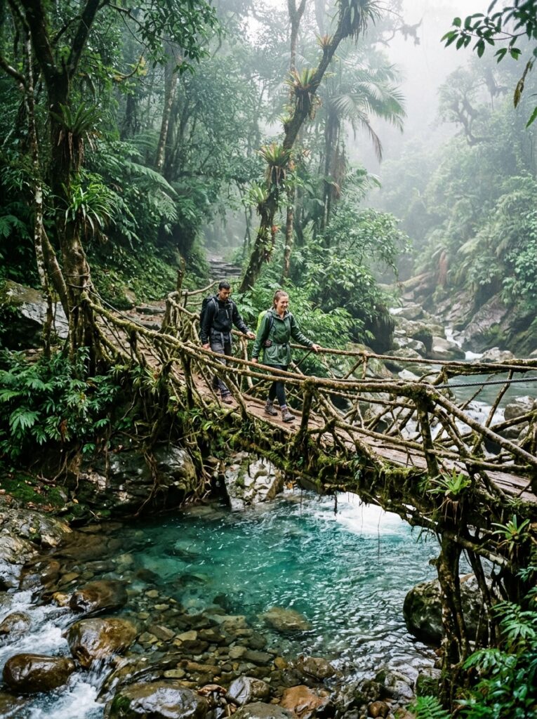
Double decker living root bridges in Cherrapunji Meghalaya
Adventure, Trekking & Road Trips, Family & Leisure, Seasonal & Monsoon Specials

Meghalaya in July: Waterfall Chasing and Living Root Bridges in the Wettest Place on Earth

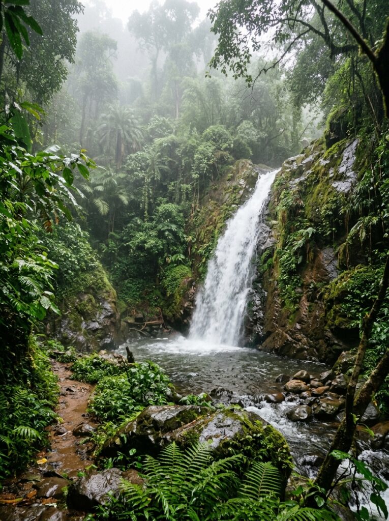
Focus Keyword: Meghalaya in July SEO Title: Meghalaya in July: The Ultimate Monsoon Travel & Waterfall Guide Meta Description: Experience Meghalaya in July. Find the best waterfalls in Cherrapunji and Shillong, living root bridges trek guide, and custom itineraries. Permalink Slug: meghalaya-monsoon-travel-guide — There is rain, and then there is the Meghalayan monsoon. If you have ever wanted to experience the skies opening up in their full, majestic glory, visiting Meghalaya in July is an experience that belongs at the top of your travel bucket list. Known as the “Abode of Clouds,” this northeastern gem transforms into a lush, emerald paradise during the monsoon season. The state’s famous waterfalls, which run thin in the winter, turn into roaring giants that shake the very ground beneath your feet, while the mist dances through the hills of Shillong and Cherrapunji. For the adventurous traveler, July offers a sensory overload of roaring water, deep green valleys, and ethereal cloud cover. However, planning a trip to the wettest place on Earth during the peak of the monsoon requires preparation, local insight, and a well-structured itinerary. This comprehensive guide details everything you need to know about exploring Meghalaya in July, from the top waterfalls to chase, to trekking the legendary living root bridges, and securing a custom Meghalaya tour package with Travel Path Holiday. — Why Visit Meghalaya in July? While many travelers avoid India’s monsoon season, seasoned adventurers know that Meghalaya is meant to be experienced in the rain. Here is why July is the prime month for an offbeat explorer: 1. Waterfalls in Peak Flow: Iconic falls like Nohkalikai, Wei Sawdong, and Seven Sisters run dry or narrow during the winter. In July, they swell to their maximum volume, creating a dramatic display of natural power. 2. The Living Root Bridges are Alive: The secondary roots of *Ficus elastica* trees, woven together by generations of the Khasi tribe, absorb the monsoon moisture, looking incredibly vibrant, wild, and ancient. 3. Fewer Crowds, More Serenity: July is considered the off-season for standard tourists who fear the rain. This means you can experience the canyons of Laitlum and the caves of Sohra without tourist buses blocking your view. 4. The Ethereal Mist: The landscape changes every minute. One second you are looking at a deep gorge; the next, a thick cloud rolls in, enveloping you in a quiet, white shroud. — Key Highlights of a Monsoon Trip to Meghalaya 1. Chase the Roaring Waterfalls of Sohra (Cherrapunji) Cherrapunji, locally known as Sohra, is the epicenter of monsoon travel in Meghalaya. Some of the must-visit waterfalls include: Nohkalikai Falls: India’s tallest plunge waterfall (340 meters) drops dramatically from a forested cliff into a pool that turns a brilliant turquoise-green. In July, the mist often covers the viewpoint, but waiting for 10 minutes usually rewards you with a breathtaking clearance. Wei Sawdong Falls: A three-tiered waterfall accessible via a steep, rustic trek down bamboo ladders. The emerald pools at each level are incredibly photogenic in the monsoon light. Seven Sisters Falls (Nohsngithiang Falls): A massive nine-tiered waterfall that represents the seven states of Northeast India. It flows in full force only during the peak monsoon. 2. Trek to the Double Decker Living Root Bridge in Nongriat Located deep in the valley near Cherrapunji, the Double Decker Living Root Bridge is a testament to Khasi bio-engineering. To reach it, you must hike down approximately 3,500 concrete steps, crossing suspension bridges over rushing turquoise rivers. In July, the rainforest surrounding the path is alive with the sound of cicadas and rushing streams. 3. The Dramatic Laitlum Canyons Laitlum, which translates to “End of Hills,” offers panoramic views of deep gorges and winding rivers. In the monsoon, the clouds rest right in the valley, making you feel as though you are standing on the edge of the world. — Detailed 5-Day Shillong Cherrapunji Itinerary for July This curated Shillong Cherrapunji itinerary is optimized for monsoon travel, balancing outdoor adventures with safe transit options during heavy rainfall. Day Destination Key Highlights & Activities Recommended Duration :— :— :— :— Day 1 Guwahati to Shillong Arrive in Guwahati, drive to Shillong. Stop at the majestic Umiam Lake (Barapani) for a misty lakeside view. Evening walk through Police Bazar. 3 – 4 Hours Drive Day 2 Shillong Sightseeing to Cherrapunji Visit Laitlum Canyons in the morning. Explore Elephant Falls and the Mawphlang Sacred Grove. Drive to Cherrapunji through mist-covered highways. Full Day (8 Hours) Day 3 The Waterfalls of Sohra Chase Nohkalikai, Wei Sawdong, and Seven Sisters Falls. Explore the limestone formations of Mawsmai Cave and the fossil-rich Arwah Cave. Full Day (7 Hours) Day 4 Nongriat Double Decker Bridge Trek Descend the 3,500 steps to the Double Decker Root Bridge. Swim in the natural pools of Rainbow Falls (optional extension). Return to Cherrapunji. 6 – 7 Hours Trek Day 5 Mawlynnong & Dawki to Guwahati Visit Mawlynnong (Asia’s cleanest village) and walk on the Single Root Bridge. Drive to Dawki to view the Indo-Bangladesh border. Drive back to Guwahati for departure. 8 – 9 Hours Drive & Sightseeing — How to Reach Meghalaya in Monsoon By Air: The nearest major airport is Lokpriya Gopinath Bordoloi International Airport in Guwahati (GAU), located about 120 km from Shillong. Shillong also has a domestic airport (Umroi Airport), but flights are highly dependent on clear weather, which is rare in July. We recommend flying into Guwahati. By Rail: Guwahati Railway Station is well-connected to major Indian cities. From the station, you can hire a private tourist cab or choose a customized transport package from Travel Path Holiday. By Road: The road from Guwahati to Shillong (NH 6) is a beautiful four-lane highway. However, the road from Shillong to Cherrapunji can get extremely misty, requiring experienced local drivers who know how to navigate low-visibility conditions. — IMPORTANT: Monsoon Travel and Safety Tips for Meghalaya * Pack Proper Rain Gear: A standard umbrella will not survive the heavy winds of Sohra. Pack a high-quality, windproof raincoat, waterproof covers
Thrilling adventure holiday trekking route mountain view
Adventure, Trekking & Road Trips, Seasonal & Monsoon Specials

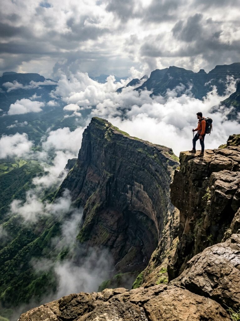
Thrill of the Monsoon: Hiking to the Harishchandragad Konkan Kada in Maharashtra

Focus Keyword: Harishchandragad trek in monsoon SEO Title: Harishchandragad Trek in Monsoon: Climbing the Epic Konkan Kada Cliff Meta Description: Climb Harishchandragad in July to see the famous Konkan Kada cliff covered in mist. Read our trekking guide, safety rules, and group trip details. Permalink Slug: harishchandragad-konkan-kada-trek-july — If there is one trek that captures the wild, untamed spirit of the Western Ghats during the rainy season, it is the Harishchandragad trek in monsoon. Situated in the Ahmednagar district of Maharashtra, this ancient hill fort lies at an altitude of 1,422 meters and dates back to the 6th century Kalachuri dynasty. While the fort has immense historical and archaeological significance, it is the natural geography that draws thousands of adventure seekers here every July. The crown jewel of Harishchandragad is the legendary Konkan Kada (Konkan Cliff)—a massive, semi-circular concave cliff face that drops vertically for over 2,000 feet into the Konkan plains below. In July, this cliff becomes the stage for a spectacular natural phenomenon: powerful wind currents blowing up the valley catch the falling waterfalls and blow them back upwards, creating the famous “reverse waterfalls.” Whether you are a seasoned trekker or an weekend warrior looking to experience the thrill of the Sahyadris, this complete guide covers the routes, sights, safety protocols, and group departures for your monsoon trek. — Why Trek to Harishchandragad in July? Trekking in Maharashtra during the monsoon is a culture of its own, and Harishchandragad is its ultimate shrine. Here is what makes July so special: 1. The Reverse Waterfalls at Konkan Kada: The sheer force of the wind colliding with the vertical cliff face is so intense that water cannot fall; instead, it is vaporized and blown upwards into your face. 2. Kedareshwar Cave’s Mystique: This cave houses a massive Shiva Lingam surrounded by ice-cold, chest-deep water. It is supported by a single remaining pillar (out of the original four). According to local legend, the four pillars represent the four Yugas (eras) of Hindu cosmology, and when the final pillar breaks, the world will end. 3. The Ethereal Brocken Spectre: On rare misty mornings when the sun is low behind you, you can see your own shadow projected onto the mist below, surrounded by a rainbow-like halo. 4. Vibrant Wildflowers: The plateau of the fort comes alive with monsoon flora, painting the rocky terrain in shades of green, yellow, and blue. — Primary Trekking Routes to Harishchandragad Depending on your fitness level and experience, you can choose from three main routes. In the monsoon, choosing the correct path is critical for safety. 1. The Pachnai Route (Easiest & Safest for Monsoon) Starting Point: Pachnai Village (accessible via Akole/Sangamner). Trek Duration: 2 to 3 hours. Difficulty: Easy. Why choose it: This trail is well-defined, has a gradual incline, and involves very little rock climbing. It passes through dense forests, small wooden bridges, and streams, making it the most recommended route for monsoon groups. 2. The Khireshwar Route (Moderate & Highly Scenic) Starting Point: Khireshwar Village (near Malshej Ghat). Trek Duration: 5 to 6 hours. Difficulty: Moderate to Difficult. Why choose it: This route takes you through the beautiful Toll Khind (pass) and features steep rocky patches. While incredibly scenic with panoramic views of the Pimpalgaon Joga Dam, it can become very slippery and challenging during heavy downpours. 3. Nalichi Vaat (Strictly Avoided in Monsoon) Starting Point: Belpada Village. Trek Duration: 8 to 9 hours. Difficulty: Extreme (Rock Climbing). Why choose it: This is a steep gorge climb that requires rope setup. During the monsoon, this gorge becomes a roaring channel for gushing water, making it extremely dangerous and life-threatening. Do not attempt this in July. — Detailed 2-Day Harishchandragad Weekend Trekking Plan This itinerary is designed for weekend travelers starting from Mumbai or Pune, utilizing the safe Pachnai route. Day / Session Trail Section & Activity Experience Highlights Recommended Duration :— :— :— :— Day 1: Morning Travel to Base Village Drive from Mumbai/Pune to Pachnai Village. The route passes through the lush scenic countryside of Bhandardara. 5 – 6 Hours Drive Day 1: Afternoon Ascent from Pachnai Start the trek from Pachnai base. Walk through lush forest trails, crossing seasonal streams. Reach the fort temple complex by late afternoon. 2.5 Hours Trek Day 1: Evening Konkan Kada Sunset / Mist View Walk to the Konkan Kada cliff to experience the heavy winds, reverse waterfalls, and watch the mist roll over the edge. Stay at a local village homestay. 2 Hours Experience Day 2: Early Morning Taramati Peak & Temple Visit Climb to Taramati Peak (highest point) for sunrise (weather permitting). Explore the ancient Harishchandreshwar Temple and the Kedareshwar Cave. 3 Hours Day 2: Morning Descent to Pachnai Trek back down to Pachnai village. Enjoy a hot, traditional Maharashtrian lunch at the base village. 2 Hours Trek Day 2: Afternoon Return Journey Drive back to Mumbai or Pune, stopping for tea at scenic spots. 5 – 6 Hours Drive — What to Pack for a Monsoon Trek Trekking Shoes with Wet-Grip: The rocky patches and clayey soil on the trail become slick. Standard running shoes or flat-soled sneakers will slip easily. Quality Rain Poncho: A poncho is better than a jacket as it covers your backpack as well. Waterproof Backcover & Dry Bags: Essential to keep your spare clothes, wallet, and phones dry. Headlamp/Flashlight: Dense fog can reduce visibility during the day, and it gets pitch black on the fort plateau at night. Change of Clothes: Pack at least two sets of dry clothes wrapped in plastic bags inside your backpack. — WARNING: Monsoon Safety Rules for Harishchandragad * Stay Away from the Edge: The wind speeds at Konkan Kada in July can exceed 70-80 km/h, which is strong enough to throw you off balance. Never stand or sit close to the cliff edge for photos. * Do Not Camp in the Rain: High winds and torrential downpours make pitching tents on the open plateau impossible and unsafe. Always choose to sleep in

Bee Falls waterfall cascade in Pachmarhi Madhya Pradesh
Adventure, Trekking & Road Trips, Family & Leisure, Honeymoon & Romance, Seasonal & Monsoon Specials, Spiritual & Pilgrimage

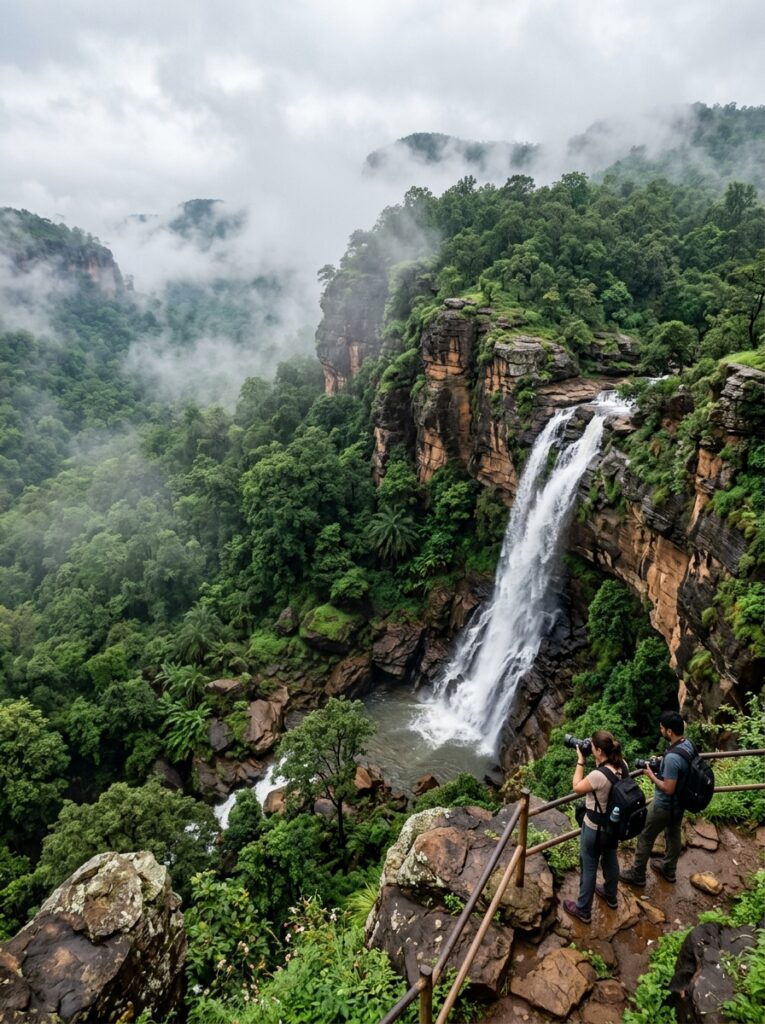
Queen of Satpura: A Complete Monsoon Travel Guide to Pachmarhi

Focus Keyword: Pachmarhi in July SEO Title: Pachmarhi in July: The Complete Monsoon Travel Guide to the Queen of Satpura Meta Description: Discover the beauty of Pachmarhi in July. Get details on caves, waterfalls, viewpoints, and custom Madhya Pradesh tour packages. Permalink Slug: pachmarhi-monsoon-travel-guide — Deep in the heart of Madhya Pradesh, nestled in the rugged Satpura Range, lies Pachmarhi. Widely celebrated as the *Satpura ki Rani* (Queen of Satpura), this is the state’s only hill station and one of its most valuable natural treasures. Standing at an altitude of 1,067 meters, Pachmarhi is a UNESCO Biosphere Reserve, rich in biodiversity, dense sal forests, ancient caves, and archaeological heritage. While Pachmarhi attracts tourists year-round, visiting Pachmarhi in July is a truly elevated experience. As the monsoon rains breathe life into the central Indian forests, the valleys turn a brilliant emerald green, the rocky ravines fill with mist, and the region’s numerous waterfalls—many of which dry up in the summer—roar back to life with incredible force. Whether you are planning a romantic weekend getaway, a family vacation, or a road trip with friends from Indore, Bhopal, or Nagpur, this complete monsoon travel guide will help you plan your journey. Discover the top sights, a detailed itinerary, safety tips, and custom Pachmarhi tour package options with Travel Path Holiday. — Why You Should Visit Pachmarhi in July Pachmarhi offers a unique monsoon experience compared to coastal or Himalayan hill stations. Here is why July is the best time to explore: 1. Spectacular Waterfall Chasing: Waterfalls like Bee Falls, Silver Falls (Rajat Prapat), and Duchess Falls are fed by monsoon rains, making them look majestic and thunderous. 2. Misty Valleys and Ravines: Deep gorges like Handi Khoh and Lanjee Giri fill with shifting clouds, creating a dramatic landscape that changes by the minute. 3. Pristine Forests: The Satpura forests of Sal and Pine look clean, vibrant, and incredibly fresh after the summer dust is washed away. 4. Pleasant Central Indian Climate: Temperatures range from a cool 20°C to a pleasant 26°C, providing a welcome escape from the humid plains. — Must-Visit Attractions in Pachmarhi During Monsoon 1. Bee Falls (Jamuna Prapat) This is Pachmarhi’s most famous waterfall. Tumbling down 35 meters into a rocky pool, the fall creates a fine mist of water droplets that resembles buzzing bees, giving it its name. In July, the waterfall is in full force. There is a well-laid staircase leading down to the pool where visitors can enjoy a refreshing spray. 2. Dhoopgarh (The Highest Point in MP) At 1,350 meters, Dhoopgarh is the highest peak in the Satpura Range and the state of Madhya Pradesh. It is legendary for its sunrise and sunset views. During July, the drive up to Dhoopgarh is enveloped in clouds, and standing at the summit makes you feel like you are floating in the sky. 3. Jata Shankar Cave & Mahadeo Temple These are natural limestone caves dedicated to Lord Shiva. Jata Shankar is situated in a deep ravine where massive rock formations resemble the tangled hair (Jata) of Shiva. A natural stream flows through the cave. The Mahadeo Cave houses a shrine with a natural water pool and stalactite formations. In July, water constantly drips from the cave ceilings, enhancing the spiritual atmosphere. 4. Pandav Caves According to local folklore, these five rock-cut Buddhist caves on a small sandstone hill were used by the Pandavas for shelter during their exile. Today, they are surrounded by beautifully manicured gardens that look exceptionally green and clean in the monsoon rain. 5. Rajat Prapat (Silver Fall) Located close to Apsara Vihar, Rajat Prapat is a single-drop waterfall that plunges 350 feet over a sheer cliff. During the rains, the thin stream of water glistens like a silver thread against the dark, forested rocks, creating a stunning visual contrast. — Detailed 4-Day Pachmarhi Monsoon Itinerary This 4-day itinerary is designed to give you a comprehensive tour of the national park, waterfalls, and historical caves at a relaxed, comfortable pace. Day Destination & Key Activities Highlights Recommended Duration :— :— :— :— Day 1 Arrival & Sunset at Rajendra Giri Arrive in Pachmarhi (via Pipariya railway station or road from Bhopal/Indore). Check into your hotel. Spend the evening walking around the local lake or watching the sunset from Rajendra Giri. 3 Hours (Evening) Day 2 Caves & High Peaks Visit the Pandav Caves in the morning. Head to Jata Shankar Cave and Bade Mahadeo Temple. In the afternoon, take a forest department Gypsy to the Dhoopgarh summit for sunset. Full Day (8 Hours) Day 3 Waterfalls & Ravines Hike down to Bee Falls. Visit Apsara Vihar (Fairy Pool) and view Rajat Prapat (Silver Falls). Visit the spectacular 300-foot deep forest ravine of Handi Khoh. Full Day (7 Hours) Day 4 Duchess Falls Trek & Departure Take a short morning trek to Duchess Falls (for active travelers) or visit Christ Church (British-era architecture). Shop for local honey and herbal medicines. Depart for your return journey. 4 Hours (Before Departure) — How to Reach Pachmarhi By Rail (Most Convenient): Pipariya Railway Station (PPI) is the nearest railhead, located about 54 km away. Pipariya is well-connected to major cities like Mumbai, Delhi, Kolkata, Jabalpur, Indore, and Bhopal. From Pipariya, private cabs take about 1.5 hours to reach Pachmarhi via a winding ghat road. By Road: Pachmarhi is well-connected by road to Bhopal (210 km, 4.5 hours), Indore (340 km, 7 hours), and Nagpur (260 km, 5.5 hours). The roads are in good condition, and the ghat section from Matkuli onwards is exceptionally scenic in July. By Air: The nearest airport is Raja Bhoj Airport in Bhopal (BHO) or Nagpur Airport (NAG). You can hire a private taxi from either airport to reach the hill station. — IMPORTANT: Monsoon Safety & Forest Regulations in Pachmarhi * Forest Department Permits: Since Pachmarhi is a Biosphere Reserve, many sights (like Bee Falls, Dhoopgarh, and Duchess Falls) lie inside the national park area. You must hire registered 4×4 open-top Gypsys and

Snowfall and pine trees landscape in Manali Himachal Pradesh
Adventure, Trekking & Road Trips

Traversing the Manali to Leh Highway in July: Pass Status, Road Conditions & Tips

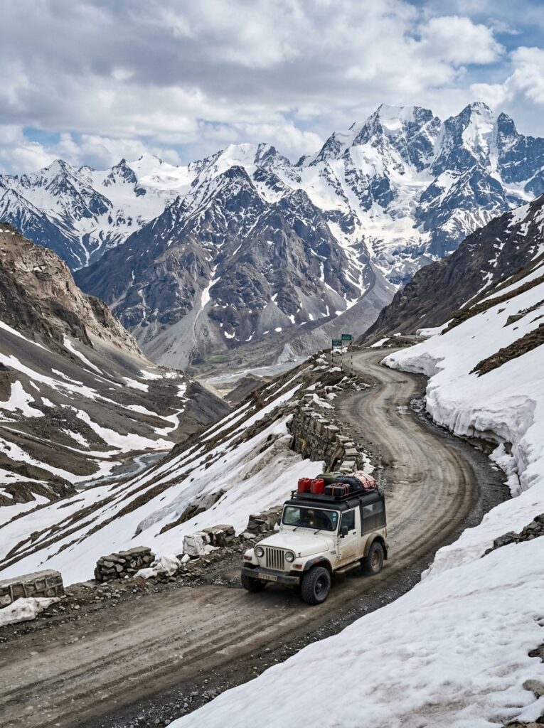
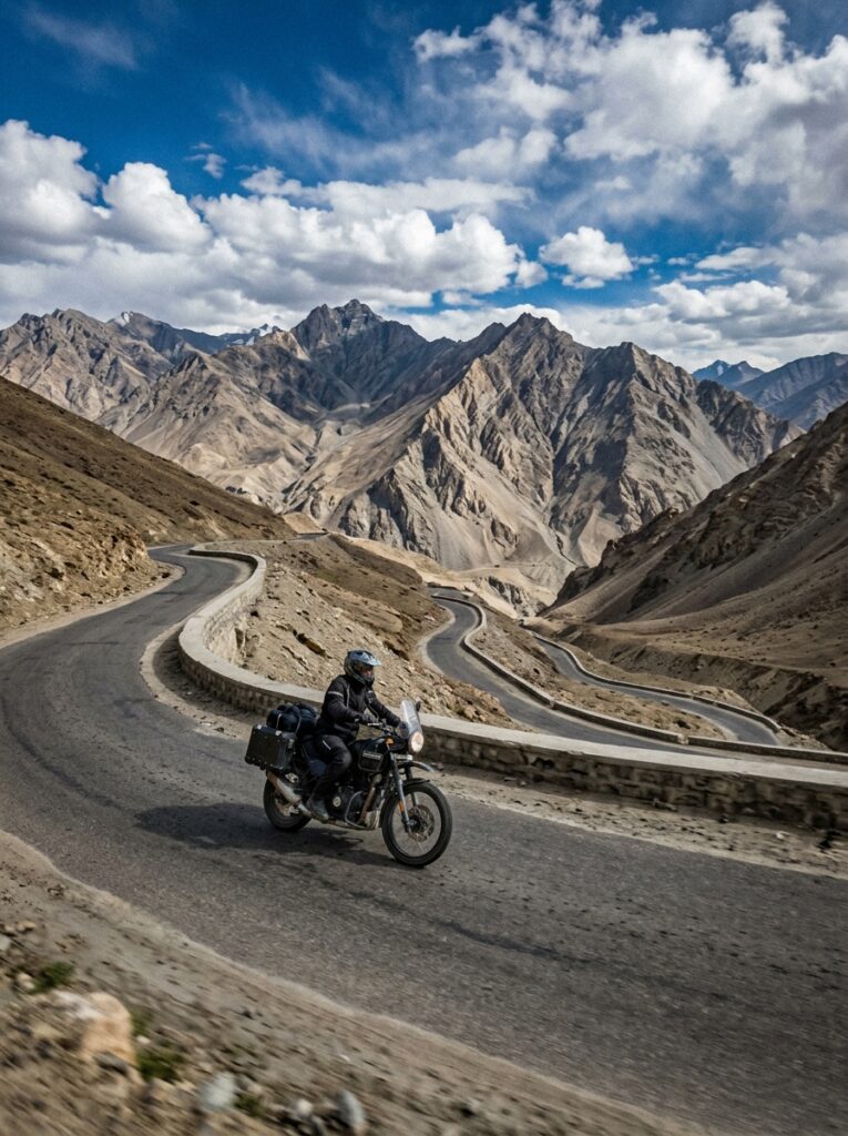
Focus Keyword: Manali to Leh highway status SEO Title: Traversing the Manali to Leh Highway in July: Pass Status, Road Conditions & Tips Meta Description: Planning a road trip from Manali to Leh in July? Get updates on pass status, road conditions, safety tips, and custom Ladakh tours. Permalink Slug: manali-to-leh-highway-july-status — For adventure seekers, road-trippers, and motorcyclists, the Manali to Leh Highway (NH-3) represents the ultimate road trip. Spanning approximately 428 kilometers, this legendary highway cuts through some of the highest mountain passes in the world, traversing rugged terrain, dry cold deserts, and high-altitude plains. July is the peak season to travel the Manali to Leh Highway. By this month, the Border Roads Organisation (BRO) has cleared the winter snow, the highway is fully open, and the cold desert of Ladakh is basking in summer warmth. However, July also coincides with the monsoon season in the lower Himalayas (Himachal Pradesh). This brings unique challenges, such as landslides, mudslides, and roaring water crossings (*nalas*) fed by melting glaciers and rain. If you are planning this epic road trip in July, being prepared is your key to safety and success. In this comprehensive guide, we cover the latest highway status, detailed conditions of the five major passes, altitude sickness prevention tips, a recommended 3-day itinerary, and essential safety guidelines. — Pass-by-Pass Breakdown of the Highway Traveling from Manali to Leh requires crossing five high-altitude passes, each presenting its own set of geographical features and road conditions: 1. Rohtang Pass (Altitude: 3,978 meters / 13,050 feet) Located 51 km from Manali, Rohtang is the gateway to the Lahaul Valley. While the Atal Tunnel (9.02 km long) now bypasses Rohtang, offering a fast and safe route directly to Keylong, many adventure travelers still choose to climb the pass for its views. In July, the pass is lush green, though the road can become muddy and slippery due to monsoon showers. 2. Baralacha La (Altitude: 4,890 meters / 16,043 feet) Baralacha La is a high-altitude pass in the Zanskar range that connects Lahaul to Ladakh. Known for its heavy snowfall, Baralacha La often has towering walls of snow even in July. Due to melting snow, the road around the pass is famous for difficult water crossings, notably Pagal Nala and Bharatpur Nala, which can be challenging to cross in the afternoon. 3. Nakee La (Altitude: 4,739 meters / 15,547 feet) Located in Jammu & Kashmir (Ladakh region), Nakee La is reached after negotiating the famous Gata Loops—a series of 21 hairpin bends that climb 465 meters in a short distance. The road here is generally dry, but the steep climb requires excellent driving skills and vehicle power. 4. Lachung La (Altitude: 5,065 meters / 16,616 feet) Just 25 km after Nakee La, you will cross Lachung La. The terrain here is highly rugged, dry, and wind-swept, characterized by unique rock formations and gorges. The road conditions can be bumpy with loose gravel. 5. Tanglang La (Altitude: 5,328 meters / 17,480 feet) Tanglang La is the second-highest motorable pass on this route (and one of the highest in the world). The climb to the pass is steep, but the road is mostly well-paved. Once you cross Tanglang La, you descend into the scenic Indus Valley, leading directly to Leh. — Road Conditions and Pass Status in July Status: Fully Open. The highway is open to all vehicles, including motorcycles, SUVs, and heavy transport. Lower Section (Manali to Jispa): Mostly smooth tarmac via the Atal Tunnel. However, the section between Manali and the tunnel entrance can experience landslides during heavy rain. Middle Section (Jispa to Sarchu): This is the most challenging section. It includes the climb to Baralacha La. Roads can be broken, muddy, and interrupted by deep water crossings. Upper Section (Sarchu to Leh): The roads are generally in excellent condition, especially the flat stretch of the More Plains (a 40-km straight road at an altitude of 4,800 meters). The final stretch from Tanglang La to Leh is smooth double-lane tarmac. — Detailed Manali to Leh Route Guide and Altitude Tracker Below is a detailed breakdown of the major stops along the highway, their altitudes, and recommended travel actions: Location Altitude (Meters) Distance from Manali Key Feature / Challenge Recommended Action :— :— :— :— :— Manali 2,050 m 0 km Starting point; lush green valleys. Spend 1 day acclimatizing here. Jispa 3,200 m 93 km Beautiful village along the Bhaga River. Ideal Night Stop for acclimatization. Baralacha La 4,890 m 140 km Glacial pass; heavy water crossings. Cross before 11:00 AM to avoid high water levels. Sarchu 4,290 m 177 km Cold, wind-swept campsite border. Avoid staying here if you feel symptoms of AMS. Gata Loops 4,190 m 200 km 21 hairpin bends; steep ascent. Drive in low gear; do not cut corners. Lachung La 5,065 m 224 km Rugged mountain terrain. Do not stop for long due to thin air. Pang 4,600 m 242 km High-altitude army transit camp. Good spot for a quick lunch and hot tea. More Plains 4,800 m 250 km 40 km of flat, straight plateau. Enjoy the smooth road, but watch for sudden dips. Tanglang La 5,328 m 365 km Extremely high altitude; cold winds. Limit your stop to 10-15 minutes for photos. Leh 3,500 m 428 km Capital of Ladakh; Indus Valley. Rest at your hotel for the evening. — Understanding and Preventing Altitude Sickness (AMS) Acute Mountain Sickness (AMS) is a very real danger on this route, as you ascend from 2,050 meters (Manali) to over 5,000 meters (Tanglang La) in a single day. Symptoms of AMS: Throbbing headache, nausea, dizziness, fatigue, shortness of breath, and loss of appetite. The Golden Rule of Acclimatization: Do not sleep at Sarchu on your first night. Sarchu sits at 4,290 meters, and its extreme cold and low oxygen levels make it a common spot for severe AMS. Instead, break your journey and sleep at Jispa (3,200 meters) or Keylong (3,080 meters). Stay Hydrated: Drink 4-5 liters of water

Thrilling adventure holiday trekking route mountain view
Adventure, Trekking & Road Trips, Seasonal & Monsoon Specials

Kheerganga Monsoon Trek Guide: Hot Springs, Pine Forests & Camping Tips

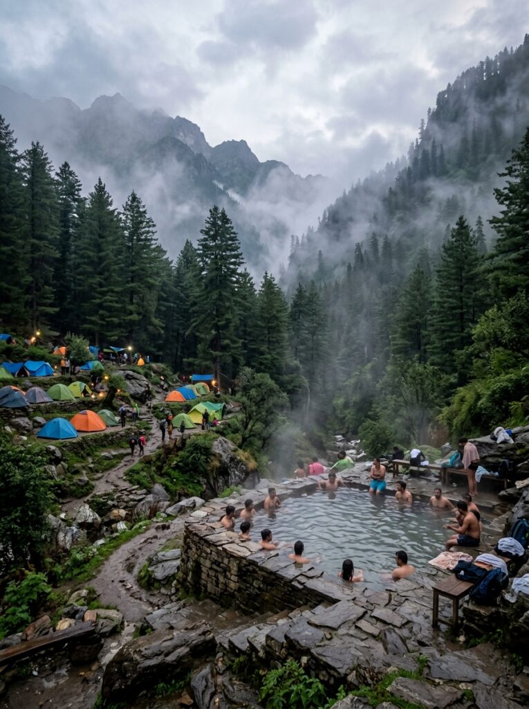
Focus Keyword: Kheerganga trek in July SEO Title: Kheerganga Monsoon Trek Guide: Hot Springs, Pine Forests & Camping Tips Meta Description: The complete Kheerganga trek guide for July. Find details on hot springs, Kasol camping, weather safety, and group packages. Permalink Slug: kheerganga-monsoon-trek-guide — Nestled deep in the mystical Parvati Valley of Himachal Pradesh, Kheerganga is one of India’s most popular trekking destinations. Siting at an altitude of approximately 2,960 meters (9,711 feet), Kheerganga is legendary for its panoramic views of snow-capped peaks, dense pine forests, cascading waterfalls, and—most famously—its natural hot water springs. While winter and spring offer snow and clear skies, visiting Kheerganga in July is a completely different adventure. As the monsoon rain hits the Parvati Valley, the entire trail undergoes a dramatic transformation. The pine forests turn a brilliant green, the air is clean and crisp, and the Parvati River roars with immense power. However, trekking in the Himalayas during the monsoon requires careful planning, proper gear, and safety precautions. In this complete guide, we cover everything you need to know about the Kheerganga trek in July, including trail descriptions, the magic of the hot springs, camping tips, a 2-day itinerary, and vital monsoon safety advisory. — Why Trek to Kheerganga in July? Trekking during the monsoon has its own rewards and challenges. Here is what makes July a unique time to experience Kheerganga: Vibrant Parvati Valley Landscape: The valley is at its most beautiful. Wildflowers bloom along the paths, moss covers the rocks, and the surrounding mountains are draped in thick green vegetation. Roaring Waterfalls: The trail features multiple seasonal waterfalls, such as the famous Rudranag waterfall, which are dry or thin in other months but flow with spectacular volume in July. The Healing Hot Springs (Parvati Kund): There is no feeling quite like soaking in a natural, steaming hot water spring while cold rain falls around you. The water is rich in sulfur and is believed to have therapeutic properties that soothe sore muscles after the long hike. A Quieter Trail: July is a shoulder season due to the rain. This means fewer crowds, quieter trails, and peaceful camping meadows at the top compared to the crowded summer months. — Detailed Trail Overview: Barshaini to Kheerganga The trek starts from Barshaini, a small village situated about 20 km (1-hour drive) from Kasol. From Barshaini, the trek is approximately 12 kilometers long, taking between 5 and 6 hours to complete depending on your fitness level. There are two primary routes to reach Kheerganga from Barshaini: Route 1: Via Nakthan Village (The Most Popular Route) This is the most common and well-marked trail. It runs along the left bank of the Parvati River. Features: It passes through the scenic Nakthan village, where you can see traditional wooden Himachali houses and stop at local cafes for hot tea and noodles. It also takes you past the sacred Rudranag Temple and its snake-like waterfall. Verdict for July: Recommended. The path is open and gets plenty of light, making it easier to navigate, though some rocky sections can become muddy. Route 2: Via Kalga Village (The Forest Trail) This trail goes through the quiet village of Kalga and winds through dense forests of pine and oak. Features: The trail is highly shaded and offers a peaceful, secluded hike with stunning forest views. Verdict for July: Beautiful but challenging. Because the path is covered by dense tree canopy, the soil stays wet and can become extremely muddy and slippery during the July rains. It is recommended only for experienced trekkers with high-grip boots. — Detailed 2-Day Kasol & Kheerganga Itinerary Here is a recommended 2-Day itinerary that starts and ends in Kasol, ensuring you have enough time to enjoy the trek and the hot springs: Day & Phase Activity Details Trekking Distance / Time Highlights :— :— :— :— Day 1: Morning Drive from Kasol to Barshaini 20 km drive (approx. 1 hour) Crossing the scenic Manikaran village. Day 1: Mid-Day Start trek from Barshaini via Nakthan 12 km hike (5 – 6 hours) Hiking past Tosh Dam, Nakthan village, and Rudranag waterfall. Day 1: Late Afternoon Arrive at Kheerganga & Dip in Hot Springs N/A Soaking in Parvati Kund to relieve hiking fatigue. Day 1: Night Camping & Dinner on the Meadow N/A Cozy dinner in a common cafe tent, followed by camping under the stars/clouds. Day 2: Early Morning Sunrise & Breakfast at Kheerganga N/A Breathtaking morning views of the mist rising from the valley. Day 2: Morning Descend back to Barshaini 12 km hike (4 – 5 hours) Descending via the forest route (if dry) or Nakthan. Day 2: Afternoon Return to Kasol & Departure 20 km drive (approx. 1 hour) Shopping in Kasol market or proceeding to Manali/Delhi. — Essential Packing List for a Monsoon Trek Proper packing is critical for a safe monsoon trek. Cotton clothes and normal sneakers will not cut it in July. Make sure you pack: Rain Protection: A high-quality rain poncho or a heavy-duty raincoat. Rain covers for your backpack are also essential. Trekking Shoes with Good Grip: Footwear is your most important gear. You need sturdy trekking shoes with deep lug soles to handle mud and wet rocks. Quick-Dry Clothing: Pack polyester t-shirts and nylon trekking pants. Avoid jeans or heavy cotton track pants as they absorb water and take days to dry. Extra Socks: Carry 3-4 pairs of dry, woolen, or sports socks kept in waterproof Ziploc bags. Headlamp or Flashlight: Essential for moving around the campsite at night, as there is no electricity at Kheerganga. Power Bank: Cold weather and lack of signal drain phone batteries quickly. Bring a high-capacity power bank. Personal Hygiene & Swimwear: Carry a lightweight towel and appropriate clothing/swimwear for the hot springs. — Camping at the Top of Kheerganga At the summit, Kheerganga opens up into a large, sloping green meadow surrounded by towering mountains. Accommodation: You will stay in structured campsites featuring dome tents or larger alpine tents equipped with sleeping

Adventure, Trekking & Road Trips, Family & Leisure, Honeymoon & Romance, Seasonal & Monsoon Specials

Wildlife Travel in July: Best National Parks in India with Active Buffer Zones

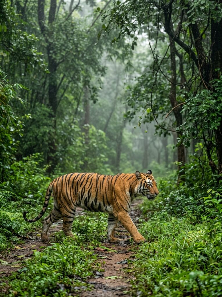
For most wildlife enthusiasts in India, the onset of the monsoon in July marks the end of safari season. A common belief prevails that all national parks lock their gates from July to October. While it is true that the core zones of major tiger reserves close to protect breeding animals and safeguard tourists from washed-out forest roads, the adventure doesn’t stop here. In recent years, the opening of active buffer zones has revolutionized monsoon wildlife travel. These peripheral forests remain open year-round, offering an entirely different, incredibly lush perspective of India’s wilderness. In July, the parched brown deciduous forests transform into a vibrant, emerald-green paradise. The dust settles, the air is clean, water bodies overflow, and the forest comes alive with the calls of frogs, insects, and birds. If you are a nature photographer, a bird-watching enthusiast, or someone who simply wants to experience the raw beauty of Indian jungles without the tourist crowds, planning a wildlife safari in monsoon is one of the best travel decisions you can make. In this comprehensive guide, we explore the best national parks in India that keep their buffer zones active in July, what wildlife you can spot, and how to plan your monsoon safari package with Travel Path holiday. — Why Monsoon Wildlife Travel is a Hidden Gem Before diving into the specific parks, let’s bust some myths and highlight why visiting the jungle under July showers is a magical experience: Stunning Green Landscapes: The dry, dusty forests turn into dense, misty green jungles. The contrast of the orange tiger or golden leopard skin against the lush emerald foliage makes for jaw-dropping photography. Fewer Crowds, More Peace: The massive rush of summer tourists disappears. You won’t find 20 gypsies crowding around a single animal. You can hear the rustle of leaves, the call of the hornbills, and the roar of the wind in absolute peace. Active Herbivores and Birds: Monsoon is the mating season for many deer species, peacock dances are common, and tree frogs, snakes, and monsoon-migratory birds are highly active. Lower Tariffs: Luxury wildlife resorts offer massive off-season discounts in July. You can experience premium hospitality at a fraction of the winter cost. The Unique Behavior of Animals: Tigers and leopards don’t disappear in the rain. In fact, many big cats prefer walking on dry safari tracks rather than wet, dripping grass, making them surprisingly visible on forest roads. — What are Core vs. Buffer Zones? Understanding the zoning system is essential when planning a monsoon safari: 1. Core Zone: The central forest area where human activity is strictly restricted. These zones close down from July 1st to October 15th due to safety hazards, river overflows, and the breeding season. 2. Buffer Zone: The area surrounding the core zone that acts as a transition space between the wild habitat and human settlements. Buffer zones host rich wildlife populations—tigers do not understand administrative borders and roam freely between core and buffer areas. These zones remain open throughout the monsoon. — Summary: Indian National Parks Open in July National Park Location Active Monsoon Zones Major Wildlife Sightings Target Buffer Gates Tadoba Andhari Maharashtra Junona, Adegaon, Devada, Agarzari Tiger, Leopard, Sloth Bear, Wild Dogs Devada, Madnapur, Junona Jim Corbett Uttarakhand Dhela, Jhirna, Kotiraw (Garjia) Asian Elephant, Tiger, Deer, Reptiles Dhela Gate, Jhirna Gate Kabini / Nagarhole Karnataka Kabini Forest (Boat & Jeep Safaris) Black Panther, Leopard, Elephant, Tiger Kabini Safari Lodge Bandhavgarh Madhya Pradesh Dhamokhar, Panpatha, Johila Tiger, Leopard, Spotted Deer, Nilgai Dhamokhar, Johila Kanha Madhya Pradesh Khapa, Phen Tiger, Barasingha, Gaur, Sloth Bear Khapa Ranthambore Rajasthan Zones 6 to 10 (Buffer Gates) Tiger, Striped Hyena, Jackal, Crocodile Kundal, Chikhli — Top 6 National Parks in India with Active Buffer Safaris in July 1. Tadoba Andhari Tiger Reserve (Maharashtra) Tadoba is legendary for its tiger sightings, and the monsoon does not slow this reserve down. While the core zones are closed, Tadoba boasts excellent buffer zones that are widely considered just as productive as the core. Active Buffer Zones: Devada-Adegaon, Madnapur, Junona, and Agarzari. Why July is Special: The lakes (like Lake Tadoba and Erai Lake) are full of water. Safaris are conducted on gravel roads that do not wash away easily. Tiger sightings are consistently reported in the buffer areas as they search for dry patches on safari tracks. Other Attractions: Great bird-watching and spotting of Sloth Bears digging for termites. 2. Kabini – Nagarhole National Park (Karnataka) Kabini is perhaps the most famous monsoon wildlife destination in India. Because it is located in the Western Ghats region, it receives heavy rains, transforming the landscape into a misty fantasy. The Safaris: Unlike Central Indian parks, Kabini continues both jeep and boat safaris in July (subject to weather). The Highlight: A boat safari on the Kabini River in the monsoon rain is unforgettable. You can see herds of Asian elephants grazing along the banks, herds of Gaurs (Indian Bison), and crocodiles. The Black Panther: Kabini is home to the famous melanistic leopard “Saya.” The rainy season brings an ethereal light to the forest, making any sighting feel legendary. 3. Jim Corbett National Park (Uttarakhand) As India’s oldest national park, Jim Corbett is famous for its dense sal forests and the Ramganga River. Active Monsoon Zones: The Dhela and Jhirna eco-tourism zones remain open throughout the year. The Garjia (Kotiraw) zone is also partially open. The Experience: Corbett in the rains is a dream for landscape lovers. Clouds hang low over the Shivalik hills, and the forest is washed clean. It is one of the best times to see wild elephants bathing in forest streams. Caution: Ramganga and Kosi rivers can swell rapidly, so crossing riverbeds during heavy downpours requires expert drivers. 4. Bandhavgarh National Park (Madhya Pradesh) Known for having the highest density of Royal Bengal Tigers in India, Bandhavgarh maintains a vibrant safari network even in the monsoon. Active Buffer Zones: Dhamokhar, Panpatha, and Johila. The Experience: Dhamokhar buffer shares its boundary with the premium Tala zone, and tigers frequently

Thrilling adventure holiday trekking route mountain view
Adventure, Trekking & Road Trips, Seasonal & Monsoon Specials

Exploring the Unexplored Zanskar Valley: Peak Adventure Guide for July

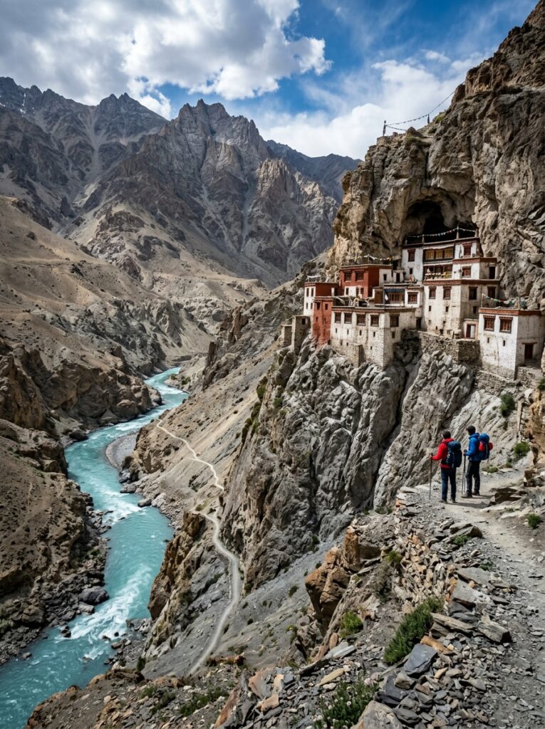
For the modern traveler seeking raw, untouched landscapes, massive glaciers, and ancient Buddhist cultures untouched by commercialization, there is no place on Earth quite like the Zanskar Valley. Situated in the remote corner of the Ladakh union territory, Zanskar is a high-altitude semi-desert valley surrounded by the towering snow-clad peaks of the Great Himalayas. For most of the year, Zanskar is completely cut off from the outside world. Heavy snowfall seals the high mountain passes, leaving the frozen Zanskar River (famous for the winter *Chadar Trek*) as the only connection. However, come July, the snow melts, the passes open, and the valley reveals its majestic summer beauty. If you are planning to visit Zanskar Valley in July, you are choosing the absolute peak season for exploration. The roads are clear, the mountain streams flow in torrents, and the weather is sunny and dry. What makes Zanskar an even better option in July is its geography: because it lies in a rain shadow zone behind the Great Himalayan wall, it escapes the heavy monsoon rains that wash out the rest of India. While the plains are flooded and the foothills suffer from landslides, Zanskar offers clear blue skies and crisp mountain air. In this ultimate guide, we dive into the routes, top attractions like the legendary Phugtal Cave Monastery, a custom itinerary, safety tips, and how you can book your adventure package with Travel Path holiday. — Zanskar Valley 6-Day Adventure Itinerary Day Travel From – To Major Highlights Overnight Stay Day 1 Leh or Kargil to Padum Drive via Pensi La Pass, View of Drang-Drung Glacier Padum (Guesthouse / Homestay) Day 2 Padum Local Sightseeing Karsha Monastery, Sani Lake, Stongdey Monastery Padum (Guesthouse) Day 3 Padum to Phugtal (Trek) Drive to Cha Village, Trek to Phugtal Monastery Phugtal Monastery Guest House Day 4 Phugtal to Padum Morning prayers at Phugtal, Trek back to Cha, Drive to Padum Padum (Guesthouse) Day 5 Padum to Manali Drive across the Shinku La Pass (5,091m), enter Lahaul Valley Manali (Luxury Cottage) Day 6 Departure Fly back from Bhuntar Airport or drive to Chandigarh – — How to Reach Zanskar: The Two Spectacular Highways Historically, reaching Zanskar was a grueling multi-day trek. Today, two spectacular, high-altitude road routes connect Zanskar’s administrative capital, Padum, to the rest of the world. Route 1: The Classic Route via Kargil & Pensi La The Path: Leh/Srinagar → Kargil → Sankoo → Rangdum → Pensi La → Padum (approx. 240 km from Kargil). The Highlights: This route takes you through the beautiful Suru Valley, offering views of the twin mountain peaks Nun and Kun (over 7,000 meters). The crown jewel of this route is the Pensi La Pass (4,400 meters), which offers a jaw-dropping view of the Drang-Drung Glacier—a massive winding river of ice that looks like a giant sleeping white dragon. Route 2: The New Highway via Manali & Shinku La The Path: Manali → Atal Tunnel → Keylong → Darcha → Shinku La Pass → Padum (approx. 270 km). The Highlights: This newly completed road is an engineering marvel and a game-changer for adventure seekers. It connects Lahaul Valley directly to Zanskar. Crossing the Shinku La Pass at a dizzying altitude of 5,091 meters, you will witness walls of snow, high-altitude mountain lakes, and the towering Gumbok Rangan—a massive, isolated monolith rock sacred to the locals. — Top Monastic Wonders of Zanskar Valley 1. Phugtal Monastery (The Cave Monastery) Phugtal (or Phuktal) is arguably the most isolated monastery in the world. Built in the 12th century, it is constructed entirely around a natural cave entrance on the face of a sheer mud cliff overlooking the roaring Tsarap River. The Adventure: Phugtal cannot be reached by vehicles. You must drive to the road head at Cha or Anmu village and trek for about 2 to 3 hours along a narrow mountain ledge trail. The Experience: The sight of the mud and timber cells hanging off the cliff face is spellbinding. The monastery houses around 70 monks and features ancient wall paintings and a sacred natural spring inside the cave. 2. Karsha Monastery (Karsha Chamspaling) Located on a hill overlooking the Padum Valley, Karsha is the largest monastery in Zanskar, belonging to the Gelugpa (Yellow Hat) sect. The View: Built like a white fortress cascading down the mountainside, it offers a stunning panoramic view of the central Zanskar valley and the river flats below. 3. Sani Monastery & Lake Located close to Padum, Sani is one of the oldest monasteries in Ladakh, built during the Kushan empire. It is unique because it is built on flat ground rather than a hilltop and features the Kanika Stupa, believed to have been built by Emperor Kanishka. Next to the monastery is a sacred lake covered in wildflowers. — IMPORTANT: Altitude Acclimatization (AMS) Warning: Padum is located at 3,600 meters (11,800 feet), and the passes you cross (Pensi La and Shinku La) are much higher. Altitude sickness is a very real risk. * Do Not Rush: Spend at least two days in Leh or Kargil before heading into Zanskar. * Hydration: Drink at least 4-5 liters of water daily. Avoid alcohol and heavy exercise on your arrival days. * Emergency Medication: Consult a doctor before your trip and carry Diamox. Always check that your vehicle has a portable oxygen cylinder. NOTE: Local Culture and Etiquette: Zanskar follows a deeply traditional Tibetan Buddhist culture. * Always walk clockwise around Buddhist stupas, mani walls, and prayer wheels. * Dress modestly when entering monasteries (shoulders and knees covered). Remove your shoes where indicated. * Homestays are the primary form of lodging outside Padum. Respect your local hosts, who offer warm hospitality, traditional meals like *thukpa* and *butter tea*, and clean, simple rooms. — Plan Your Zanskar Expedition with Travel Path holiday Zanskar Valley is not a destination for the unprepared. The roads are rugged, water crossings are common, mobile network is limited, and medical facilities are basic. To experience this raw wilderness safely, you need

Adventure, Trekking & Road Trips, Honeymoon & Romance, Seasonal & Monsoon Specials

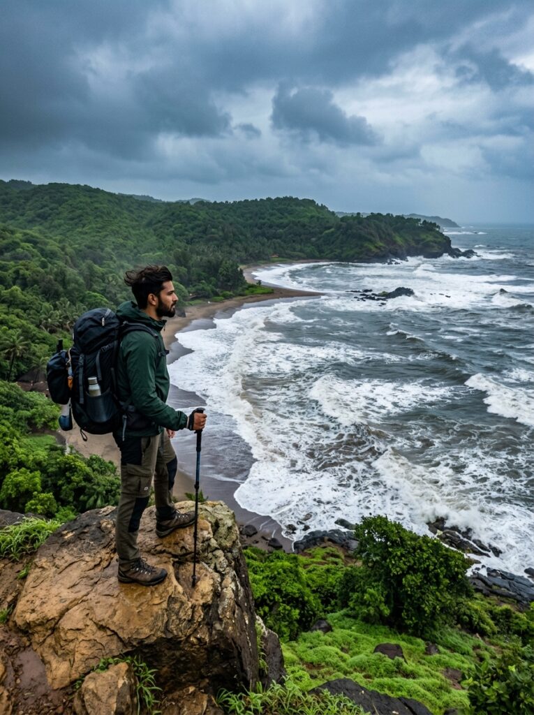
Gokarna in July: Backpacking through Half-Moon and Om Beach in the Rains

For beach lovers who prefer peace over parties, and rugged nature over manicured resorts, Gokarna is the ultimate sanctuary. Located on the coast of Karnataka, this town is famous for two things: being a sacred pilgrimage site dedicated to Lord Shiva, and hosting some of the most beautiful, undeveloped beaches in India. While Goa attracts party crowds, Gokarna has always retained its laid-back, bohemian, and spiritual charm. If you choose to visit Gokarna in July, you will experience this coastal haven in its most raw, dramatic state. The southwest monsoon is in full swing, bringing heavy rain showers that wash the red clay roads, fill the coconut groves with life, and turn the hills of the Western Ghats into a brilliant neon green. The ocean waves crash against the cliffs with thunderous power, and the beaches—otherwise busy in winter—become completely empty. For budget travelers and backpackers, July is a golden window. Accommodation rates plummet, hostel culture is cozy and intimate, and the landscape is spectacular. In this comprehensive guide, we cover the legendary Gokarna beach trek, offbeat day-trips, budgeting tips, safety guidelines, and how you can book your custom coastal getaway with Travel Path holiday. — Gokarna Monsoon Backpacking Highlights Beach / Attraction Key Monsoon Feature Access Method in July Vibe / Experience Kudle Beach Wide sandy shore, dramatic waves Walk / Auto from town Quiet, moody, great for sunset walks Om Beach Shape of ‘Om’ symbol, rocky outcrops Scooter / Cab Cafe chilling, watching the waves Half-Moon Beach Secluded crescent cove Trekking only (Boats suspended) Wild, deserted, surrounded by jungle Paradise Beach Rocky beach with ruins Trekking only (Boats suspended) Ultimate isolation, rugged beauty Mirjan Fort Covered in green moss, historic ruins 20 km drive by scooter/cab Feels like a medieval European castle Yana Caves Black karst monoliths in rainforest 50 km drive + 1.5 km hike Mystic, ancient, Jurassic-Park feel — The Famous Gokarna Beach Trek in the Rain The signature experience in Gokarna is the cliff-side beach trek. It is a trail that connects Gokarna’s five primary beaches: Kudle Beach, Om Beach, Half-Moon Beach, Paradise Beach, and Belekan Beach. The Route: The trail climbs up rocky cliffs from one beach, winds through forests and scrublands, and descends onto the next beach. The Monsoon Advantage: In July, the local boat services that carry tourists between beaches are completely shut down due to high tides. This means the *only* way to reach Half-Moon and Paradise beaches is by trekking. You will have these pristine coves entirely to yourself. Kudle to Om Beach: The trek starts from Kudle, climbing a rocky plateau that offers a breathtaking view of the sea. As you descend to Om Beach, you can stop at one of the few open cafes for a hot coffee while watching the rain lash the ocean. Om Beach to Half-Moon and Paradise: This section is wilder, passing through dense green foliage and climbing over rocky bluffs. Standing on a cliff edge in July, feeling the monsoon wind and rain on your face while watching the dark blue ocean below, is an exhilarating experience. — Exploring Gokarna’s Spiritual Heart Gokarna means “Cow’s Ear,” referring to the shape of the confluence of two rivers or the legend of Lord Shiva emerging from a cow’s ear. Mahabaleshwar Temple: This ancient temple houses the *Atmalinga* of Lord Shiva. In July, which falls during the holy month of Sawan, the temple has an intense spiritual energy. Devotees bathe in the nearby sea (or sprinkle water for safety) and queue up in the rain to offer prayers. The stone corridors of the temple, polished by centuries of footsteps, feel cool and mystical under the grey sky. — Offbeat Monsoon Day-Trips Near Gokarna If you have a scooter or a private taxi, use the rainy afternoons to explore the surrounding Uttara Kannada district, which boasts some of the finest monsoon sights in South India: 1. Mirjan Fort (22 km) Located on the banks of the Aghanashini River, this 16th-century fort was ruled by Chennaiya Bhairadevi, the “Pepper Queen” of Karnataka. In July, the entire lateral structure, bastions, and steps are covered in a thick layer of green moss and grass. It looks incredibly picturesque and is a dream for photographers. 2. Yana Caves & Vibhuti Falls (50 km) Tucked deep inside the rainforests of the Western Ghats: Yana Caves: Two massive black crystalline karst rock monoliths (standing 120m and 90m tall) rise dramatically out of the green canopy. A wet, misty walk through the forest leads you to the cave passage beneath the rocks, which houses a self-manifested Shiva Linga. Vibhuti Falls: A short distance from Yana, this multi-tiered jungle waterfall is surrounded by bamboo groves. In July, the waterfall is in its full, roaring glory. — CAUTION: High Tide and Swimming Warning: The Arabian Sea during the southwest monsoon is extremely dangerous. The currents are powerful, and rip tides are common. * Do Not Swim: Swimming is strictly prohibited on all Gokarna beaches in July. Do not enter the water beyond your ankles. * Slippery Trails: The clay paths and laterite rocks along the beach trek can be very slippery when wet. Wear sturdy trekking shoes with good grip. Avoid trekking after dark. NOTE: Backpacker Budget Tips for July: * Hostel Stays: While beach shacks are closed, boutique backpacker hostels located on the cliffs (like Zostel or Hosteller) remain open. They offer clean dorm beds and private rooms at very low rates, along with common areas where you can meet fellow travelers. * Transport: Rent a geared scooter or a moped in Gokarna town for around ₹350–₹500 per day. It is the cheapest and most convenient way to explore. Ensure you carry your helmet and driver’s license. — Plan Your Backpacking Getaway with Travel Path holiday A monsoon backpacking trip requires reliable local information—which trails are safe, which hostels are operating, and which waterfalls are accessible. At Travel Path holiday, we offer curated budget and semi-luxury packages to Gokarna, handling the details so you

Adventure, Trekking & Road Trips, Family & Leisure, Honeymoon & Romance, Seasonal & Monsoon Specials

Why Goa in July is a Budget Traveler’s Paradise: Off-Season Deals & Hidden Waterfalls

When most people think of Goa, they picture crowded beaches, sunbathing, loud beach shacks, and vibrant winter nightlife. But if you visit Goa in July, you will experience an entirely different world. The party crowd disappears, the sunbeds are packed away, and the entire state is draped in a beautiful, green tropical canopy. July is the heart of the monsoon in Goa, and it is a budget traveler’s paradise. With luxury hotels slash their prices by up to 60%, empty beaches that feel like private sanctuaries, and the Western Ghats coming alive with rushing waterfalls, Goa in monsoon is an experience you do not want to miss. In this guide, we will share why Goa in July should be your next travel destination, the best waterfalls to explore, budget hacks, and how to get the best out of a Goa monsoon package. — Peak Season vs. Monsoon Season in Goa: A Comparison Is a monsoon trip to Goa right for you? Let’s look at how the seasons compare: Feature Peak Season (Nov – Feb) Monsoon Season (June – Sept) :— :— :— Hotel Prices Very High (Double or triple rates) Extremely Low (50% to 70% discounts) Beach Atmosphere Crowded, loud, commercialized Quiet, serene, clean, uncrowded Water Sports Fully Operational Suspended due to rough sea conditions Ocean Swimming Safe and popular Strictly prohibited due to strong currents Natural Beauty Dry, dusty palms Lush green forests, active waterfalls Sightseeing Hot and sunny Cool, refreshing, light rain showers — Breathtaking Monsoon Waterfalls in Goa While the beaches take a backseat in July, Goa’s rivers and waterfalls steal the spotlight. Here are the top waterfalls to explore during your July visit: 1. Dudhsagar Waterfalls Dudhsagar (literally meaning “Sea of Milk”) is one of India’s tallest waterfalls, cascading down a height of 310 meters. Located on the Mandovi River inside the Bhagwan Mahavir Wildlife Sanctuary, this four-tiered waterfall looks spectacular when the train passes over the bridge right in front of the falls. Monsoon Access: The standard jeep safari trails are closed during heavy rains. However, you can take a scenic train ride to Castle Rock or Kulem and trek along the tracks, or view it from a distance via organized monsoon treks. 2. Tambdi Surla Waterfall Deep inside the Bhagwan Mahavir Wildlife Sanctuary lies the Tambdi Surla waterfall. Reaching this waterfall requires a trek through dense, green rainforests, crossing small streams along the way. The Temple: The base of the trek features the famous Tambdi Surla Temple, a 12th-century stone temple dedicated to Lord Shiva. It is the only surviving structure of the Kadamba dynasty in Goa. 3. Harvalem Waterfalls Located in North Goa near Sanquelim, Harvalem is a beautiful, easily accessible waterfall that drops from a height of 50 meters into a large pool. Side Trips: Combine your visit with a trip to the historic Aravalem Caves (carved by Buddhist monks in the 6th century) and the Rudreshwar Temple, which are located nearby. 4. Netravali & Savri Waterfalls Located in Sanguem (South Goa), the Netravali Wildlife Sanctuary is home to several hidden waterfalls. The Savri waterfall is a double-step waterfall surrounded by dense foliage. Attraction: Visit the nearby *Tanshikar Spice Farm* for a traditional Goan buffet lunch and check out the *Bubbling Lake* (Netravali Bubble Pond), where natural gas bubbles rise to the surface when you clap. — 4-Day Goa Monsoon Itinerary Here is a balanced 4-day itinerary designed to show you the best of Goa’s beaches, culture, and waterfalls in July. “`mermaid graph TD A[Day 1: Heritage & Old Goa] –> B[Day 2: Waterfalls & Spice Farms] B –> C[Day 3: Forts & South Goa Beaches] C –> D[Day 4: Panaji Cafes & Departure] “` Day 1: Portuguese Heritage & Historic Churches Arrive at Manohar International Airport (Mopa) or Dabolim Airport. Rent a car or scooter right at the airport and head to your resort. Afternoon: Visit Fontainhas, the Latin Quarter of Panaji. Walk past brightly colored Portuguese-style houses with tiled roofs, wooden balconies, and narrow streets that look like a European town in the rain. Old Goa: Visit the UNESCO World Heritage site of the Basilica of Bom Jesus (where the mortal remains of St. Francis Xavier are kept) and the towering Se Cathedral. Evening: Enjoy a relaxing dinner at a cozy indoor cafe in Panaji, tasting traditional Goan fish curry and *poee* (local bread). Day 2: Waterfall Trek & Traditional Spice Plantation Dedicate today to exploring the lush green interior of Goa. Morning: Take an organized trek to Tambdi Surla Waterfall. Walk under the canopy of giant trees, listen to the calls of forest birds, and admire the ancient stone temple. Lunch: Visit a nearby spice plantation. Take a guided walk to learn how black pepper, cardamom, vanilla, and nutmeg are grown. Enjoy a buffet lunch served on banana leaves, accompanied by fresh *Feni* (Goa’s local cashew/coconut liquor). Overnight Stay: Beach resort in Candolim or Benaulim. Day 3: Cliffside Forts & Empty South Goa Beaches The monsoon is the perfect time to explore Goa’s ancient forts, which offer panoramic views of the roaring ocean. Cabo de Rama Fort: Located in South Goa, this fort is built on a high cliff overlooking the sea. In July, the cliffs are covered in bright green grass, contrasting with the dark blue waves crashing below. Agonda & Palolem Beach: Head to the quiet beaches of South Goa. While you cannot swim, walking along the wide, empty shores of Palolem or Agonda with a light sea breeze and drizzle is incredibly relaxing. Overnight Stay: Resort in South Goa. Day 4: Cafe Hopping & Departure Spend your last morning shopping for local goods and enjoying Goa’s modern culinary scene. Shopping: Buy cashew nuts, local spices, bebinca (a traditional Goan multi-layered cake), and handcrafted pottery in Panaji. Afternoon: Enjoy lunch at a cliffside cafe in Anjuna or Vagator, watching the rain wash over the rocky coast. Transfer to the airport for your return flight. — Budget Travel Hacks for Goa in July To make your trip

Adventure, Trekking & Road Trips

The Ultimate Ladakh Road Trip in July: Itinerary, Permits & Packing Guide

For adventure enthusiasts, bikers, and road-trippers, a Ladakh road trip is the ultimate dream. Driving or riding through the highest motorable mountain passes in the world, alongside pristine glacial lakes, through cold deserts, and past ancient Buddhist monasteries is a life-changing experience. While Ladakh is a cold desert, the access roads leading to it are heavily weather-dependent. July is widely considered the peak and most favorable month for a road trip to Ladakh. By July, the two primary highways connecting Ladakh to the rest of India—the Manali-Leh Highway and the Srinagar-Leh Highway—are fully open and cleared of snow. The weather in Leh is pleasant and warm during the day, the high-altitude lakes like Pangong and Tso Moriri have completely melted into brilliant shades of blue, and the river crossings are exciting challenges. In this ultimate guide, we provide everything you need to plan a successful Ladakh road trip in July—including a detailed 10-day itinerary, permit information, packing checklist, and critical safety advice. — Ladakh Road Trip: Quick Overview Here is a summary of what to expect on a classic Ladakh loop: Parameter Details :— :— Ideal Duration 10 to 12 Days Total Distance Approximately 1,200 km to 1,500 km (depending on route) High Passes Crossed Rohtang Pass, Baralacha La, Tanglang La, Khardung La, Chang La, Zoji La Best Vehicle Types SUVs with 4×4 (Fortuner, Thar) or high-ground-clearance bikes (Himalayan, Bullet) Permits Required Ladakh Inner Line Permit (ILP) & Rohtang Pass Permit (if starting from Manali) Starting Points Manali or Srinagar — Detailed 10-Day Ladakh Road Trip Itinerary (The Classic Loop) This 10-day itinerary starts in Manali, crosses the high-altitude desert of Ladakh, and finishes in Srinagar, offering the ultimate Himalayan road-tripping experience. “`mermaid graph LR Manali –> Jispa Jispa –> Leh Leh –> Nubra_Valley Nubra_Valley –> Turtuk Turtuk –> Pangong_Lake Pangong_Lake –> Leh Leh –> Kargil Kargil –> Srinagar “` Day 1: Manali to Jispa via Atal Tunnel (Drive: 90 km | 3–4 hours) Start your journey from the green valley of Manali. Drive through the engineering marvel of the Atal Tunnel (9.02 km long), which bypasses the landslide-prone Rohtang Pass and brings you instantly into the dry, rain-shadow region of Lahaul. Scenic Highlights: Watch the landscape shift from the lush green pine forests of Manali to the rugged, barren mountains of Sissu and Keylong. Overnight Stay: Swiss tents or a cozy hotel in Jispa, situated next to the Bhaga River. Day 2: Jispa to Leh via Baralacha La & Tanglang La (Drive: 335 km | 9–10 hours) This is one of the most challenging yet beautiful driving days of the trip. Start early (by 5:00 AM) to cross the high passes before the midday sun melts the glaciers, creating deep water crossings. The Route: Cross the legendary Baralacha La (4,890 m), drive past the emerald-green Suraj Tal lake, descend into Sarchu (the border of Himachal and Ladakh), climb the famous 21 Gata Loops, cross Nakee La and Lachung La, drive through the flat plains of More Plains, and finally cross Tanglang La (5,328 m)—the second-highest motorable pass on the route. Overnight Stay: Hotel in Leh. Day 3: Leh Acclimatization & Local Sightseeing After a long drive and a sudden gain in altitude, it is critical to spend Day 3 resting and letting your body adjust to the thin air (preventing Acute Mountain Sickness – AMS). Afternoon Sightseeing: Take a relaxed drive to the Hall of Fame (Indian Army museum), visit the historic Shanti Stupa for a panoramic view of Leh town, and see the confluence of the Indus and Zanskar rivers (*Sangam*) near Nimmu. Magnetic Hill: Experience the optical illusion where vehicles appear to roll uphill against gravity. Overnight Stay: Hotel in Leh. Day 4: Leh to Nubra Valley via Khardung La (Drive: 120 km | 4–5 hours) Begin your journey into the northern valleys of Ladakh. Cross the legendary Khardung La (5,359 m), which was long considered the highest motorable road in the world. Nubra Valley: Descend into a unique high-altitude cold desert featuring white sand dunes. Activities: Visit the majestic Diskit Monastery with its giant 106-foot Buddha statue. Later, enjoy a ride on the rare double-humped Bactrian camels at the Hunder Sand Dunes. Overnight Stay: Luxury tents/Hotel in Hunder or Diskit. Day 5: Nubra Valley to Turtuk & Back (Drive: 160 km round trip | 5 hours) Embark on a day trip to Turtuk, the northernmost village in India. Turtuk was under Pakistani control until the 1971 war, when the Indian Army reclaimed it. The Experience: Explore the unique Balti culture, walk through apricot orchards, view the stone houses, and chat with the friendly locals. On a clear day, you can catch a glimpse of the K2 mountain peak in the distance. Overnight Stay: Hunder/Diskit. Day 6: Nubra Valley to Pangong Lake via Shyok Route (Drive: 170 km | 5–6 hours) Instead of returning to Leh, take the direct route to Pangong Lake along the gushing Shyok River. This road is highly scenic but requires cautious driving due to rocky patches and river crossings. Pangong Lake: Arrive at the world’s highest saltwater lake (4,250 m). The lake is famous for changing its colors from deep blue to turquoise and light green throughout the day. Overnight Stay: Lakefront cottage or camp in Spangmik or Maan. Day 7: Pangong Lake to Leh via Chang La (Drive: 160 km | 5–6 hours) Watch a beautiful sunrise over the lake, then pack your bags and head back to Leh. Cross the steep and rugged Chang La (5,360 m), the third-highest motorable pass. Stopovers: Stop at the Hemis Monastery and Thiksey Monastery on your way back into the Leh valley. Overnight Stay: Hotel in Leh. Day 8: Leh to Kargil via Lamayuru (Drive: 220 km | 6 hours) Start your return journey via the Srinagar-Leh highway. The roads on this stretch are extremely smooth and wide. Key Highlights: Stop at the stunning Lamayuru Monastery, famous for its “Moonland” rock formations that resemble the surface of the moon. Cross the Fotu La

You have been successfully Subscribed! Ops! Something went wrong, please try again.

About Us

Travel Path Holiday is a full-service travel company dedicated to delivering seamless, personalized, and memorable travel experiences. We specialize in crafting customized journeys for both corporate and leisure travelers, ensuring every trip is stress-free and enjoyable.

Destinations

Kashmir

Manali

Leh-Ladakh

Nepal

Bhutan

Blog

  • All Post
  • Adventure, Trekking & Road Trips
  • Andaman
  • Bali Honeymoon
  • Bhutan Honeymoon
  • Dubai Honeymoon
  • Family & Leisure
  • Goa Honeymoon
  • Gujarat
  • Himachal Honeymoon
  • Himachal Pradesh
  • Honeymoon & Romance
  • India Travel Guides
  • Kashmir Honeymoon
  • Kerala Honeymoon
  • Nepal Honeymoon
  • Rajasthan Honeymoon
  • Seasonal & Monsoon Specials
  • Sikkim & Northeast
  • Singapore Honeymoon
  • Spiritual & Pilgrimage
  • Thailand
  • Tour Packages & Guides
  • Uttarakhand Honeymoon

Travel Path Holiday, Indore | © 2026 Travel Path Holiday. All Rights Reserved. | Website crafted by Amit Nayak, India

Scroll to Top